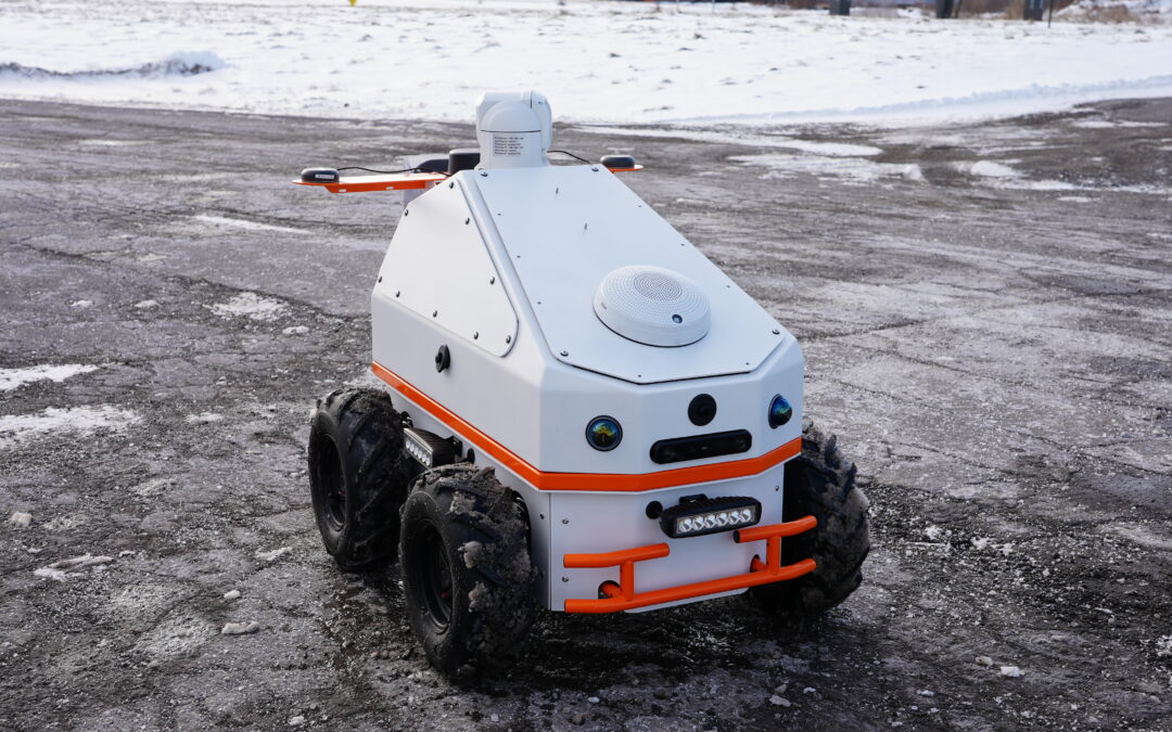
New InDro Controller: A simple solution to complex robotics missions

New InDro Controller: A simple solution to complex robotics missions

By Scott Simmie


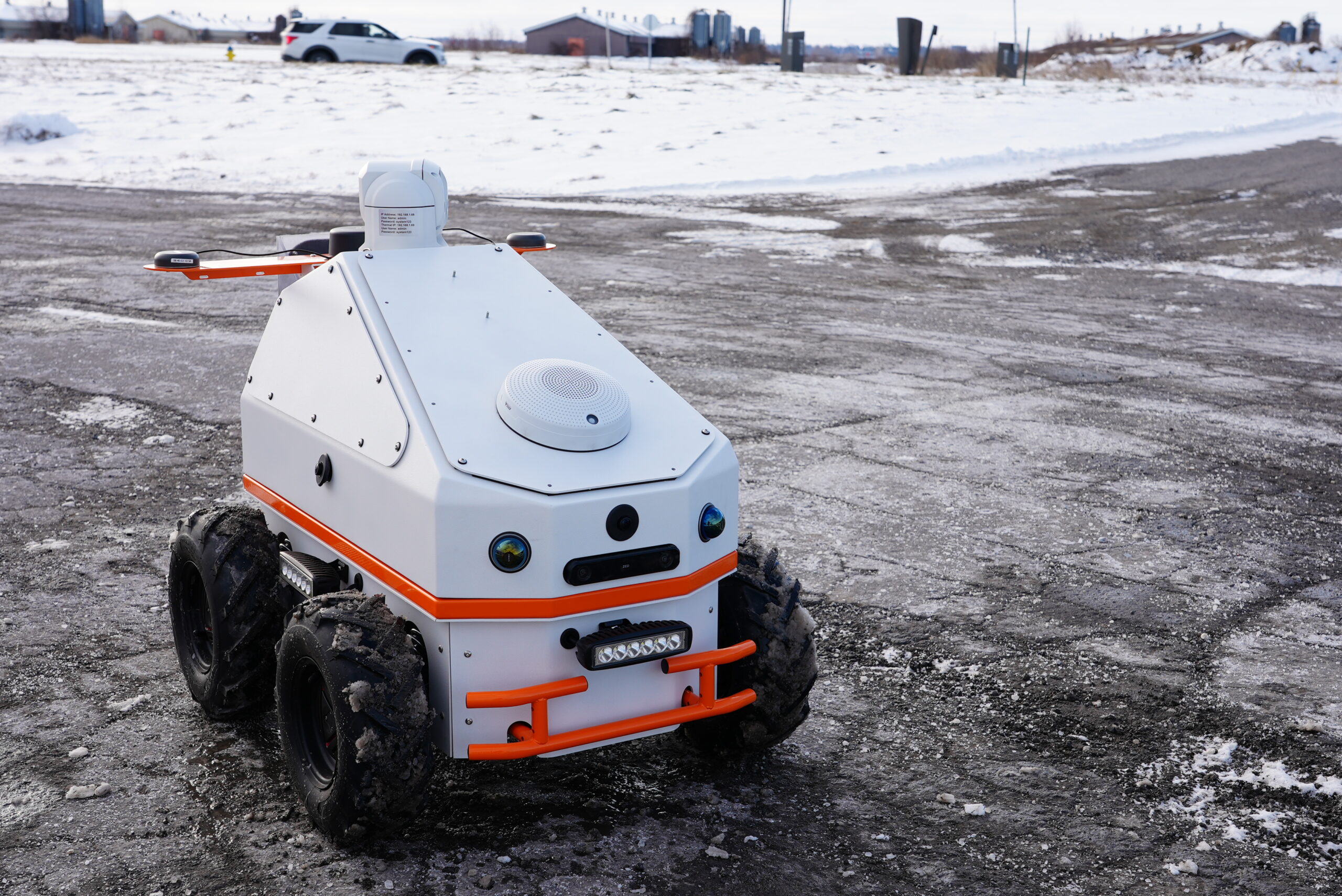
InDro Robotics – as always – has been hard at work on innovative new products. And we’re particularly proud of our latest accomplishment: The InDro Controller.

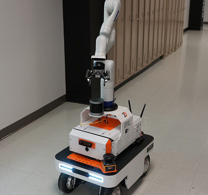
It’s an all-in-one solution for operating virtually any type of robot from a highly secure console. It’s completely robot-agnostic, very easy to use – and exceedingly powerful. We’ll get into the details as we go, but first let’s hear from Front End Developer RJ Bundy with an elevator pitch.

“It’s an all-in-one data visualization, robot management and robot control software,” he says. “Whether you’re a student first learning how to use a robot or you’re a commercial giant, you’d be able to manage and maintain all of your robots.”

He’s not exaggerating. We walked through a demo of this system recently, with Head of R&D Sales Luke Corbeth at the controls and Bundy explaining the various features. We connected remotely with one of our InDro robots. The software immediately detected all of the sensors on the platform, offering up a display of windows showing the data they were collecting with minimal latency.

“It can handle all sorts of data,” says Bundy. “It doesn’t matter if the robot has standard or custom sensors, InDro Controller can automatically detect and visualize them. For example, if you added a radar unit to an existing robot, the system will pick up on that immediately.”

Of course, it has teleoperation. Missions can be run manually or autonomously (with InDro’s autonomy stack loaded onto any ROS-based robot).

“We have a GPS-based autonomy – which is better for outdoors – and then we have a SLAM- (Simultaneous Localisation and Mapping) based autonomy which is ideal for indoors,” says Corbeth.

And while InDro Controller has very complex capabilities, it’s a snap to use.

“Once it’s set up, it’s pretty straightforward to initiate the mission. Even someone without any robotics knowledge could do it,” he adds.

Below: The Pilot View mode in InDro Controller. Data from any desired sensors is displayed with minimal latency via a highly secure connection.

Teleoperations

HIGHLY SECURE


Regardless of whether you’re a startup, researcher, or a major corporation collecting sensitive data – security is important. InDro Controller has been built with that in mind.

“We’ve created an interface that makes it very hard for a third party to intercept any of those commands or the data coming from the robot to you.”

Though the person controlling the robot is the primary login, others with a secure login can also monitor the missions remotely from anywhere in the world. The software can store as many repeatable missions as you can throw at it, and you can initiate a previously stored mission with a single click.


MISSION PLANNING


Mission planning could not be simpler.

For the first mission, the pilot would manually control the robot. InDro Controller uses an Xbox controller plugged into your computer for intuitive operation (though other options are available). All buttons on the Xbox device can be quickly mapped to carry out specific functions.

InDro Controller tracks everything you’ve done – and we mean everything – and saves it as a repeatable autonomous mission.

“If you manually drive the robot somewhere, it will remember it’s been there and it’ll be able to go back, follow that same path every time. It will also remember to carry out any specific actions you’ve taken at those points of interest, including camera angles, zoom, etc.” says Bundy.

The mission planner also automatically loads a map to locate your robot (you also have the option of satellite view), so you can monitor exactly where it is on any given mission.

And, of course, it can do this for an entire fleet of robots.

Below: InDro Controller shows Points of Interest – which can be repeated with saved missions

Robot Teleoperation

HIGHLY CUSTOMISABLE


InDro Controller has been designed to allow users to easily customise the user interface for any robot, any mission, and any dashboard view. Multiple streams of data, including upload and download speeds, battery levels and overall robot health are available at a glance. Oh, and did we mention it also works with third-party autonomy stacks?

“The dashboard, the cameras, the heads up display on the autonomous missions – those all can be customised,” says Bundy. “We’re also adding other personal user customisations, like a light and dark mode, metric conversion, schedule missions – all the kinds of features you could want.”

InDro Controller already works exceptionally well. But – as with all of our R&D projects – it will continually be refined with additional features and functionality.

“We’re heavily invested in continuously improving the software,” says Corbeth. “So regardless of which version you’re shipped, know that this is something that InDro Robotics is constantly developing and improving with client feedback in mind to ultimately provide the best mission planning, teleoperations and development software tool in the robotics industry.”

Speaking of versions, there’s a simpler version of InDro Controller – which does not have the autonomy features – already being used for missions in the academic world. Feedback has been excellent.

“Users tell us they find it InDro Controller Lite exceedingly powerful, but also very simple to use. That was exactly our goal in developing this product,” says Corbeth.

Academics and corporate innovation groups could take advantage of the Lite version, while the InDustrial package is intended for solving more complex problems in an industrial environment


SATISFYING R&D


For Front End Developer Bundy, who oversaw this project with support from other engineering staff, it’s been a hugely satisfying – and challenging – project.

“A lot of the customization features were pretty difficult because it has to be robust and dynamic, which is always tough,” he says. “This is a relatively complicated application and I’ve managed to put together something pretty nice and functional – and it will only get better. “I’ve had a bunch of other help, but putting together the UI for InDro Controller has been, and continues to be, highly satisfying.”

Teleoperating Robots

INDRO’S TAKE


We’re obviously excited about InDro Controller. And we’re particularly excited because we have a forthcoming piece of hardware – the InDro Module. It’s a small box with a lot of brains that can be added to any robot to increase functionality and enable the seamless addition of sensors and other modifications (as well as pre-loaded autonomy stack and ROS drivers). We’ll have more on that soon, but it’s the perfect match for InDro Controller for users with complex requirements.

For the moment, we’re looking forward to putting both the Lite and InDustrial versions into the hands of clients.

“When we first began remote teleoperation several years ago, we relied on third-party software as the UI,” says InDro Robotics CEO Philip Reece. “But we found it wasn’t powerful or customisable enough for our needs. It also required that we have our own autonomy stack – and we did – but many clients do not. InDro Controller comes with our proprietary autonomy stacks for both outdoor and GPS-denied locations. And, as noted previously, this is a long-term project, where even early adopters can be assured the package will be continuously refined with additional features.”

Word has already been spreading in the R&D and commercial fields about this product, and the feedback from those using the Lite version has been outstanding. Interested in learning more or seeing a demo? Contact Luke Corbeth here.

New TC Advisory Circular contains guidance for night BVLOS flight – and much more

New TC Advisory Circular contains guidance for night BVLOS flight – and much more

By Scott Simmie


A new Advisory Circular from Transport Canada is generating a lot of buzz in Canada’s RPAS world.

Although an Advisory Circular is not legislation, they offer guidance and a glimpse of what the regulator is planning for the future.

“Advisory circulars are one of the methods that Transport Canada can use to provide guidance on complying with regulations,” explains Kate Klassen, Training and Regulatory Specialist at InDro Robotics. Klassen is an instructor and pilot of traditional aircraft as well as drones. Her online courses have trained more than 10,000 RPAS pilots in Canada. She has also served as Co-Chair of the Canadian Drone Advisory Committee, or CanaDAC.

“It kind of acts like a preview, foreshadowing in a way the regulations we know are coming later this fall. This one in particular is exciting because of the depth of guidance that they’ve provided,” she says.

Here’s how Transport Canada describes the purpose of the Advisory Circular – entitled Remotely Piloted Aircraft Systems Operational Risk Assessment – in its introduction:

“This Advisory Circular (AC) is provided for information and guidance purposes. It describes an example of an acceptable means, but not the only means, of demonstrating compliance with regulations and standards. This AC on its own does not change, create, amend or permit deviations from regulatory requirements, nor does it establish minimum standards.

“This AC provides information and guidance to manufacturers and operators intending to develop or operate a Remotely Piloted Aircraft System (RPAS) for operations in accordance with the requirements of Part IX, Subpart 3 of the Canadian Aviation Regulations (CARs).”

The document itself is 131 pages, and a lot of it is dense and laden with acronyms. But for operators planning complex operations down the road – including the potential of flying BVLOS at night – the highly detailed guidance offered in the document is a gold mine. It goes into extraordinarily fine detail about carrying out Risk Assessment in a variety of scenarios.

Below: Screengrab from InDro research into urban wind tunnels being carried out for the National Research Council. This was a highly complex operation involving a heavier drone in a dense urban setting and required a Special Flight Operations Certificate. The new Advisory Circular helps spell out precisely what TC is looking for from operators to ensure safe operations in multiple scenarios


NRC Urban Wind Tunnel Eric

RISK ASSESSMENT AND SFOCs


Back in the early days of drones, pretty much every flight required special permission – an SFOC – from Transport Canada. As drone technology and reliability/robustness improved and the regulator collaborated with the industry, detailed regulations for RPAS were first issued in 2019.

That change meant what we could generally term as routine, low-risk flights with drones weighing up to 25 kilograms could be carried out without an SFOC, providing the operator met all criteria laid out in the Canadian Aviation Regulations, Part IX. That included requirements that the operator have a Basic or Advanced RPAS Certificate to operate small RPAS. TC also established its drone portal, where compliant drones weighing more than 250 grams are registered and assigned a number by the regulator. All of this was, in general, very good news for the RPAS industry.

But for those more complicated operations – generally meaning operations with greater risk – an SFOC was still required to satisfy Transport Canada that the operation could be carried out safely. Specifically, as the AC points out, SFOCs were (and are) still required in these circumstances:

“No person shall conduct any of the following operations using a remotely piloted aircraft system that includes a remotely piloted aircraft having a maximum take-off weight of 250 g (0.55 pounds) or more unless the person complies with the provisions of a special flight operations certificate — RPAS issued by the Minister under section 903.03:

(a)  the operation of a system that includes a remotely piloted aircraft having a maximum take-off weight of more than 25 kg (55 pounds);

(b)  the operation of a system beyond visual line-of sight, as referred to in subsection 901.11(2);

(c)  the operation of a system by a foreign operator or pilot who has been authorized to operate remotely piloted aircraft systems by the foreign state;

(d)  the operation of a remotely piloted aircraft at an altitude greater than those referred to in subsection 901.25(1), unless the operation at a greater altitude is authorized under subsection 901.71(2);

(e)  the operation of more than five remotely piloted aircraft at a time from a single control station, as referred to in subsection 901.40(2);

(f)  the operation of a system at a special aviation event or at an advertised event, as referred to in section 901.41;

(g)  the operation of a system when the aircraft is transporting any of the payloads referred to in subsection 901.43(1);

(h)  the operation of a remotely piloted aircraft within three nautical miles of an aerodrome operated under the authority of the Minister of National Defence, as referred to in subsection 901.47(3); and

(i)  any other operation of a system for which the Minister determines that a special flight operations certificate — RPAS is necessary to ensure aviation safety or the safety of any person.”

“In order to be issued an SFOC – RPAS, an operator must submit an application to the Minister as detailed in CAR 903.02. In particular, CAR 903.02 (p) indicates that in addition to the specific information required by 903.02 (a) through (o), the operator must submit “any other information requested by the Minister pertinent to the safe conduct of the operation”. For certain complex operations, as determined during the application process, an Operational Risk Assessment (ORA), acceptable to the Minister, is one of the items of ‘other information’ required in support of an application for an SFOC – RPAS.”

It’s that last paragraph that’s particularly relevant to this Advisory Circular.


COMPLEX PROCESS


The issue, as many operators discovered, was that applying for an SFOC wasn’t a slam-dunk. It’s not uncommon for TC to come back – sometimes more than once – asking for more details or requesting additional steps or precautions. This slowed the approval process, which was frustrating for operators. Some conveyed to regulators that there wasn’t enough clear guidance to ensure operators were meeting TC’s detailed expectations.

“So it made the SFOC application process for those more complex operations challenging as both parties were trying to sort out what the requirements needed to be to keep things safe,” explains Klassen.

The new Advisory Circular spells out, in detail, precisely what Transport Canada is looking for from operators. It contains multiple protocols, including the fine details of carrying out standardized risk assessments, that will be of benefit to all operators – even in cases where an SFOC is not required. Klassen believes the new document is the direct result of discussions between operators and TC. In addition to making complex operations safer, it provides all the fine print to assist operators in getting everything right the first time with SFOC applications.

“This Advisory Circular, I think, is a result of all of the back-and-forths between those RPAS operators who have been pursuing the boundary-pushing applications, and Transport Canada. TC has been able to accumulate all of that guidance in one location so that the process is streamlined.”

We’ll hit on a few highlights – including BVLOS at night – but the document is so thorough and dense that we’ll link so that operators can download and study it themselves. The Advisory Circular is so detailed that it’s not easy to synopsise, as you’ll gather from the following table of contents. (Don’t worry if some of the acronyms are unfamiliar; there’s an extensive glossary):

TC Advisory Circular

WHAT’S NEW


This is actually a revision to a previously published Advisory Circular. Because it contains so much information, TC thoughtfully provided a round-up of what’s new – and there’s quite a bit that is.

It contains the following changes to definitions:

  1. Airport / Heliport Environment was renamed Aerodrome Environment and a 3000 ft (915 m) AGL maximum altitude provision was added.
  2. (ii)  The Atypical Airspace infrastructure masking provision was clarified, and a low altitude night provision was added. (We’ve bolded this because it’s kind of a big deal, and we’ll get to it.)
  3. (iii)  Operating Weight definition was added to support changes to ground risk assessment.

In addition, ground risk assessment now relies on the weight of the drone rather than a kinetic energy calculation. Thresholds are now based on the most recently available population density numbers, rather than just a description of the area.

All ground risk scores now assume BVLOS operations; if you are carrying out a VLOS operation that is included as a mitigating factor.

There’s more, of course. But the most attention-grabbing line from above is the provision for low-altitude BVLOS at night. This will obviously require a risk assessment and SFOC, but it’s expected this will be included in legislation anticipated this fall (Canada Gazette 2). And that opens a lot of doors for operators.

“You could fly BVLOS along power lines, transmission lines because there’s not going to be an aircraft within 100 feet vertically of that. You could also carry out deliveries at night, pending airspace,” says Klassen.

It’s also worth noting that Transport Canada had previously indicated that routine, low-risk BVLOS flights will be permitted in the forthcoming regulatory amendments. An additional level of Transport Canada pilot certification will be required for such flights.

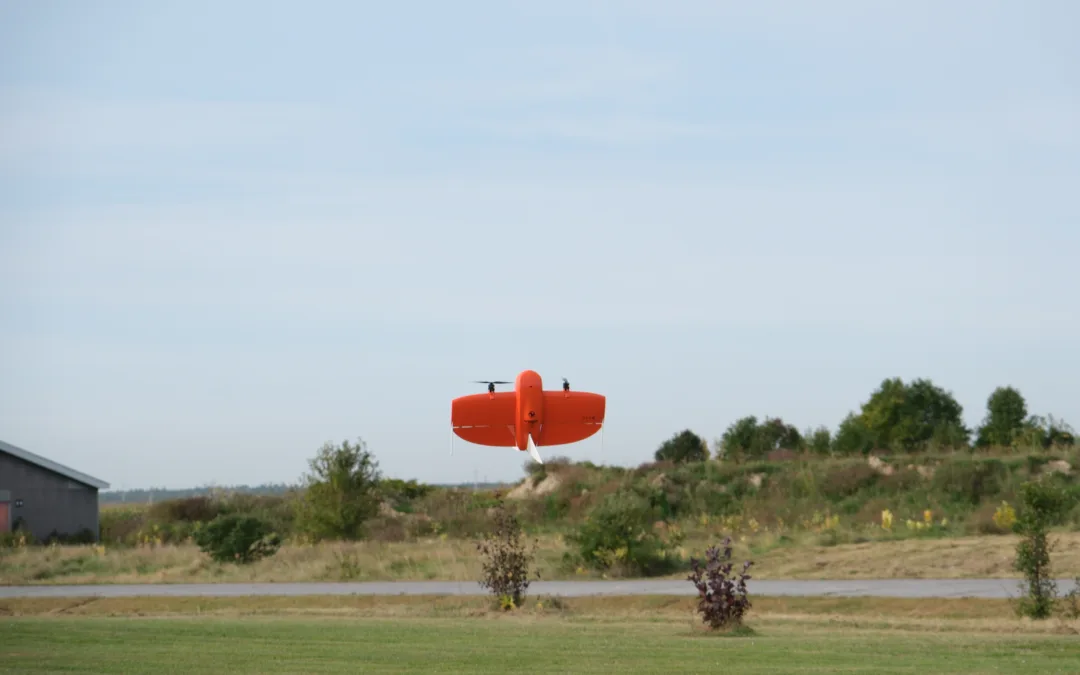
Below: With a satisfactory risk assessment and an SFOC, drones like this might be flying BVLOS missions at night when updated regulations are released sometime in the fall of 2024


HIGHLIGHTS


When Kate Klassen went through the AC, she was impressed with the extraordinary level of detail. Every step of risk assessment and mitigation is thoroughly described, with examples in the appendices.

Many operators will be familiar with risk assessment tools. But there will also be many, particularly those who currently carry out very basic, non-complex operations, who might know the acronyms but little beyond them. This is very much a “how-to” document.

An Operational Risk Assessment (ORA) is a very methodical process – once you know the method. And here, TC outlines the specific steps laid out by the JARUS (Joint Authorities for Rulemaking on Unmanned Systems) SORA (Specific Operations Risk Assessment) process. (There are some minor tweaks here, which are explained, to optimize this for the Canadian environment.)

The AC walks you through every step of the process, and includes graphics. The document takes a much deeper dive than this overview, with each phase of risk assessment explored in detail. This, however, gives you a glimpse:

TC Advisory Circular JARUS SORA

OPERATIONAL VOLUME


The document also defines something critical for any risk assessment – what it calls the “Operational Volume.” This involves calculating boundaries beyond the planned flight operations for safety/mitigation/contingency purposes.

Here’s how the Circular defines it:

TC Advisory Circular Operational Volume

“ATYPICAL AIRSPACE”


One of the things that caught Klassen’s keen eye was the definition of Atypical Airspace. Here’s the wording from the Advisory Circular:

  1. (i)  Restricted Airspace, with authorization from the person specified in the Designated Airspace Handbook TP1820 or in a NOTAM.
  2. (ii)  Northern Domestic Airspace as defined in the Designated Airspace Handbook, outside an Aerodrome Environment, at a maximum altitude of 400 ft (122 m) AGL.
  3. (iii)  Within 100 feet (30 m) above and within 200 feet (61 m) horizontally from any building or structure which stands out vertically beyond the adjacent surface of surrounding terrain with sufficient size and shape to be noticeable to the pilot of a traditional aircraft in flight.
  4. (iv)  Within the hours of legal night, in uncontrolled airspace outside of an Aerodrome Environment, at a maximum altitude of 400 ft (122 m) AGL.

Why is this extension to the definition of Atypical Airspace (AA) exciting? When an operation takes place in AA, the Air Risk Class is automatically assigned as “a” (ARC-a). This lowers the relative SAIL, depending on your Ground Risk Class, and therefore the requirements to meet the operational safety objectives are simpler. It will give you a much easier time applying for and obtaining your SFOC due in major part to the Detect and Avoid options available to you to use.

Below: With adequate lighting (and more safety precautions), operating at night provides some interesting BVLOS opportunities!


INDRO’S TAKE


Transport Canada’s new Advisory Circular is an important, detailed, and well thought-out document. Yet again, TC is attempting to make things easier for professional operators while striking that critical balance of safety – both in the air and on the ground.

“The past decade has seen both tremendous advances in the reliability and safety of drones, and – after some initial resistance in the early days – tremendous willingness on the part of Transport Canada to safely open up new opportunities for the industry at large,” says InDro Robotics CEO Philip Reece.

“The level of detail in the Advisory’s extensive sections on Risk Assessment will be of great benefit to operators – and to the safe expansion of the industry into other use-cases, including BVLOS flights at night. We commend those at Transport Canada for both the vision and thought put into this document, and look forward to the new regulatory changes.”

You can download the Advisory Circular here.

Aergility hits major milestone with untethered ATLIS hover test

Aergility hits major milestone with untethered ATLIS hover test

By Scott Simmie


A US-based company called Aergility just hit a major milestone worth recognising. The company’s uncrewed cargo vehicle, called ATLIS, successfully completed multiple untethered test hovers on May 10.

This is a big deal on the path toward commercialisation for Aergility, which has designed an aircraft unlike any other we’ve seen. It’s a VTOL with a small fixed wing that also employs managed autogyro technology to assist in lift.

We first saw this just over two years ago in Florida, at the AUVSI show. The company was attracting a lot of attention because of its range (800km/500 miles) and payload capabilities (300 pounds then; since upgraded to 500 pounds).

At the time, the product on the floor still required further integration and FAA permission before test flights could commence. Last fall, Aergility conducted successful tethered test flights – but this was the first time it was in a free hover, manually controlled by a pilot. In all, there were four test hovers, each lasting roughly a minute. Pitch, yaw and control functions were successfully tested. The aircraft also flew out of ground effect mode, to a height of six metres (20′).

“The solid performance of ATLIS in its initial and subsequent hover flights gives us the confidence to move to forward flight testing in early June. We are excited about demonstrating the full potential of ATLIS to our stakeholders,” said Jim Vander Mey, CEO of Aergility Corporation.

We’ll get into far more details about this aircraft in a moment. But first, here’s a look at a video Aergility just posted showcasing the event.


A CLOSER LOOK AT ATLIS


The beauty of ATLIS is its simplicity.

Takeoff (and hovering) is accomplished by six electrically powered rotors (the commercial version will feature eight rotors in four coaxial pairs for redundancy purposes).

Once airborne, the front tractor turboprop spins up and the aircraft begins forward flight with no awkward transition. The VTOL stage of flight lasts only about 30 seconds, so ATLIS doesn’t need to carry massive batteries.

As the forward speed increases, the power supplied to the lifting motors is reduced and eventually tapers to net zero when ATLIS reaches reaches an airspeed of 112-128 km/hr (70-80 mph). In forward flight, airspeed spins the lifting rotors.

But these rotors aren’t simply freely spinning. Remember this is “managed autogyration” – which means ATLIS is in control of the RPMs at all time – with the ability to slow some or speed up others.

“We get our forward propulsion from a turboprop, and airflow goes through the rotors to provide autogyro-type of lift,” explained Brian Vander Mey, Aergility’s head of Business Development and Partnerships.
 
“Our wings provide a portion of lift during cruise flight, but the rotors themselves carry about 40 per cent of the lift.”
 

CONTROL SURFACES


Although there are control surfaces for testing in the current version of ATLIS (trim tabs and a rudder for slow-speed manoeuvering), the eventual version for clients will have no control surfaces. Pitch, roll and yaw functions in both hover and forward flight operate in a similar fashion to a standard quadcopter, with variations in speed between the different lifting rotors resulting in the desired manoeuvre.

“To summarize the technology, essentially the aircraft takes off and lands vertically like a normal multi-rotor aircraft,” says Brian Vander Mey.

“But in forward flight the power for our rotors slowly tapers off until it’s down to zero net power for forward flight…(that’s where) our rotors go into a state that we call managed autorotation. It is called that because of the fine control we have over the autorotation state, allowing us to stay at net zero power while still having attitude and maneuvering control – which would expend net power in a quadcopter.”

Remember, Aergility is in control of those RPMs at all times. That means if pitch, yaw or roll are required, it can accomplish this by putting the brakes on the appropriate rotors and speeding up others. In doing so, similar to a Tesla, regenerative braking is involved.

“So if we need to make some sort of a banking maneuver, we may accelerate rotors on one side and brake rotors on the other side, which both consumes and generates power, but in equal proportions. So we end up maintaining net zero power usage across the whole system.”

In other words, the energy created by putting the brakes on one rotor generates electricity that is applied to another. Because of this design, ATLIS doesn’t have to carry much battery power, which means lower battery weight and greater payload capacity.

“That means that our range is only limited by the amount of fuel that we have on board.”

Below: An image from an Aergility information deck shows how the system works

Aergility Deck

REMOTE LOCATIONS, LIMITED INFRASTRUCTURE


Its impressive payload capacity and range make ATLIS ideal for getting critical cargo to remote locations, or places with limited infrastructure. It requires only a 9m x 9m (roughly 30′ x 30′) space for takeoff of landing, and the company says it has a small downwash and noise signature.

This makes it ideal, says Brian Vander Mey, for multiple use-case scenarios. It is perfect, he says, for “anywhere that is difficult to access due to its remoteness, or where the cost of getting there is prohibitive, or areas with non-existent, limited, or damaged infrastructure.”

He then offers a few examples:

“This could include places like Puerto Rico, where all of the roads were destroyed by Hurricane Maria. It could be used in mining, oil & gas – really anywhere that fits that profile that it’s hard, dangerous or expensive to get there via other means.

“Canada may be one of the biggest potential opportunities. We’ve spoken with Canada Post and learned of the challenges delivering to the northern regions and First Nations communities, and with the massive wildfire problems, this aircraft can address remote support.”

CEO Jim Vander Mey adds: “We look forward to the impact this technology will have on various industries, including logistics, disaster relief, and military applications.”


COMMERCIAL VERSION


The current version of ATLIS will be going through further testing, starting with forward flight in June of 2024. Meanwhile, the team is also looking ahead to a new iteration of ATLIS intended for production for clients. Lessons have been learned – as always in R&D – that can help improve the next generation. The cargo hold will be larger and modular, the rotors will be higher off the ground to allow ground crews to move safely below the aircraft, and the previously mentioned eight-rotor coaxial VTOL system will be incorporated.

“That will enable us to lose one to two rotors and still complete a mission – not simply just be able to get down to the ground under control,” says Brian Vander Mey.

And remember how ATLIS is only required to carry minimal batteries because the period of hovering is quite brief? An onboard generator that’s part of the turboprop engine recharges those batteries completely in as little as eight to 10 minutes during forward flight. And if that generator stops working? Aergility has a solution for that, as well.

“In the event the generator was to fail, we can change the angle of attack of the aircraft,” he says.

In other words, pitch down slightly to increase the airspeed spinning those VTOL rotors.

“So the entire aircraft has more aerodynamic energy coming across the rotors and we can recharge directly off of the rotors from forward flight without the the intermediate generator on the motor.”

As stated, this machine can fly 800 kilometres (500 miles) carrying 227 kg (500 pounds). That also means it could fly shorter distances with a heavier payload – or an exceptionally long range if the payload is additional fuel. Vander Mey says the commercial version of ATLIS will be able to fly some 3,400km (1900 miles) if that cargo bay is carrying additional fuel as its payload.

Below: More data from a supplied Aergility information deck:


THE COMING WORLD OF AAM


Uncrewed cargo vehicles like ATLIS will play an important role in the coming world of Advanced Air Mobility – where airspace is shared between traditional aircraft and this new generation of vehicles. The FAA and Transport Canada have their own long-term plans on achieving this integrated airspace and both regulators are fully onboard with this vision of the future. Uncrewed vehicles will (generally) offer more sustainable flight, and be able to drop into locations unreachable except by helicopters at a reduced cost.

We’ve written about this world at length here. It’s also worth mentioning that in Canada, the lobby organization the Canadian Advanced Air Mobility Consortium is working closely with regulators and the industry to ensure a smooth transition forward.

There’s no question that under-serviced areas and remote locations – including those with zero traditional aviation infrastructure – will benefit greatly. There’s also, of course, the important use-cases of getting emergency supplies into disaster zones.

That world isn’t going to happen tomorrow. Nor is the FAA certification of ATLIS – a meticulous and time-consuming process that will truly begin when the commercial version of the aircraft is built. In the meantime, Aergility is operating with a Special Airworthiness Certificate (SAC-EC) from the FAA. It also has Certificates of Authorization (COAs) that cover an area near its local hangar, which grants permission for forward flight testing within a specific area (roughly 10 square miles, or 2,590 hectares). It also allows for flights at higher altitudes.


WAIVERS


When it comes to commercial applications, Aergility knows that process will be lengthy. It’s following standards set up by ASTM International during all phases of design, construction and testing.

“Industry standards are being developed through organizations like ASTM,” says Brian Vander Mey. “We expect that by aligning our processes with what ASTM is developing, that will be the the cleanest path to permission to operate in the US.”

And until that coveted certification is reached? Aergility says FAA Waivers for specific operations will be obtained to enable commercial flights for operations until then.

“We don’t need Waivers for our own testing because of our special FAA permissions. But potentially we’ll have clients initially flying under Waivers.”


Aergility ATLIS

INDRO’S TAKE


We were impressed with ATLIS from the moment we first saw the vehicle. Its cargo capacity and range filled a void, and the managed autogyration is an ingenious concept. But it’s one thing to see a static, non-functioning display on a convention floor – and quite something else to see this machine carry out multiple stable hovers.

“Aviation R&D is a very tricky business, and becomes more complex with larger aircraft intended for eventual certification,” says InDro Robotics CEO Philip Reece.

“This is an incredible milestone for ATLIS and the Aergility team. We see great potential for this aircraft in multiple use-case scenarios, and look forward to success in the upcoming forward flights.”

To learn more about Aergility and its progress, check out its website here. You can also follow Aergility on LinkedIn here.


Cypher Robotics and Captis gain attention at Automate 2024

Cypher Robotics and Captis gain attention at Automate 2024

By Scott Simmie


Cypher Robotics was on the road this week. Specifically, the InDro-incubated company was at the big Automate 2024 show in Chicago. It’s North America’s largest robotics and automation event, and a conference that’s geared toward the industrial sector.

Looking for a robot that can pick and place? Move inventory off a truck and into a warehouse? How about an Autonomous Mobile Robot (AMR) capable of lifting and moving even immensely heavy loads? You’ll find all of that – and more – here. There are even manipulators that can mix drinks or make you a fine cappuccino. It’s a showcase for the future (and even the present) of everything from manufacturing to the restaurant space. And it’s all in one place.

This short video provides a pretty good overview. Trust us, there’s a lot of robotics at this show.

CYPHER ROBOTICS AND CAPTIS


If you follow the news from InDro on a regular basis (and who doesn’t?), you’ll likely recognise the Cypher Robotics name. The Ottawa-based company specialises in robotic solutions for cycle counting and inventory management at scale. InDro Robotics has an incubation agreement with Cypher Robotics, and assisted in the development and testing of its signature launch product – Captis.

Captis is a system that integrates an autonomous ground robot with a drone that’s attached to the base with a tether. That tether provides power for the drone and handles data between the drone and the ground robot. As the robot navigates even narrow warehouse aisles, the drone ascends to the various levels of stock on the shelves. That Robot Operating System- (ROS) based drone then scans any and all codes (it’s code-agnostic) on products as the robot works its way forward.

And the data? It’s instantly integrated into a company’s existing Warehouse Management System (WMS), WCS (Warehouse Control System) and WES (Warehouse Execution System) software. The power storage in the Captis base means autonomous missions can last up to five hours before the system returns to home for wireless recharging. This is a huge differentiator from solutions that count stock with a drone alone, since flight times are limited.

What’s more, Captis is also capable of autonomous RFID scanning, with the same data instantly loaded into those same management systems. So you can actually set Captis free on a showroom floor and it will find its way around using its own brains and sensors – all while counting stock.

“Operations managers and pretty much everyone on the floor understands how important it is for inventory to be accurate in their Warehouse Management System,” explains Stacey Connors, InDro’s Head of Strategic Initiatives. She was at Automate 2024 on behalf of Cypher Robotics.

“Organizations that want to make the right business decisions quickly need to be empowered with the data of what inventory they have on hand at any given time so they can pull quick triggers. ‘How much do we have and where is it? Do we want to sell product X to a reseller or distributor?’ Inventory accuracy and data are invaluable in making these decisions quickly,” says Connors.


PARTNERS


Already, Cypher Robotics has forged some powerful partnerships in the industry. It has teamed up with AI fulfilment leaders GreyOrange, global telecommunications innovator Ericsson, and a leading Canadian retailer with several hundred retail locations across the country. (In fact, much of the testing and hardening of the Captis system took place in one of that partner’s massive warehouses.)

Cypher Robotics has also quickly gained attention. When Captis was displayed at the big Modex convention earlier this year, it gained significant buzz – and was even covered by the likes of TechCrunch. That’s not surprising, since Modex is a convention that focusses on automation within the supply chain. Though Automate 2024 had a broader focus, Captis once again attracted a lot of interest. Cypher Robotics was invited by Ericsson to share its display, which focussed on a wide range of robotic and IoT solutions that operate over 5G or private 5G networks – which Ericsson supplies. (Captis can also operate and transfer data over secure WiFi.)

Cypher Robotics Captis Automate 2024

COMPLEX SIMPLICITY


The appeal of Captis is simple: It’s hands-free and highly accurate. It literally goes about and does its cycle counting or RFID scans on its own, working shifts of up to five hours before recharging. Most warehouses still rely on manual solutions, sending people out with hand-scanners to carry out what is a pretty dull and even potentially dangerous task. (Think of how high some of those warehouse stacks are.)

Attrition rates are high, because human beings get bored of highly repetitive tasks, especially if they’re intrinsically unrewarding. In one of the cases we looked at, a 1.2 million square foot warehouse that runs 24/7 has a human being scanning full-time on all three shifts, throughout the day and overnight. A single Captis unit can do all of this more efficiently and accurately, allowing those people to find more satisfying or meaningful work.

“It is a mundane job that is hard to keep people in because you train them and three months later they’re tired of counting so they move on. So labour attrition and retention is an issue, and human error in a mundane job is a reality,” explains Connors. “Cypher stands out from all of the solutions because just a single device is needed for even a million square foot warehouse.”


AND THAT’S NOT ALL


The other big feature of Captis is its ability to multi-task. Specifically, it can carry out precision 3D scans of industrial spaces in extraordinary resolution while it’s doing other work. These scans are valuable for planning, monitoring construction or renovations, simulations prior to adopting other technologies – even for creating plans to duplicate an entire facility.

“I’d say half of my conversations at Automate 2024 were around the ability of Captis to capture a precise, digital point cloud of their environment while it’s doing other tasks,” says Connors.

“A theme throughout the entire conference was how critical simulation is prior to or during the assessment or adoption of a new technology. And in order to have an accurate simulation, you need an accurate representation of the environment. Captis provides this.”

Before we wrap up, it’s worth mentioning that while the tethered drone and extraordinary run-times are key components of this system, some of the most complex magic is due to the robot’s autonomy stack. With its proprietary combination of hardware and software, Captis can be placed in a completely unfamiliar, GPS-denied environment and still get the job done.

“The secret sauce of our total solution is absolutely the embedded autonomy,” says Connors.


Below: Stacey Connors with Captis at the Modex show


Stacey Connors Captis MODEX

INDRO’S TAKE


Automate 2024 is an important conference, showcasing the cutting-edge in industrial robotics right across the sector. It was the perfect venue to let interested parties know about Cypher Robotics and its Captis solution. It was also, yet again, validation of the Cypher Robotics value proposition and business plan.

“It’s great to see the excitement continue to build around Captis,” says Connors. “We’re grateful to our partners Ericsson for inviting us to display alongside them, and there’s no doubt 5G and private networks will play a role in this product’s future.”

And that future? It’s now.

“Cypher Robotics has tested and hardened its technology, and the company will soon be shipping its first orders.”

Interested in learning more? You can contact the Cypher Robotics team here.

FLYY releases “how to” guide for building, expanding a drone program

FLYY releases “how to” guide for building, expanding a drone program

By Scott Simmie


Thinking of starting a drone program? Perhaps you have one already, and are thinking of expanding. Or maybe your existing program grew organically on an ad-hoc basis and you’d like to ensure you’re following Best Practices.

There’s a solution for that.

Kate Klassen, InDro’s Training and Regulatory Specialist (who’s also a flight instructor for crewed aircraft),  has written a comprehensive manual specifically for this purpose.

Klassen is widely respected in Canadian RPAS and traditional aviation circles. In addition to her extensive experience as a pilot (multi-engine rating, IFR, night), she was an early adopter in the drone world. Her regulatory expertise is top-notch, and her online RPAS instruction courses have trained more than 10,000 pilots in Canada (you can find her current courses here). She’s been on the board of the Aerial Evolution Association of Canada for years, and was co-chair of Transport Canada’s CanaDAC Drone Advisory Committee. So she knows her stuff.

Now, she’s pulled together that knowledge (in addition to what she’s learned working with InDro Robotics and consulting with other companies with RPAS programs) into a single, comprehensive document that covers everything you need to know to build out a safe, compliant, cost-effective drone program.

“The goal with the book was to put in one spot all of the information that you should know,” she says.

She certainly achieved that.

Below: Kate Klassen, in one of her many elements.


Drone Training

SOLID KNOWLEDGE BASE


The e-book is entitled Remotely Piloted Aircraft Program Development Guide for VLOS and BVLOS Operations. And it covers pretty much every aspect of running a drone program – including maintenance, staffing, recency, risk assessment – and much more (we’ll give you a peek at the table of contents shortly).

There’s also, of course, a meaty section on the regulations – including the anticipated Transport Canada changes on the horizon that will permit routine, low-risk Beyond Visual Line of Sight flights (which will require obtaining an additional TC RPAS Certificate). And while the book covers high-level operations suitable for companies with mature drone programs, it also covers the basic meat and potatoes.

“This book could be used by individuals looking to use their drone in a professional capacity or as a really serious hobby – but it’s geared more for someone who is either starting, expanding or improving a drone program within their organisation,” says Klassen.


DECISIONS, DECISIONS, DECISIONS


A well thought-out drone program involves a lot of decisions. How do you choose your crew, including flight lead? When is it time to replace an aircraft? What’s a good maintenance schedule – and how do you track that? What’s the best way to manage data? And what about insurance?

You’ll find all that and more. Klassen has packed a lot (including links to references and resources) into the 55 pages of this manual. And she’s taken special care to pore through the finer details of dense Transport Canada regulatory language and write the key takeaways in clear, concise terms.

“There was a lot of digging through Transport Canada documents to gain insights into where the drone industry is going from a regulatory perspective – and put that into plain English,” she says.

Below: The cover page

FLYY Kate Klassen drone program manual

LOGICAL, ORGANIZED


Whether you’re a seasoned pro or someone just starting a drone program, Klassen has constructed the manual in a highly organised fashion. The progression of sections builds logically from the basics, through to complex areas such as Specific Operational Risk Assessment (SORA).

Here are the sections:

  1. Regulation Roadmap
  2. Certification
  3. Operational Considerations
  4. Budgeting
  5. Program Structure and Operation
  6. Training
  7. Equipment
  8. SORA Process

And within each of those sections? Let’s just say Klassen has it all covered. Take a look:

Kate Klassen Drone Program Manual

EXCERPT


It’s one thing to tell you this manual is clear and concise. It’s another to let you see for yourself. So we’re going to paste from the very top of Section One – Regulation Roadmap – to give you a better idea:

The Canadian Remotely Piloted Aircraft System (RPAS) industry took a major leap forward in June of 2019 with the publication of drone-specific regulation in the Canadian Aviation Regulations (CARs). These regulations enable route visual line of sight (VLOS) operations for small RPAS (250g – 25kg), with additional guidance for aircraft above that weight range, through a Special Flight Operation Certificate (SFOC) process, and below, with reduced prescriptive microdrone regulation.

With the release of a Canada Gazette draft of lower risk BVLOS regulation in the summer of 2023, we have an idea of the direction Transport Canada is heading and had an opportunity to raise concerns and encourage positive direction with the drafted version.

While formal regulation, once in place, will provide a clearer path to certification for BVLOS, there will still be many of the similar requirements to what’s currently in place, through the SFOC process, including training, mission planning, procedure development and technology.

  • NOTE: While BVLOS with a microdrone is not explicitly prohibited by the regulations, the onus would be on the operator to prove it was done without being reckless, negligent, risking or being likely to risk the safety of a person or aviation safety. (CAR 900.06) Throughout this document, the aircraft and operations we’ll be referring to are those with small RPAS, that is those between 250g and 25kgs, unless otherwise specified.
  • As it stands as of the time of publication, flying an RPA heavier than 25kgs or BVLOS is not permitted in Canada except if specifically authorized in a Special Flight Operation Certificate. (CAR 901.11) This document will address considerations for a BVLOS program in anticipation of BVLOS-specific regulation being introduced in 2025 and the structure, operational considerations, components of an SFOC and training.

This is a rapidly changing space. As the industry continues to develop new technology and applications, and new regulation is announced to accompany these advancements we’re going to see a lot of refinement to the processes described within this document. It’s what’s so exciting about working in this area! The information here should help you in that pursuit.

As you can see, it’s really clearly written. It’s also filled with helpful graphics like these:

Kate Klassen Drone Program Manual

INDRO’S TAKE


Kate Klassen is widely acknowledged as both a regulatory expert and a phenomenal communicator/instructor. She combines those skills well in the production of this manual, which we believe is a “must-have” for anyone serious about their drone program.

“Kate has tremendous expertise in this field – including personally overseeing some 150 RPAS flight reviews,” says InDro Robotics CEO Philip Reece. “This manual ticks all the right boxes, and includes material that will benefit even the most mature drone program. We’re pleased to see this published, and believe it will truly help those running serious programs make the most effective and efficient decisions.”

And the cost? You can download the manual here for $49.

That’s less than a dollar per page. And, in our opinion, a bargain.

Thirty-one drones detected at Niagara Falls during eclipse – most of them breaking regulations

Thirty-one drones detected at Niagara Falls during eclipse – most of them breaking regulations

By Scott Simmie


The solar eclipse attracted more than sightseers to Niagara Falls.

It also brought out drones – with as many as 31 detected at a single point in time. A few of those drones were authorised to be flown by law enforcement, but the majority were being flown by people who either weren’t aware of the regulations, or wilfully ignored them.

That’s because Niagara Falls is Class F Airspace. And the Park makes the policies very clear:

“Niagara Parks does not permit the use of drones within the property for any recreational purposes. Use of drones for commercial projects (commercial film, photography, survey or engineering work, etc.) may be considered and approved under a Permit,” reads the Park’s website page outlining the rules for film, photography, recording and drones. It goes on to the nuts and bolts of the airspace restriction.

“The airspace surrounding Niagara Falls is classified as CYR-518 Class F Restricted Airspace which further requires a Letter of Authorization from Transport Canada prior to Niagara Parks issuing a permit. Transport Canada’s authorization is required no matter the size or weight of the drone or how low or high the flight path.”

So no, you can’t take your sub-250g drone and think you’re in the clear.

But that didn’t stop a lot of people from putting drones into the air. And that’s cause for concern, given that helicopters and other traditional aircraft with special permission are in that same airspace for tours.

Below: Collage of the eclipse by Solar Eclipse by KMHT Spotter, Wikimedia Commons 4.0.

Solar Eclipse Wikimedia Commons 4.0 KMHT Spotter

THE NEWS


Word of the multiple drones in the air came at the Canadian Hazmat and CBRNE Summit in Kitchener, where that acronym stands for Chemical, Biological, Radiological, Nuclear, and Explosive. It brought together First Responders, law enforcement and Hazmat specialists from across the country. The conference featured a heavy emphasis on how technology – drones, ground robots, ROVs, counter-UAS systems and more – have become essential tools for law enforcement and other First Responders.

One of the sessions focused on the D-Fend Solutions EnforceAir counter-UAS system, which was seen in use in an exercise with Niagara Police during the solar eclipse to monitor drones. It’s a critical area because there are often crewed aircraft, helicopters in particular, taking tourists for flights over the falls. It is also, as noted, restricted airspace where no drones that do not have special authorisation should be in the air.

But the system picked up plenty of them.

“We saw at one point 31 drones in the air at one time at Niagara Falls during the eclipse,” David Beatty, Director of Sales for D-Fend Solutions Canada, said in a presentation. That kind of traffic, he added, could mean “a possibility of a mid-air collision not just between the drones, but also with the manned aviation that was flying at the same time at the same place.”


INTRUDERS


A small number of those drones were being flown by law enforcement and marked as “authorised” by the EnforceAir system operator. But the vast majority were not. And not only were those drones in restricted airspace, at least one was detected breaking two other regulations: It was flying at an altitude of 1640′ above ground level and far Beyond Visual Line of Sight. (Transport Canada regulations limit drones – in airspace where they can be flown – to 400′ AGL and within Visual Line of Sight without special authorisation.)

“The system identified the operator was four kilometres away flying at that altitude which was impeding both fixed wing and rotary aviation,” said Beatty in a follow-up interview with InDro Robotics. “Our understanding is that Niagara Police, because they have the residence location, will be conducting followup visits to the perpetrators.”

The EnforceAir operator team was also able to relay information about drone positioning in real-time to a helicopter pilot who was carrying out flights over the falls, ensuring he had airspace awareness.

Below: David Beatty with the D-Fend system during a demonstration. Scott Simmie photo.


THE D-FEND SOLUTIONS SYSTEM


Developed in Israel, D-Fend Solutions originally began as a counter-drone solution for multiple Tier One agencies – meaning special forces and other elite services in the military and intelligence sectors around the world. Current clients listed on its website include three US federal departments: Defence, Homeland Security and Justice. A D-Fend system is also being evaluated for airport use by the FAA.

But D-Fend Solutions is now seeing opportunities in the broader market. This has come with both the widespread proliferation of drones, as well as their potential to be modified for nefarious and criminal purposes – including the frequent attempts to deliver contraband to prison yards.

“We were primarily dealing in the military realm, but based upon the threats that have occurred to public safety we’ve expanded into that marketplace,” explained Beatty. D-Fend Solutions products have been used at large public gatherings, to detect and mitigate drones at prisons and near critical infrastructure – including major airports.

And while drones can potentially cause conflict with traditional crewed aircraft, Beatty says there’s concern about another threat that has emerged in recent years.

“As we see in the conflict in the Ukraine, they are the poor man’s Air Force. Drones are very easily weaponised, and that could be someone flying the drone directly into someone, or placing some form of munition or chemical irritant on it.”

Beatty says clients have also seen an increase in the use of drones at protests, flying dangerously close over the heads of people – and even interfering with police drone activity.

Below: D-Fend Solutions at a demonstration for First Responders

D-Fend Niagara

HOW IT WORKS


There’s a variety of types of c-UAS systems on the market. They range from direct energy type weapons (think lasers) to kinetic (nets, etc.), frequency jamming and radar. The D-Fend Solutions system is a passive cyber-solution, meaning there’s no direct jamming or kinetic action. It also meets what are sometimes called the “Four Pillars” of a complete c-UAS system, including the ability to detect, track, identify and mitigate.

“The system detects drones at ranges in excess of five kilometres,” says Beatty. “We will track the drone so we know its flight path. We identify the drone to the point where we get the serial number of the drone, the controller, the make and model of the drone, with options for mitigation.”

Before we get to mitigation options, it’s worth explaining that the D-Fend Solutions system is constantly listening for the unique characteristics of the drone. That’s how it detects not only the type of drone but also other relevant information.

In terms of mitigation, there are multiple options. D-Fend Solutions can support a geofence, for example, that prevents drones marked as unauthorised from flying into a certain area. They’ll simply hit the boundaries of that geofence and can then be tracked or fended off. A rogue drone can also be forced to simply stop and hover in a location so that ground observers can get a closer look to determine if it poses a threat.

“The final option is that we can take control of the drone and send it on a safe passage to a safe collection point. And the emphasis is always on control.”

And how does the system do that passively, without jamming frequencies (where Industry Canada has some pretty strict rules)? Quite simply, it can trick the drone so that D-Fend Solutions becomes the control system.

Two of multiple drones being tracked by D-Fend Solutions at a demonstration outside Kitchener. 

SOMETIMES, IT’S ABOUT EDUCATION


The D-Fend Solutions EnforceAir system identified the location of the drone pilots violating the regulations at Niagara Falls on the day of the eclipse. An officer involved said during the conference there will be a follow-up with the pilot of that BVLOS drone flying at 1640′. It’s unclear whether this will be an informal education session, or whether any further action will be taken.

But sometimes, education is also a key tool. And that’s enabled by the system pinpointing the location of the pilot.

“This allows for a form of soft policing – in lieu of mitigating the drone, the police are able to educate the public with direct intervention by police units and the drone operator,” says Beatty.

Thankfully, there were no mishaps on April 8. Crewed air assets (and police drone operators) were kept in the loop on the location of all unauthorized drones.

Below: The company even has a version that fits in a backpack


INDRO’S TAKE


The D-Fend Solutions system provided important airspace awareness – and was a critical safety tool – during the eclipse event at Niagara Falls. The system has been demonstrated at several other major public events in Canada, providing critical awareness to law enforcement and other First Responders. The company’s EnforceAir product won first place for hardware and systems design at the 2023 AUVSI XCELLENCE awards.

“There’s a growing demand for c-UAS products globally, whether for public safety, critical infrastructure, airport security – even for protection from pirates on the high seas,” says InDro Robotics CEO Philip Reece.

“D-Fend Solutions EnforceAir provided an important solution during the Niagara demonstration, and its ability to mitigate without jamming or kinetics is impressive.”

You can learn more about D-Fend Solutions here.

We’d be remiss if we didn’t also mention Bravo Zulu Secure, an InDro sister company that also offers detection and mitigation solutions. The incident detailed above is also reminiscent of the detection of many illegal drone flights in Ottawa during the convoy protests. If you haven’t seen that one, it’s definitely worth a read.