What InDro does

What InDro does

By Scott Simmie


Have you ever wondered: What exactly InDro Robotics does?

The answer might surprise you.

InDro is often described as a research and development company. While accurate, that isn’t very explanatory. So we’ll give the first word to CEO Philip Reece.

“InDro Robotics does a lot of different things – ranging from product development to service provision to creating and building solutions for global clients,” he says. “But all of these tasks have some things in common:

“This is an engineering-first company – dedicating to inventing, enhancing and deploying technologies and products that make difficult work easier and more efficient. Customers purchase these technologies, and we are also a service provider using these InDro innovations.”

That’s a good starting point. But what does that actually look like? We thought a good way to explain this might be to look at some of the milestones the company has accomplished between September of 2021 and 2022.

There are, unfortunately, some that we’re prohibited from telling you about due to non-disclosure agreements with clients. But even without those, it’s been a very productive year.

InDro Commander

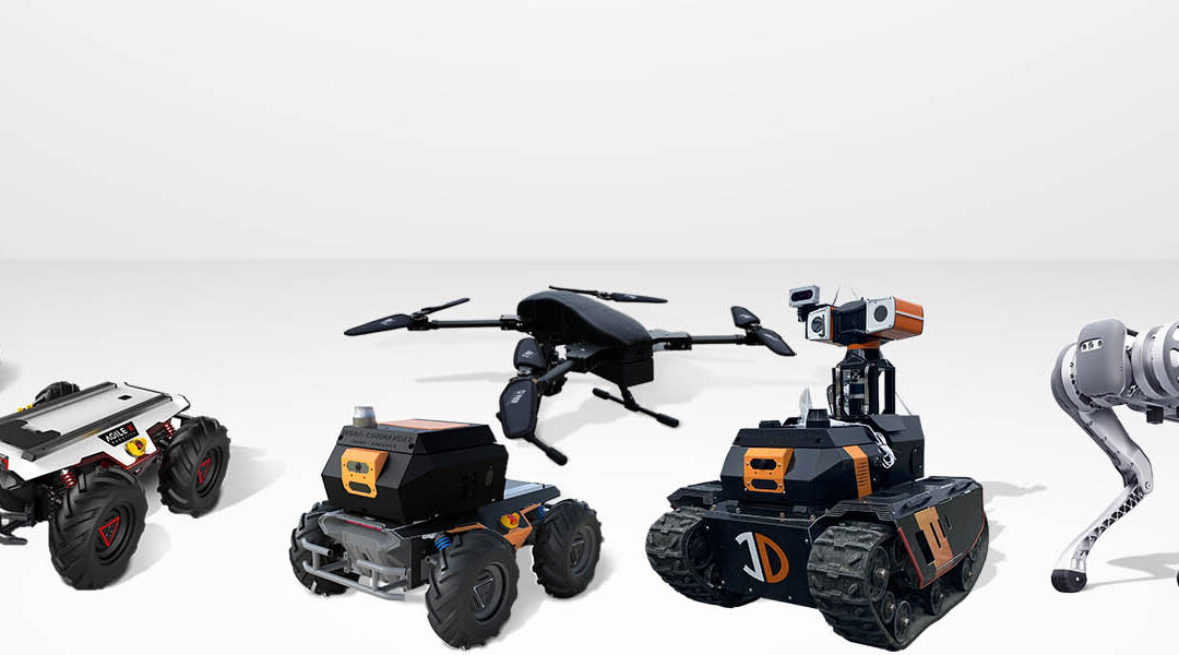
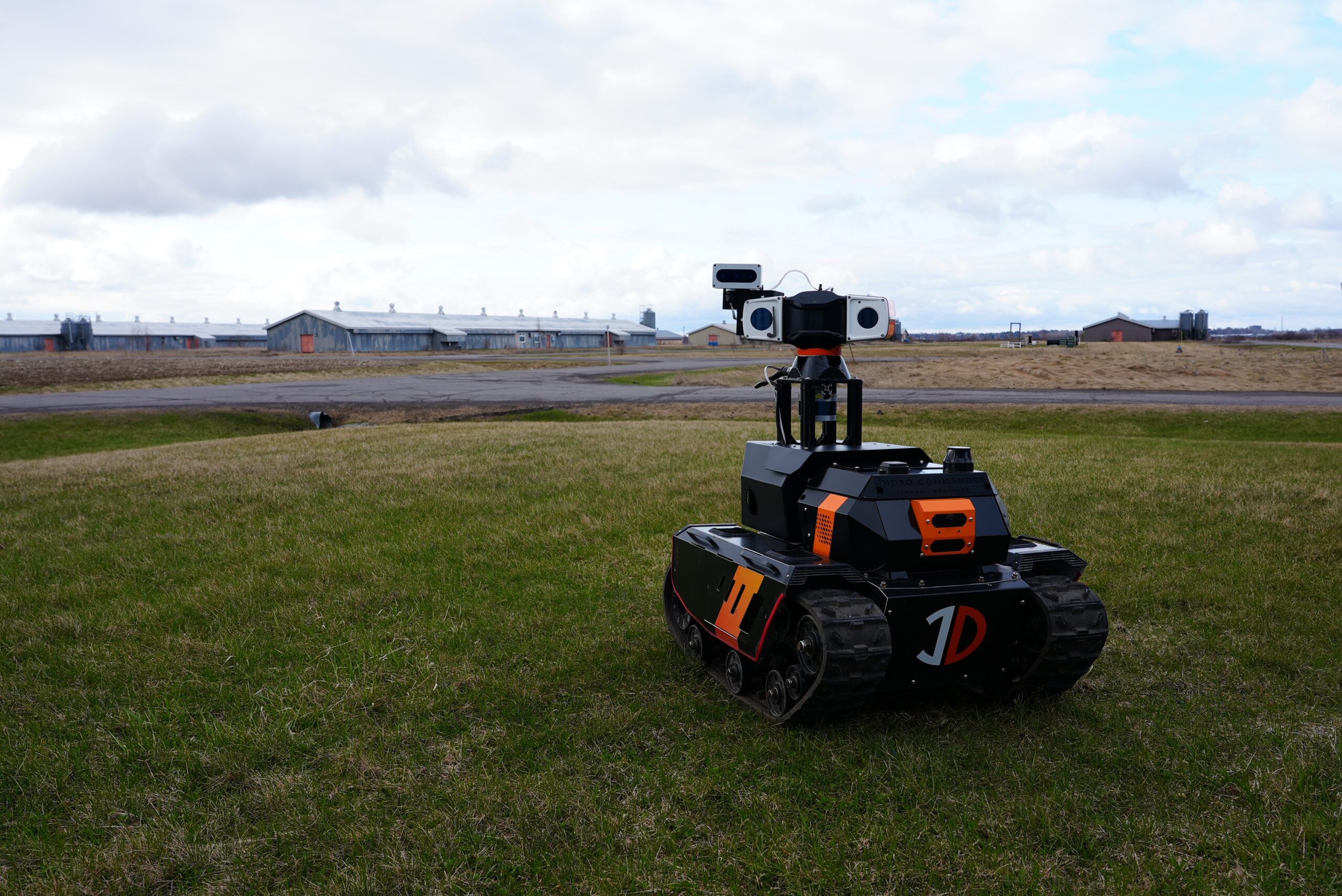
We’ll start with something that has allowed many clients to quickly customise and deploy ground robots. You’ll see this in the image below; it’s the module sitting directly on top of the robot chassis below. Specifically, it’s toward the front of the chassis above the InDro Robotics logo.

InDro Commander

The process


There’s an interesting backstory here. One of the things InDro is known for is building custom robots designed for specific tasks. But building robots – especially building multiple robots with different functionalities – is hard work.

We have a head start on this process, because we use the excellent platforms built by AgileX, China’s leading producer of quality robotic platforms and locomotion systems. But – and you can ask any robot builder – the real challenge is building robots that do things besides move.

You need to integrate sensors – everything from optical and thermal sensors to LiDAR and even arms with end effectors. You’ve got to figure out how to power these sensors and pull their data – a task that involves much more than wiring. With most robots, it means finding and integrating the proper software from the Robot Operating System libraries (ROS and ROS2). Then you generally need an onboard computer to process that data – along with coming up with a solution to moving that data from the robot to somewhere else.

Our engineering team thought there had to be a better way. In particular, lead engineer Arron Griffiths envisioned a module that might act like a kit to make this process much, much easier. InDro Robotics then developed and tested a module that could be added to most ground robotic platforms. It contains a powerful Jetson computer for onboard EDGE processing, multiple USB slots for adding peripheral sensors, two wide-angle cameras to give the operator a 360° view of the robot’s surroundings, and more.

That “more” includes the ability to operate the robot, in realtime, over a 5G or 4G cellular connection. The browser-based console provides data from all sensors in a clean and easy to navigate dashboard. And the operation? You can simply use an Xbox controller and operate your newly integrated robot from down the street – or across the country.

You can learn more about InDro Commander in this story. But the point here is that our engineers identified a problem and came up with a solution. Many of our products have a similar origin: Thinking of a new way to do things that’s easier and more efficient.

InDro now regularly manufactures and ships Commanders to clients globally, providing the ability to rapidly customise any ground robot utilising the Robot Operating System – without all the hassle. (If you’re interested in more details, feel free to reach out to Account Executive Luke Corbeth.)

Now that you’ve got the Commander basics, let’s take a brief look at our ground inspection robot Sentinel.


InDro Robotics Sentinel

Location, location, location


The phrase doesn’t just apply to real estate.

Many companies have valuable assets in remote locations. To inspect such locations generally means dispatching one or two employees to make the often-long trek and then simply walk around and ensure things are working as they should be. They’ll check for any signs of corrosion or wear, perhaps watch and listen for electrical arcing or test for thermal anomalies, even watch out for signs that wildlife has been chewing on wires or building nests in locations that might pose a risk. Inspectors are also frequently dispatched following violent weather events.

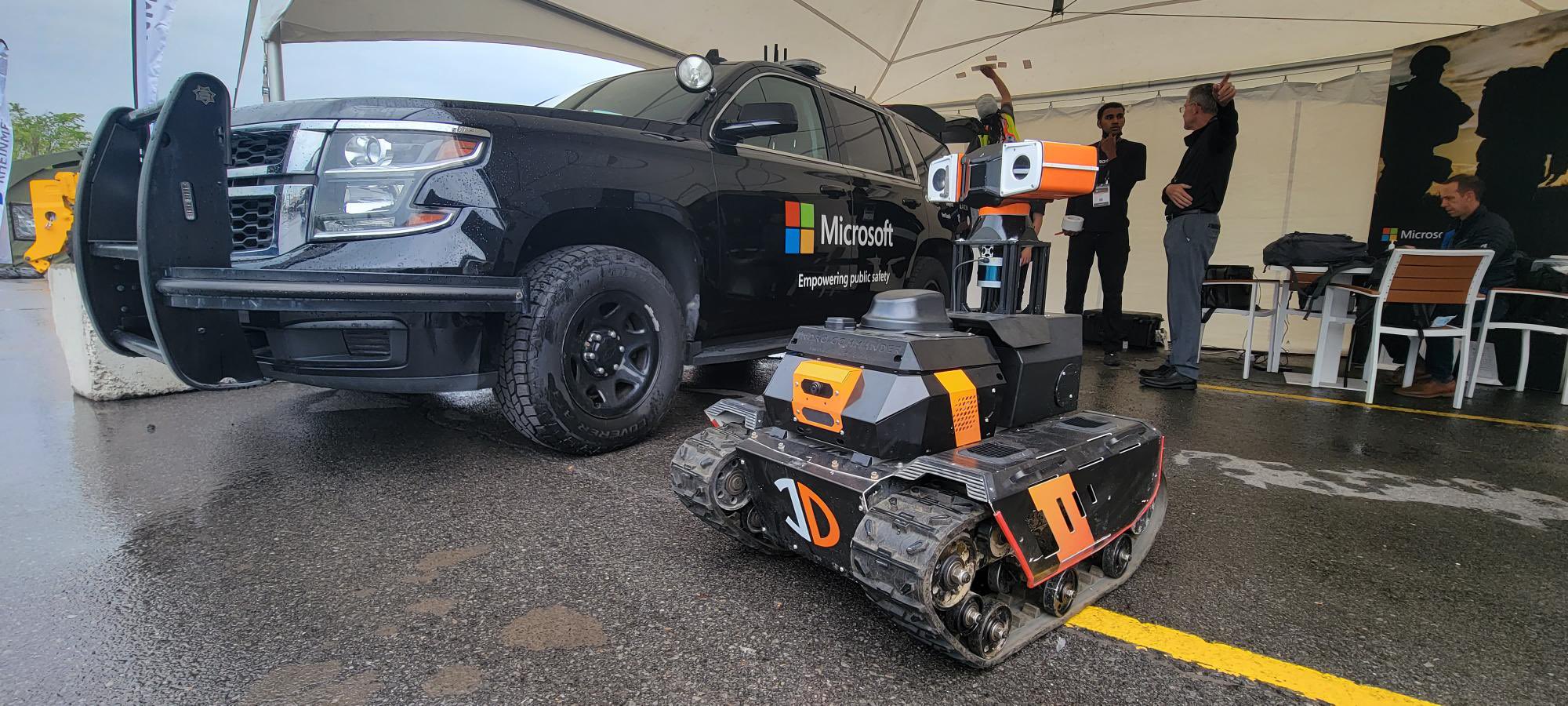
InDro started thinking about this problem, with a particular focus on electrical substations – often-remote and uncrewed facilities where the current from high-voltage transmission Iines is stepped-down for delivery to consumers. What if a robot could be placed on site that could carry out these inspections remotely? In fact, what if InDro took the InDro Commander module and customised a new ground robot for the task?

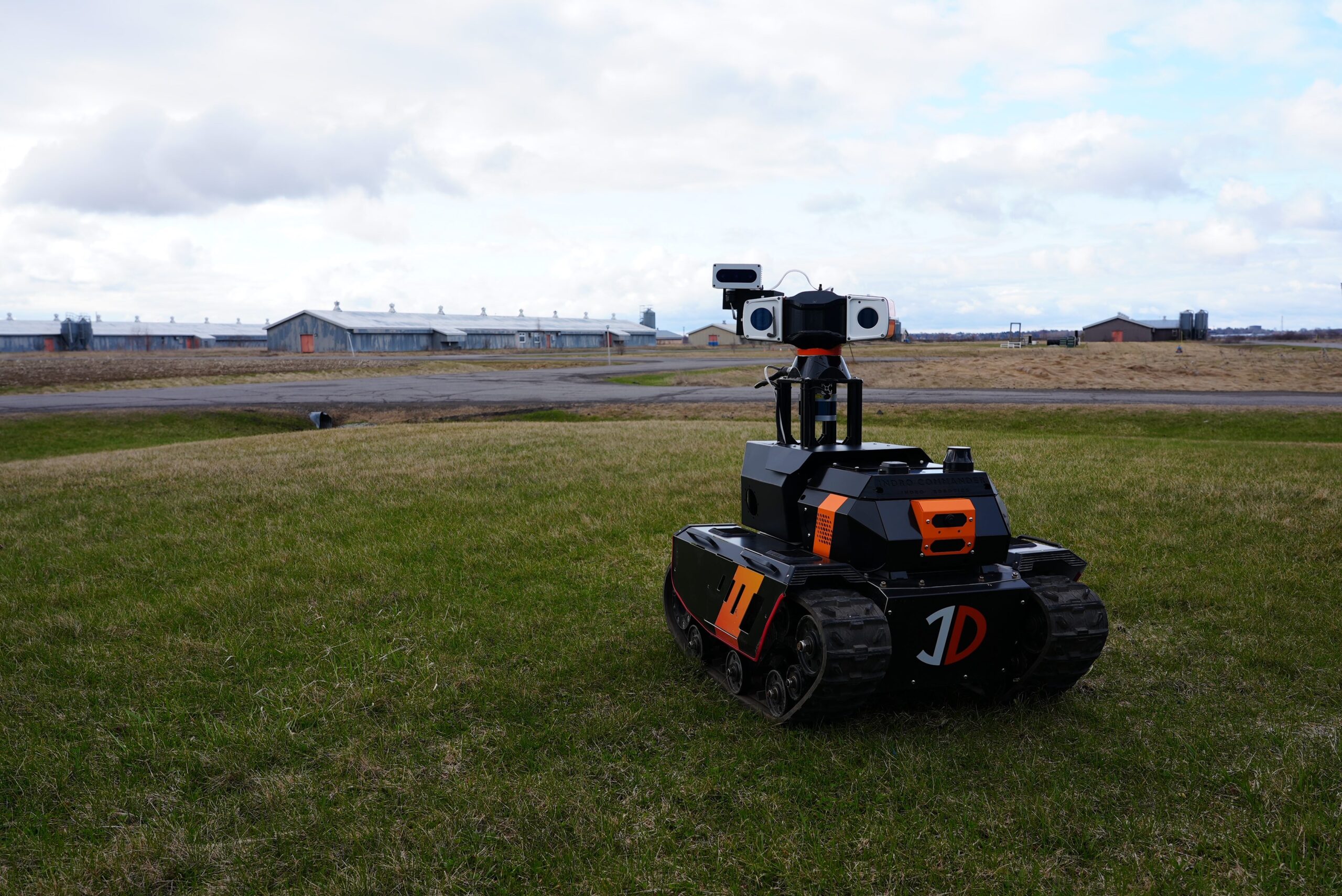
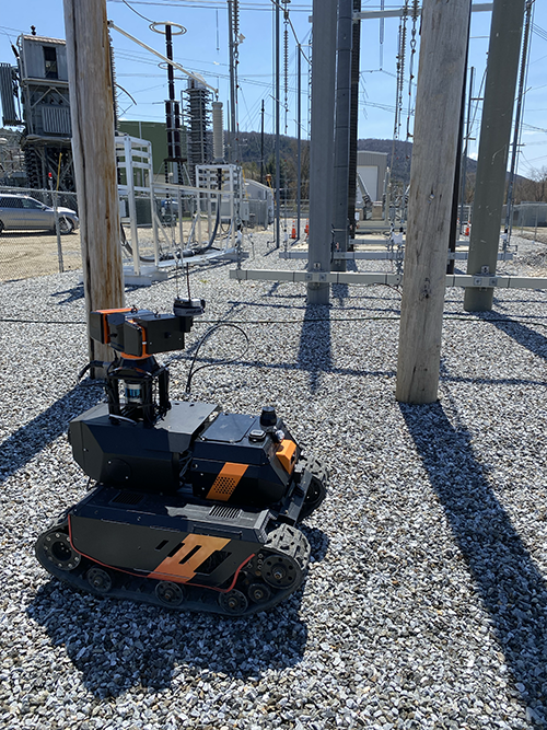
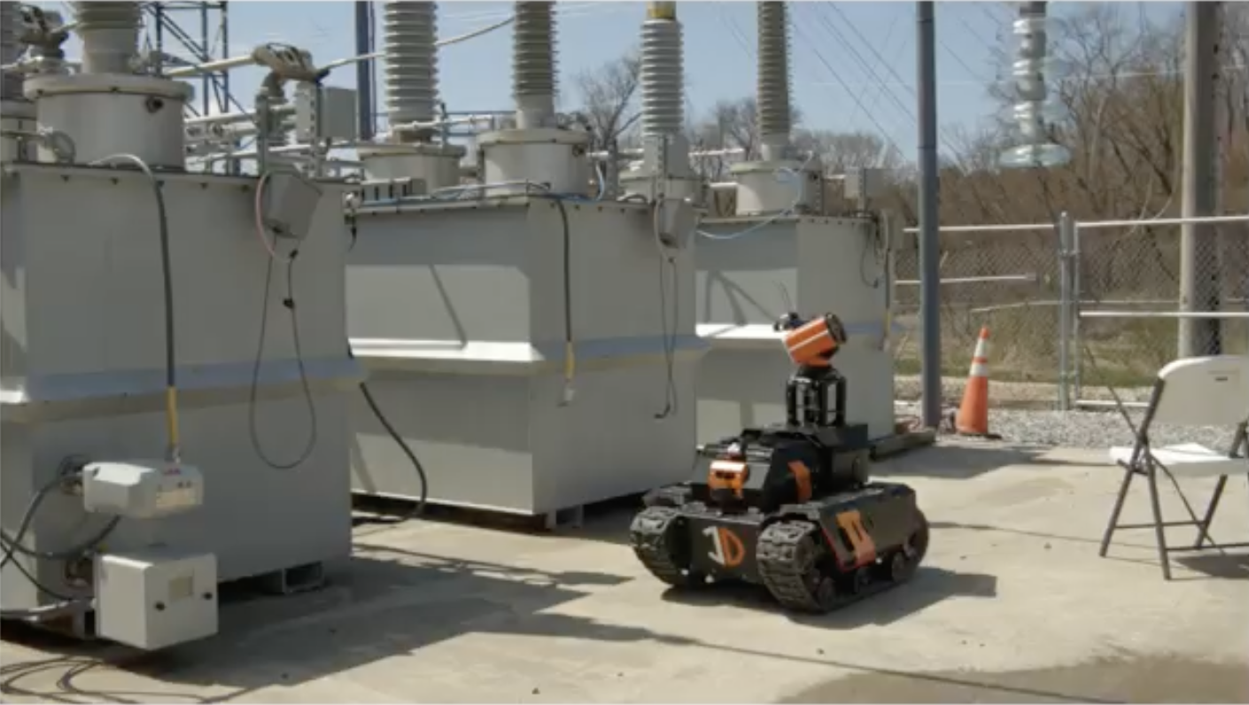
That’s how Sentinel came to be. The tracked robot features a 30x optical tilt-pan-zoom camera, a thermal sensor – along with any additional sensors clients would like incorporated. Sentinel can autonomously return to its wireless charging base and can literally be left on its own for months. An operator can remotely carry out regular inspections, read gauges, capture high-resolution photo and video, check for thermal anomalies – and generally accomplish nearly everything that could be carried out by a human inspector without the time and expense. Plus, Sentinel can be dispatched within minutes when necessary.

You can read more about Sentinel here. The robot also recently took part in exhaustive testing at the Electrical Power Research Institute’s (EPRI) substation test facility in Lenox, Massechusetts.

This is a great example of where one InDro innovation – the Commander module – helped pave the way for a second innovation: Sentinel.

It also contributed to a third: The ROLL-E delivery robot:


Delivery Robot

ROLL-E


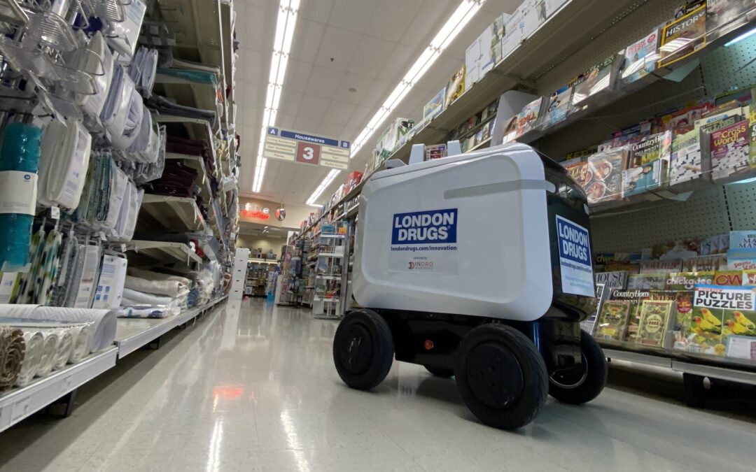
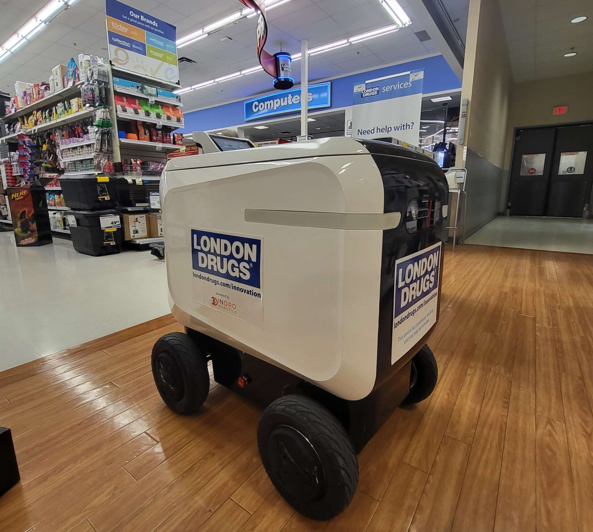
ROLL-E is another beneficiary of the InDro Commander invention. This delivery robot is capable of remotely teleoperated urban deliveries, such as from a retail outlet to a home.

InDro has already completed trials with London Drugs at a Victoria location, delivering goods purchased online for curbside pickup.

InDro now has a second-generation ROLL-E, which the company will be unveiling shortly. ROLL-E 2.0 has been purpose-built to maximize integration into an urban environment with features like signals, brake and running lights – and a series of cameras (including depth perception cameras) to provide the operator with a 360° view of ROLL-E’s surroundings. Goods are contained in a secure cargo bay that opens only when the recipient interacts with a touch-screen.

And that’s not all.

InDro is currently building the InDro Backpack – a smaller version of Commander. Its purpose? To offer the same capabilities for teleoperation and high speed data transmission on the Unitree GO1 and its other quadrupeds.

Here’s a brief video demonstrating teleoperation of the GO1 as the backpack was under development; InDro anticipates the bolt-on 4G/5G system will be ready for clients later this fall.


What about drones?


Good question. While we were developing Commander, a similar but separate project was underway for aerial robots.

Canada Drones

InDro Capsule


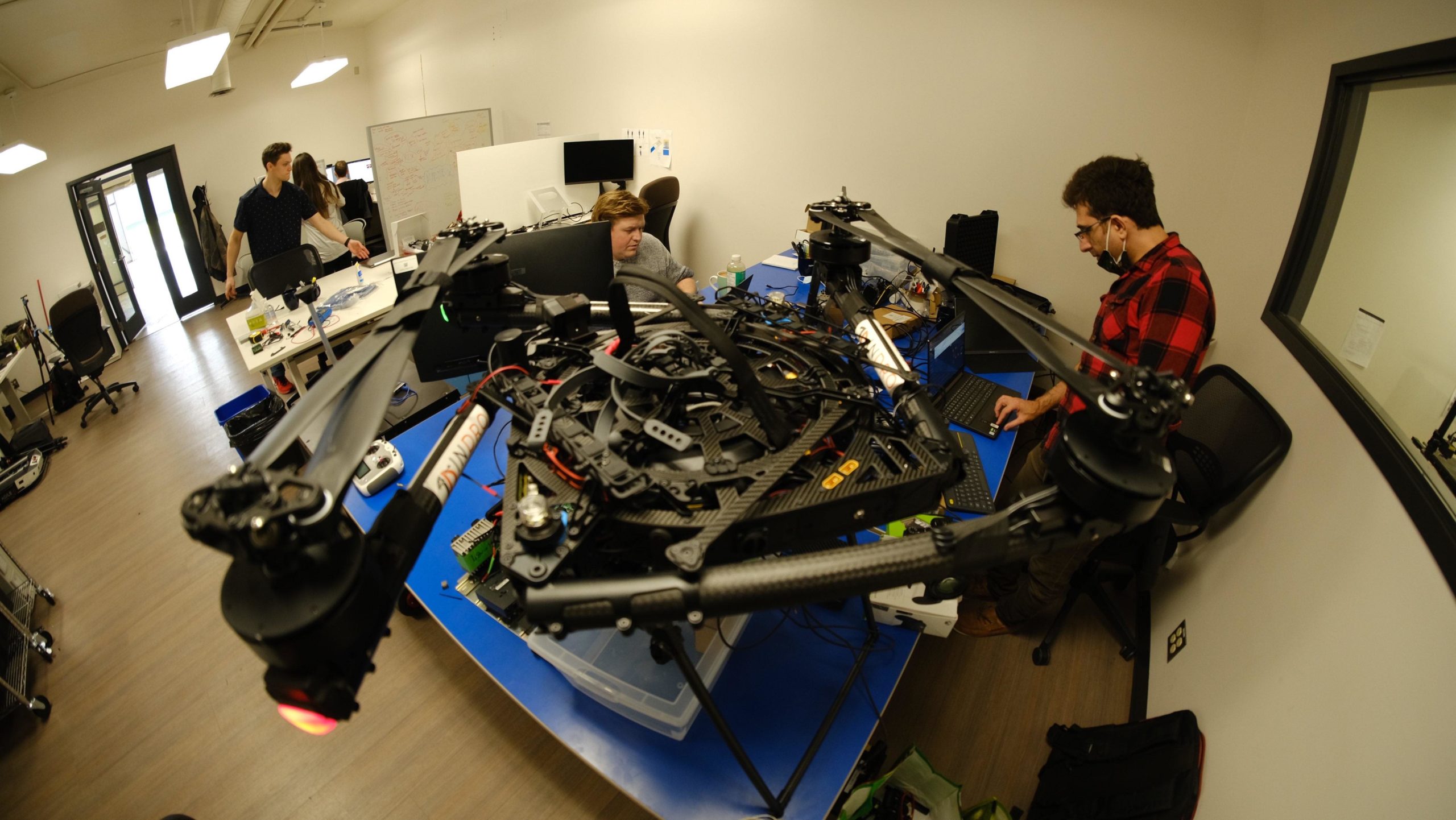
See that guy on the right? That’s Ahmad Tamimi, an engineer at InDro’s Area X.O location in Ottawa.

When this photo was taken in the fall of 2021, he was deep into something called NERDS (Network Enhanced Realtime Drone project). It was a technology challenge in conjunction with the Ontario Centre of Innovation, Ericsson and the ENCQOR 5G network – a testbed corridor that runs through Quebec and Ontario.

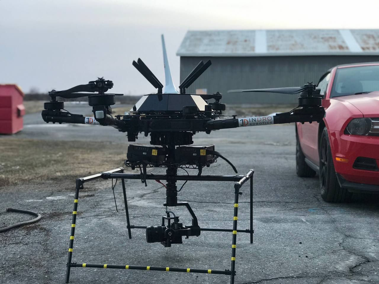
You can find full details of that project here – and a link to InDro’s White Paper on NERDS here. But in a nutshell, Tamimi created a module similar to Commander, only for Enterprise drones using the Pixhawk flight controller. It enables operations over cellular, including real-time dense-data uploads directly to the cloud during flight. It also broadcasts to nearby traditional aircraft that a drone is operating – a tremendous boost to BVLOS flights.

Here’s a picture of that module on top of our Wayfinder drone:

Canada Drones

InDro Pilot


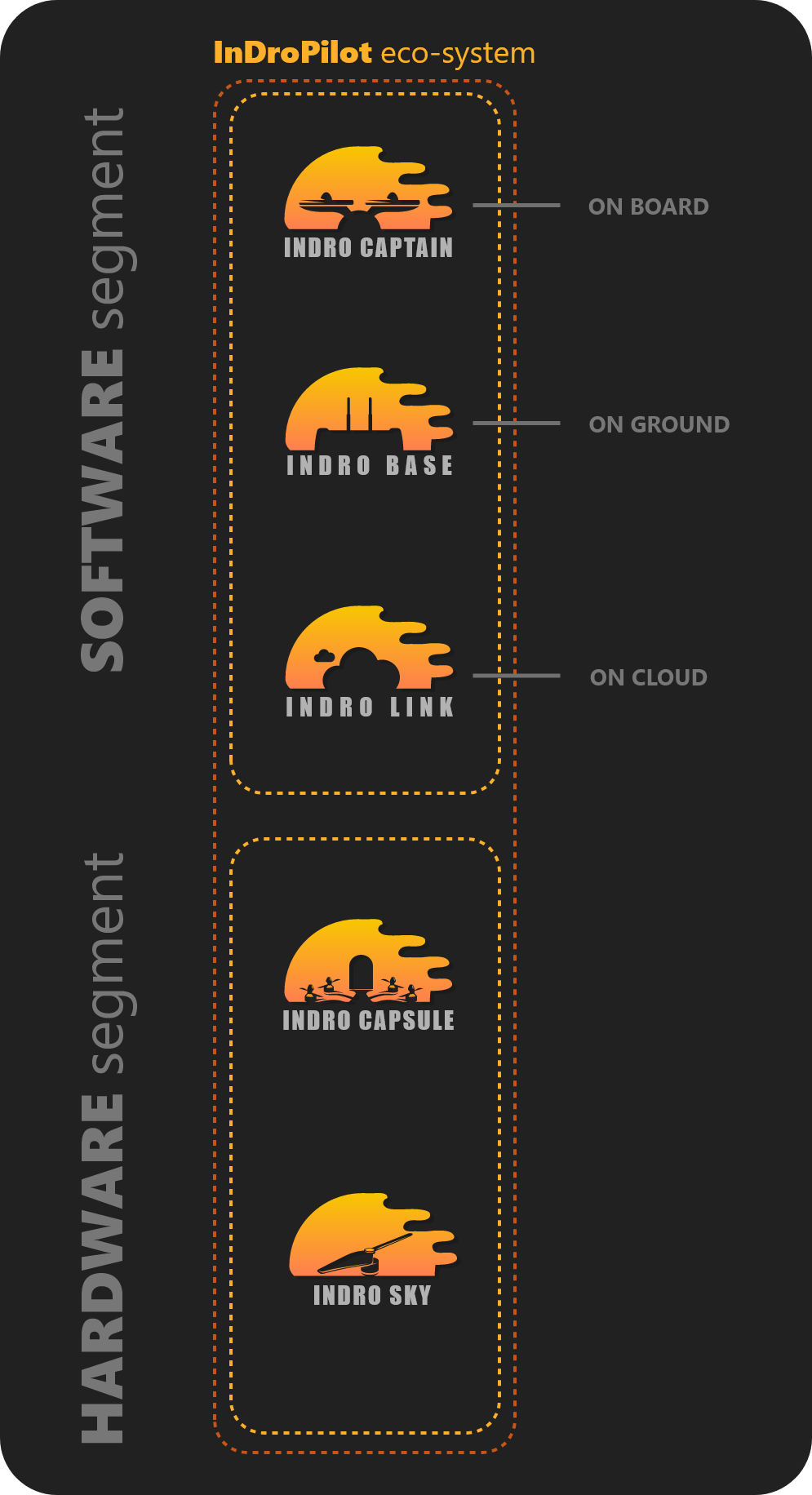
InDro didn’t stop there. The company created an entire software suite – InDro Pilot – for Enterprise drones (and, specifically, drones using the InDro Capsule).

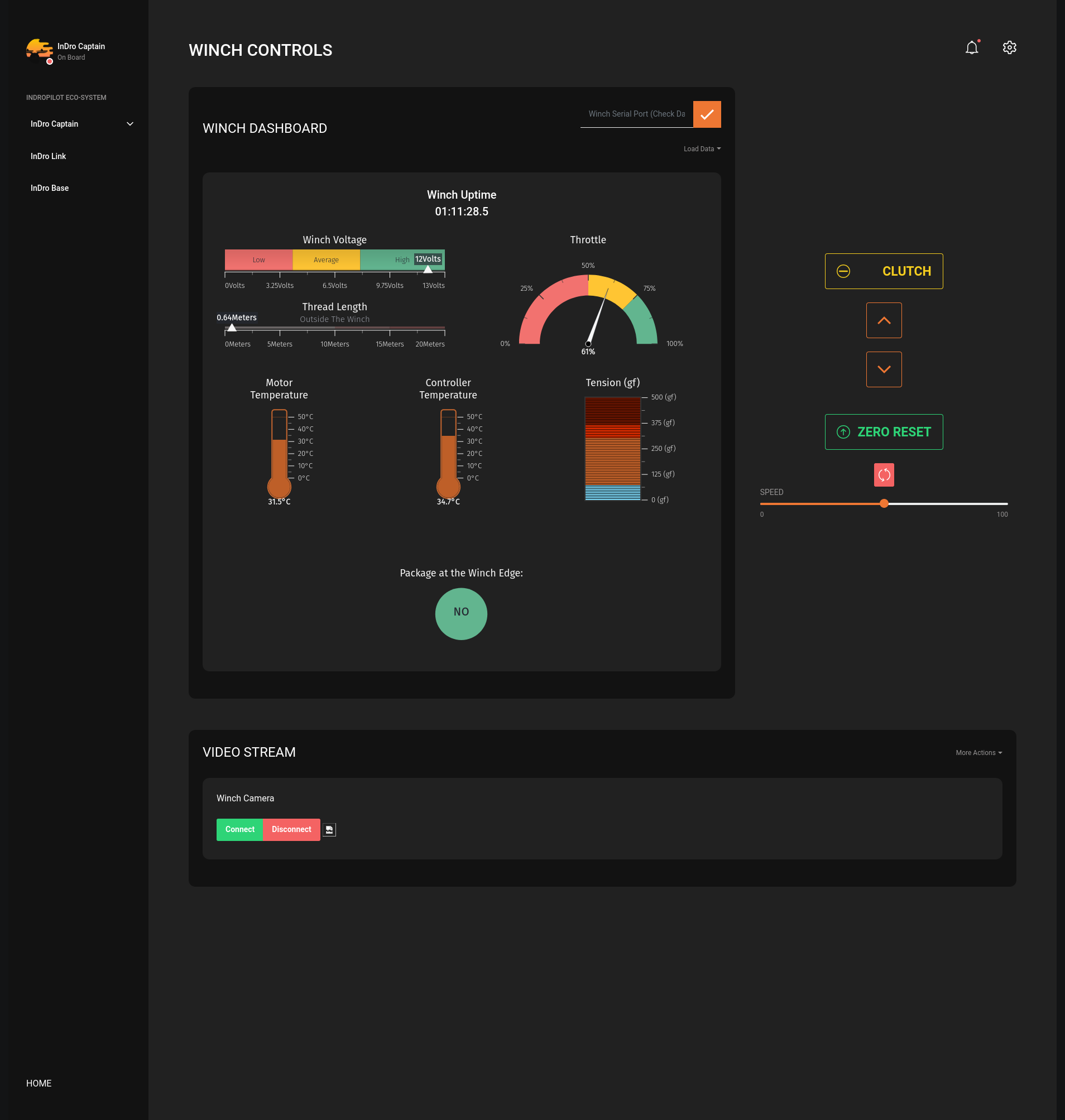
That software makes it a snap to add and integrate other sensors onto drones and carry out low-latency flights over cellular networks. As with Commander, sensors can simply be plugged in to InDro Capsule, and the dashboard allows for drag-and-drop sensors modules to be added to the software suite. Want a winch? Simply add on the winch module and all operational controls and parameters are added to the InDro Pilot software. A robust and encrypted link between the InDro Ground Station and the drone ensures that any data collected remains secure. 

This project was completed in that 2021-2022 window we established earlier. InDro is currently creating a smaller and lighter InDro Capsule for commercialization of the entire InDro Pilot system. 

Here’s a screen grab of the winch software module:

Canada Drone

One more time


And here’s a look at the complete system…

Again, if you’d like a more thorough look at that system you’ll find far more details here.

Drones Canada

That’s not all…


As mentioned, it’s been a highly productive year at InDro. We’ve flown drones in the NRC Wind Tunnel in Ottawa for research on urban wind tunnels. The company has partnered with UBC, Honeywell and others on a major research project involving flights over 5G and using AI software to precisely predict energy demands and costs of any planned drone mission.

As drones begin deliveries at scale in the future, the data being obtained about the capabilities of 5G networks to handle multiple drones simultaneously – as well as costs – will be tremendously useful to the industry-at-large.

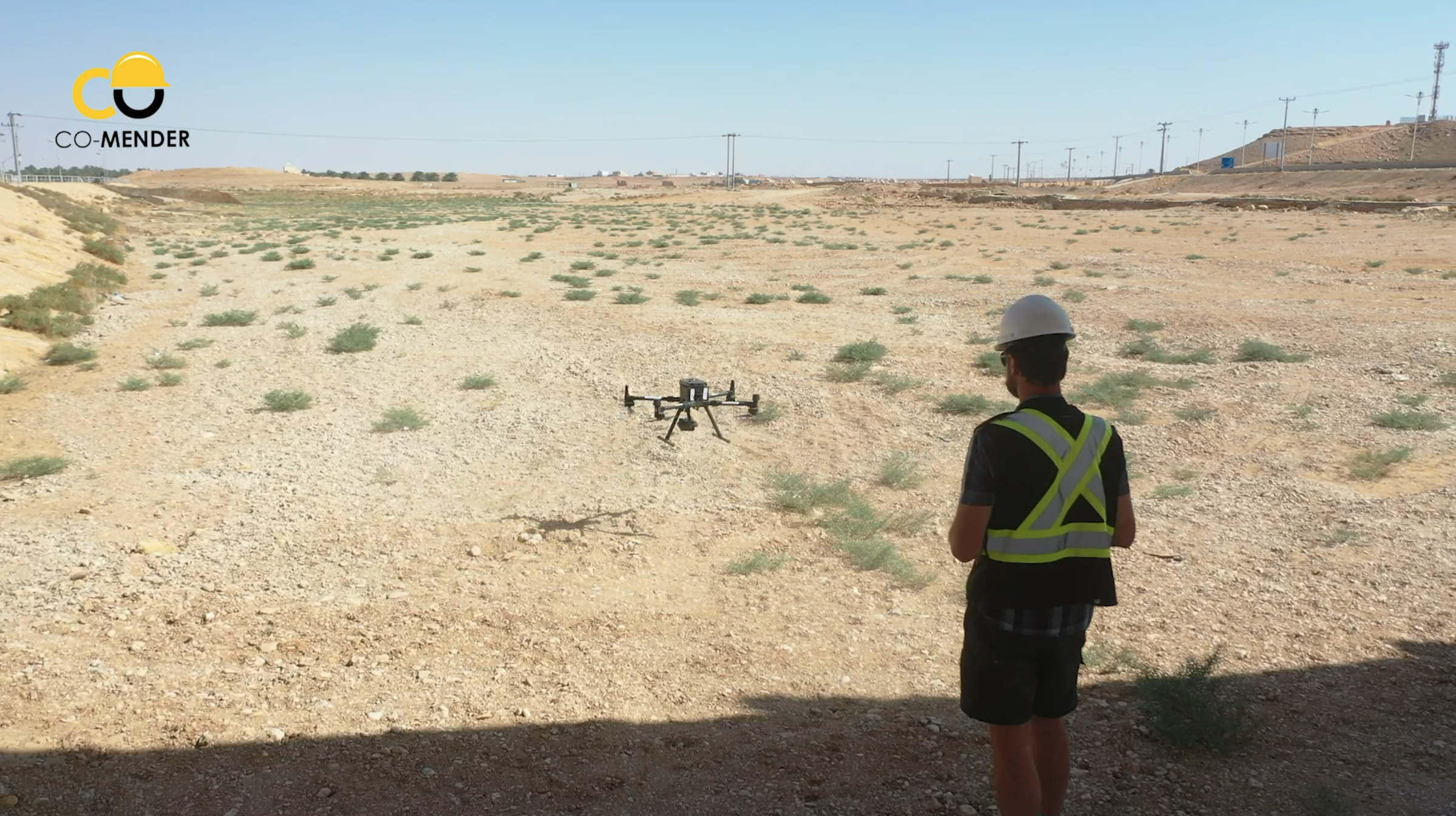
All this, while carrying out service provision for clients on a global scale, including this mission in Saudi Arabia. (That’s our photogrammetry/GIS specialist Eric Saczuk in the photo).

Drones Canada

Before we forget…


InDro was also in the news this year for its role in the Drone Detection Pilot Project at the Ottawa International Airport.

During the protests in the nation’s capital, data obtained by the system revealed that scores of unauthorized drone flights were taking place in restricted airspace – including above Parliament Hill, over 24 Sussex Drive, and even near embassies and other sensitive locations.

InDro takes part in this project – and supplies the drone detection equipment for free – because there’s valuable data being obtained that contributes to both safety at YOW and informed policy and procedures.

In fact, the news even made the cover of WINGS magazine:

Drone detection

Wait, there’s more!


Hard to believe, but there is (and congrats for sticking through this long-ish read!).

InDro reached several other milestones between the fall of 2021 and 2022. The company can’t, unfortunately, share details of these due to non-disclosure agreements. But innovative solutions have been created for global clients. In one example, a prototype robot was so successful that InDro received orders for many more.

On top of that, the company has worked closely with industry and regulatory partners during this period, including delivering InDro Pilot-enabled drones to Transport Canada and assisting RPAS parachute manufacturer AVSS with testing of its latest product. 

Drones Canada

InDro’s Take


With an agile and motivated team, InDro Robotics has created multiple new and innovative products in the course of a single year. Some of these were created specifically for clients, while others were organic in nature. The development of InDro Commander has paved the way for multiple robots (Sentinel, ROLL-E, ROLL-E 2.0). In addition, the company has shipped custom Commander-enabled robots to clients – including one fully customized for Solar Farm inspection. Many clients are now order Commander modules to make the customization of their own ground robotics platforms a vastly easier process.

In addition, the development of the InDro Capsule and InDro Pilot system for Enterprise drones will soon allow clients to easily customize their RPAS with additional sensors, along with secure high-data bandwidth (direct to Cloud) and remote teleoperations via console over cellular networks. Stay tuned for more on that.

CEO Philip Reece got the first word in this summary; he also gets the last:

“I’m justifiably proud of our team for the multiple milestones we’ve surpassed during the past year,” he says. “InDro has created numerous products – and participated in multiple projects – where we’ve been able to push the envelope. Every single one of these products and processes uses technological innovations to make hard jobs easier, or to significantly expand the capabilities of drones and robots. The team has really hit its stride.”

Hopefully, this gives you a much better idea of What InDro Robotics Does. And why we proudly call ourselves an R&D company.


Methane detection via drone with Aerometrix

Methane detection via drone with Aerometrix

By Scott Simmie


There’s no denying climate change. Whether it’s the recent and devastating floods in Pakistan, fires in Portugal – or the multiple rivers globally that have dropped to historically low levels – the planet’s equilibrium has been changing.

While carbon dioxide emissions get much of the press, methane is one of the most potent contributors to the problem of greenhouse gases.

“Methane has more than 80 times the warming power of carbon dioxide over the first 20 years after it reaches the atmosphere,” states the Environmental Defense Fund.

“Even though CO2 has a longer-lasting effect, methane sets the pace for warming in the near term.”

That’s a key reason why the detection of methane emissions has become a priority. It’s also a large part of why Aerometrix – a company specialising in methane detection using drones – was formed.

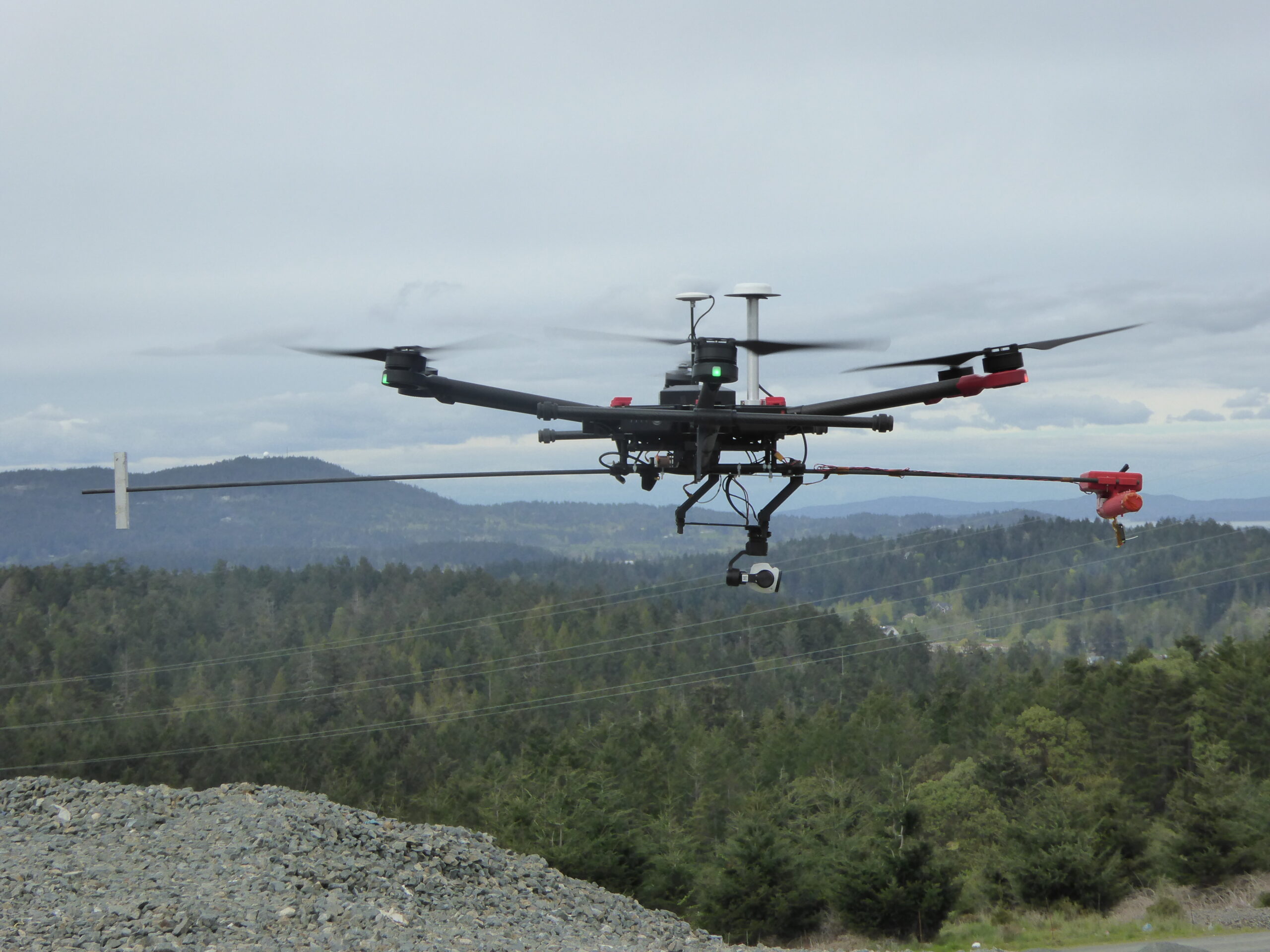
Below: One of the early Aerometrix rigs for methane detection. The sensor is at the forward end of the counter-weighted rod to keep it clear of prop wash.

Aerometrix

Aerometrix


Before we get more into what Aerometrix does (and how it does it), we should point out there’s an InDro Robotics connection here. InDro CEO Philip Reece, along with Michael Whiticar, founded the company. Aerial operations for Aerometrix are carried out by InDro Robotics.

“We felt there was a void in the marketplace for the detection of methane and other gases,” explains Reece. “We also wanted to approach this from an engineering-first perspective, ensuring that we were using, and even developing, the best available sensors and workflow.”

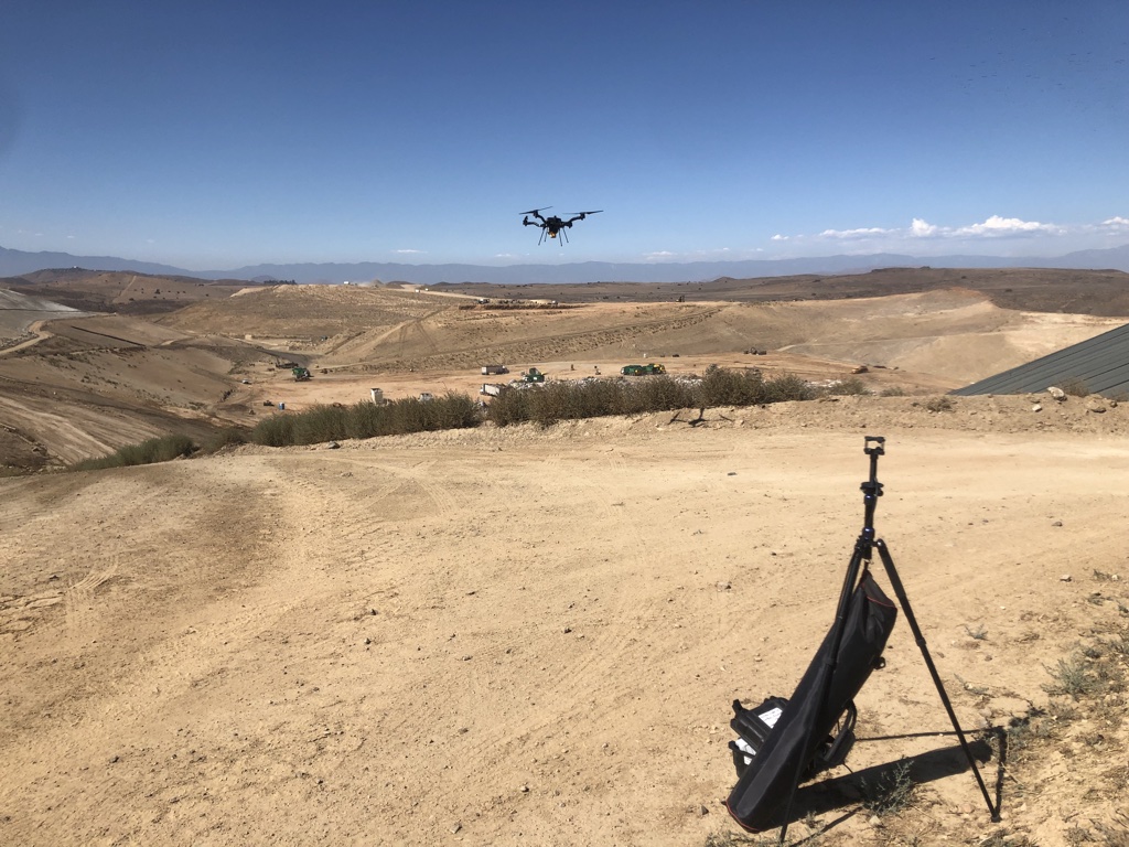
Aerometrix uses two different types of sensors for methane detection. The first is the proprietary GasMap sensor, which is capable of detecting methane in parts per billion (ppb). This laser-based sensor had its origins at NASA’s Jet Propulsion Laboratory, where it was developed for Mars missions. Aerometrix has further refined that sensor and has used it to accurately map methane emissions at petrochemical plants, gas wells, landfills – and even on agricultural sites. (Animals, particularly cows, are a significant methane source.)

“GasMap uses laser spectroscopy,” explains Peter Sherk, an electronics engineer with Aerometrix. “It uses the absorption of lasers by methane to detect concentration. And it’s very precise – detecting not only its presence, but how much there is at a given point in time and space right down to parts per billion.”

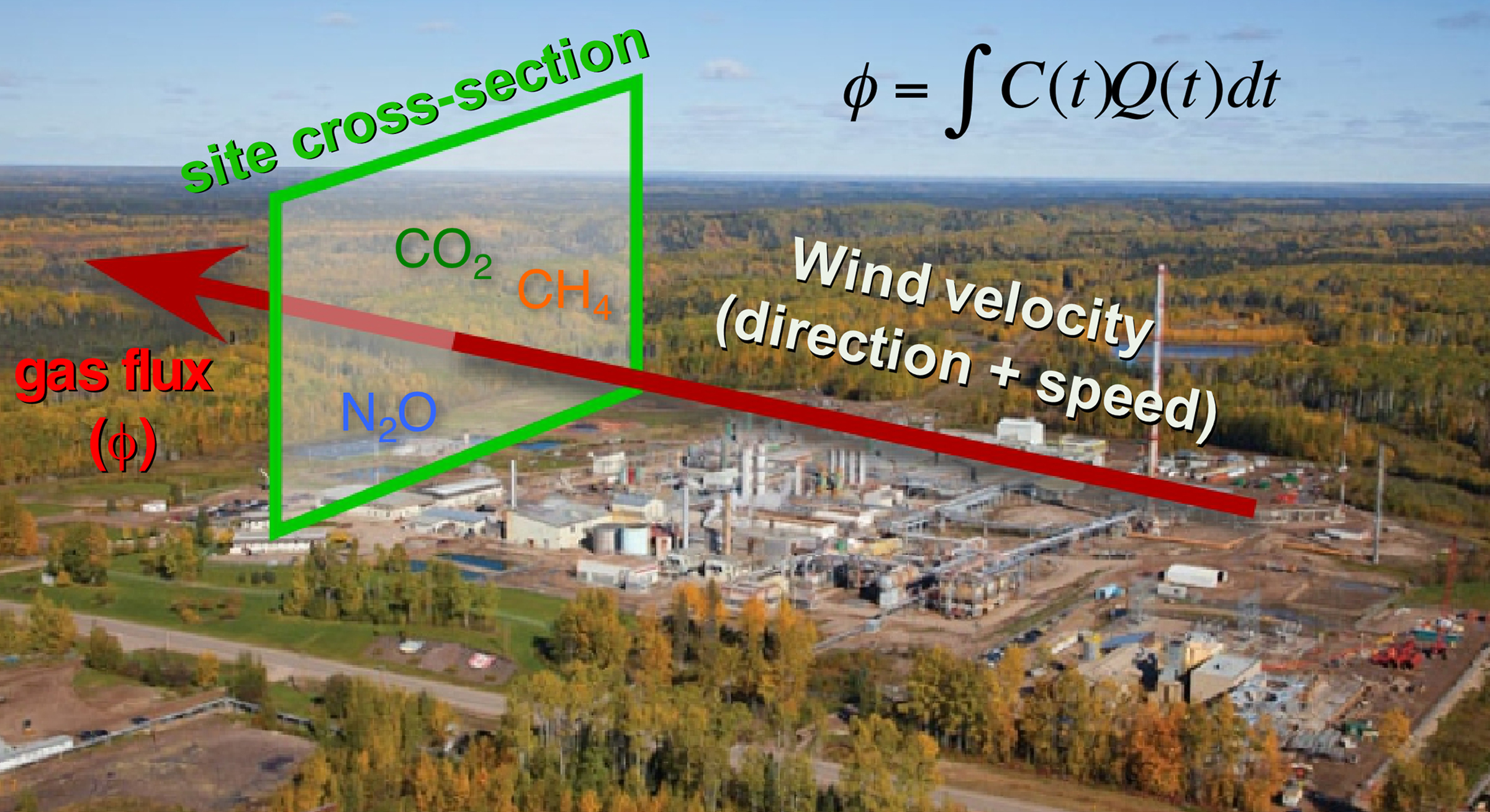
The sensor maps methane (and other gases) by flying horizontally through the plume. When multiple passes at different altitudes have been completed, a “curtain” is obtained. (Don’t worry, we won’t ask you to carry out the calculation – besides, our FluxCurtain software does that.)

Flux Curtain

Zig-zag


As mentioned, the drone flies horizontally through the plume – with each parallel flight at a slightly higher altitude. The sensor is constantly capturing georeferenced data which Aerometrix then runs through software.

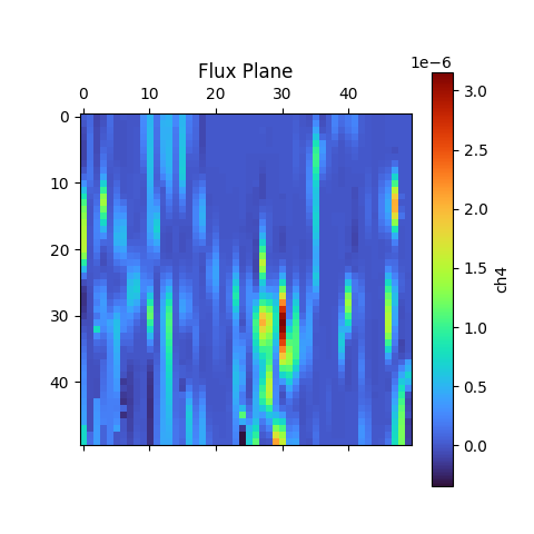
In the images below, you’ll see that zig-zag flight pattern. The blue lines at the bottom indicate methane concentrations. Not surprisingly, those concentrations begin to dissipate at higher altitudes as the methane plume mixes with the surrounding air.

The second image is what’s referred to as the actual “Flux Plane” – where the methane concentrations are represented visually by colour.

Methane Detection
Methane Detection

Efficiency


Though pipelines and facilities that handle methane are obvious places where detection is required, local city dumps are also interested in detecting – and even capturing – methane produced by buried garbage. But many are unaware of the efficiency and accuracy of using sensors like the GasMap mounted on a drone.

“A lot of landfills are doing methane detection already,” says Sherk, “but they’re using far less convenient methods. A lot of the time there’s someone walking back and forth with handheld sensors. With larger landfills any sort of grid pattern will take days and days – and walking over an old landfill can’t be a really healthy operation.Operating a drone is vastly more efficient. And the GasMap sensor is capable of detecting not only the presence of methane, but its concentration at various altitudes as the gas forms a plume and mixes with surrounding air.

Some landfills have been able to not only capture but exploit methane that was previously escaping. The Capital Regional District on southern Vancouver Island has been running a power generating plant on-site at the Hartland Landfill, fuelled solely by captured methane produced by decomposing garbage. It’s been doing so since 2004, creating enough energy to power 1,600 homes.

Recently, the volume of methane produced by the landfill has increased, and the power plant is nearing the end of its operational life. In 2023, the landfill will switch gears and process the biogas into natural gas – selling the product to FORTIS BC.

Kudos to the Capital Region District for having such foresight; the example also highlights how captured methane can be put to positive use.

Aerometrix has carried out surveys now at numerous landfills hoping to capture or otherwise mitigate methane emissions. Using FluxCurtain software, its reports turn what was previously an invisible problem into clear, actionable data that provide a clear picture of emissions and concentrations.

Methane Detection

Another sensor


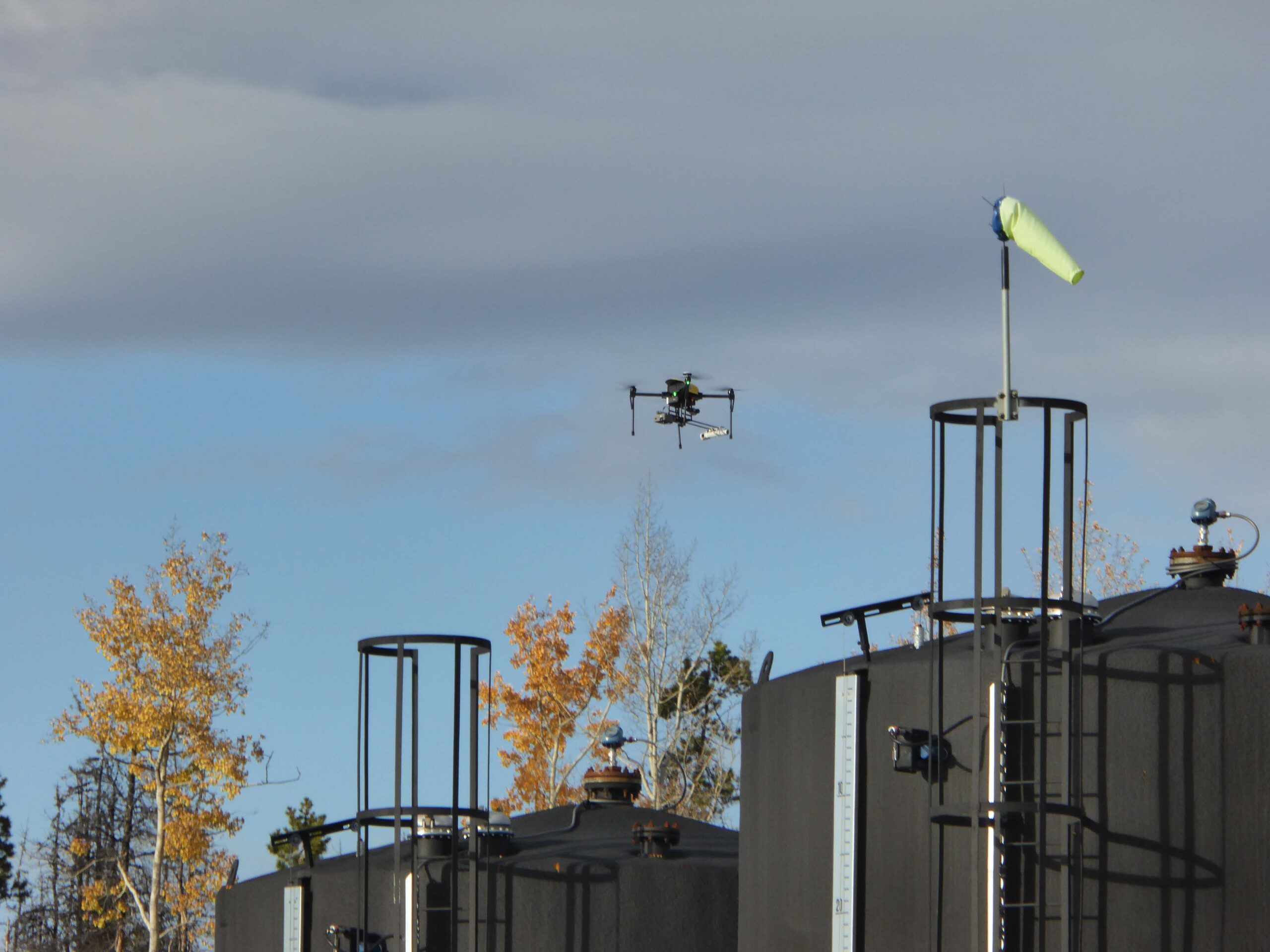
We mentioned a second sensor also being used by Aerometrix. It’s called the LaserScan, and it’s a very lightweight sensor that also uses laser spectroscopy to detect the presence of methane.

Unlike the GasMap, the newer sensor is able to measure vertically. In other words, the drone can be flying directly above a plume and take a measurement straight down to the ground. While it’s not quite as precise as the GasMap sensor (parts per million, rather than parts per billion), the LaserScan does have an advantage when it comes to speed.

Because it does not rely on flying through the plume, the LaserScan is ideal for detecting emissions over large areas. By simply flying a grid pattern at a single altitude, it can rapidly identify emissions. At an altitude of 98.4′, it’s capable of detecting 500 ppm of methane with a plume diameter of one meter.

“While the Falcon is less precise than the GasMap sensor, it has a definite advantage when it comes to speed,” explains Keegan Richter, a mechanical engineer with Aerometrix.

In cases where greater precision is required, Aerometrix can fly two missions: The first with the LaserScan to rapidly detect the location of emissions – particularly over large landfills – followed by GasMap for parts-per-billion accuracy.

Methane Detection

InDro’s Take


We obviously have a special interest in Aerometrix, since InDro’s pilots and drones carry out its aerial missions.

Not surprisingly, since CEO Philip Reece is a co-founder, the mission of Aerometrix closely aligns with InDro’s guiding philosophy: Developing and utilising technology to increase efficiency and – whenever possible – contribute to positive change.

Arguably, the dramatic and apparently escalating shifts we’ve seen to global climate patterns are one of the most pressing problems on the planet. Methane is a key contributor to those changes.

The ability of Aerometrix to accurately detect methane emissions has already helped clients cap leaks and examine other methods for capturing this gas before it hits the atmosphere. Its missions have also meant that human beings are no longer exposed to hazardous environments while capturing data using handheld devices.

In our mind, those are both positive outcomes.

Interested in more information? You can contact Aerometrix directly here.

Putting Sentinel through its paces at EPRI

Putting Sentinel through its paces at EPRI

By Scott Simmie


There’s testing. And then there’s “real-world” testing.

For example, InDro Robotics builds and tests drones and ground robots. We do this constantly, pushing for continuous improvements (and even breakthroughs) with our products. In BC, we’re frequently flying missions to test cellular connectivity or our new proprietary drone software, InDro Pilot.

At Area X.O in Ottawa, we routinely deploy our ground robots on missions to test tele-operations, new sensors, and even autonomous functions. (We have a real advantage here, because Area X.O is made for robots. There are several roads – and even traffic lights – designated for testing and use by autonomous vehicles.)

And while such research always provides us with useful data, it’s just not the same as putting technology to the test in a real-world environment.

That’s why we took Sentinel – our custom-built robot for monitoring and inspection at remote facilities – to Massachusetts.


Autonomous Robots

The EPRI challenge


EPRI stands for the Electric Power Research Institute. It’s a non-profit energy research, development and deployment organisation. EPRI is constantly doing research – collaborating with more than 450 private companies across 45 countries globally. The purpose, according to its website, is to “ensure the public has clean, safe, reliable, affordable, and equitable access to electricity across the globe.” EPRI shares its research with members, which represent virtually all facets of the power generation and delivery sector.

EPRI has multiple research facilities, including one in Lenox, Massachusetts. This particular location features an electrical substation that can be energised, de-energised – and can even simulate rain for testing purposes.

Earlier this year, InDro Robotics was one of a small number of companies to participate in research to analyse the effectiveness of remotely-operated and autonomous ground robots in a variety of conditions. The purpose was to determine the ability of such devices to carry out inspection and monitoring – including whether these robots could detect problems such as arcing.

InDro Robotics Sentinel

The InDro Team


We dispatched InDro Account Executive Luke Corbeth and Robotics Engineer Austin Greisman (along with Sentinel, of course) to the EPRI facility in Lenox, Massachusetts.

“EPRI’s goal for this program was to evaluate technologies that are capable of 24/7 autonomous substation inspection and security monitoring,” explains Corbeth. “This put Sentinel in a real substation environment, to conduct inspections and security patrols amidst powerful electrical currents.”

In fact, there was a series of specific tests during the week-long demonstration. These included all permutations of the following:

  • With the substation energised and de-energised
  • With simulated rain and without rain
  • During daylight and at night

That makes for eight separate missions carried out in different conditions – including an energised substation with simulated rain during nighttime, and a de-energised substation on a clear day.

In addition, each of the above eight missions was carried out both via remote teleoperations – and also autonomously. Factor that in, and there were 16 separate challenges.

And that’s not all. EPRI engineers carried out their own tests on Sentinel, seeing how well it handled inclines, manoeuvres through mud, what weight it could carry at what speeds, and battery life. On these tests, Sentinel performed very well.

“Once we were on site, the value that Sentinel brings to utilities became very apparent – especially identifying thermal signatures to identify (overheating) components onsite or intruders trying to break in,” says Corbeth.

“The performance at night and during simulated rain tests was very successful. They actually have hoses that go overhead and can blast the site with water.”

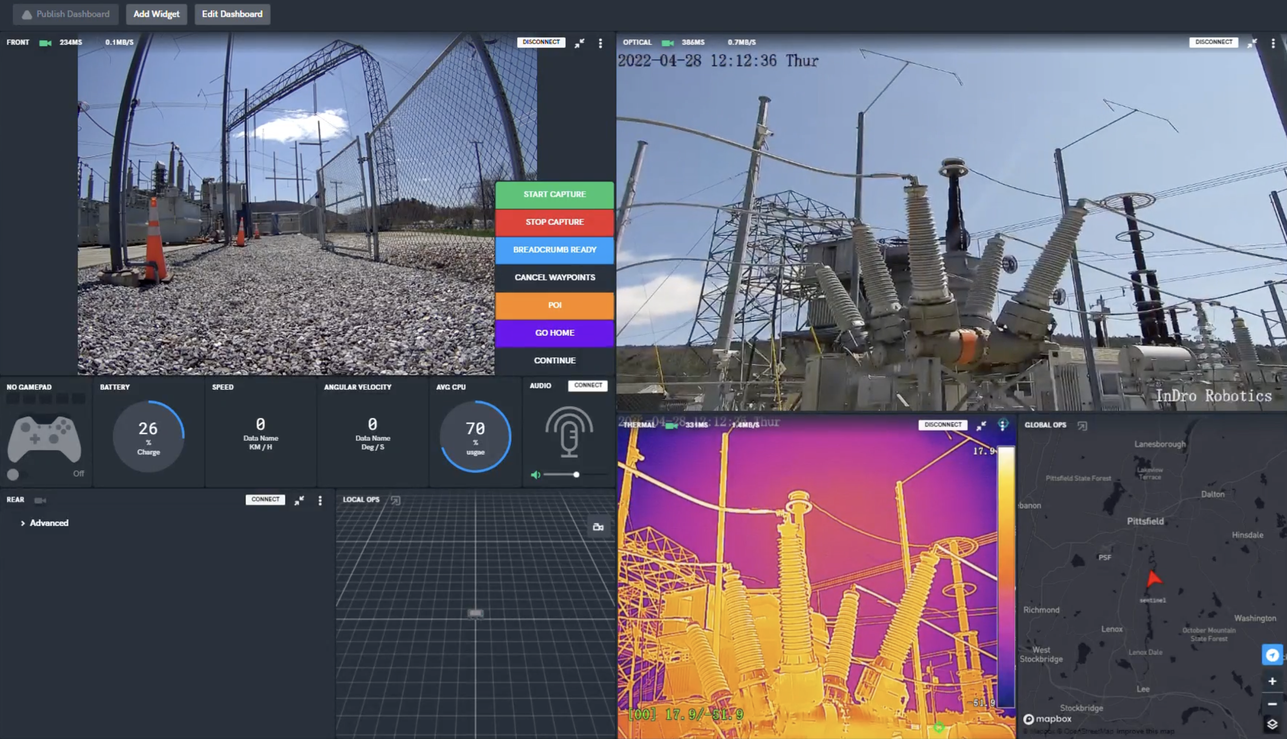
FYI, the image below is a screenshot from the secure, browser-based controller for Sentinel. The operator can see all key parameters, control propulsion and camera systems, in real-time.

EPRI

Lessons learned


At the outset, we told you this was very much a real-world test for Sentinel. If this article were simply a piece of marketing, we’d tell you that everything went perfectly. But it didn’t, and there were lessons learned.

For one thing, we discovered that Sentinel’s track-based locomotion – though ideal in numerous demanding terrains – fell somewhat short in the heavy gravel bed of this substation. Pieces of gravel got caught in the tracks from time to time. As a result, we’re now building a rugged wheel-based variant of Sentinel specifically for this kind of surface (though the tracked version will still be available).

We also faced some challenges with autonomous missions. For one thing, at the time of testing Sentinel did not yet have an optical-based docking system for wireless re-charging (it does now). We also originally thought that a GPS-based guidance system would work in this environment. And while it did, we soon realized that SLAM (Simultaneous Localisation And Mapping) would be a better option. That feature will be integrated into Sentinels going forward.

“The opportunity to get onsite enabled us to test our autonomy package and understand what it’s good at, as well as what needs to be improved,” says Corbeth. “We believe we’re well on our way to a complete, 24/7 autonomous solution. I’d say we’re 85 per cent of the way there. This is new technology” 

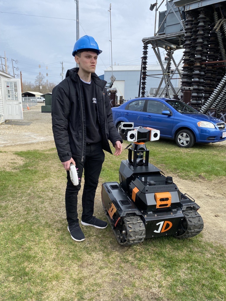
InDro Engineer Austin Greisman on-site in Lenox with Sentinel

InDro Robotics Sentinel

InDro’s Take


Research and development, as we often say, is at the very core of InDro Robotics.  And a big part of R&D is testing outside of the confines of the lab.

And while we were very pleased with many aspects of Sentinel’s performance in the field, we also identified areas where there was room for improvement. Sentinel is now capable of fully autonomous docking to its wireless charging station, and we’re well along the path with fine-tuning SLAM on this device.

Full autonomy, as many of you know, is a difficult challenge. Whether it’s ground robots or drones, InDro has always taken a “Crawl, Walk, Run” approach. Sentinel is now hitting its stride with walking – and getting ready to run.

InDro Robotics partners with UBC, Rogers, Honeywell on 5G UAV project

InDro Robotics partners with UBC, Rogers, Honeywell on 5G UAV project

By Scott Simmie


Picture a small fleet of drones, flying over an urban centre. They are connected to pilot-observers – and each other – over a 5G network.

Some are carrying critical documents, others prescription medication. The UAVs are flying autonomously, able to avoid any conflicts both with each other and with traditional crewed aviation. One of the drones is powered by a hydrogen fuel cell.

The energy requirements of each flight – factoring in payload, weather and distance were calculated prior to takeoff. The financial cost of each flight is also known, valuable data as companies weigh the business case of drones versus more traditional deliveries.

Sounds valuable to us. And that’s one of the reasons InDro Robotics is part of an ambitious research project, in conjunction with corporate and academic partners, at the University of British Columbia.

Drones Canada

Collaboration


If you’ve been following the work of InDro Robotics, you’ll know that collaboration is a big part of what the company is about.

InDro has partnered with such companies and organisations as NASA, the Canadian Space Agency, Ericsson, the National Research Council – and many others. (If you’re interested in seeing some of our other partnerships, check out the bottom of this page.)

We’re now pleased to announce our latest collaboration: A major project involving the University of British Columbia, Rogers, Honeywell and more.

It’s called the UBC Mini Cities Research project. And it has ambitious goals.

Below: UBC Campus. Photo by Martin Dee / UBC Brand & Marketing


Canada Robotics

Mini-Cities


Let’s start by taking a look at what the term “Mini-Cities” actually means. For that, we contacted Omar Herrera, Senior Program Manager at UBC.

“UBC is just like a small city,” he says. “It has its own population, its own services, streets, garbage disposal – so it’s like a mini-city, in a way. One of the things we’re interested in with this project is how can we really deploy UAVs in the cities.”

So you can think of the UBC Campus, which is also serviced by a Rogers 5G corridor, as kind of a test-bed to prove the safety, viability and economics of drone deliveries in a major urban centre. What weights and sizes of packages can be delivered and over what range? How many drones can be operated autonomously at a single time over the network? Does 5G connectivity vary with altitude? Can an Unmanned Traffic Management system – to minimise the potential for conflict with low-flying traditional aircraft – be successfully deployed and demonstrated in a mini-city? Can AI use data from previous flights to accurately predict energy demands for future missions? How efficient (and cost-effective) is a hydrogen fuel cell drone when compared with one powered by lithium-polymer batteries?

These are all questions – and there are more – that the project will be answering.

If that sounds like a major task, it is. In fact, InDro has relocated mechanical engineer Keegan Richter from our Vancouver bureau to a lab office at UBC – allowing Richter to work directly with the UBC team and MéridaLabs.

Richter is now InDro’s “traveling scientist,” working on the UBC campus three days a week, connecting with broader engineering departments.” That’s Richter below, on the UBC campus.


5G UAV


“I’m really excited to be working with the MéridaLabs team,” he says. “They’re truly reimagining clean technology.”

Richter is acting as the technical lead for InDro’s proprietary hardware and software (Wayfinder and InDroPilot), serving as liaison between InDro Robotics and other partners, and assisting with project management.

The InDro robotics Wayfinder drone will be flown over 5G using InDroPilot for the first phases of the project. Rogers has supplied a CradlePoint router which will measure and log 5G signal strength along the flight corridor – including at various altitudes. Heat maps created with this data will be used to optimize future flight planning.

“We want to assess the capacity of InDro’s Wayfinder to deliver packages,” explains Richter. “Demonstrating how much, how fast, and how far we can carry essential goods are questions of particular interest to the team.”

A Masters student, working within MéridaLabs, will be crunching the data for energy demands and costs. The goal is to build an AI model that can quickly determine energy needs and ranges for future planned missions. This software could prove to be of great assistance to other UAV companies hoping to conduct deliveries at scale.

Canada Drones

UBC’s Interest


Omar Herrera also has a technical background. He’s a chemical engineer with a PhD in mechanical engineering. He explains that a major project about energy was already underway and that this seemed a logical next step.

“The reason why this all came to be is because we (MéridaLabs) had a project with the University – a large test bed – combining different kinds of energy sources into energy storage. Moving that energy is what really drives us, and our research is related to that.

“One of the visions we have is that transportation doesn’t have to be limited to manned vehicles. And that’s how we got connected with InDro Robotics.”

The project will also capture data to help determine how many drones could potentially be operating simultaneously (and autonomously) in a 5G environment.

“We’re going to look at a few things, including the implications of antennae. Let’s say we have hundreds of drones (in flight) with hundreds of signals underneath. With drones flying autonomously, what would be the threshold for the number of drones that can fly safely (over 5G)?

It’s a good question. And while the project will at one stage involve multiple drones flying simultaneously – there won’t be a real-world test involving hundreds. But Herrera says software developed for the project will be able to predict, based on a small number of drones, what is likely to happen with many more in the air.

You’ll recall Herrera mentioned MéridaLabs is deeply involved with energy and energy storage. This video (which includes drones!) provides a good overview.

InDro’s Take


UBC was North America’s first 5G campus, and this isn’t InDro’s first involvement with the institution. It is, however, the most ambitious.

“This project should produce excellent data – along with further solutions – to enable safe and autonomous BVLOS drone missions and deliveries over 5G,” says InDro Robotics CEO Philip Reece. “We believe the results will be useful not only to project participants, but to the RPAS industry as a whole.

“A world where drones and ground robots carry out important tasks at scale, utilising the bandwidth and power of high-speed networks, is coming. I believe this research is an important part of the way forward.”

Stay tuned. This is a long-term project. But we’ll keep you up to date as we hit milestones along the way.

InDro’s “Drone-in-a-box” captures precision agriculture data without the hassle

InDro’s “Drone-in-a-box” captures precision agriculture data without the hassle

Recently, we told you about a really intriguing InDro Robotics solution.

It’s one that appeals to people who need drone data – but don’t have a drone or a certified pilot. It also appeals to people who like to keep an eye on their money, and can’t quite justify the expense of hiring a contractor to come on-site.

In a nutshell, it works like this: InDro ships you a fully-charged drone with the appropriate sensor for the job. We arrange for a mission time when you’re available and the weather is cooperating.

And then what? You simply pull the drone from the box, follow our instructions over the phone, and we’ll do the flying.

In our recent post, we talked about how this is ideal for solar farms – and it is. But that’s not the only sector where we can help. Our “Drone-in-a-Box” program is also ideal for precision agriculture, an area where it’s helpful to have a professional fly the mission and crunch the data.

And that…looks like this:

Expertise


You might have noticed that video is from 2017. Which means InDro Robotics is now in its fifth year of offering remotely piloted services.

But some things have changed since that video was produced. We are now capable of remotely piloting using 5G network connections. That translates into near-zero latency for our remote pilots – and more. We now have the ability to stream even extremely dense data directly to the cloud. This means clients with 5G service in their areas have only a minimal wait time before receiving actionable data.

In the early days of this service, InDro would process the data once the drone was returned. With direct-to-cloud uploads, processing can begin literally while the mission is being carried out.

What’s more, literally any kind of aerial inspection can be done in Canada using our system. If you haven’t seen it, please take a moment and check out this more recent video: InDro inspected a large solar farm from more than 500 kilometres away:


InDro’s Take


Precision agriculture requires high-end hardware, software – and expertise. It’s not something the average farmer can simply jump into.

Yet a single flight can provide a wealth of data surrounding moisture, crop health, nutrient levels and more. That data allows farmers to save costs through the precise applications of fertiliser, water, herbicides and insecticides only where they are needed.

Clients have told us they previously shied away from precision agriculture using drones due to cost and complexity. Our “Drone-in-a-Box” is a cost-effective solution that produces results.

If you’re interested in precision agriculture, solar inspections – or any other area where a remotely piloted drone flight can capture meaningful data, get in touch. We’ll ship you a drone, we’ll fly the mission – and you’ll receive the data you need.