On the scene: InDro Robotics – in Saudi Arabia

On the scene: InDro Robotics – in Saudi Arabia

At InDro Robotics, it’s fair to say we receive inquiries from all over the world.

Some inquiries are about our R&D, and whether we might create a solution for a client’s problem. Others are about InDro’s many services – ranging from training and certification to hands-on service provision. And sometimes, companies simply want to tap into our expertise, to see if we can help them out with a job.

We don’t say that to brag, but to help explain how and why our own Dr. Eric Saczuk happened to recently be flying drone missions in Saudi Arabia. One more bit of background: Eric is an expert when it comes to drones and data capturing and interpretation. He has a PhD in Remote Sensing and – in addition to working for InDro Robotics – is also head of the RPAS (drone) Hub at the BC Institute of Technology.

That’s why Eric is one of our “go-to” pilots when it comes to complex data acquisition missions. He travels a lot – but why this trip to Saudi Arabia?

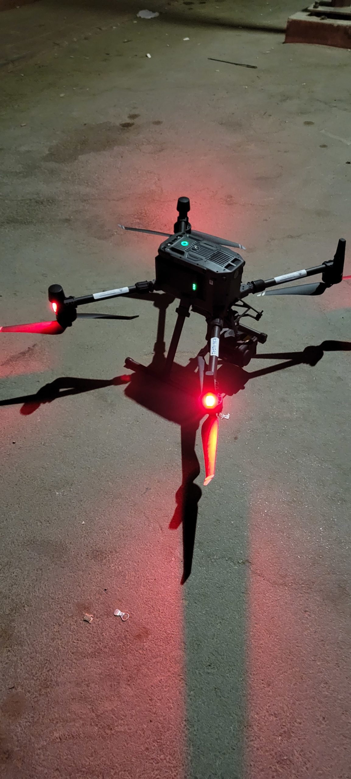
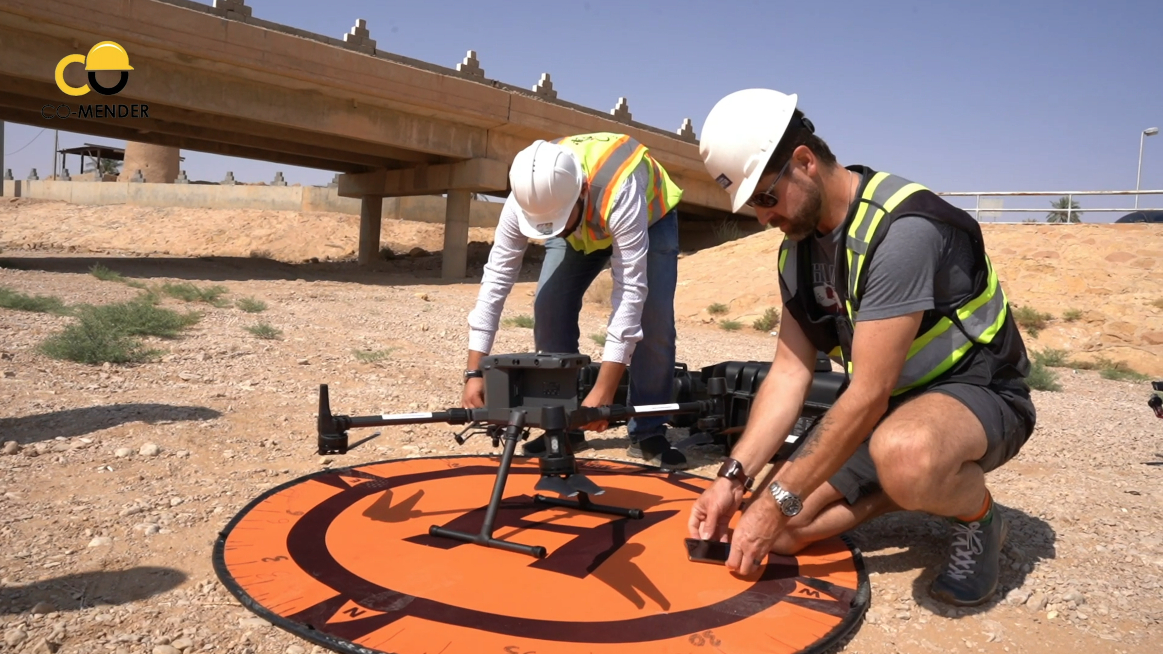
“I went to essentially help a company develop their drone inspection and survey program,” he explains. The company (Co-Mender, which specializes in concrete infrastructure inspection and repair) had purchased a DJI M300 from Canada and hadn’t flown it yet. The firm also had a couple of critical inspections they wanted to get done ASAP.

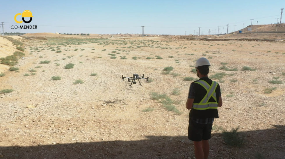
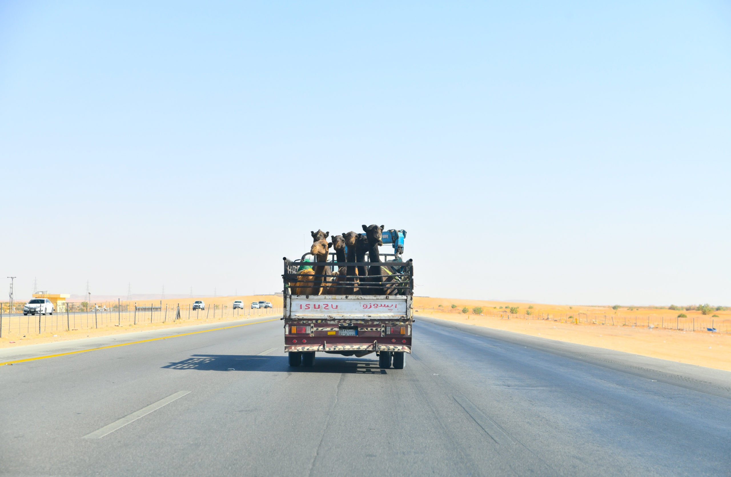
So Eric hopped on a jet, and 17 hours later arrived somewhere decidedly less green than his home base of Vancouver. He took this snap while on the trip:

Saudi Drone Inspection

Getting the drone to fly…


Normally, this is the easy part. You set up the machine, ensure the firmware is updated, do a physical inspection, check that all permissions have been obtained and that it’s generally safe to proceed. (There are other steps, but you get the drift.) Except in this case, there was a problem – even though it was a brand new enterprise drone that had never been flown.

They turned it on, and, well, nothing.

“Their drone was actually region-locked to North America, so there was no way it would turn on in Saudi Arabia. So the first order of business was to figure out how to unlock it. As soon as the drone turned on it was saying ‘I’m in Saudia Arabia, I’m not supposed to be here. I will not turn on.'” (Well, it wasn’t literally saying that, but that was the gist of the message popping up on the controller.)

The clients, of course, were concerned. Their brand-new drone wasn’t working and they had time-sensitive jobs to do. So Eric set to work.

Canada Drone Companies

The path to a solution

After trying everything he could think of related to firmware hacks, Eric contacted InDro’s engineering team and reached out to DJI’s Enterprise side for support. While waiting for some a workaround and not one to waste time, Eric borrowed a DJI Mavic Air 2 from a company hired to create video content about the projects. This allowed for the capture of preliminary photogrammetry of the bridge. Eric also took ground-based DSLR photos from the ground, shooting upward to capture the underside of the bridge.

Drone photos are all geo-referenced, meaning they contain metadata that places the photo in 3-D space at a specific time. But, with rare exceptions, DSLR images do not contain that kind of data. So how would these images be integrated? Well, the photogrammetry software is capable of picking out common features in any kind of imagery, whether aerial or terrestrial. So once it understood what a certain pillar looked like, for example, the software integrated those DSLR photos and a rough 3D digital twin could be created.

But the project required an accurate digital model, which mean that they still needed that M300 to fly. Finally, says Eric, the answer came from DJI support.

“Within two days, we had a solution from DJI to apply for a geo-unlock prior to each flight,” he explains. “It was not ideal, but it allowed us to get the jobs done.”

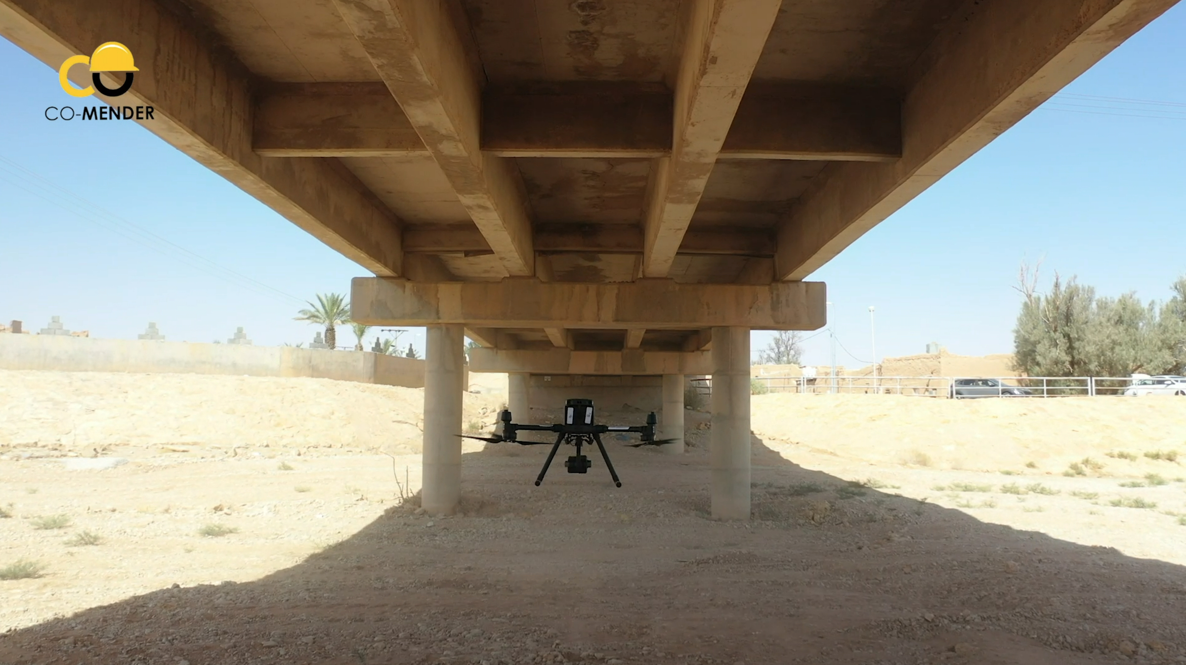
Several days later, Eric began re-flying the bridge mission, using the M300 to capture the structure from all angles (including from below, with the gimbal tilted upward). There were issues with dust, as the M300 kicked up a fair bit when flying beneath the low bridge. In fact, Eric had to pause the mission from time to time to wipe the lens clean.

M300 Drone

M300 back in action


With the M300 back in action, Eric was able to proceed with the mission with the ultimate goal of producing a complete digital twin of the bridge (a 3D digital reconstruction of the physical site, which is very useful for inspection purposes). Engineers use these digital twins to look at the asset and inspect it from all angles. If they find areas of concern, seeing the high-res images associated with that spot are just a few clicks away. In this case, the firm was attempting to determine whether the bridge should be repaired or replaced.

Then it was on to the next mission.

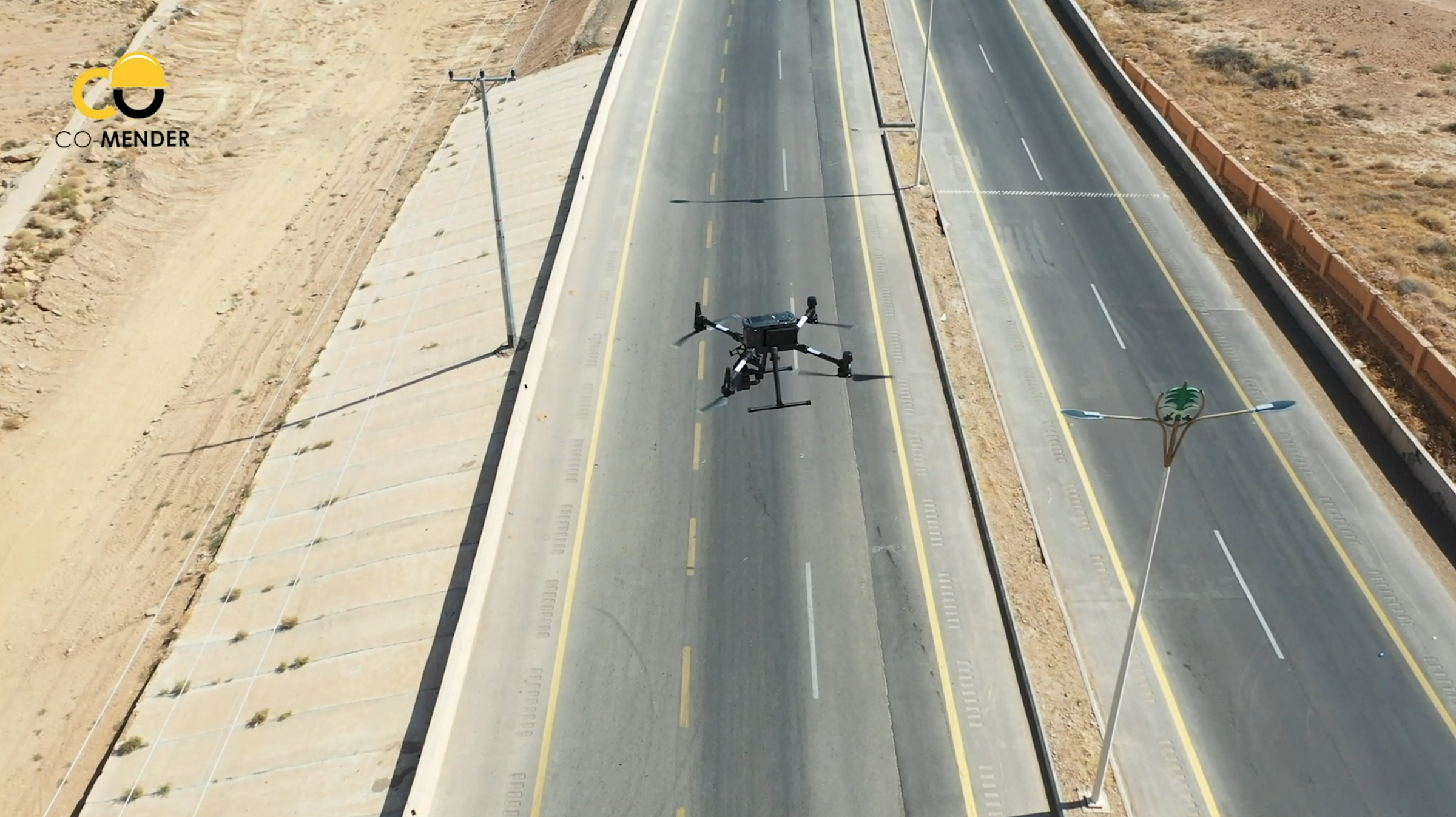
“The other site was about 50 kilometres southeast of the mountainous town of Al-Bahah. Here, the team was dealing with a dangerous 80-metre high rock cliff adjacent to a recently twinned highway,” explains Eric. “They were quite concerned about the high risk of rock fall activity and needed to engineer mitigative structures to stabilize the slope. In order to proceed, they needed detailed contours so their engineering team could design these structures.”

M300 Drone

If only there was a video…

Words and photos are nice, but sometimes a video can really give you a better sense of the job. Thankfully, Co-Mender pulled one together and has given us permission to share it. You’ll get a glimpse of the work InDro’s Dr. Saczuk carried out:

So, how did it go?


According to Eric, very well. Putting an enterprise drone to work, in conjunction with an excellent ground crew and reliable photogrammetry software, produced impressive results.

“I think ultimately it was quite shocking for the client: To be able to fly the drone for a couple of hours to collect the imagery, and within 24 hours deliver to them accurate contours. That was something they had never had access to before on that short of a timeline and that level of accuracy. To have surveyed that slope manually and generate contours would have taken probably taken two weeks.”


M300 Drone

‘A memorable trip


Eric says he met a really great team at Co-Mender and Gulf Crete (the support company), including one engineer who wanted to soak up as much knowledge as humanly possible during his stay. Eric also really enjoyed experiencing Saudi Arabia for the first time.

“I was quite keen on experiencing the culture – and I’m glad I did. I met incredibly friendly people and saw such diversity – everything from 400-year-old villages to a theme park that was like New York/Vegas.”

Eric also sends a ‘Thank You’ to Ian Wills, the President of Coastal Drone Co. It was Ian who connected the client with InDro Robotics.


InDro’s View


We are pleased with the outcome of this trip – simply because the client was happy. We perhaps don’t advertise these services as much as we should, but InDro has a full team of engineers and expert pilots (both of drones and Uncrewed Ground Vehicles), who are happy to help with solutions and training pretty much anywhere on the planet.

“A lot of foundations at InDro are based on providing unique and specialized training and solutions for clients,” says Eric. “And there have already been discussions on how we now take that to an even greater scale.”

If you have a problem…we’d love to help you solve it. Get in touch here.


The InDro Robotics “InDro Commander” for ground robots

The InDro Robotics “InDro Commander” for ground robots

By Scott Simmie, InDro Robotics


Today, building basic robots isn’t hugely challenging for engineers – though, of course, some robots are a lot more complex than others.

The really tough part is making those robots be useful.  Tasks like navigating, capturing thermal imagery and other data – even identifying and manipulating objects – all require much more than wheels and sensors and end effectors (the robotic equivalent of hands). Regardless of whether the robot is simple or complex, it needs brains.

Those brains consist of both hardware and software, with specific bundles of code that can help with specific tasks. And that’s where the Robot Operating System, or ROS, comes into play. ROS.org is a repository of software packages, purpose-built for specific robotic applications by a global network of collaborators.


via ROS.org

As the organization’s website explains it, ROS “is a collection of tools, libraries, and conventions that aim to simplify the task of creating complex and robust robot behavior across a wide variety of robotic platforms.

“Why? Because creating truly robust, general-purpose robot software is hard. From the robot’s perspective, problems that seem trivial to humans often vary wildly between instances of tasks and environments. Dealing with these variations is so hard that no single individual, laboratory, or institution can hope to do it on their own.”

And so ROS could be thought of as a super helpful toolkit, where collaborators upload and share code they’ve developed – and also download and integrate (or even modify) code others have written in order to make their robot carry out required tasks, including specific ways of communicating with an operator or base station.


ROS is cool, but could it be even cooler?


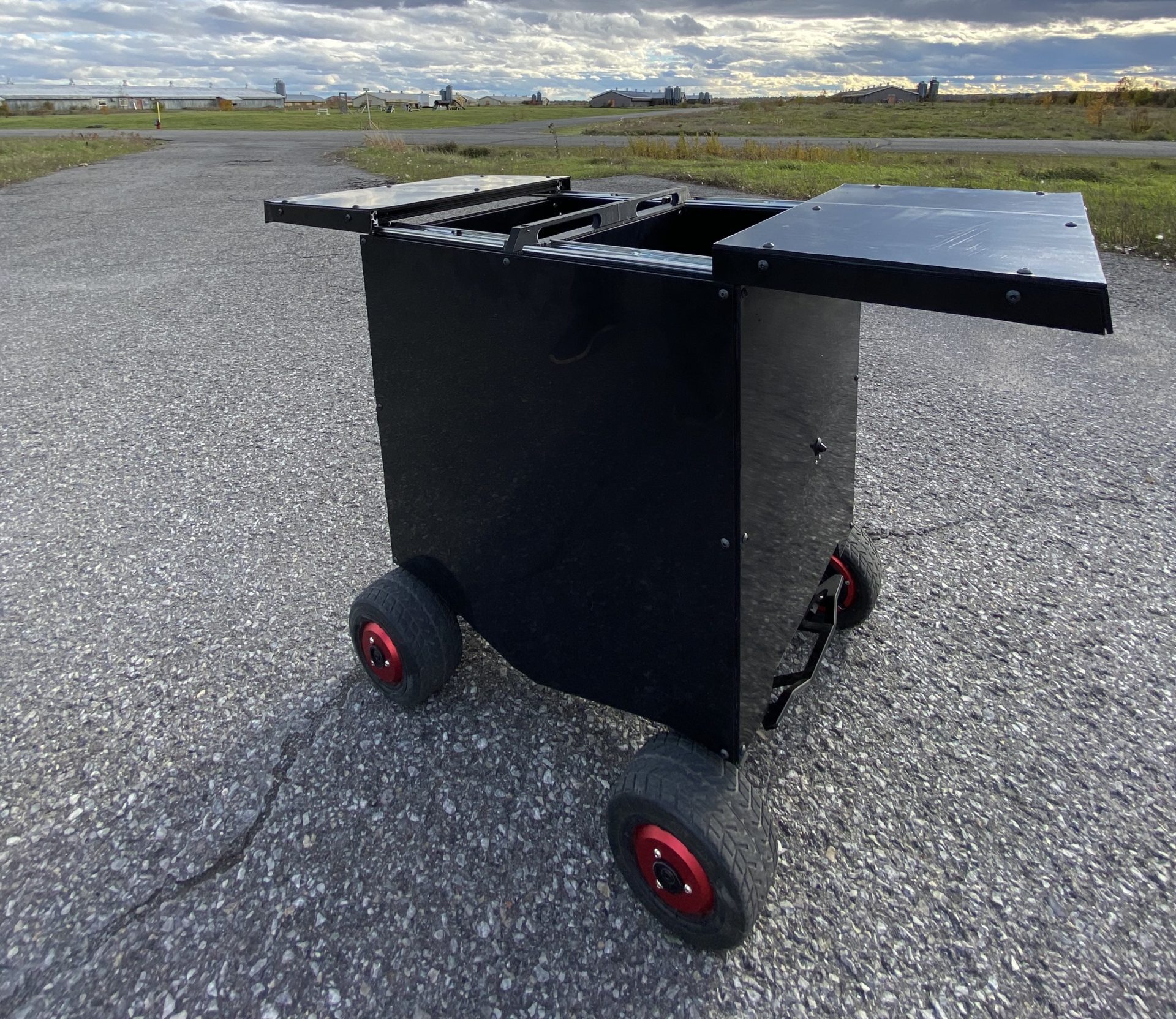
Some time back, we started to ponder this question. Specifically, what if you could pack some of that software in a box – along with the hardware required to run it? And what if that box could easily be integrated to a ground-based robot (most already use ROS drivers) to get it up and running as seamlessly as possible?

That’s the concept of a new InDro Robotics product called InDro Commander, developed by Engineering Manager Arron Griffiths in conjunction with the InDro Robotics Area X.O team.

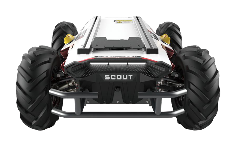
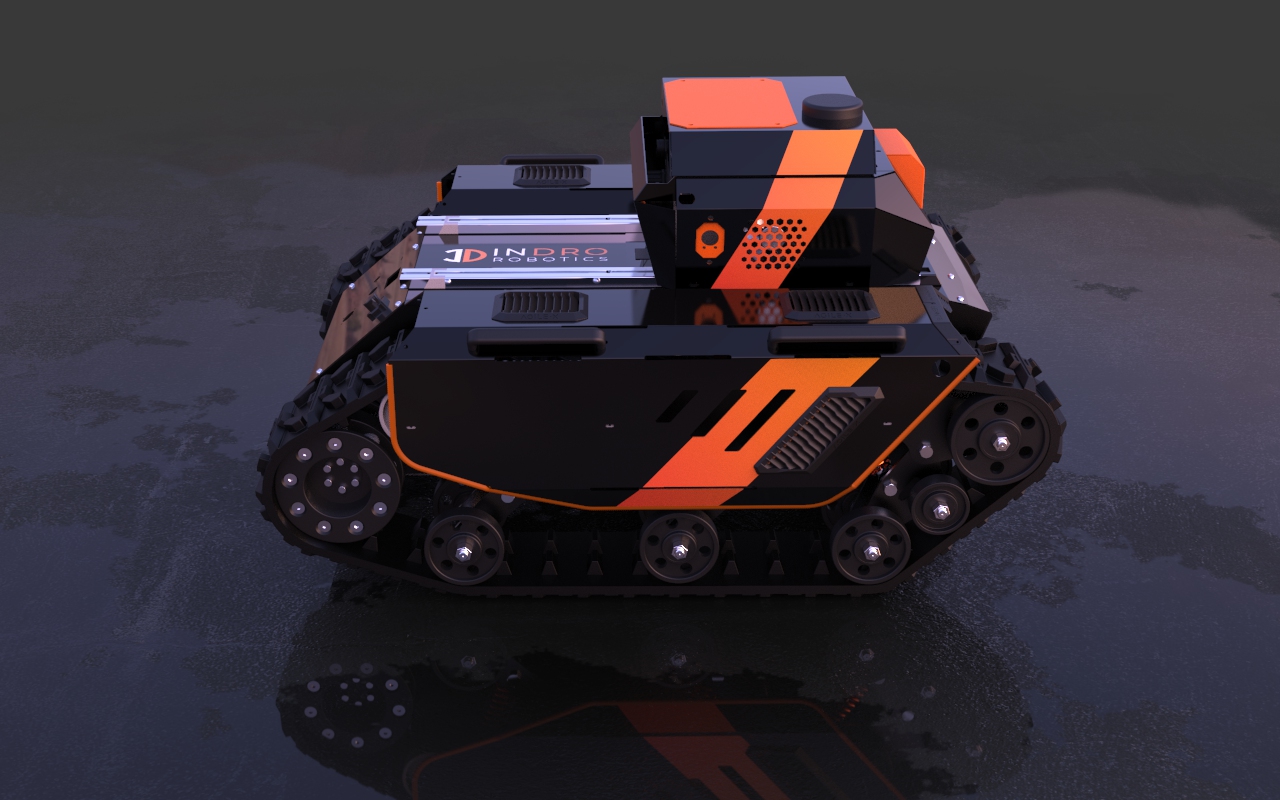
Arron had been working with ROS for about five years, so he already had a great understanding of the available software tools. Arron has worked in robotics for more than a decade now (he was also the Senior Application Engineer at Clearpath Robotics prior to joining InDro Robotics). And Unmanned Ground Vehicles, or UGVs, is an area that has really picked up for InDro since we partnered with Chinese robotics leader AgileX. The picture below is of “Scout” – one the company’s UGVs.


AgileX Scout

With a solid understanding of the software and the hardware required to run it, Arron realized there could be tremendous potential for an “all-in-one, bolt-on” solution. Such a device could get an ROS-compatible robot up and running much more quickly, with zero hassle. In a nutshell, that’s the concept behind InDro Commander. Here’s Arron:

“We’ve created a hardware product around the concept of a simple ROS module, which can be utilized on multiple different robot types. We’re also trying to make it platform-agnostic. We actually don’t want to make a robotic platform, we want to make a box that has robotic systems in it, to make other robotic platforms smarter.”

We’ve been using our InDro Commander on the AgileX Scout Mini, a great R&D platform. And, well, it works like a charm. InDro Commander is also compatible with all the AgileX platforms and any other ROS-ready robot platform.

In fact, we’re so proud of this InDro Robotics innovation that we produced this video for the recent ROS World 2021 Virtual Conference. (At that time, we were calling it ROS-IN-A-BOX):


InDro Commander integrates easily


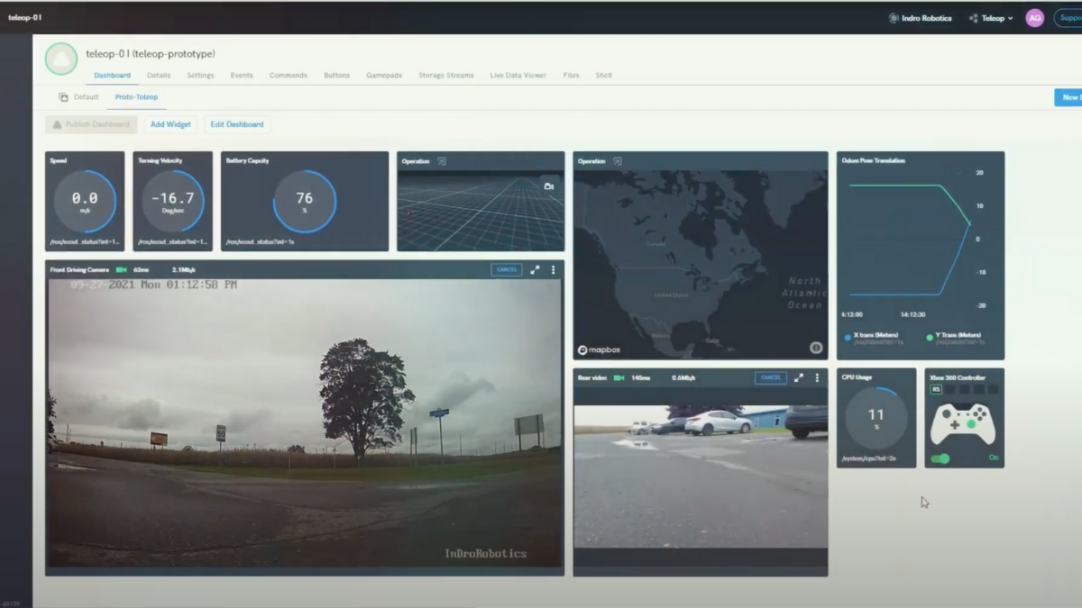
That’s a key piece here. The box contains everything a developer or end-user would need. EDGE computing is done onboard by the NVIDIA Jetson processor, reducing latency and unlocking potential for AI-related tasks like object recognition or change detection. Connectivity is via 4G/5G, and the box can utilize the CAN (Controller Area Network) protocol, Serial or Ethernet. The ruggedized box has its own cooling system and power regulator, and has an Ingress Protection factor of IP55. It’s literally a solution you can bolt onto pretty much any ground-based robot and begin remote teleoperations over 4G or 5G.

And yes, InDro Commander vastly simplifies things.

“It’s just two wires (battery power and communications) people plug in,” says Arron. “The box already has cameras, communications, power regulators – all inside the box. So you’re not fiddling with all of these various peripherals. It’s truly a self-contained ecosystem. Suppliers, OEMs, they don’t have to think – they just have to bolt this box on.”

ROS-IN-A-BOX

InDro Robotics has long been known for its R&D in the drone space, and has garnered multiple industry “firsts” as a result. Now, with the company’s expansion into ground robotics, InDro Commander is a significant breakthrough – not only for InDro, but for others who will immediately see the benefit of this solution.

“We work closely with academia and collaborate with industry partners and end users,” explains InDro Robotics CEO Philip Reece.

“The common question is: ‘How can we integrate this sensor or piece of tech with this robot or system?’ Now we have a simple working answer to this question, as InDro Commander is designed as a Plug and Play all-in-one module and is platform agnostic.” (Providing the platform either has a ROS driver already, or working example (Python/C++) code which Indro can use to develop a custom ROS driver.)

ROS-IN-A-BOX

Reece says the creation of this product is a very different solution, which he anticipates will help many in the Unmanned Ground Vehicle (UGV) space.

“There are many UGV companies, and more start up every day. Ninety-five per cent of them only make custom solutions for their own. hardware. InDro is doing things differently,” he says.

“InDro Commander is an important addition to our technology development, as we are supplying the industry with a number of different ground robots, and they are interacting in many different ways. InDro Commander will build on the benefits of a common operating system such as ROS, by bringing a standard suite of sensors and systems (camera, GPS, IMU, Computers Power distribution, communications, 4/5G) that can all be simply but powerfully integrated onto any flavour of UGV.”

InDro partners with ROCOS

We’re already quite proud of the InDro Commander solution. But we’ve taken things a step further, partnering with ROCOS. The company’s Robot Operations Platform allows an operator to connect, monitor and control robots – whether it’s a single unit or an entire fleet. But that’s not all.

ROCOS was recently acquired by DroneDeploy, one of the world leaders in drone data acquisition, interpretation and photogrammetry. And what does that mean? Well, imagine having data acquired by a ground robot seamlessly integrated with what is captured by air and presented as meaningful data for the end-user. Further picture a desktop, browser-based console where you can program aerial or ground-based missions and monitor a feed as they unfold in real-time.

Force multiplier

Whether the use-case is industrial, agricultural, security – and much more – having eyes in the air, combined with robotic boots on the ground, can only be a force multiplier.

We’ve already seen what InDro Commander can do in our own testing; we can’t wait to see what others do with this solution.

For more information on InDro Commander, contact us here.

The amazing, unusual robots of Squishy Robotics

The amazing, unusual robots of Squishy Robotics

By Scott Simmie, InDro Robotics


When we think of robots, a few different images can come to mind.

You might envision something like Spot, the dog-like ground robot built by Boston Dynamics. You might also think of an Uncrewed Ground Vehicle, or UGV, such as the AgileX Scout 2.0. You might even think of a walking, talking machine from some sci-fi film. And sure, they’re all robots. For that matter, even a Roomba vacuum cleaner is a robot.

Before we hop in further, we’d like to drop in this definition, from Brittanica.com:

“any automatically operated machine that replaces human effort, though it may not resemble human beings in appearance or perform functions in a humanlike manner. By extension, robotics is the engineering discipline dealing with the design, construction, and operation of robots.”

Robots can come in unexpected shapes and sizes

Today, we’re going to look at a very atypical robot that really intrigues us. It’s made by a US company called Squishy Robotics. Why Squishy? Well, it’s because of the form factor of these unique devices. They are, actually, squishy. And that form factor allows Squishy’s robots to do things that others cannot.

Let’s take a look at an introductory video. It gives a great high-level overview of what the product does, and why it’s built the way it is: 

Use-case scenarios

As you likely noted in the video, these robots can be dropped from significant heights without damage. So in situations where you can’t easily get a drone to the ground, they can be deployed simply by dropping them from the air. Squishy has done tests dropping from up to 1,000′ from fixed-wing crewed aircraft and helicopters. (In North America, drones are generally limited to 400′ Above Ground Level).

As the Squishy website explains, “We provide sensor robots that can be air-deployed into hazardous areas to furnish persistent, ground-level, real-time data for your operations.”

Static or mobile

The company has two different flavours of Squishy Robots. One version is static, and simply reports back from a stationary position after it’s been dropped (or tossed). There’s also a version that can move itself using a rolling motion. Here’s CEO and Co-Founder Dr. Alice Agogino:

We have both a Stationary Robot and a Mobile Robot. Our Stationary Robot is currently being used by several pilot partners,” she says. “Of course, some situations require mobility, but our customer discovery determined that deploying our stationary tensegrity sensor unit (either by drone or by tossing) provided an ideal solution to improve the efficiency and increase the safety of emergency responders and the public. The robot’s six camera and sensor could provide—and continuously update—the immediate situational awareness that emergency personnel need to respond to a crisis.”

And these little devices do a lot. We’ve borrowed, with permission, this graphic from the Squishy Robotics website. It helps to explain what its robots do:


Squishy Robotics Feature

There are multiple use-cases for such a device. Imagine, for example, there’s been a dangerous gas leak. One of the Squishy Robots comes equipped with a sensor that can ‘sniff’ the levels of four different gases: CO, H2S, LEL, O2. That same robot has six cameras for full 360° coverage and a GPS. Because it creates its own mesh network, data can be shared with its operator even in situations where a cellular network is down.

We asked Dr. Agogino what she feels differentiates the company’s products from other robots.

“A key differentiator is that our air-deployed robots can get to places that ground robots cannot easily access,” she says.

“We can fly over rivers or wreckage and debris from natural disasters, for example. Some ground robots can manage travel around such obstacles, but our tensegrity robots can get there faster and send data sooner than a ground-based robot. Our robots can also be deployed by humans—someone can easily throw or toss one of our lightweight robots over a fence or a rescuer could drop them down a mineshaft or into a cave. Those actions aren’t possible with a heavy robot with so many breakable components.”

In an earthquake scenario, a Squishy Robot could be tossed into a building at risk of collapse. It would provide eyes on the ground, be able to sniff for dangerous gases, and – depending on the model – potentially move by rolling around. It’s pretty easy to see the utility here, and how such a device would aid First Responders in gathering data before sending people inside.

How did Squishy Robotics begin?

Good question. And the answer is found on the company’s website.

“Squishy Robotics is a spinoff of research at UC Berkeley with NASA to develop planetary probes for space exploration. The probe could orbit a planet and drop to the surface and survive to provide scientific monitoring. Squishy Robotics has commercialized this technology for a range of applications on planet Earth: disaster response, military applications, Industrial Internet of Things (IIoT), and package delivery.”

We can certainly envision situations where these devices could be put to good use in the Public Safety, Industrial/Enterprise, and even Military sectors. We particularly like that these devices could be safely dropped by drone, meaning decision-makers would be able to gather more data before dispatching human beings into potentially hazardous situations.

A solid team

Squishy Robotics is a majority female-owned startup. CEO Dr. Alice Agogino’s research has included work on machine learning, sensor fusion and a specialty called “tensegrity robotics” – which was referred to earlier. We looked up a definition for this one, and found the following here:

“Soft spherical tensegrity robots are novel steerable mobile robotic platforms that are compliant, lightweight, and robust. The geometry of these robots is suitable for rolling locomotion, and they achieve this motion by properly deforming their structures using carefully chosen actuation strategies.”

Squishy Robotics dropped from drone
Squishy Robotics on the ground
In addition to her work as CEO, Dr. Agogino’s bio states that she’s “currently the Roscoe and Elizabeth Hughes Professor of Mechanical Engineering and is affiliated faculty at the Haas School of Business at the University of California at Berkeley.”
Alice Agogino

What’s next for Squishy Robotics?

We asked Dr. Agogino that question. And it looks like there are some interesting developments on the horizon.

We are working to develop an innovative solution for increasing the number of methane inspections and the quality of recorded measurement data with our robots,” she says.

“Methane is the second most common greenhouse gas and accounts for approximately 20 percent of global emissions. Identifying methane emissions requires improved tracking and analysis and will need to incorporate tracking at remote and often unmanned sources, such as at orphan wells and pipelines.”

Squishy Robots are currently being deployed – with very positive results – by a number of partners. In fact, the capabilities of these devices were designed with those end-users in mind.

We listened to our future users and honed our robots to their specifications and needs. I think that is why we get positive feedback from virtually all the First Responder and military personnel that have tested and used our robots,” says Dr. Agogino.

“We have several ongoing pilot partnerships with U.S. fire departments that are putting our robots to work out in the field in real life emergencies.”

InDro’s Take:

We’re alway keeping our eyes out for unusual robots that break the mold and offer something of value. Squishy Robotics definitely fits this criteria. The ability to drop these devices from a significant height – directly into a situation that could be very hazardous for humans – is something we haven’t seen elsewhere. It doesn’t surprise us that this design emerged from research for planetary exploration.

And now, these devices are available for exploration on our own planet. If you’d like more information, you’ll find it at the Squishy Robotics website.

Oh, and if you’re aware of another intriguing robot you think we should write about, feel free to flag me here.


Advanced Air Mobility: A primer

Advanced Air Mobility: A primer

By Scott Simmie, InDro Robotics


The world of drones and aerospace is laden with acronyms. UAVs, VTOL and BVLOS are but a few of the terms frequently kicked around. But there’s another one that’s starting to gain traction. It’s AAM, or Advanced Air Mobility. We thought it would be worth having a look at what this means, and what the implications are as we head into the future of aerospace: A world where crewed and uncrewed aircraft take on new roles, while safely sharing the airspace.
There are a few definitions of AAM kicking around, but we particularly like this thorough take from Delloitte Insights:

“Advanced air mobility (AAM) – the emergence of transformative airborne technology to transport people and goods in new, community-friendly, and cost-effective aircraft in both rural and urban environments – represents the next inflection point in the aerospace industry’s ongoing evolution.5 AAM is expected to be the next significant change in mobility and perhaps the global economy, as it could lead to fundamentally new capabilities and applications that were previously not feasible. AAM technologies promise to transform how people and cargo are moved…”

Inflection point


So it’s a pretty big deal. And while “inflection point” makes us stand up and pay attention, what might this mean in practical terms? Well, for one thing we’ll see the emergence of a new category of aircraft, the eVTOL. This means an electrically powered, zero emission machine that can take off and land vertically. This eliminates the need for runways and the kind of support services (such as aviation fuel storage, hangars) required at even smaller regional airports. Some of these eVTOLs might require a pilot, but many will operate like drones – carrying goods, or people, without requiring a crew.

We asked InDro Robotics CEO Philip Reece what he envisions this new age will bring.

“Having short- to medium-range aerial options for transporting cargo – and even people – will bring multiple benefits: Using electricity or hydrogen for power will be better for the environment and these aircraft will reduce road congestion. It will also expand access for many to regional air travel due to lower infrastructure costs: Think many ‘Vertiports’ instead of large airports.

“Advanced Air Mobility will also boost jobs and skills in new areas, as well as access to resources including consumables and medical supplies. There are many cut-off communities in Canada, including some that do not have year-round road access. The list goes on. While these are only some ideas at the moment, once the communities grow into the infrastructure, new industries and solutions will rapidly come to light.”

This era is coming…

A number of companies are already building and testing such aircraft. One of the best-known is China’s EHang, which is manufacturing the EH-216 Autonomous Aerial Vehicle, or AAV. It can carry two passengers or cargo. In a future not too far removed, you might be able to summon this aircraft to a nearby landing pad with a smartphone app (think Uber), and have it deliver you, or critical cargo, from a congested urban centre to a nearby city in minutes.

There’s a growing number of other companies in this field, as well. They include Lilium, Joby Aviation, and Volocopter – to name just a few. Some of the designs – many of which have been made possible by the technology that powers drones – are pretty amazing. (If you’re interested in seeing some of these vehicles, check out this Aviation Today article.)

It’s also worth mentioning Jaunt Air Mobility. Though the company originated in the US, it now has offices and a highly experienced leadership team in Montreal. The company’s patented design is like a fixed-wing helicopter, promising an estimated range of up to 160 kilometres, with a top speed of up to 280 kph. Once in forward flight, the main rotor slows and functions like an autogyro, providing lift while saving energy. Here’s a description from its website:

Jaunt is the global leader in slowed rotor compound (SRC) technology. Our patented technology slows the rotor once aloft (the rotor tip speed equaling the aircraft’s pace) thereby reducing drag and associated vibration. In combination with a small wing sized for cruise, this produces a lift to drag ratio equivalent to a fixed wing airplane providing an exceptionally efficient flight with very low noise. Noise that is practically imperceptible in flight.”‘

Although its video is CGI, the company is *very* real, and the vehicle it’s building is based on a field-proven design:

So that’s one part of the Advanced Air Mobility picture: New, electrically powered aircraft that carry passengers or cargo to nearby communities currently not served (or under-served) because they lack either the infrastructure or the ongoing demand to support more traditional aviation models.

But there’s another piece to this puzzle. And that involves drones.

Drones and Advanced Air Mobility

Smaller Uncrewed Aerial Vehicles (UAVs, or drones) are very much part of this picture. They might be delivering prescription medications or urgent parts, or perhaps even transporting Automated External Defibrillators to the site of a 9-1-1 call (something InDro Robotics has proven in trials). They could even be moving a life-saving organ for human transplant from one hospital to another, reducing time and improving patient outcomes. Plus, or course, there’s the multitude of tasks drones can achieve on the scientific and industrial/Enterprise side of things. (A quick aside: When referring to the use of drones or these new and larger eVTOLs solely within an urban center, it’s often referred to as Urban Air Mobility, or UAM. But UAM and AAM will go hand-in-hand.)

It all paints a pretty exciting picture of the future. But it’s a future the world can’t simply dive into. With more aircraft taking to the skies, often at lower-altitude flights, the runway to this future needs to be methodical. It requires an approach often referred to as “Crawl, walk, run.” As you’ve likely guessed, that means starting out very slowly and carefully, using an incremental approach.

UTM: Uncrewed Traffic Management

One key component in this equation is minimizing the potential for any of these aircraft to come into conflict with one another. And here we get to introduce another acronym: UTM, or Uncrewed Traffic Management. The future requires a system which – through a combination of hardware and software and automation – can seamlessly ensure the skies above (and the ground below) remain safe.

Here, too, there is no shortage of companies and working groups pushing for solutions. Just as surely as vehicles like the EH-216 will one day become routine, a robust and reliable UTM solution – likely involving a combination of software integrated with NAV Canada’s air traffic control, along with detect-and-avoid sensors on aircraft and specific flight corridors – will emerge. But that’s not going to happen overnight.

In this country, a group called the Canadian Advanced Air Mobility Consortium has already started planning for the future.

Bringing Advanced Air Mobility to Canada

This isn’t something any one company – or regulator – can do on their own. It requires consensus, collaboration, and a shared vision and commitment. That’s why the Consortium, whose home page image you see below, has brought together multiple partners.

Air Mobility

Advanced Air Mobility is a team effort

As the Consortium’s website states: “We’re in this together.” That’s why the Consortium’s members are drawn from across the industry – including representation from academia and government. It would take quite some time to list them all here, but you can find a list of all members on this page. InDro Robotics is but one of many members.

“We’re building an ecosystem of national collaboration towards a sustainable, equitable and profitable Advanced Air Mobility industry in Canada,” states the Consortium’s website. Its goals, it says, are simple: “Zero emissions from Advanced Air Mobility operations in Canada.” Somewhere down the road, says the Consortium, one in five aircraft in Canada will operate with zero emissions.

We asked Chris Howe, the Consortium’s Lead Operating Officer, why he’s optimistic about this new future:

“AAM requires aviation to look outside itself and collaborate with so many innovative new technologies,” he says.

“New energy (electric and hydrogen), engineering (quieter operations), and also connectivity (5G) and advanced decision-making (artificial intelligence) are required to make AAM a safe, sustainable and equitable solution. I’m personally excited to see how this incredibly interdisciplinary industry will work together to get off the ground and solve real problems like emergency medical transportation.” 

The Consortium operates with a commitment to six pillars it believes “are necessary to make AAM an agent of global positive change.”

Those pillars, from the website, are as follows:

Air Mobility

What’s next for AAM in Canada?

Great question. Two key projects are already well underway. The first is to create a Canadian Advanced Air Mobility Master Plan. Phase One of that project is a strategic roadmap that hopes to guide the next 20 years of AAM development in Canada. It will focus on these three areas, which we’re quoting verbatim from the site:

  • Define the unifying national AAM vision for Canada
  • Identify gaps & barriers in accomplishing the vision
  • Create the national AAM implementation Roadmap & Master Plan

Phase Two will get a little more technical. The site says it’s “designed to de-risk AAM operations, coordinate business planning, and expedite technology integration required to activate revenue generating use cases.”

Goals for this phase, in conjunction with regional projects taking place in Vancouver and Toronto, include:

  • Design airspace structure, flight routes, physical infrastructure maps and noise footprints for urban and rural operations
  • Develop Concept of Operations (CONOPS) for specific AAM use cases and integration with RPAS Traffic Management (RTM)

There’s much more…


The Canadian Advanced Air Mobility Consortium website is very well put together. There’s a lot of information there, as well as a standing invite for other stakeholders and interested parties to get involved.

We can’t predict, at least not with certainty, where AAM will take us in the coming years. Certainly there are a number of new eVTOL designs already being tested, with many more under development. There’s no question zero-emission aircraft will be welcome additions in a world under growing pressure from climate change.

There’s also no question that these aircraft will be moving goods and people to areas currently under-served by traditional aviation – and that’s a very good thing.

But there’s one pressing question: When will all this arrive? We put that to Consortium lead Chris Howe.

“Commercial eVTOL manufacturers are telling us they are aiming for certification of their aircraft by 2024,” he says.

“We are working hard to ensure the infrastructure and regulations will allow for safe, sustainable and equitable commercial passenger operations in Canada by 2030.”

It’s a future we very much look forward to. 

And finally…

If you’re interested in reading more on the topic, Howe suggests the following links as good resources:

And a quick PS: The fact InDro Robotics is a consortium member didn’t play a role in this post. We wrote this simply because AAM is coming, and fast. Keep this on your radar.

By Scott Simmie


Percepto’s autonomous drone-in-a-box

Percepto’s autonomous drone-in-a-box

By Scott Simmie, InDro Robotics


If you’re in the drone industry, you’ve likely heard the phrase: “Drone-in-a-box.” If refers to an autonomous system where a drone nests inside an enclosure for charging and safe harbour – and is regularly dispatched for automated missions. Usually, those missions are pre-programmed and involve inspection, surveillance, or change detection. Manual missions can be carried out when necessary, but the real point is automation.
The idea is that missions are carried out repeatedly, with a human simply monitoring from a remote location. Remotely could mean inside a building on an industrial site where the drone is based. But, because these emerging systems operate using LTE to control the drone and communicate with the software, they can be operated from hundreds or even thousands of kilometres away (providing you have permission to operate Beyond Visual Line of Sight and an available LTE network). With missions carried out automatically and on a regular schedule, this makes for vastly more efficient inspections, surveillance, tracking of construction progress, etc.

It beats requiring a pilot on site, and the drone never suffers from fatigue. The advantages for Enterprise clients are immediately apparent: Inspections, surveillance or general monitoring take place like clockwork, with all relevant data stored for easy access and interpretation. But think also of the edge such systems could provide for First Responders: A drone could be automatically dispatched to the location of a 9-1-1 call or critical incident. Video or thermal imagery can be securely live-streamed to decision makers down the line, regardless of where they’re located. The potential of such systems is unlimited.

At InDro Robotics, we’re no strangers to this concept. In fact, we’ve got a few things under the hood in this regard. But we like to acknowledge and celebrate success in this field. And so today’s post will focus on Percepto – the world’s leader in drone-in-a-box solutions. The company has a proven system, currently deployed in more than 100 locations around the globe. We recently had an opportunity to see a demo of the Percepto system, hosted by Canadian distributors RMUS (Rocky Mountain Unmanned Solutions).

Percepto’s autonomous drone system

The Percepto website outlines its offering with this statement: “Changing the way visual data is collected and analyzed, Percepto AIM is the only end-to-end inspection and monitoring software solution that fully automates visual data workflows, from capture to insights.” AIM stands for Autonomous Inspection and Monitoring, and is the software integral to the overall package.

This Percepto video provides a good overview:

It’s one thing to see a company video, quite something else to see that system in person. We were part of a briefing with Percepto’s Ehud Ollech (Head of Business Development) and Shykeh Gordon (VP Global Sales). They demonstrated the AIM software, the Sparrow drone (which comes with a parachute), and much more.

But they started by explaining that this system is purpose-built for major industrial customers, with clients from the mining, solar, oil & gas/petrochemical and utilities sector. And, they said, don’t think of Percepto as a drone company.

“Basically we are a big data analytics company,” said Shykeh, “offering end-to-end inspection and monitoring solutions.” What kind of solutions? This corporate graphic, supplied by Percepto’s marketing department, helps explain:

Percepto Drone

Percepto’s AIM software

During the demonstration, Shykeh and and Ehud walked us through the AIM (Autonomous site Inspection and Monitoring) software. It’s a browser-based system that allows you to program missions, monitor flights in real-time, watch a live stream from the Sparrow drone’s RGB or thermal camera, and take a deep dive into meaningful data. The User Interface is simple, and Percepto says a mission can be planned in as little as three minutes. In fact, they flew a brief mission from indoors with visitors watching from a conference room and visual observers outside. Every aspect of the mission, including a live video feed, was delivered in real-time. We could monitor what the drone was seeing, which is part of the point. And Ehud had the option, if something caught his eye, of stopping for a closer look.

RGB and thermal data is continuously captured during missions, then uploaded to the AWS cloud when the drone comes home to roost. Significantly, the AIM software is capable of change detection – a major feature for many clients. Once a baseline capture of a designated area has been stored in the Cloud, if a subsequent mission detects any changes, anomalies will be flagged. These could include thermal changes, issues with solar panels, oil leaks, a broken window – the list goes on. (The thermal data is radiometric, meaning it provides the actual temperatures measured.) The AI does not always categorize the type of anomaly, but even when it doesn’t it will quickly point out the relevant images for the operator to take a closer look. Percepto can also be integrated with Smart Fences or Pan-Tilt-Zoom cameras and dispatched automatically if something seem amiss.

Percepto Autonomous Drone

“The heart of our system is our software,” says Ehud.

AIM can also integrate data from ground-based robots, such as Boston Dynamics’ Spot. Even a smartphone photo or other image can be added to the mix, providing it contains geolocation data. The system can produce 3D digital twins, with all photogrammetry stitching done in the Cloud by AIM. (Some solutions for automated data capture rely on third-party software for photogrammetry.)  As part of the demonstration, Ehud defined an area of a pile of earth; a volumetric calculation was instantly performed. And this was all while the group was comfortable indoors. We were probably 50 metres from the actual system, but we could have just as easily have been across the planet, assuming LTE connection at the drone end.

Seeing the Percepto drone in a box in action

Percepto Autonomous Drone

After the first mission was complete, we went outside to watch the system in person. It began with the clamshell housing – which Percepto says can withstand a Category 5 hurricane, closed. Once the mission was initiated, it opened up quickly and the Sparrow took off. The system is operational in winds up to 40 kph, with a takeoff/landing limit of 27 kph. Winds during the demo were 24 kph; the Sparrow was rock steady.

Percepto Autonomous Drone

The system does not have obstacle avoidance, but uses ground-based radar to avoid conflicts with crewed aircraft. Altitude parameters, obviously, are programmed when setting the mission.

“Everyone’s waiting for aerial radar to get cheaper and lighter,” said Shykeh.

More sensors to come

The company already is working on a gas detection sensor (aka OGI camera), and is looking at potential LiDAR sensors as well. Maximum flight time is 40 minutes under optimal conditions, but generally flights are limited to 30 minutes. The next generation battery will offer a 20-30 per cent increase in time and range, and charging time in the station – from zero to full – is about 40 minutes.

Percepto Drone

InDro’s view

This is a refined and mature system, well-suited for major corporations with the budget for this kind of data acquisition and interpretation. It’s particularly suited for remote sites – especially sites that do not have staff on site but require persistent monitoring for safety, security or other reasons. Percepto has some very high-profile clients on its roster, including FPL, Koch, Verizon and Enel.

We’re strong supporters of drone-in-a-box solutions – and are actively exploring systems that might be helpful to First Responders. Kudos to Percepto…and stay tuned.