GCXpo 2024: A stunning showcase of Smart Mobility

GCXpo 2024: A stunning showcase of Smart Mobility

By Scott Simmie


The third annual showcase of Canada’s Smart Mobility sector – formerly known as TCXpo – is a wrap.

Bringing together more than 80 companies from across Canada and abroad, more than 1500 attendees registered to see the latest and greatest innovations – some of them being shown publicly for the first time. Ground robots, drones, even agricultural equipment and demonstrations of new technologies – it was all on display at Ottawa’s Area X.O, a private facility where technology companies (including InDro Robotics) build and test innovative products on a daily basis.

This was the largest event so far – and that’s reflected in the title. It’s now called “GCXpo” – with the first two letters standing for Government of Canada (the previous “TC” stood for Transport Canada). It’s a reflection of the importance Canada puts on supporting this growing sector as companies develop new products and push toward commercialisation. And there are a *lot* of agencies and departments behind this event.

GCXpo is hosted by Area X.O and operated by Invest Ottawa in partnership with the Government of Canada and event sponsors, including:

“GCXpo Is truly about celebrating Canadian innovation, companies driving the smart revolution that are changing our country for the better,” said Invest Ottawa President and CEO Sonya Shorey during opening remarks. She also pointed out why Area X.O in the nation’s capital is such a fitting location: Ottawa per capita, has “the top tech talent concentration in all of North America.”

And GCXpo 2024 did not disappoint.

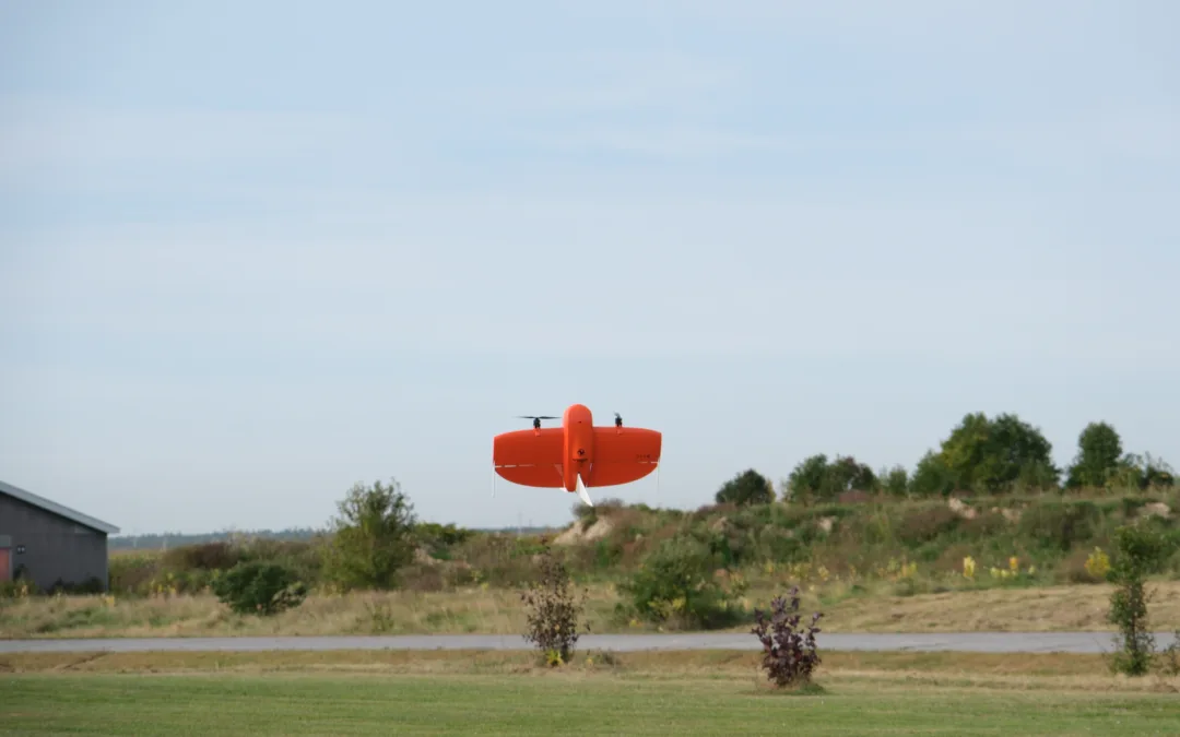
Below: A crowd watches as Matt Johnston, Assistant Test Integration Engineer with Lockheed Martin Skunkworks Calgary, demonstrates a drone that can fly (and land) in GPS-denied environments, followed by the drone in flight. All photos by Scott Simmie

A LOT TO SEE


With some 80 companies, government agencies, academic institutions and others at the show, there was a lot of ground to cover. And while the exhibits were underway, the CAVCanada Stage provided top-flight panels and keynotes on a wide range of topics.

InDro Robotics Founder and CEO Philip Reece took part in a panel entitled: “Creating the Cities of Tomorrow,” which looked at how municipalities and regulators can best work together to safely encourage the transition toward newer technologies.

‘I would say failing fast is a super important thing,” he said. “We started flying drones 10-12 years ago, when it was really new. And the answer to everything at the start was: ‘No, you can’t do that.’ So instead of accepting that, we basically brought them (Transport Canada) with us, and we’d say ‘What would it take to do this? How can we do this next step?'”

There were some failures, but with the regulator on site there was a joint understanding of why things had failed – and the willingness to work together to identify those points of failure and take another run at things. This helped both the company – and the regulator itself. And it ultimately led toward a new way of thinking – with both parties viewing themselves as partners with a common goal.

“It’s much better to invite them in – let’s (jointly) spur innovation forward,” said Reece.

Interestingly, as the move toward Smart Cities continues, there’s obviously a lot of adoption of AI technologies and research in that realm. Because those AI processors can use a lot of energy – and because AI-enabled devices are starting to become ubiquitous in our lives – Ottawa Hydro has noticed a surge in energy demands and has had to adjust its own resources to ensure it’s keeping up with the transition. This surge has also, presumably, been influenced by the increasing adoption of electric vehicles (which, in addition to charging, rely heavily on AI).

“Bringing on AI has a very different energy footprint, and it’s not just one section of the city we’re seeing that in – we’re seeing it throughout,” said Julie Lupinacci, Chief Customer Officer with Ottawa Hydro.

“We’re moving from a utility that was planning and building one substation every five years – to one every year. So these are very interesting and exciting times, but it’s very crucial to get this right for the future.”

Below: InDro Robotics CEO Philip Reece

FROST, FOG AND Electric vehicles


If you’re a Canadian who drives in the winter, you’ll know all about the challenges of frost and fog on your windshield. But you likely haven’t given much thought to the energy requirements it takes to de-ice or de-fog that windshield, particularly in electric vehicles (EVs).

But one Ontario company based in Oakville, Betterfrost Technologies, has given this problem a lot of thought over many years. And it has developed a solution for the problem that uses 10x to 20x less energy than traditional methods.

And how does it do that? Well, there’s an invisible layer in the windshields of most cars today that is used for passive cooling, by deflecting infrared rays. That same layer can be energised using rapid pulses of power to concentrate on melting the frost or ice right where at counts: At the point where it adheres to the windshield. The company has produced an algorithm that’s embedded on a small chip that can be added to pretty much any modern vehicle with a couple of wires. When that algorithm gets the energy pulsing at the right frequency and intensity, that boundary layer is quickly and efficiently melted, allowing for the easy physical removal of frost or ice.

“This was researched at New Hampshire’s Dartmouth College’s Ice Research Laboratory,” explains company co-founder and CTO Sameh Saad. “They looked at how ice attaches to surfaces and the best way to break that bond, between ice and any surface. Most of the stickiness of ice happens at the interface. So if you can melt the ice at the interface it will fall off with external force.”

And so the company developed an algorithm that ensures the heat only goes to that boundary layer – and isn’t wasted beyond.

“The pulsing gives us better control, so the heat doesn’t move as far. So even though the pulsing is high power, the way this works leads to low energy consumption,” says CEO Derrick Redding.

And it’s not just about EVs.

“The other application besides automotive is aerospace, where airplane wings or critical surfaces need to be clear of ice and frost before takeoff and during flight,” says Saad. “So this could be done using the same technology, using a polymer coating. And if we do automotive vehicles, we can do defence vehicles, bridge windows on ships – it doesn’t matter how thick the glass is. What’s important is that we can defrost it and defog it very quickly.”

The company has been around since 2015, and Better Frost Technologies is hoping its product may soon come standard on vehicles straight off the production line.

“We’re working closely with two car OEMs and one truck OEM, and that’s going very well,” says CEO Redding.

Below: CTO Sameh Saad, a mechanical engineer, with the company’s proprietary algorithm-embedded chip.

Better Frost Technologies CTO Sameh Saad

A LITTLE BIT OF EVERYTHING


Though the overarching theme of the show is Smart Mobility, one of the joys of this event is the variety of companies showing off innovations you might not immediately associate with the sector but which are nonetheless both interesting and related. One such surprise was KTV Working Drone Ottawa, a company that uses a drone for high-rise window and facade cleaning. The company’s president, Gesummino Sala, explained he’d come across the idea of using drones for cleaning, and was thinking of starting his own drone company.

He then discovered Norwegian company KTV Working Drone already had such a product and was franchising it. In fact, it had operations in Halifax and Vancouver. Sala managed to secure the franchise for Ottawa (along with rights for a large portion of Ontario). He launched earlier this month.

“It’s been about a year in the making, but lots of preparation was needed for this,” he says.

The platform is a DJI M350 RTK, where that realtime kinematic sensor allows for very precise positioning. A hose attached to a spraying unit on that drone sucks up purified water (to 0 ppm) heated to 80° C and applies it directly to the windows of facade. Because of that hot, pure water – Sala says the building dries quickly and cleanly. He says the drone can loft that hose up to the Transport Canada ceiling of 400′ AGL, meaning it could clean a 40-storey building.

“The finish is spotless,” says Sala. “It’s safer, the building doesn’t get damaged from swing stages (which are used in traditional window washing operations), it’s more efficient, and it’s faster. Everybody’s interested; people who have heard about it want to see it.”

Below: KTV Working Drone Ottawa’s President, Gesummino Sala

RIDESHARK


When it comes to commuting, Smart Mobility doesn’t just mean autonomous vehicles (though there were plenty of those at GCXpo). It can also mean a smarter way of commuting that will eventually include self-driving cars. And that’s why an Ottawa-based company called RideShark was at the show. We asked President and Co-Founder Sharon Lewinson to give us the elevator pitch.

“RideShark is a multi-modal platform that helps people choose sustainable transportation options to reduce congestion, emissions, and improve quality of life,” she says.

And how does it do that? Well, with a very sophisticated mobile app.

“In one click, a person can enter their destination and it automatically gives them all their multi-modal transportation options: Carpool partners, transit options, bike buddies, shuttles…And then it has carpooling. People can book, pay and communicate all in-app.”

RideShark sells its SaaS platform to clients, and it’s then “white labelled” – meaning the app might bear the name and branding of a university, large corporation, or one of the many other institutions and sectors where it’s in use. The company secured Nortel as its first customer back in 2006. It’s grown a lot since then, and has multiple high-profile clients across North America.

Now, says, Lewinson, it’s time for the next step.

“We’ve been around a lot and now we’re looking to globally scale. We’re a partner with Invest Ottawa – they provide a lot of support. GCXpo is where the future is of what we call ‘unified mobility.’ With all the autonomous vehicles, ultimately they have to get people into those vehicles – and our technology will help with that.”

Below: A video explaining how RideShark works, followed by a photo of company president Sharon Lewinson.

Sharon Lewinson RideShark

THE NEXT GENERATION


Innovation is on a stellar trajectory. With the accelerated use of AI and related technologies, the breakthroughs just keep on coming. So it’s worth noting that many educational institutes were at GCXpo, along with government agencies and accelerators that help fund startups to encourage continued innovation.

We stopped briefly at the Algonquin College booth, partly to let them know we’d recently profiled two InDro employees – both of whom came to Canada from India – to study engineering there. (Their story documents a pretty remarkable voyage and can be found here.)

“Why GCXpo?” we asked Algonquin representatives.

“We’re here to kind of market the value of not only the Co-op & Career Centre, but everything our Experiential and Innovation centre can offer – ranging from applied research, co-op positions, through to entrepreneurship co-ops,” explained Ashoka Patel, the College’s Industry Engagement Specialist Team Lead.

“When we’re at these events, we want to meet with anyone interested in attending the college, so (we talk about) work-integrated learning opportunities, which could be a placement, a short-term internship. And then we speak to our current students to encourage them to look for jobs and ask how we can help them, help out with research projects. And then we want to meet with employers and see what we kind of different programs we can provide to students and graduates.”

And, says Patel, that commitment doesn’t end with commencement.

“Once a student leaves Algonquin College, we still offer them post-graduation support to find their career of choice.”

And those are the people, from Algonquin College and elsewhere, who will forge the next wave of innovations.

Below: Ashoka Patel, along with Industry Engagement Specialist Alexandra Trudel.

Algonquin College Ashoka Patel and Alexandra Trudel

INDRO’S TAKE


This event is now in its third year – and GCXpo has truly become the showcase of Canadian and international companies in the Smart Mobility and related sectors. It’s an opportunity for everyone from big industry players through to small entrepreneurs and interested students and members of the public to learn about the products, services and agencies that are committed to helping shape the future in a positive way.

“As always, Area X.O and Invest Ottawa have done a tremendous job of hosting and planning this event,” says InDro Robotics CEO Philip Reece. “The shift from TCXpo to GCXpo really highlights the commitment of the Government of Canada to this future, and also illustrates how truly engaged regulators and funding agencies are to this growing sector. Of course, it’s always nice to show what InDro has been up to – but the real value here is the diversity of thought and innovation on display, all in one place and in one day. We look forward to 2025.”

See you next year!

InDro deploys drones, ground robots in Kelowna precision agriculture project

InDro deploys drones, ground robots in Kelowna precision agriculture project

By Scott Simmie

There’s a buzz around Kelowna these days.

Well, actually, there are two kinds of buzz. The first is the occasional faint sound of a small but smart drone, carrying out flights every two weeks over two separate orchards. These orchards grow peaches, pears, cherries and more.

And the other buzz? Well, that’s the discussion this special two-year project – a collaboration between InDro Robotics and the City of Kelowna (enabled with funding from Agriculture and Agri-Food Canada’s Agriculture Clean Technology Program) – is generating among farmers in the region.

“Technology is always getting bigger and better,” says Riley Johnson, a manager at Byrnes Farms – one of the two locations where the project is being carried out. Johnson is an experienced farmer, and the land has been in the hands of his wife’s family for five generations. He knows the land and crops well, but is curious to see what additional data can be gathered.

“Anything in agriculture, the more information you get, you’re not going to be worse off. Especially for new farmers coming into the industry, any new kind of information can help out ten-fold – particularly if you’re on new land. Any information outside of the Old Farmer’s Almanac is always appreciated.”

What InDro is doing, to the best of our knowledge, is a type of precision agriculture that hasn’t been carried out before. It combines data acquisition from both drones and ground robots to ensure the most robust and reliable data possible.

This data is then used to assess overall vegetation health. Are there indications of pests in certain areas? Are any plants indicating low levels of chlorophyl? Does it look like that patch needs some pesticide – or maybe additional watering?

These are important questions for farmers whose livelihoods depend on maximizing the yield and health of their crops.

And this project? It’s all about finding the answers – and implementing solutions. Those solutions will include precision spraying of nutrients or other compounds in the precise location where they are required. The end result should be maximum yields with minimal – or no – areas of unhealthy crops.

Below: Healthy pears growing at Byrnes Farm. Photo courtesy Riley Johnson

Healthy pears in Kelowna. Photo courtesy Riley Johnson

AN INTRODUCTION


Before we get into all the details, it’s worth introducing you to Dr. Eric Saczuk (assuming you haven’t already met). He’s our Chief of Flight Operations – and comes with some serious chops.

Eric holds a PhD in Remote Sensing. He’s been assessing vegetation health (among many other things) using satellite data since the early days – long before drones came on the scene. But when drones did come on the scene, he quickly recognized their potential for the acquisition and interpretation of multiple kinds of data. He has flown missions all over the world on behalf of InDro, all involving complex data and analysis.

But that’s not all. He’s been an instructor at the British Columbia Institute of Technology since 2003 and has been the director of the institute’s RPAS Hub since 2016. He’s divided his time between BCIT and InDro since 2018 and is our go-to for highly complex operations. He’s also carried out multiple missions to acquire data for projects undertaken by Canada’s National Research Council – including this fascinating research on urban wind tunnels. There’s likely not a more qualified person in the country when it comes to drones and data.

Below: Dr. Eric Saczuk on an InDro mission. Image by Scott Simmie

SkyScout Ai Eric Saczuk

THE PROJECT


Okay. You’ve most likely heard of precision agriculture by now. When it comes to drones, most of us picture something like this: A drone with a multispectral camera flies over a field of wheat or some other crop. That multispectral camera captures spectrums of light both visible and invisible to the human eye. When that data is crunched, it provides a detailed picture of crop health (we’ll explore more of this shortly).

In collaboration with the City of Kelowna and local farmers, we’ve been flying a mission every two weeks over two separate fruit orchards. We use a drone with a special type of camera. It has five lenses. One of those lenses simply captures RGB (or simply, colour) images. But the other four have filters that are tuned to pick up light only within specific spectrums that can be collectively analyzed to indicate the health of vegetation.

“So in addition to the RGB camera, you’d have one camera capturing just red reflected light, one capturing just green reflected light using filters, and then the other two are what we call red edge and near-infrared,” says Dr. Saczuk.

Red edge is particularly useful in the early detection of disease or stress in plants – as it is highly reflected by healthy chlorophyl. But the real magic happens when you take the data captured in these different light wavelengths of light and run some calculations on them. That’s what gives you the bigger picture.

“Think of each of these images as a number. Capturing these multiple spectral bands allows you to combine them using complex equations in a type of calculator to give you various indicators of vegetation health,” he says.

That data can answer a lot of questions.

“Is it healthy? Is it not healthy? Is it being productive? Is there chlorophyll? If so, how active is it?” he says.

“These are the kinds of questions we can answer when we do what we call ‘multispectral band combinations.’ And it gives us a really clear picture that cannot be detected by the human eye.”

A CLOSER LOOK


We’re going to take a look at an image in a moment.

Before we get there, though, it’s worth exploring something Eric said earlier. He mentioned complex math. He’s right. The math happens at the individual pixel level between each of the input bands and there are millions of pixels per band. The most common calculation is used to produce a result called NDVI (not be be confused with NVIDIA, the producer of AI chipsets). The acronym stands for Normalized Difference Vegetation Index. And once the math is done, it gives you an accurate picture of vegetation health.

NDVI is calculated by using near infrared (NIR) and red bands (you’ll see the formula below).

The resulting pixel number in an NDVI image, will always be between -1 and +1. The higher the number, the better the health. If the number is low, it means there’s something worth looking at. The NDVI provides a detailed look at crop health and while it is regarded as the gold standard, there are also other calculations that can drill down to more specific indicators of vegetation health.

Below: Healthy vegetation absorbs most of the visible light that hits it, reflecting a large portion of the near-infrared spectrum. Unhealthy or sparse vegetation (right) reflects more visible light and less near-infrared light. When you do the math, it yields a lower NDVI number. (Public domain image by Robert Simmon.)

The second image is the equation used to calculate NDVI (which explains what those numbers are at the bottom of the first image).

NDVI
NDVI

FROM DATA TO DECISIONS


Using the equation above (as well as other formulas), Dr. Saczuk turns all of that data into something both meaningful and actionable. By looking at the data – and calculating not just NDVI but other indexes, images are generated that provide an at-a-glance look at crop health.

Traditionally, this has been a hugely time-consuming task involving multiple steps (and plenty of processing) on a laptop. Now, new tools are available that streamline the process. Dr. Saczuk is using a cloud-based solution specifically for precision agriculture.

“It really makes the whole process very efficient – because not only does it do the photogrammetry on the images, stitches them into these orthomosaics, but it also gives you the tools with which to analyse them. This would typically be a multi-step process, but this software makes it a one-stop shop, which is really nice.”

That’s without even getting into some of the AI capabilities of the software. It can, for example, count all the trees in a given orchard – and even give you the elevation of a specific tree.

Below: An NDVI image of one of the farms in the Kelowna project.

Solvi Kelowna NDVI

NOW WHAT?


At this phase of the project, InDro is gathering data by drone alone. But as it progresses, two more things will happen: We will introduce ground robots and precision spraying.

The plan is that a ground robot will initially be fitted with the same kind of multispectral sensor used by the drone. Autonomous missions will be plotted and the robot will capture a series of images from the ground as it drives through the orchard. That data will be crunched and compared with the results captured from the air.

“This is a way of doing ground-based validation of what we’re seeing from the air, from the aerial images of the drones,” says Dr. Saczuk.

Once that validation is complete and if problem areas are detected, the next phase would involve precision spraying – which could be carried out by an AGRAS agricultural drone – or even potentially by ground robot. Because all of the data is georeferenced, that means the fertilizer (or possibly pesticide or herbicide, depending on the issue) can be precisely applied to only the required locations. That, of course, is where the term Precision Agriculture comes from.

VICE-VERSA


This project is data-driven, with aerial and ground acquisition. But at the outset, shortly after our initial flight in April of 2024, farmer Riley Johnson noticed that a couple of trees weren’t doing well. It wasn’t clear what was causing this failure to thrive, but he didn’t want to take any chances that a potential disease might spread further in the orchard. So those trees were taken down.

In this case, because the issue was spotted early and the location was known, Dr. Saczuk is quite interested in doing some deep drilling into the data at that spot. In fact, that’s the very issue he has recently been exploring.

“So we’ve got that data, that information that’s saying, ‘Hey, these trees were actually not doing well.’ And then the next question is: Can we see anything in the multi-spectral images that would indicate that these trees are somehow spectrally or reflecting light differently than the ones that are healthy?”

This is something that is also of particular interest to Johnson. Will the data reflect what years of experience indicated was a problem to his naked eye?

“As the season progresses, it will be really interesting to see what InDro comes up with,” he says. “But I can definitely see the value of this for someone just getting into farming, or for farms up the hills with new plantings, new growth. This could be very useful.”

Below: Another image of a Kelowna orchard from this project, showing elevation

Solvi Kelowna Elevation

INDRO’S TAKE


We’ve been involved with precision agriculture projects in the past. In fact, we pioneered a “drone-in-a-box‘ solution, where we’ve shipped a drone to farmers. We talk them through the process of being a visual observer, then instruct them on how to power up the drone. InDro then carries out the flight remotely, using 4G or 5G – while in constant contact with the observer. When it’s done, the farmer puts the drone in the box and sends it back. InDro carries out the data analysis and quickly sends an easy-to-understand report indicating what areas require attention – and what kind of attention they require.

But this project is very different, and exciting for multiple reasons.

“The bi-weekly flights by drone will provide a huge amount of timely data, enabling us to detect any potential problems at an early stage,” says InDro Robotics Founder and CEO Philip Reece. “But by adding robots to validate from the ground, we’ll have a more robust dataset that can be used to truly pinpoint areas of concern and which may require precision spraying. We are going to learn a lot with this project – and believe our findings will be of great benefit to farmers down the road.”

A final note. When Dr. Saczuk isn’t carrying out these flights, they’re being flown by a new addition to the InDro team, Jon Chubb. He’s already had interest from other farmers in the Okanogan who are eager to maximize their own yields and have an early detection system for any trouble spots. If you’re in that neck of the woods and would like to arrange a demo, you can contact Jon here.

Sales and support: The InDro Experience

Sales and support: The InDro Experience

By Scott Simmie


We’ve all had them. Some unfamiliar number shows up on your phone, and the next thing you know someone is trying to pitch duct cleaning, a new cellular plan, or something else you likely don’t want or need.

You’ll never receive a call like that from us. For one thing, we don’t do duct cleaning (though we could probably build a robot capable of that). But there’s a bigger, more important reason. We cater – above all – to building a relationship with and satisfying the needs of the client. That’s both before we agree on a sale, and for long after the product is delivered.

While InDro is known for such ground-breaking stand-alone products as InDro Commander, the new InDro Cortex and InDro Controller, along with other platforms that enable researchers and R&D companies to build their own robots and drones with greater efficiency and simplicity, the bulk of our sales are custom products.

That means designing and building a robot or other device based on the specific needs and use-cases of the customer. Sometimes it’s a single, one-off design. But it could also be, as we recently reported, an entire fleet of custom robots for swarm research.

Regardless of the product or platform, the process nearly always begins with the first of many conversations with Luke Corbeth, our Head of R&D sales.

Below: Luke at a recent conference

Luke Corbeth

CORBY CAR CLEANERS


The story, or part of it, begins with a company called Corby Car Cleaners. “Corby” was Luke’s nickname in high school. An entrepreneur at heart, the prospect of working a traditional job didn’t appeal much. Corbeth wanted to learn about running his own business and was looking for the satisfaction that comes with building something from scratch. So he opened an on-demand car detailing business, where he’d show up at the client’s home and perform the service. How many people do you know that had the drive to start their own company in high school? (I can think of only one other; a friend who installed car stereos. I ran into him, decades later, at a CES show. His company was by then installing high-end systems – $100k+ – into cars owned by pro athletes, actors etc.)

“That was my way of building a basic business – doing sales and then actually executing the business,” he recalls.

With that – and high school – under his belt, Corbeth went to McGill University. Specifically, the prestigious Desautels Faculty of Management for a degree in Management. Corbeth had already shown a real knack for finance, which was part of the course. But he had the option of choosing specialisations. He was tremendously interested in technology – learning about AI, startups, the growing impact of other forms of tech – so he selected Digital Innovation as one of his tracks. But there was still another specialty he could select.

“I had something I was interested in (Digital Innovation), something I was good at (Finance) and something I felt I was missing,” he says. And that third piece of the puzzle?

“I didn’t understand the way operations are conducted. So I felt Operations Management was the missing piece; data science and understanding the optimal way to carry out operations. So that became the third piece of my arsenal.”


FROM CAR CLEANING TO WALL STREET


With his degree fresh in hand in 2019, Corbeth quickly landed two impressive jobs straight out of the gate. He did equity research at a hedge fund in New York, working to identify investment opportunities that the company referred to as having “material dislocation from fair value.” In other words, assets and stock that were undervalued. He also worked at a private real estate investment firm – which only had a single product to sell. He didn’t like that one much.

“When you have only one offering as a sales professional, it occasionally it feels like you’re trying to put a triangle into a circular hole – like you’re trying to force something upon someone.”

That wasn’t a fit for Corbeth. He was still drawn to technology; felt that was the future. Plus, something A McGill professor once said still resonated with him. It was along the lines of: ‘All the best investments in life, you need to be contrarian and right.’

“I was like, ‘Wow, that’s a very profound thought.’ Another way to think of that is: ‘You have to believe in a future that people don’t yet believe in, but will one day also believe in.’ And that’s what really attracted me to robotics,” he says.

“Sci-fi would suggest that it’s the future, but not everyone sees a future where robots are assistants to humans – carrying out useful and valuable tasks and doing the jobs we don’t want our kids to do. But I believe in that future, and I think people are going to want that future. And you know what? It’s becoming increasingly true.”

And then came the perfect fit: An opening for a sales professional at InDro Robotics in 2021.

“I was very excited at the prospect of joining the very field I was most interested in,” he says.

Below: Head of R&D Sales Luke Corbeth doing a public demo at the opening of Area X.O’s DARTT – the Drone and Advanced Robot Training and Testing facility 


THE INDRO EXPERIENCE


With this background, Corbeth had the perfect skill set – and passion – to take on sales with InDro Robotics. His keen interest in technology led him to quickly absorb everything possible when it came to sensors, compute capabilities, autonomy and more. But it was the chance to tailor something very specifically suited to the needs of a customer that truly appealed. He would never again be in a position of trying to put a triangle into a circular hole.

“What’s very unique about InDro Robotics is that because we take such a modular approach and we have so many partners and ways to bring solutions together, It feels like I always have the right shape to put in each hole – regardless of what shape it is.”

As mentioned, InDro most often builds completely custom robots for its clients. Corbeth is truly passionate about working with clients to fully understand their needs before even beginning to explore what options might be developed for them.

“The way I think about my job is this: People present a problem that they envision a solution for that requires uncrewed systems of some kind, whether that’s robots or drones. And I take it upon myself to thoroughly understand that problem and recommend all of the best available hardware and software at our disposal to solve that problem,” he says.

With rare exceptions, this isn’t just a simple phone call. Nor is it a process of simply ticking boxes for sensors, compute, platform etc. For Corbeth (and InDro), it’s the beginning of a relationship where together we explore every conceivable option to ensure that the client’s needs are met and their problem is solved. It generally starts with Corbeth sending a resource package to potential clients prior to any deeper conversation, so that they can fully understand InDro’s offerings, expertise, platforms, etc.

“The whole idea there is: Let’s identify the problem – and let’s identify the desired future. And since they’ve done their homework, ideally with the resources I’ve sent, then we can really dive into exactly what InDro Robotics can do specifically to get them there.”

This is a key part of the process.

“So the initial part of the conversation is always trying to understand the client’s desired future: What is it they’re actually trying to accomplish? And often times, just by talking it out with the client, I make discoveries about what they’re trying to do. They even make discoveries about what they’re trying to do. That’s always the first part: Thoroughly identifying the problem and what the ideal future should be.”

In some cases, for example, clients have come in looking for a wheeled platform, perhaps because they’ve seen a similar robot with wheels. But after further exploration of the use-case and terrain, they might together discover that a quadruped or tracked platform might be more suitable.

“If a client doesn’t know the existence of something, then it’s impossible for them to know that’s actually what they need,” he explains. “So part of my job is informing them of what is available, what is trending, what has been successful. It’s all about clarifying that problem and that vision for the future – and then seeing if we have something in the arsenal that can help get them there quickly.”

Below: Luke being interviewed at Area X.O’s DARTT

FROM PROBLEM TO SOLUTION


So then what happens?

Well, the second phase is seeing if there’s a fit. Can we provide what the client is seeking? Usually, of course, the answer is yes.

“With all that is available to us, can we offer something that meets their budget, meets their timeline, meets all of the project requirements so that we can help them achieve this future they’re seeking?”

This is something we really want to nail down.

“Sometimes in sales, companies will say: ‘Yes, my solution can solve every problem’ – and that’s not always the case. So if it makes sense to refer them to an adjacent providers outside our immediate circle, I’ll do that. But we’re in a fortunate position where we can solve a lot of problems – so that doesn’t happen very often.”

Once the client’s needs are fully understood, Corbeth works closely with them to drill down to the specifics: What type of LiDAR and other sensors best suit the application? How much compute power is needed? What platform and locomotion is best suited to the use-case? Is an autonomy stack required? The list, of course, goes on. And InDro has multiple options in every category to ensure the end product is the right one.


NEXT STEPS


We live, unfortunately, in a world where there’s a lot of hype – particularly when it comes to technology. There’s no shortage of vapourware, renders for products that don’t yet exist, and other techniques to draw clients into a sales funnel. At InDro, we take great pride in the fact our products are real and do exactly what we state.

“We’ve built custom products for everyone from small colleges and research teams right up to the largest technology companies in the world,” says Corbeth.

It’s one thing to say that; it’s quite another to prove it. And so Corbeth frequently arranges for an in-person or remote demonstration, where clients can control an existing robot or drone and take it for a test drive. They can experience the near-zero latency with remote ops, see the intuitiveness of the control system, and view all sensors, robot health (and much more) through the secure InDro Controller dashboard.

“We get them time on the sticks – ideally in person, but very often over Teams – and let them control a robot on our site. They can see how we plan missions, how we execute missions, and just how user-friendly and effective this technology is.”

That demo – controlling and seeing InDro products in action – generally seals the deal.

“Usually we move from there to quotes and service agreements and then, ultimately, a purchase order.”

Below: Luke engages with an attendee at the big IROS conference in Detroit in fall, 2023

FULFILLMENT AND SUPPORT


Even with the PO signed, the job isn’t done. Prior to starting the build, there’s generally a review call with the client along with engineering staff on the call. We want to ensure we have everything right, and understand every single facet of what the client is expecting.

“It’s a way of ensuring that what we end up delivering ultimately meets every expectation – because the worst thing you can do is send something out the door that doesn’t meet expectations. So we do that, and then we execute,” he says.

With the build complete, the product is shipped. Then there’s another call once it arrives. That ‘kickoff’ call points the client to the vast array of resources and continuously updated documentation InDro provides, as well as answering any initial questions the client might have. The whole concept here is to flatten the learning curve and ensure the client can get up and running with their robot or drone as quickly as possible. That support continues with any issues or questions that might arise after the client becomes familiar with their robot or drone or other device. At InDro, we are just as concerned with ensuring the client is satisfied and able to fully exploit their new product as we were with the original sale.

“We really value the client’s experience and the client’s feedback. In some ways, we create a feedback loop. And that feedback loop is what has enabled us to improve and evolve our products and our documentation at such a fast rate.”


KNOWLEDGE BASE


Luke Corbeth is frequently our lead person at robotics conferences and academic gatherings. He’s the guy PhD engineers will often engage with on InDro products and solutions. And the funny thing here? Luke’s comprehensive understanding of the technologies involved frequently lead people to assume he’s an engineer. In fact, that happened just this week at a University of Toronto event.

“That was like the penultimate compliment,” he says. “Despite having no formal education in engineering, I understand every part of our solution in enough detail that I can knowledgeably discuss hardware and solutions with some of the best professors in the world. Granted, I can’t build an autonomy algorithm. But I know what the robot needs to enable that.”

Of course, Luke would not have been able to reach that knowledge level without working closely with InDro’s talented engineering team at Area X.O. Whenever he’s had a question – they’ve had the answer. Many on our team have served as mentors for him.

Now, it’s one thing for us to say all this. But the real credibility comes with feedback from our clients. Luke received this note after the delivery of a custom robot build for, truly, one of the biggest companies in the world:

“Hey Luke – The robot is fantastic; the craftsmanship is superb; the power on the base is enabling; the intricate way in which the computer fits in the base housing is incredible; the compute box + mast feels “just right” (there’s no template for social robot design, but I feel like we got very close); all these things make me really confident that, with the right algorithms (my responsibility) we can safely and efficiently navigate through crowds.  It’s a really special robot that I can’t wait to put in the field.  Your team deserves a raise!”

(We’ll have to ask our CEO about that last bit.)

Below, our recent swarm robotics build for a US client


Robosense LiDAR Swarm

INDRO’S TAKE


InDro would not be thriving without satisfying our clients (many of whom are repeat customers, or are referred to us by existing ones). It is part of our very ethos to fully understand the problems they are trying to solve before we ever start discussing a solution. And it’s only then, through a very collaborative process with the client, that we can deliver a product that not only meets – but frequently exceeds – their expectations.

“Luke is a crucial and always enthusiastic part of the InDro Robotics team,” says Founder and CEO Philip Reece. “His understanding of the technology is phenomenal, and his drive to truly help clients achieve the future they envision seems to be hard-wired into him. Yes, meticulous builds are a key part of client satisfaction and InDro’s reputation. Luke plays an absolutely key role in ensuring that what we ultimately build and deliver is a match with their expectations.”

If you’re considering a robotics solution, contact Luke Corbeth here. He’ll be happy to arrange a test drive.

InDro completes design, build and delivery of robots for swarm research

InDro completes design, build and delivery of robots for swarm research

By Scott Simmie

You’ve likely seen swarm behaviour in nature – or at least video of it.

Flocks of starlings produce incredible patterns known as murmurations, undulating with split-second speed. Certain species of termites build massive and complex mounds, complete with sophisticated ventilation shafts to ensure air exchange and temperature regulation. Some types of fish, when attacked by predators, form tightly whirling balls as a defense mechanism. Bees build complex hives and have specific roles that all contribute to the collective. And ants, as you’re aware, can do a lot more than spoil picnics.

All of these, though very different, are examples of swarm behaviour. No single individual is in charge, yet these creatures work together to great synergic effect.

Below: A starling murmuration at Rigg by Walter Baxter, CC BY-SA 2.0 via Wikimedia Commons

A_starling_murmuration_at_Rigg_

SWARM ROBOTICS


It was actually through these observations in nature, particularly of insects, that the concept of swarm robotics first emerged.

“In a robot swarm, the collective behavior of the robots results from local interactions between the robots and between the robots and the environment in which they act… The research of swarm robotics is to study the physical body and the controlling behaviours of robots. It is inspired but not limited by the emergent behaviour observed in social insects, called swarm intelligence. Relatively simple individual rules can produce a large set of complex swarm behaviours. A key component is the communication between the members of the group that build a system of constant feedback. The swarm behaviour involves constant change of individuals in cooperation with others, as well as the behaviour of the whole group,” states this Wikipedia entry.

Much of the early research (and some of the more complex, current research) involves high numbers of very simple robotic devices. But as the field has developed, so too has the size and capabilities of the robots being used in swarm applications and research.

“The idea behind swarm robotics is the robots are able to communicate with each other and thus improve their decision-making and data acquisition in a given environment from a real world application standpoint,” explains Head of R&D Sales Luke Corbeth.


THE BOSTON EXAMPLE


One InDro client, Boston University, is using a very large fleet of small but smart robots called LIMO in swarm scenarios. One aspect of their research involves how autonomous vehicles interact with each other. Can the robots detect others merging and take appropriate action? How can autonomous vehicles detect and interact with robots that have been programmed to behave as if they’re human-driven vehicles?

Research like this is obviously more practical (and far less costly) to carry out in a lab rather than on city streets. It’s important work as we head toward the Smart Cities of the future, where eventually all vehicles will be autonomous – and much of the current infrastructure (traffic lights, stop signs) will no longer be necessary because all Connected Automated Vehicles will be part of a network.

“These vehicles become nodes in an Internet in which the vehicles talk to each other,” said Christos Cassandras, Distinguished Professor of Engineering, Head of the Division of Systems Engineering, and Professor of Electrical and Computer Engineering in an earlier interview with InDro.

“They exchange information and so, ideally cooperatively, they can improve metrics of congestion, of energy, of pollution, of comfort, of safety – perhaps safety being predominant.”

It’s fascinating work, and you can check out our story about it here.

But the ability of swarms to move and collect and share data collaboratively also opens up other use-case scenarios.

“If you are able to team your robots together, obviously you can cover a lot more area in a shorter period of time because the robots are essentially building a map together rather than being dependent on a single robot to build that map. One of the most obvious applications is search and rescue,” says Corbeth.

To illustrate, we borrow this example from research being carried out at Carnegie Mellon University:

INDRO’S CUSTOM SWARM


We recently built and shipped four identical custom robots for North Carolina State University’s Department of Mechanical and Aerospace Engineering. Corbeth was the conduit, putting together a package that suited their very specific needs. It began with selecting one of our 18 available platforms.

“They chose the Scout Mini, which is far and away our most cost-effective platform. And it’s unique in that it’s capable both indoors, like in their lab, but also for outdoor use,” says Corbeth.

That, of course, was just the start. Each robot was outfitted with the InDro Commander, which tucks a lot of power and flexibility within its IP54-rated enclosure. Commander houses the brains or the robot – which in this case is a very powerful piece of compute. Commander is completely customisable based on client requirements and contains ROS1 and ROS2 folders. (It also enables rapid integration and recognition of multiple sensors, and has the option of shipping with either or both of InDro’s autonomy stacks for outdoor or indoor use – think GPS-denied and SLAM. In this case, the client will be building their own autonomy stack, as that’s part of their research.)

And this client wanted Commander equipped with a powerhouse.

“They upgraded from a Jetson Xavier NX to the AGX Orin Developer Kit. That’s the best-in-class onboard compute you can add to a robot these days,” he adds.

That’s not hyperbole. The AGX contains a 2048-core NVIDIA Ampere architecture GPU with 64 Tensor Cores. Unfamiliar with Tensor Cores? They mean ultra fast AI processing.

“Tensor Cores enable mixed-precision computing, dynamically adapting calculations to accelerate throughput while preserving accuracy and providing enhanced security,” states the NVIDIA website. “The latest generation of Tensor Cores are faster than ever on a broad array of AI and high-performance computing (HPC) tasks. From 4X speedups in training trillion-parameter generative AI models to a 30X increase in inference performance, NVIDIA Tensor Cores accelerate all workloads…”

That AI computer is capable of – wait for it – 275 TOPS, or trillions of operations per second. (Yes, it’s kind of hard to get your head around that.)


SENSORS, SENSORS, SENSORS


Corbeth worked with the client to outfit each swarm robot with the sensors needed for the job. Starting with the basics, each robot contains two pinhole cameras (one front, one rear) so the operator can remotely see the robot’s eye view using our proprietary dashboard, InDro Controller. For depth perception, we added ZED X stereo cameras which – like human eyes – see the world in three dimensions. These are used for obstacle avoidance (in conjunction with LiDAR, which we’ll get to).

Connectivity is key with any robot. But when it comes to swarm robotics, it’s particularly important to have high-speed, low-latency communication not just with the controller, but between the robots themselves.

“Obviously doing swarm requires 5G connectivity,” says Corbeth. “So there’s a 5G modem in each robot as well as our Wi-Fi development module. In addition to communication between the robots and with InDro Controller, this also means they can program these robots without having to hard-wire into them. In fact, students or researchers could upload algorithms from pretty much any location – they don’t need to be on-site or on the same WiFi network, which has been the traditional route.”

Each robot features GPS and IMU modules, plus a Robosense Helios RS-5515 32-beam LiDAR module. These sense the environment in three dimensions by rapidly scattering and receiving the reflections from eye-safe laser beams. It allows the robot to safely navigate and map in completely unfamiliar and GPS-denied locations, and even carry out precision scans. We recently featured Robosense in this post, detailing how the quality is absolutely on par with the biggest names in the industry. (Selecting Robosense for this project saved the client close to $80,000 without losing any capabilities.)

Outstanding in their field: A look at the InDro-built swarm fleet just prior to shipping to the client

Robot Swarm

INDRO’S TAKE


It was a fascinating project to build a small swarm from the ground up for the specific needs of this client. We look forward to checking in with North Carolina State University once the research is fully underway – and will report back to you.

“There’s no doubt that swarm robotics is an important tool, not only in R&D but increasingly in real-world applications,” says InDro Robotics Founder and CEO Philip Reece. “Whether it’s search and rescue, mapping difficult environments at scale, or developing algorithms that will enable Connected Automated Vehicles in the Smart Cities of the future, swarms are synergic tools that produce outcomes far greater than the sum of their parts – and that do so with greater speed and efficiency.”

Interested in exploring options for swarm robotics? Contact Luke Corbeth here.

SkyScout AI offers new solution for wildfire detection, mitigation

SkyScout AI offers new solution for wildfire detection, mitigation

By Scott Simmie


We did a quick check, just now, on the current wildfire situation in British Columbia.

Nine wildfires were burning and labelled as “Out of Control” by the BC Wildfire Service. An additional two fires were categorised as “Wildfires of Note.” And we’re still very early in the wildfire season.

Recent years have seen an increase in devastating wildfires – in British Columbia, Alberta, California, Hawaii and elsewhere in North America. A 2014 fire in the Northwest Territories completely destroyed 8.5 million acres (3.44M hectares). There have also been massive wildfires in Portugal, Australia (42 million acres/17M hectares burned in 2019/2020), Russia – and other countries as well.

These examples are indicative of a trend; there’s compelling (and troubling) data to back this up.

“Multiple studies have found that climate change has already led to an increase in wildfire season length, wildfire frequency, and burned area,” says the United States Environmental Protection Agency. “The wildfire season has lengthened in many areas due to factors including warmer springs, longer summer dry seasons, and drier soils and vegetation.”

What’s worse is that major wildfires actually contribute to the likelihood there will be more of them in the future.

“Climate change is one of the major drivers of increasing fire activity,” says the World Resources Institute, which states that “the latest data on forest fires confirms what we’ve long feared: Forest fires are becoming more widespread, burning nearly twice as much tree cover today as they did 20 years ago…

“Extreme heat waves are already 5 times more likely today than they were 150 years ago and are expected to become even more frequent as the planet continues to warm. Hotter temperatures dry out the landscape and help create the perfect environment for larger, more frequent forest fires. This in turn leads to higher emissions from forest fires, further exacerbating climate change and contributing to more fires as part of a “fire-climate feedback loop.”

This is, obviously, concerning. Existing firefighting and fire suppression techniques haven’t changed much over the years – and the threat is growing.

A new Canadian company, SkyScout AI, believes it holds part of the solution. And after seeing a demonstration of some of its capabilities recently in British Columbia, we’re inclined to agree.

Below: SkyScout Ai’s Shawn Bethel prepares a “drone tanker” at a demonstration outside Penticton. Scott Simmie photo

SkyScout AI

SKYSCOUT AI


So. What is SkyScout Ai – and what does its solution entail?

It starts with the leadership.

“It’s a company that’s comprised of people who want to make a difference for their communities and trying to save them as climate change drives increase in fire activity,” says Chief Operations Officer and Co-Founder Geoff Griffiths.

We’ll explore some of that shortly. First, though, we asked Griffiths for his elevator pitch.

“We’ve come up with a first-in-class vertically integrated solution that spans satellite and drone early detection. And we have the capability with our drone tanker to not only fight the fire but protect the communities from fire by pre-treating vegetation and housing with our EPA-certified fire inhibitor called Citrotech. So it really is about a fully vertically integrated approach that really focuses on interface fires – those fires that interface with communities and critical infrastructure, that’s really our niche.”

All you have to do is think back to Kelowna last year and the threat posed to the city by wildfires. The McDougall Creek Fire forced the evacuation of West Kelowna and made headlines across the country. Griffiths has seen such fires hit close to home.

“My parents were living in Kelowna during a major wildfire in 2003. Their neighbourhood burned down so it’s always been in the back of my mind – wanting to do something.”

Below: Helping detect and proactively inhibit wildfires also protects wildlife. Scott Simmie photo

SkyScout Ai

HOW IT WORKS


The SkyScout Ai system integrates multiple components that collectively can – as the company states – “Detect, respond, protect.” And there’s a lot of technology at play to make that happen.

Though the startup is at the demonstration stage, here’s how the fully integrated system will work.

Let’s take the city of Kelowna as an example. In a long-term, proactive scenario, SkyScout Ai would place multiple permanent drone docks at several locations around the city. Those weather-resistant docks would contain drones with high-resolution thermal sensors. They’re simply sitting, with the drones fully charged, waiting for a signal.

That signal could come, automatically, from satellite data. Satellites are capable of detecting thermal hotspots and lightning strikes. So, in this example, let’s say a lightning strike is detected near Kelowna. That data and GPS location is instantly relayed, via SkyScout Ai’s software, to one or more of the thermal drones. The docks open and the drones launch, headed to the area of interest.

If the drones pick up a thermal signature – a fire – that information can, in turn, be relayed immediately to First Responders. So a fire crew might be quickly dispatched. Because this early warning system can detect so quickly, that crew will have a much better chance of extinguishing a fledgling fire.

But, as we all know, fires can spread tremendously fast. And that’s where SkyScout Ai has some other options to help protect valuable assets. Those options include what the company calls “tanker drones” and a very unique product called Citrotech. It’s a food-grade fire inhibitor that can prevent ignition (and which we’ve seen in action).

If it’s still a small fire, a tanker drone carrying Citrotech could be dispatched to extinguish the fire by aerosolising that compound over the site. But don’t start thinking this has the power of a water bomber – it doesn’t (though the company envisions larger drone tankers in its future).

Rather, a drone carrying Citrotech on board has the capability to protect infrastructure at that wildfire-urban interface point. The tanker can quickly spray the roofs of multiple homes or other structures requiring protecting. The product dries quickly and crystallises. Once applied, it is nearly impossible for that protected surface to ignite – even if that roof gets coated with burning embers (a common way houses are ignited during wildfires). Citrotech could also be sprayed on dry vegetation near those structures, effectively creating a firebreak.

“Citrotech modifies the material its on at a molecular level and has extremely high efficacy when it’s dry,” explains Chief Commercial Officer and Co-Founder Shawn Bethel. “So it coats combustible vegetation and really just inhibits the ability of combustible vegetation to combust. You can’t get it to ignite.”

Bethel knows what he’s talking about when it comes to wildfires. He’s the former BC Provincial Fire Control Officer – who was responsible for all of BC’s firefighting resources out of the Provincial Wildfire Operations Centre. His bio on the SkyScout Ai website says “He brings 25+ years of operational wildland fire management experience including senior roles on incident command teams and aerial firefighting asset management. Shawn also brings an additional 15+ years working in the private sector spearheading global business operations with technology services companies providing wildfire mitigation solutions and fire aviation services.”

So Bethel obviously has deep expertise in wildfires, including all available suppression technologies.

“SkyScout Ai is pushing to protect the wildland-urban interface from new fires starting from ember transfers and lightning strikes,” he says. “When it’s applied in advance of anticipated new wildfire activity, it has time to dry – which is easy to do during drought wildfire weather conditions – and essentially stops fire in its tracks.”

Again – this is not a solution to extinguish a massive raging fire. But it definitely is capable of stopping small fires from becoming larger, and protecting homes, vineyards, orchards and critical infrastructure from igniting.

“This is not for Rank 6 conflagration fires. What this is for inception fires, combustible vegetation near homes, near assets, and for infrastructure and roadways. Citrotech is an excellent fire inhibiting product.”

Below: Shawn Bethel, followed by a DJI Agras T-40 during a SkyScout Ai demonstration. The company envisions larger “drone tankers” in its future. Scott Simmie photos


Shawn Bethel SkyScout Ai
SkyScout AI Penticton

SKYSCOUT Ai IN ACTION


At the end of May, 2024, SkyScout Ai brought its mobile Command Centre to a location outside Penticton, where vineyards – also highly vulnerable to wildfire – pepper the lush hills of the Okanogan Valley. That command centre (the first of many planned) contained a dock for a thermal drone, a massive spraying drone (in this case, a DJI Agras T-40), Citrotech and a control centre for the pilot(s) who will monitor autonomous operations and manually fly the tanker drone when necessary. That Command Centre, btw, is towed on a trailer. But it has been designed to quickly detach and the entire operation can be lifted by helicopter to any location where it’s required.

SkyScout Ai came to test its technology in advance of forthcoming demonstrations for the media, First Responders and other decision makers.

During testing, a small fire was set using a small fire starter brick placed on a stone. A thermal drone with RTK positioning was dispatched to locate the hotspot. In a full demo, that data and GPS location would be  automatically forwarded to First Responders or a tanker drone which would head to that spot to dispense Citrotech (which can not only inhibit, but also extinguish).

That was impressive. But there were two real show-stoppers.

In the first, a pile of dry tumbleweeds were treated with Citrotech by spraying a fine mist on them (this was done manually, but could easily be done by the tanker drone). Thirty minutes later, a pile of untreated tumbleweeds was placed directly adjacent to the treated section. Then Bethel ignited the untreated pile with a blow torch. Within seconds, flames were shooting about two metres in the air. The burn was rapidly spreading.

And when it hit the treated tumbleweed? It stopped dead. Nothing burned.


DRONE TANKER


In the second exercise, the drone tanker was filled with water. Two piles of tumbleweeds (one treated, one untreated) were again placed in a pile. The tumbleweeds were ignited and the Agras took off. From a distance of about four metres AGL, the spraying function was engaged. The blaze was extinguished in mere seconds.

So with near real-time detection using satellites and thermal drones, a tanker (or other First Responder, depending on the threat) could be dispatched literally within minutes of a lightning strike. And if that fire appeared to be growing and potentially threatening homes, vineyards, or other important infrastructure, the tanker could quickly coat these with Citrotech. Because it’s EPA-approved and food-safe, there’s no issue with spraying crops like grapes, cherries, etc. You could literally drink a glass of this stuff and be fine (though we didn’t try that).

Below: Shawn Bethel prepares to manually treat some dry brush with Citrotech

SkyScout AI Penticton Shawn Bethel

BUSINESS MODEL


Though the Citrotech is important, a key part of the value proposition is in the early detection and location of fires. The earlier a fire is detected, the better the odds of mitigation before it can get out of control.

Here, SkyScout Ai has the advantage of integrating that satellite data directly into its software – which can then trigger an immediate launch of one or multiple thermal drones. With RTK positioning, they can get a precise bead on the trouble spot – and send back not only thermal images but also high resolution photos/imagery that can be shared with First Responders. Depending on the size of the conflagration and location, a tanker drone can also be dispatched.

So the primary business model would be to have a contracts with cities adjacent to forests. The docks with thermal drones would be installed at strategic locations as the first line of defense, with a tanker drone on standby. There’s also the option, as mentioned, to lift the entire command centre by helicopter to a location where it’s urgently needed.


CITROTECH


The fire inhibitor, of course, could be dispensed by drone in the above scenario. But SkyScout Ai has an exclusive distribution contract for Citrotech’s product (known as Mighty Fire Breaker MFB-31) for all of Canada. It has plans to sell the product to individuals or companies that would like to have it handy for the ability to treat their buildings or property in advance of a threat. (Citrotech washes off in the rain, but there’s generally not much rain happening during the drought-like conditions that generally precede major wildfires. When sprayed prior to painting or staining, it remains effective.) So this product is definitely part of the equation.

“The secret sauce also is the addition of citrotech,” says Geoff Griffiths. “That fire inhibitor is the only fire inhibitor certified by the EPA in the US. It’s a non-toxic option that hasn’t existed before, and as you can see by our demonstration is highly effective.”

Griffiths says the timing for the SkyScout Ai solution is perfect.

“Obviously climate change is driving a lot of the wildfire activity that we’re seeing across the world. And regulators, government, private industry now realize that the standard ways they’ve approached wildfires in the past aren’t working or maybe aren’t good enough anymore. They’re open to new approaches. Add in the drone technology, satellite detection, and it’s a critical extra step in the evolution of a solution.”

Below: SkyScout Ai’s first Mobile Command Centre. The entire unit can be quickly detached from its trailer and transported by helicopter to remote locations. Image two: InDro’s Dr. Eric Saczuk prepares a DJI Agras T-40 for flight. Scott Simmie photos


SkyScout AI Penticton
SkyScout Ai Eric Saczuk

INDRO’S TAKE


We’ve been involved with wildfire operations in the past. In Kelowna last year, we were called upon to help detect hotspots indicating subterranean combustion at a landfill. Locating and extinguishing hotspots like these (or burning tree roots – which can burn for weeks and reignite new fires), are also a critical part of wildfire suppression.

When SkyScout Ai was being formed, InDro Robotics was involved.

“We’re assisting with technology on the drone side of things,” says InDro Robotics CEO Philip Reece.

“We’re providing pilots and other technical support. For example, we’re putting our InDro Command module onto the drones. This enables not only Command and Control via 5G and dense data throughput, but also the integration of all of the drone data into the SkyScout Ai dashboard. As the company grows and Transport Canada regulations change, we anticipate assisting with the R&D required for much larger tanker drones…

“Wildfires can be devastating and the models unfortunately predict will only get worse. We’re proud to be assisting with Scout Ai’s innovative solution.”

You can learn more about Scout Ai right here.

New TC Advisory Circular contains guidance for night BVLOS flight – and much more

New TC Advisory Circular contains guidance for night BVLOS flight – and much more

By Scott Simmie


A new Advisory Circular from Transport Canada is generating a lot of buzz in Canada’s RPAS world.

Although an Advisory Circular is not legislation, they offer guidance and a glimpse of what the regulator is planning for the future.

“Advisory circulars are one of the methods that Transport Canada can use to provide guidance on complying with regulations,” explains Kate Klassen, Training and Regulatory Specialist at InDro Robotics. Klassen is an instructor and pilot of traditional aircraft as well as drones. Her online courses have trained more than 10,000 RPAS pilots in Canada. She has also served as Co-Chair of the Canadian Drone Advisory Committee, or CanaDAC.

“It kind of acts like a preview, foreshadowing in a way the regulations we know are coming later this fall. This one in particular is exciting because of the depth of guidance that they’ve provided,” she says.

Here’s how Transport Canada describes the purpose of the Advisory Circular – entitled Remotely Piloted Aircraft Systems Operational Risk Assessment – in its introduction:

“This Advisory Circular (AC) is provided for information and guidance purposes. It describes an example of an acceptable means, but not the only means, of demonstrating compliance with regulations and standards. This AC on its own does not change, create, amend or permit deviations from regulatory requirements, nor does it establish minimum standards.

“This AC provides information and guidance to manufacturers and operators intending to develop or operate a Remotely Piloted Aircraft System (RPAS) for operations in accordance with the requirements of Part IX, Subpart 3 of the Canadian Aviation Regulations (CARs).”

The document itself is 131 pages, and a lot of it is dense and laden with acronyms. But for operators planning complex operations down the road – including the potential of flying BVLOS at night – the highly detailed guidance offered in the document is a gold mine. It goes into extraordinarily fine detail about carrying out Risk Assessment in a variety of scenarios.

Below: Screengrab from InDro research into urban wind tunnels being carried out for the National Research Council. This was a highly complex operation involving a heavier drone in a dense urban setting and required a Special Flight Operations Certificate. The new Advisory Circular helps spell out precisely what TC is looking for from operators to ensure safe operations in multiple scenarios


NRC Urban Wind Tunnel Eric

RISK ASSESSMENT AND SFOCs


Back in the early days of drones, pretty much every flight required special permission – an SFOC – from Transport Canada. As drone technology and reliability/robustness improved and the regulator collaborated with the industry, detailed regulations for RPAS were first issued in 2019.

That change meant what we could generally term as routine, low-risk flights with drones weighing up to 25 kilograms could be carried out without an SFOC, providing the operator met all criteria laid out in the Canadian Aviation Regulations, Part IX. That included requirements that the operator have a Basic or Advanced RPAS Certificate to operate small RPAS. TC also established its drone portal, where compliant drones weighing more than 250 grams are registered and assigned a number by the regulator. All of this was, in general, very good news for the RPAS industry.

But for those more complicated operations – generally meaning operations with greater risk – an SFOC was still required to satisfy Transport Canada that the operation could be carried out safely. Specifically, as the AC points out, SFOCs were (and are) still required in these circumstances:

“No person shall conduct any of the following operations using a remotely piloted aircraft system that includes a remotely piloted aircraft having a maximum take-off weight of 250 g (0.55 pounds) or more unless the person complies with the provisions of a special flight operations certificate — RPAS issued by the Minister under section 903.03:

(a)  the operation of a system that includes a remotely piloted aircraft having a maximum take-off weight of more than 25 kg (55 pounds);

(b)  the operation of a system beyond visual line-of sight, as referred to in subsection 901.11(2);

(c)  the operation of a system by a foreign operator or pilot who has been authorized to operate remotely piloted aircraft systems by the foreign state;

(d)  the operation of a remotely piloted aircraft at an altitude greater than those referred to in subsection 901.25(1), unless the operation at a greater altitude is authorized under subsection 901.71(2);

(e)  the operation of more than five remotely piloted aircraft at a time from a single control station, as referred to in subsection 901.40(2);

(f)  the operation of a system at a special aviation event or at an advertised event, as referred to in section 901.41;

(g)  the operation of a system when the aircraft is transporting any of the payloads referred to in subsection 901.43(1);

(h)  the operation of a remotely piloted aircraft within three nautical miles of an aerodrome operated under the authority of the Minister of National Defence, as referred to in subsection 901.47(3); and

(i)  any other operation of a system for which the Minister determines that a special flight operations certificate — RPAS is necessary to ensure aviation safety or the safety of any person.”

“In order to be issued an SFOC – RPAS, an operator must submit an application to the Minister as detailed in CAR 903.02. In particular, CAR 903.02 (p) indicates that in addition to the specific information required by 903.02 (a) through (o), the operator must submit “any other information requested by the Minister pertinent to the safe conduct of the operation”. For certain complex operations, as determined during the application process, an Operational Risk Assessment (ORA), acceptable to the Minister, is one of the items of ‘other information’ required in support of an application for an SFOC – RPAS.”

It’s that last paragraph that’s particularly relevant to this Advisory Circular.


COMPLEX PROCESS


The issue, as many operators discovered, was that applying for an SFOC wasn’t a slam-dunk. It’s not uncommon for TC to come back – sometimes more than once – asking for more details or requesting additional steps or precautions. This slowed the approval process, which was frustrating for operators. Some conveyed to regulators that there wasn’t enough clear guidance to ensure operators were meeting TC’s detailed expectations.

“So it made the SFOC application process for those more complex operations challenging as both parties were trying to sort out what the requirements needed to be to keep things safe,” explains Klassen.

The new Advisory Circular spells out, in detail, precisely what Transport Canada is looking for from operators. It contains multiple protocols, including the fine details of carrying out standardized risk assessments, that will be of benefit to all operators – even in cases where an SFOC is not required. Klassen believes the new document is the direct result of discussions between operators and TC. In addition to making complex operations safer, it provides all the fine print to assist operators in getting everything right the first time with SFOC applications.

“This Advisory Circular, I think, is a result of all of the back-and-forths between those RPAS operators who have been pursuing the boundary-pushing applications, and Transport Canada. TC has been able to accumulate all of that guidance in one location so that the process is streamlined.”

We’ll hit on a few highlights – including BVLOS at night – but the document is so thorough and dense that we’ll link so that operators can download and study it themselves. The Advisory Circular is so detailed that it’s not easy to synopsise, as you’ll gather from the following table of contents. (Don’t worry if some of the acronyms are unfamiliar; there’s an extensive glossary):

TC Advisory Circular

WHAT’S NEW


This is actually a revision to a previously published Advisory Circular. Because it contains so much information, TC thoughtfully provided a round-up of what’s new – and there’s quite a bit that is.

It contains the following changes to definitions:

  1. Airport / Heliport Environment was renamed Aerodrome Environment and a 3000 ft (915 m) AGL maximum altitude provision was added.
  2. (ii)  The Atypical Airspace infrastructure masking provision was clarified, and a low altitude night provision was added. (We’ve bolded this because it’s kind of a big deal, and we’ll get to it.)
  3. (iii)  Operating Weight definition was added to support changes to ground risk assessment.

In addition, ground risk assessment now relies on the weight of the drone rather than a kinetic energy calculation. Thresholds are now based on the most recently available population density numbers, rather than just a description of the area.

All ground risk scores now assume BVLOS operations; if you are carrying out a VLOS operation that is included as a mitigating factor.

There’s more, of course. But the most attention-grabbing line from above is the provision for low-altitude BVLOS at night. This will obviously require a risk assessment and SFOC, but it’s expected this will be included in legislation anticipated this fall (Canada Gazette 2). And that opens a lot of doors for operators.

“You could fly BVLOS along power lines, transmission lines because there’s not going to be an aircraft within 100 feet vertically of that. You could also carry out deliveries at night, pending airspace,” says Klassen.

It’s also worth noting that Transport Canada had previously indicated that routine, low-risk BVLOS flights will be permitted in the forthcoming regulatory amendments. An additional level of Transport Canada pilot certification will be required for such flights.

Below: With a satisfactory risk assessment and an SFOC, drones like this might be flying BVLOS missions at night when updated regulations are released sometime in the fall of 2024


HIGHLIGHTS


When Kate Klassen went through the AC, she was impressed with the extraordinary level of detail. Every step of risk assessment and mitigation is thoroughly described, with examples in the appendices.

Many operators will be familiar with risk assessment tools. But there will also be many, particularly those who currently carry out very basic, non-complex operations, who might know the acronyms but little beyond them. This is very much a “how-to” document.

An Operational Risk Assessment (ORA) is a very methodical process – once you know the method. And here, TC outlines the specific steps laid out by the JARUS (Joint Authorities for Rulemaking on Unmanned Systems) SORA (Specific Operations Risk Assessment) process. (There are some minor tweaks here, which are explained, to optimize this for the Canadian environment.)

The AC walks you through every step of the process, and includes graphics. The document takes a much deeper dive than this overview, with each phase of risk assessment explored in detail. This, however, gives you a glimpse:

TC Advisory Circular JARUS SORA

OPERATIONAL VOLUME


The document also defines something critical for any risk assessment – what it calls the “Operational Volume.” This involves calculating boundaries beyond the planned flight operations for safety/mitigation/contingency purposes.

Here’s how the Circular defines it:

TC Advisory Circular Operational Volume

“ATYPICAL AIRSPACE”


One of the things that caught Klassen’s keen eye was the definition of Atypical Airspace. Here’s the wording from the Advisory Circular:

  1. (i)  Restricted Airspace, with authorization from the person specified in the Designated Airspace Handbook TP1820 or in a NOTAM.
  2. (ii)  Northern Domestic Airspace as defined in the Designated Airspace Handbook, outside an Aerodrome Environment, at a maximum altitude of 400 ft (122 m) AGL.
  3. (iii)  Within 100 feet (30 m) above and within 200 feet (61 m) horizontally from any building or structure which stands out vertically beyond the adjacent surface of surrounding terrain with sufficient size and shape to be noticeable to the pilot of a traditional aircraft in flight.
  4. (iv)  Within the hours of legal night, in uncontrolled airspace outside of an Aerodrome Environment, at a maximum altitude of 400 ft (122 m) AGL.

Why is this extension to the definition of Atypical Airspace (AA) exciting? When an operation takes place in AA, the Air Risk Class is automatically assigned as “a” (ARC-a). This lowers the relative SAIL, depending on your Ground Risk Class, and therefore the requirements to meet the operational safety objectives are simpler. It will give you a much easier time applying for and obtaining your SFOC due in major part to the Detect and Avoid options available to you to use.

Below: With adequate lighting (and more safety precautions), operating at night provides some interesting BVLOS opportunities!


INDRO’S TAKE


Transport Canada’s new Advisory Circular is an important, detailed, and well thought-out document. Yet again, TC is attempting to make things easier for professional operators while striking that critical balance of safety – both in the air and on the ground.

“The past decade has seen both tremendous advances in the reliability and safety of drones, and – after some initial resistance in the early days – tremendous willingness on the part of Transport Canada to safely open up new opportunities for the industry at large,” says InDro Robotics CEO Philip Reece.

“The level of detail in the Advisory’s extensive sections on Risk Assessment will be of great benefit to operators – and to the safe expansion of the industry into other use-cases, including BVLOS flights at night. We commend those at Transport Canada for both the vision and thought put into this document, and look forward to the new regulatory changes.”

You can download the Advisory Circular here.