FLYY releases “how to” guide for building, expanding a drone program

FLYY releases “how to” guide for building, expanding a drone program

By Scott Simmie


Thinking of starting a drone program? Perhaps you have one already, and are thinking of expanding. Or maybe your existing program grew organically on an ad-hoc basis and you’d like to ensure you’re following Best Practices.

There’s a solution for that.

Kate Klassen, InDro’s Training and Regulatory Specialist (who’s also a flight instructor for crewed aircraft),  has written a comprehensive manual specifically for this purpose.

Klassen is widely respected in Canadian RPAS and traditional aviation circles. In addition to her extensive experience as a pilot (multi-engine rating, IFR, night), she was an early adopter in the drone world. Her regulatory expertise is top-notch, and her online RPAS instruction courses have trained more than 10,000 pilots in Canada (you can find her current courses here). She’s been on the board of the Aerial Evolution Association of Canada for years, and was co-chair of Transport Canada’s CanaDAC Drone Advisory Committee. So she knows her stuff.

Now, she’s pulled together that knowledge (in addition to what she’s learned working with InDro Robotics and consulting with other companies with RPAS programs) into a single, comprehensive document that covers everything you need to know to build out a safe, compliant, cost-effective drone program.

“The goal with the book was to put in one spot all of the information that you should know,” she says.

She certainly achieved that.

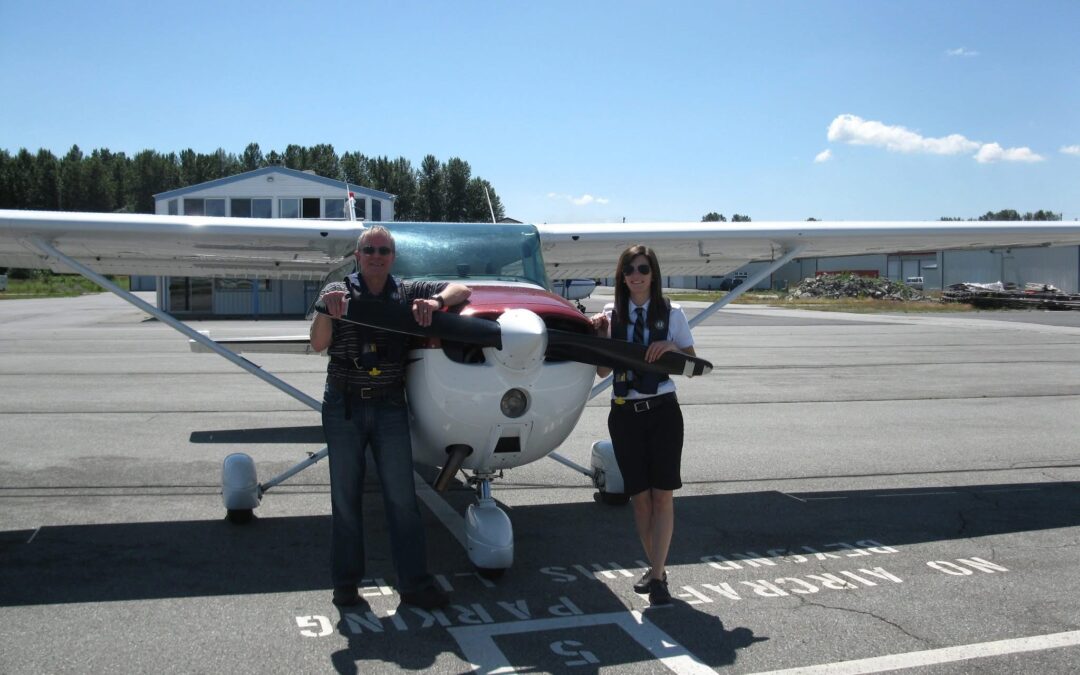
Below: Kate Klassen, in one of her many elements.


Drone Training

SOLID KNOWLEDGE BASE


The e-book is entitled Remotely Piloted Aircraft Program Development Guide for VLOS and BVLOS Operations. And it covers pretty much every aspect of running a drone program – including maintenance, staffing, recency, risk assessment – and much more (we’ll give you a peek at the table of contents shortly).

There’s also, of course, a meaty section on the regulations – including the anticipated Transport Canada changes on the horizon that will permit routine, low-risk Beyond Visual Line of Sight flights (which will require obtaining an additional TC RPAS Certificate). And while the book covers high-level operations suitable for companies with mature drone programs, it also covers the basic meat and potatoes.

“This book could be used by individuals looking to use their drone in a professional capacity or as a really serious hobby – but it’s geared more for someone who is either starting, expanding or improving a drone program within their organisation,” says Klassen.


DECISIONS, DECISIONS, DECISIONS


A well thought-out drone program involves a lot of decisions. How do you choose your crew, including flight lead? When is it time to replace an aircraft? What’s a good maintenance schedule – and how do you track that? What’s the best way to manage data? And what about insurance?

You’ll find all that and more. Klassen has packed a lot (including links to references and resources) into the 55 pages of this manual. And she’s taken special care to pore through the finer details of dense Transport Canada regulatory language and write the key takeaways in clear, concise terms.

“There was a lot of digging through Transport Canada documents to gain insights into where the drone industry is going from a regulatory perspective – and put that into plain English,” she says.

Below: The cover page

FLYY Kate Klassen drone program manual

LOGICAL, ORGANIZED


Whether you’re a seasoned pro or someone just starting a drone program, Klassen has constructed the manual in a highly organised fashion. The progression of sections builds logically from the basics, through to complex areas such as Specific Operational Risk Assessment (SORA).

Here are the sections:

  1. Regulation Roadmap
  2. Certification
  3. Operational Considerations
  4. Budgeting
  5. Program Structure and Operation
  6. Training
  7. Equipment
  8. SORA Process

And within each of those sections? Let’s just say Klassen has it all covered. Take a look:

Kate Klassen Drone Program Manual

EXCERPT


It’s one thing to tell you this manual is clear and concise. It’s another to let you see for yourself. So we’re going to paste from the very top of Section One – Regulation Roadmap – to give you a better idea:

The Canadian Remotely Piloted Aircraft System (RPAS) industry took a major leap forward in June of 2019 with the publication of drone-specific regulation in the Canadian Aviation Regulations (CARs). These regulations enable route visual line of sight (VLOS) operations for small RPAS (250g – 25kg), with additional guidance for aircraft above that weight range, through a Special Flight Operation Certificate (SFOC) process, and below, with reduced prescriptive microdrone regulation.

With the release of a Canada Gazette draft of lower risk BVLOS regulation in the summer of 2023, we have an idea of the direction Transport Canada is heading and had an opportunity to raise concerns and encourage positive direction with the drafted version.

While formal regulation, once in place, will provide a clearer path to certification for BVLOS, there will still be many of the similar requirements to what’s currently in place, through the SFOC process, including training, mission planning, procedure development and technology.

  • NOTE: While BVLOS with a microdrone is not explicitly prohibited by the regulations, the onus would be on the operator to prove it was done without being reckless, negligent, risking or being likely to risk the safety of a person or aviation safety. (CAR 900.06) Throughout this document, the aircraft and operations we’ll be referring to are those with small RPAS, that is those between 250g and 25kgs, unless otherwise specified.
  • As it stands as of the time of publication, flying an RPA heavier than 25kgs or BVLOS is not permitted in Canada except if specifically authorized in a Special Flight Operation Certificate. (CAR 901.11) This document will address considerations for a BVLOS program in anticipation of BVLOS-specific regulation being introduced in 2025 and the structure, operational considerations, components of an SFOC and training.

This is a rapidly changing space. As the industry continues to develop new technology and applications, and new regulation is announced to accompany these advancements we’re going to see a lot of refinement to the processes described within this document. It’s what’s so exciting about working in this area! The information here should help you in that pursuit.

As you can see, it’s really clearly written. It’s also filled with helpful graphics like these:

Kate Klassen Drone Program Manual

INDRO’S TAKE


Kate Klassen is widely acknowledged as both a regulatory expert and a phenomenal communicator/instructor. She combines those skills well in the production of this manual, which we believe is a “must-have” for anyone serious about their drone program.

“Kate has tremendous expertise in this field – including personally overseeing some 150 RPAS flight reviews,” says InDro Robotics CEO Philip Reece. “This manual ticks all the right boxes, and includes material that will benefit even the most mature drone program. We’re pleased to see this published, and believe it will truly help those running serious programs make the most effective and efficient decisions.”

And the cost? You can download the manual here for $49.

That’s less than a dollar per page. And, in our opinion, a bargain.

Thirty-one drones detected at Niagara Falls during eclipse – most of them breaking regulations

Thirty-one drones detected at Niagara Falls during eclipse – most of them breaking regulations

By Scott Simmie


The solar eclipse attracted more than sightseers to Niagara Falls.

It also brought out drones – with as many as 31 detected at a single point in time. A few of those drones were authorised to be flown by law enforcement, but the majority were being flown by people who either weren’t aware of the regulations, or wilfully ignored them.

That’s because Niagara Falls is Class F Airspace. And the Park makes the policies very clear:

“Niagara Parks does not permit the use of drones within the property for any recreational purposes. Use of drones for commercial projects (commercial film, photography, survey or engineering work, etc.) may be considered and approved under a Permit,” reads the Park’s website page outlining the rules for film, photography, recording and drones. It goes on to the nuts and bolts of the airspace restriction.

“The airspace surrounding Niagara Falls is classified as CYR-518 Class F Restricted Airspace which further requires a Letter of Authorization from Transport Canada prior to Niagara Parks issuing a permit. Transport Canada’s authorization is required no matter the size or weight of the drone or how low or high the flight path.”

So no, you can’t take your sub-250g drone and think you’re in the clear.

But that didn’t stop a lot of people from putting drones into the air. And that’s cause for concern, given that helicopters and other traditional aircraft with special permission are in that same airspace for tours.

Below: Collage of the eclipse by Solar Eclipse by KMHT Spotter, Wikimedia Commons 4.0.

Solar Eclipse Wikimedia Commons 4.0 KMHT Spotter

THE NEWS


Word of the multiple drones in the air came at the Canadian Hazmat and CBRNE Summit in Kitchener, where that acronym stands for Chemical, Biological, Radiological, Nuclear, and Explosive. It brought together First Responders, law enforcement and Hazmat specialists from across the country. The conference featured a heavy emphasis on how technology – drones, ground robots, ROVs, counter-UAS systems and more – have become essential tools for law enforcement and other First Responders.

One of the sessions focused on the D-Fend Solutions EnforceAir counter-UAS system, which was seen in use in an exercise with Niagara Police during the solar eclipse to monitor drones. It’s a critical area because there are often crewed aircraft, helicopters in particular, taking tourists for flights over the falls. It is also, as noted, restricted airspace where no drones that do not have special authorisation should be in the air.

But the system picked up plenty of them.

“We saw at one point 31 drones in the air at one time at Niagara Falls during the eclipse,” David Beatty, Director of Sales for D-Fend Solutions Canada, said in a presentation. That kind of traffic, he added, could mean “a possibility of a mid-air collision not just between the drones, but also with the manned aviation that was flying at the same time at the same place.”


INTRUDERS


A small number of those drones were being flown by law enforcement and marked as “authorised” by the EnforceAir system operator. But the vast majority were not. And not only were those drones in restricted airspace, at least one was detected breaking two other regulations: It was flying at an altitude of 1640′ above ground level and far Beyond Visual Line of Sight. (Transport Canada regulations limit drones – in airspace where they can be flown – to 400′ AGL and within Visual Line of Sight without special authorisation.)

“The system identified the operator was four kilometres away flying at that altitude which was impeding both fixed wing and rotary aviation,” said Beatty in a follow-up interview with InDro Robotics. “Our understanding is that Niagara Police, because they have the residence location, will be conducting followup visits to the perpetrators.”

The EnforceAir operator team was also able to relay information about drone positioning in real-time to a helicopter pilot who was carrying out flights over the falls, ensuring he had airspace awareness.

Below: David Beatty with the D-Fend system during a demonstration. Scott Simmie photo.


THE D-FEND SOLUTIONS SYSTEM


Developed in Israel, D-Fend Solutions originally began as a counter-drone solution for multiple Tier One agencies – meaning special forces and other elite services in the military and intelligence sectors around the world. Current clients listed on its website include three US federal departments: Defence, Homeland Security and Justice. A D-Fend system is also being evaluated for airport use by the FAA.

But D-Fend Solutions is now seeing opportunities in the broader market. This has come with both the widespread proliferation of drones, as well as their potential to be modified for nefarious and criminal purposes – including the frequent attempts to deliver contraband to prison yards.

“We were primarily dealing in the military realm, but based upon the threats that have occurred to public safety we’ve expanded into that marketplace,” explained Beatty. D-Fend Solutions products have been used at large public gatherings, to detect and mitigate drones at prisons and near critical infrastructure – including major airports.

And while drones can potentially cause conflict with traditional crewed aircraft, Beatty says there’s concern about another threat that has emerged in recent years.

“As we see in the conflict in the Ukraine, they are the poor man’s Air Force. Drones are very easily weaponised, and that could be someone flying the drone directly into someone, or placing some form of munition or chemical irritant on it.”

Beatty says clients have also seen an increase in the use of drones at protests, flying dangerously close over the heads of people – and even interfering with police drone activity.

Below: D-Fend Solutions at a demonstration for First Responders

D-Fend Niagara

HOW IT WORKS


There’s a variety of types of c-UAS systems on the market. They range from direct energy type weapons (think lasers) to kinetic (nets, etc.), frequency jamming and radar. The D-Fend Solutions system is a passive cyber-solution, meaning there’s no direct jamming or kinetic action. It also meets what are sometimes called the “Four Pillars” of a complete c-UAS system, including the ability to detect, track, identify and mitigate.

“The system detects drones at ranges in excess of five kilometres,” says Beatty. “We will track the drone so we know its flight path. We identify the drone to the point where we get the serial number of the drone, the controller, the make and model of the drone, with options for mitigation.”

Before we get to mitigation options, it’s worth explaining that the D-Fend Solutions system is constantly listening for the unique characteristics of the drone. That’s how it detects not only the type of drone but also other relevant information.

In terms of mitigation, there are multiple options. D-Fend Solutions can support a geofence, for example, that prevents drones marked as unauthorised from flying into a certain area. They’ll simply hit the boundaries of that geofence and can then be tracked or fended off. A rogue drone can also be forced to simply stop and hover in a location so that ground observers can get a closer look to determine if it poses a threat.

“The final option is that we can take control of the drone and send it on a safe passage to a safe collection point. And the emphasis is always on control.”

And how does the system do that passively, without jamming frequencies (where Industry Canada has some pretty strict rules)? Quite simply, it can trick the drone so that D-Fend Solutions becomes the control system.

Two of multiple drones being tracked by D-Fend Solutions at a demonstration outside Kitchener. 

SOMETIMES, IT’S ABOUT EDUCATION


The D-Fend Solutions EnforceAir system identified the location of the drone pilots violating the regulations at Niagara Falls on the day of the eclipse. An officer involved said during the conference there will be a follow-up with the pilot of that BVLOS drone flying at 1640′. It’s unclear whether this will be an informal education session, or whether any further action will be taken.

But sometimes, education is also a key tool. And that’s enabled by the system pinpointing the location of the pilot.

“This allows for a form of soft policing – in lieu of mitigating the drone, the police are able to educate the public with direct intervention by police units and the drone operator,” says Beatty.

Thankfully, there were no mishaps on April 8. Crewed air assets (and police drone operators) were kept in the loop on the location of all unauthorized drones.

Below: The company even has a version that fits in a backpack


INDRO’S TAKE


The D-Fend Solutions system provided important airspace awareness – and was a critical safety tool – during the eclipse event at Niagara Falls. The system has been demonstrated at several other major public events in Canada, providing critical awareness to law enforcement and other First Responders. The company’s EnforceAir product won first place for hardware and systems design at the 2023 AUVSI XCELLENCE awards.

“There’s a growing demand for c-UAS products globally, whether for public safety, critical infrastructure, airport security – even for protection from pirates on the high seas,” says InDro Robotics CEO Philip Reece.

“D-Fend Solutions EnforceAir provided an important solution during the Niagara demonstration, and its ability to mitigate without jamming or kinetics is impressive.”

You can learn more about D-Fend Solutions here.

We’d be remiss if we didn’t also mention Bravo Zulu Secure, an InDro sister company that also offers detection and mitigation solutions. The incident detailed above is also reminiscent of the detection of many illegal drone flights in Ottawa during the convoy protests. If you haven’t seen that one, it’s definitely worth a read.


InDro Robotics ROS-based drone an R&D powerhouse

InDro Robotics ROS-based drone an R&D powerhouse

By Scott Simmie


InDro Robotics is pleased to unveil details of its highly capable new R&D drone.

Running the Robot Operating System (ROS) and with powerful onboard compute capabilities, the drone is perfect for advanced Research and Development.

“It’s a drone geared toward R&D first and foremost,” explains Luke Corbeth, Head of R&D Sales. “It truly is a flying robot – and you can program and use it in a very similar fashion to all our other robots.”

There’s a real demand in the research world for open-source drones that can be programmed and run highly complex algorithms. These kinds of drones can be used to study swarm behaviour, object detection and identification, mapping in GPS-denied locations and much more.

For some researchers, the budget go-to has been the Crazyflie, a micro-drone that uses a Raspberry Pi for compute. Its advantage is that it’s quite affordable. But its low cost, 27 gram weight and relatively low computing power means it has limitations – including the ability add sensors of any weight.

“This drone can do so much more,” says Corbeth. “With the NVIDIA Xavier NX onboard for compute, it can effectively map entire environments. And when it comes to landing and object recognition, it’s truly phenomenal. It can even land on a moving vehicle.”

Below: A look at InDro’s new drone, which comes complete with LiDAR, a depth-perception camera, 5G connectivity – and much more.

InDro ROS drone

THE BACK STORY


If you’ve been following the latest news from InDro, you’ll be aware we have an incubation agreement with Cypher Robotics. That company builds solutions for cycle counting and precision scanning in the industrial/supply chain space. InDro assisted with the development of its signature product, Captis.

Captis integrates an autonomous ground robot with a tethered drone. As the Captis robot autonomously navigates even narrow stock aisles, the drone ascends from a tether attached to that ground robot. The drone then scans the barcodes (it’s code-agnostic) of the products on the shelves. All of that data is transferred seamlessly, in real-time, to the client’s Warehouse Management System (WMS), WCS (Warehouse Control System) and WES (Warehouse Execution System) software.

The capabilities of Captis led to a partnership with global AI fulfilment experts GreyOrange and leading global telco innovator Ericsson. The product debuted at the recent MODEX2024 conference (one of the biggies in the automated supply chain world), where it gained a *lot* of attention.

While working on the project, it was always clear the drone – thanks to multiple modifications – would be highly suitable as a research and development tool. It’s capable of machine vision/object recognition, machine learning, and can find its way around in completely unfamiliar, GPS-denied environments.

“In fact, I have one client that’s using it for research in mines,” says Corbeth.


THE JETSON DIFFERENCE


NVIDIA has made quite a name for itself – and quite a profit for its shareholders – with its powerful AI-capable processors. The Jetson Xavier NX features a 6-core NVIDIA Carmel Arm®v8.2 64-bit processor running at speeds of up to 1.9 GHz. Its graphics processor unit features a 384-core NVIDIA Volta™ architecture with 48 Tensor Cores. Put it all together, and the computing power is astonishing: The Xavier NX is rated with a maximum achievable output of 21 TOPS – trillion operations per second. (We were going to try to count, but thought it more efficient to rely on NVIDIA’s specs for this.)

The LiDAR unit currently shipping with the drone also has some flex. It’s the Ouster 32-channel OS1 (Rev6.2). With a maximum range of 200 metres (90 metres on a dark, 10 per cent target), its powerful L3 chip is capable of processing scans of up to 5.2 million points per second with 128 channels of vertical resolution (again, we didn’t count). Hostile environment? No problem. The LiDAR can operate from -40°C to 60°C and has an IP68 Ingress Protection rating.

The OS1 is designed for all-weather environments and use in industrial automation, autonomous vehicles, mapping, smart infrastructure, and robotics,” states its manufacturer“The OS1 offers clean, dense data across its entire field of view for accurate perception and crisp detail in industrial, automotive, robotics, and mapping applications.”

The unit uses open source ROS and C++ drivers, and comes with Ouster’s Software Development Kit. Its ability to accurately sense its environment (down to distances of 0.5 metres away), combined with the NVIDIA processor and the depth camera also allows this machine to do something pretty extraordinary: It can recognise and land on a moving platform.

“That’s a very challenging problem to solve and requires not only specific sensing but also really powerful onboard compute. This drone can do it,” explains Corbeth.

Already, word about the product has been spreading. A number of units have already been sold to academic institutions for research purposes – and the team has been hard at work building and testing for the next set of orders (as seen below).

THE FORGE CONNECTION


Like all new products, the new drone required custom parts. We looked no further than InDro Forge, our rapid prototyping and limited production run facility in Ottawa.

Using state of the art additive and subtractive tools, the Forge team created custom mounts using carbon fibre and other strong but lightweight materials, while also ensuring the frame was robust enough to take on even the most challenging environments where these drones will be deployed.

“InDro Forge has been critical to the finished product,” says Corbeth. “We wanted a look, feel and quality that matches this drone’s capabilities – and InDro Forge delivered.”

InDro ROS drone

INDRO’S TAKE


We’re obviously excited about the capabilities of this new drone, and we’re not alone. Interest in this product from researchers has already been significant. In fact, we’re not aware of any other drone on the market offering this combination of specific capabilities.

It was that void – in concert with our partnership with Cypher Robotics – that led to its creation.

“InDro has always placed a great emphasis on the development of innovative new products,” says CEO Philip Reece. “We build new products at the request of clients and also develop our own when we see a market opportunity. In this case, the requirements for Cypher Robotics dovetailed nicely with demand for such a drone from researchers.”

Production of the new drone is moving at a swift pace. If you’re interested in a briefing or demo, you can contact us here.

George Mason U. researchers enable robots to intelligently navigate challenging terrain

George Mason U. researchers enable robots to intelligently navigate challenging terrain

By Scott Simmie


Picture this: You’re out for a drive and in a hurry to reach your destination.

At first, the road is clear and dry. You’ve got great traction and things are going smoothly. But then the road turns to gravel, with twists and turns along the way. You know your vehicle well, and have navigated such terrain before.

And so, instinctually, you slow the vehicle to navigate the more challenging conditions. By doing so, you avoid slipping on the gravel. Your experience with driving, and in detecting the conditions, has saved you from a potential mishap. Yes, you slowed down a bit. But you’ll speed up again when the conditions improve. The same scenario could apply to driving on grass, ice – or even just a hairpin corner on a dry paved road.

For human beings, especially those with years of driving experience, such adjustments are second-nature. We have learned from experience, and we know the limitations of our vehicles. We see and instantly recognize potentially hazardous conditions – and we react.

But what about if you’re a robot? Particularly, a robot that wants to reach a destination at the maximum safe speed?

That’s the crux of fascinating research taking place at George Mason University: Building robots that are taught – and can subsequently teach themselves – how to adapt to changing terrain to ensure stable travel at the maximum safe speed.

It’s very cool research, with really positive implications.

Below: You don’t want this happening on a critical mission…

George Mason Xuesu Xiao Hunter SE

“XX”


Those are the initials of Dr. Xuesu Xiao, an Assistant Professor at George Mason University. He holds a PhD in Computer Science, and runs a lab that plays off his initials, called the RobotiXX Lab. Here’s a snippet of the description from his website:

“At RobotiXX lab, researchers (XX-Men) and robots (XX-Bots) perform robotics research at the intersection of motion planning and machine learning with a specific focus on robustly deployable field robotics. Our research goal is to develop highly capable and intelligent mobile robots that are robustly deployable in the real world with minimal human supervision.”

We spoke with Dr. Xiao about this work.

It turns out he’s particularly interested in making robots that are particularly useful to First Responders, and carrying out those dull, dirty and dangerous tasks. Speed in such situations can be critical, but comes with its own set of challenges. A robot that makes too sharp a turn at speed on a high friction surface can easily roll over – effectively becoming useless in its task. Plus, there are the difficulties previously flagged with other terrains.

This area of “motion planning” fascinates Dr. Xiao. Specifically, how to take robots beyond traditional motion planning and enable them to identify and adapt to changing conditions. And that involves machine vision and machine learning.

“Most motion planners used in existing robots are classical methods,” he says. “What we want to do is embed machine learning techniques to make those classical motion planners more intelligent. That means I want the robots to not only plan their own motion, but also learn from their own past experiences.”

In other words, he and his students have been focussing on pushing robots to develop capabilities that surpass the instructions and algorithms a roboticist might traditionally program.

“So they’re not just executing what has been programmed by their designers, right? I want them to  improve on their own, utilising all the different sources of information they can get while working in the field.”


THE PLATFORM


The RobotiXX Lab has chosen the Hunter SE from AgileX as its core platform for this work. That platform was supplied by InDro Robotics, and modified with the InDro Commander module. That module enables communication over 5G (and 4G) networks, enabling high speed data throughput. It comes complete with multiple USB slots and the Robot Operating System (ROS) library onboard, enabling the easy addition (or removal) of multiple sensors and other modifications. It also has a remote dashboard for controlling missions, plotting waypoints, etc.

Dr. Xiao was interested in this platform for a specific reason.

“The main reason is it is because it’s high speed, with a top speed of 4.8m per second. For a one-fifth/one-sixth scale vehicle that is a very, very high speed. And we want to study what will happen when you are executing a turn, for example, while driving very quickly.”

As noted previously, people with driving experience instinctively get it. They know how to react.

“Humans have a pretty good grasp on what terrain means,” he says. “Rocky terrain means things will get bumpy, grass can impede a motion, and if you’re driving on a high-friction surface you can’t turn sharply at speed. We understand these phenomenon. The problem is, robots don’t.”

So how can we teach robots to be more human in their ability to navigate and adjust to such terrains – and to learn from their mistakes?

As you’ll see in the diagram below, it gets *very* technical. But we’ll do our best to explain.

George Mason Hunter Xuesu Xiao

THE APPROACH


The basics here are pretty clear, says Dr. Xiao.

“We want to teach the robots to know the consequences of taking some aggressive maneuvers at different speeds on different terrains. If you drive very quickly while the friction between your tires and the ground is high, taking a very sharp turn will actually cause the vehicle to roll over – and there’s no way the robot by itself will be able to recover from it, right? So the whole idea of the paper is trying to enable robots to understand all these consequences; to make them ‘competence aware.'”

The paper Dr. Xiao is referring to has been submitted for scientific publication. It’s pretty meaty, and is intended for engineers/roboticists. It’s authored by Dr. Xiao and researchers Anuj Pokhrel, Mohammad Nazeri, and Aniket Datar. It’s entitled: CAHSOR: Competence-Aware High-Speed Off-Road Ground Navigation in SE(3).

That SE(3) term is used to describe how objects can move and rotate in 3D space. Technically, it stands for Special Euclidean group in three dimensions. It refers to keeping track of an object in 3D space – including position and orientation.

We’ll get to more of the paper in a minute, but we asked Dr. Xiao to give us some help understanding what the team did to achieve these results. Was it just coding? Or were there some hardware adjustments as well?

Turns out, there were both. Yes, there was plenty of complex coding. There was also the addition of an RTK GPS unit so that the robot’s position in space could be measured as accurately as possible. Because the team soon discovered that intense vibration over rough surfaces could loosen components, threadlock was used to keep things tightly in place.

But, as you might have guessed, machine vision and machine learning are a big part of this whole process. The robot needs to identify the terrain in order to know how to react.

We asked Dr. Xiao if an external data library was used and imported for the project. The answer? “No.”

“There’s no dataset out there that includes all these different basic catastrophic consequences when you’re doing aggressive maneuvers. So all the data we used to train the robot and to train our machine learning algorithms were all collected by ourselves.”


SLIPS, SLIDES, ROLLOVERS


As part of the training process, the Hunter SE was driven over all manner of demanding terrain.

“We actually bumped it through very large rocks many times and also slid it all over the place,” he says. “We actually rolled the vehicle over entirely many times. This was all very important for us to collect some data so that it learns to not do that in the future, right?”
 
And while the cameras and machine vision were instrumental in determining what terrain was coming up, the role of the robot’s Inertial Measurement Unit was also key.

“It’s actually multi-modal perception, and vision is just part of it. So we are looking at the terrain using camera images and we are also using our IMU. Those inertial measurement unit readings  sense the acceleration and the angular velocities of the robot so that it can better respond,” he says.

“Because ultimately it’s not only about the visual appearance of the terrain, it is also about how you drive on it, how you feel it.”


THE RESULTS


Well, they’re impressive.

The full details are outlined in this paper, but here’s the headline: Regardless of whether the robot was operating autonomously heading to defined waypoints, or whether a human was controlling it, there was a significant reduction in incidents (slips, slides, rollovers etc.) with only a small reduction in overall speed.

Specifically, “CAHSOR (Competence-Aware High-Speed Off-Road Ground Navigation) can efficiently reduce vehicle instability by 62% while only compromising 8.6% average speed with the help of TRON (visual and inertial Terrain Representation for Off-road Navigation).”

That’s a tremendous reduction in instability – meaning the likelihood that these robots will reach their destination without incident is greatly improved. Think of the implications for a First Responder application, where without this system a critical vehicle rushing to a scene carrying medical supplies – or even simply for situational awareness – might roll over and be rendered useless. The slight reduction in speed is a small price to pay for greatly enhancing the odds of an incident-free mission.

“Without using our method, a robot will just blindly go very aggressively over every single terrain – while risking rolling over, bumps and vibrations on rocks, maybe even sliding and rolling off a cliff.”

What’s more, these robots continue to learn with each and every mission. They can also share data with each other, so that the experience of one machine can be shared with many. Dr. Xiao also says the learnings from this project, which began in January of 2023, can also be applied to marine and even aerial robots.

For the moment, though, the emphasis has been fully on the ground. And there can be no question this research has profound and positive implications for First Responders (and others) using robots in mission-critical situations.

Below: The Hunter SE gets put through its paces. (All images courtesy of Dr. Xiao.)

Hunter SE George Mason Xuesu Xiao

INDRO’S TAKE


We’re tremendously impressed with the work being carried out by Dr. Xiao and his team at George Mason University. We’re also honoured to have played a small role in supplying the Hunter SE, InDro Commander, as well as occasional support as the project progressed.

“The use of robotics by First Responders is growing rapidly,” says InDro Robotics CEO Philip Reece. “Improving their ability to reach destinations safely on mission-critical deployments is extremely important work – and the data results are truly impressive.

“We are hopeful the work of Dr. Xiao and his team are adopted in future beyond research and into real-world applications. There’s clearly a need for this solution.”

If your institution or R&D facility is interested in learning more how InDro’s stable of robots (and there are many), please reach out to us here.

Blue Books offer crucial guides for First Responder RPAS programs

Blue Books offer crucial guides for First Responder RPAS programs

By Scott Simmie


There are two important tools available for First Responders who use RPAS in their work.

No, they’re not drones. Instead, they are guides for developing safe and effective RPAS programs – and for carrying out low-risk BVLOS flight in the near future. These “Blue Books” are intended for fire departments, Search and Rescue organisations – and more.

These guides came about because the Canadian Association of Fire Chiefs, the Civil Air Search and Rescue Association and the Search and Rescue Volunteer Association of Canada identified a need for clear and credible reference documents. InDro Robotics received the contract to pull these books together, under the expertise of Kate Klassen and with a generous grant from the Government of Canada’s Search and Rescue New Initiatives Fund.

Kate was an early adopter in the drone world and already had a solid background in traditional aviation. She’s a flight instructor with multi-engine and Instrument Flight Rules ratings, as well as ratings for flying at night. She loves nothing more (with the exception of her two young daughters) than poring through regulations and working with bodies like Transport Canada to help safely advance the use of drones in Canadian airspace.

In other words, she was perfect for the job.

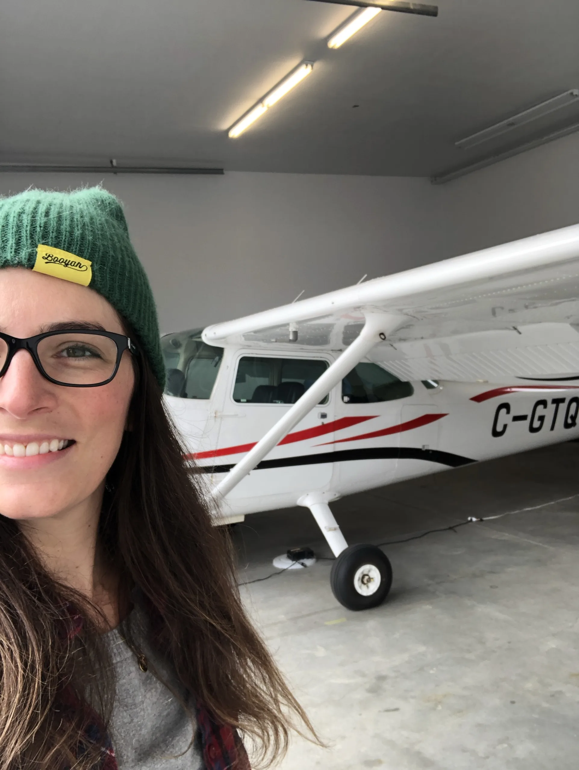
That’s Kate, in her element, below:


DRONES AND FIRST RESPONDERS 

These days, you’d be hard-pressed to find a First Responder organization that doesn’t have some kind of drone program. RPAS have been particularly helpful in Search and Rescue operations, including night searches using thermal sensors. Many people have been rescued quickly and safely as a result. The use of drones has also helped keep First Responders out of harm’s way. For example, it’s much safer to locate a person lost on a frozen lake with a drone and then dispatch a rescue team to precise coordinates rather than having that crew roaming around on potentially hazardous conditions.

They’re also a tremendous tool for firefighting operations. Not only do they supply immediate situational awareness that can be securely shared with decision makers down the line, but thermal sensors can also detect hot spots invisible to the naked eye. Police departments and even paramedics routinely use drones in operations. (In one example from Renfrew County, a drone was put up immediately following a tornado for damage assessment and to search for any injured people.) So drones are here to stay.


A REVOLUTION 

It’s not an exaggeration to say that drones have truly revolutionised the work carried out by these organizations. But it’s easy to forget that this has been a recent development.

DJI released its original Phantom drone back in 2013. At the time, it didn’t come with a camera and you had to attach a GoPro. Smart tinkerers figured out how to modify those GoPros so that the pilot could stream real-time video. Another company, Draganfly, was producing basic drones even earlier and selling them to law enforcement and other First Responders.

But drones weren’t widely known, and many of the use-cases now so common had not even yet been conceived.

A few early adopters began purchasing drones for First Responder work. It was largely trial and error, as people experimented with using drones for SAR, strategic monitoring of fires, photographing accident scenes – and more. Results started to be shared by word of mouth and at conferences. Drones were gaining traction.

Yet it wasn’t so easy to just pop up a drone in those early days. Transport Canada at the time was rightly cautious about these new devices, and pretty much any flight back then required a Special Flight Operations Certificate, even if you were flying within line of sight. Unless you managed to get a blanket SFOC, it was against the regulations to simply put a drone without that long SFOC process.


AN EVOLUTION

As the technology improved and the utility and safety was recognised, things began to shift. More and more First Responders started adding drones to their tool kit. And Transport Canada eventually modified (and continues to modify) its regulations to safely integrate drone operations into the national air space.

If that sounds like progress, it was. But still, there was a hitch. Organizations were creating their own ad-hoc drone operations. They were doing their best, but there was really no Best Practices guide to help inform First Responders on how to create an effective program. Yes, there was piecemeal information if you wanted to endlessly surf the internet, but there wasn’t a single repository of knowledge that could be used as a guide. What qualifications are required? What type of drone is best for the job? What scheduled maintenance is necessary and why?

And that’s how the idea for the Blue Book series came about.

Below: One of the early DJI Phantoms, with an integrated camera and gimbal system.

Canada Drone Companies

THE BLUE BOOKS

The first Blue Book was released in November of 2022 and is available for members of First Responder, Search and Rescue and Fire Departments here. Kate Klassen worked extensively with the various interested parties to ensure that the book was specifically tailored to the needs of these organizations. It quickly became the reference guide for those implementing or improving their drone operations.

“I think it prevents a lot of trial and error so that folks don’t have to learn all the lessons the hard way,” explains Klassen.

“A lot of fire departments are poorly funded, and I’m sure that goes for SAR as well. So you want to be smart with the dollars that you put towards tools like this. The guide supports making sure you’re not wasting money on poor aircraft decisions or poor personnel decisions.”

That initial Blue Book is entitled “Remotely Piloted Aircraft Program Development Guide, First Edition.” It’s a comprehensive blueprint for starting an operation from scratch, or improving an existing operation. Sections in the book include:

  • Training and certification regulations and resources
  • Airspace operations
  • Aircraft budget considerations, maintenance, payload and staffing
  • First Responder deployment

There’s much more, but you get the idea. And while it’s called the Blue Book, it’s really the gold standard of guides for First Responder operations.


BLUE BOOK II

The newest edition was launched last week, with Kate Klassen conducting a webinar to go over the highlights. This edition is geared toward routine, low-risk Beyond Visual Line of Sight flight. Obviously, particularly in Search and Rescue operations, being able to dispatch a drone over long distances can be critical in locating missing parties. And while Transport Canada does offer some leeway for First Responders in this regard, BVLOS is going to become more routine.

Transport Canada plans to deploy new BVLOS regulations. While SFOCs were previously required, the new rules (anticipated in 2025) will permit BVLOS flights in lower risk scenarios. Specifically, within uncontrolled airspace and outside of populated areas.

But even lower risk BVLOS is higher risk than Visual Line of Sight flights. And so Blue Book II takes a deep dive into the coming regulations. These regs include a new type of RPAS certificate required for low-risk BVLOS operations called a Level One Complex Certificate. Obtaining this certificate will require obtaining additional ground school education, as well as a more complex in-person Flight Review. Operators will have to maintain specific skillsets and recency in order to take on these BVLOS flights.

Among the contents of Blue Book II:

  • Defining BVLOS
  • Policy developments, procedures and checklists
  • Detect and Avoid, Mission Planning, Human Factors

There’s also an entire section on Specific Operational Risk Assessment (SORA), including Ground Risk Class Assessment (GRC), Air Risk Class Assessment (ARC), Tactical Mitigation Performance Requirements (TMPR) and Specific Assurance and Integrity Level (SAIL).

“This manual is a guide for preparing your RPAS program in fire or search and rescue organizations for Beyond Visual Line of Sight (BVLOS) operations,” states its introduction, co-written by CAFC President Chief Ken McMullen, SARVAC President Janelle Coultes and CASARA President Dale Krisch.

“The book is designed to be relevant to both fire departments and search and rescue (SAR) organizations, all hazard, emergency operations or fire suppression. Whether your fire department or SAR organization is expanding their use of RPAS into beyond visual line of sight (BVLOS) operations or whether it is advanced in the domain, we hope will find useful information in this manual.”

“We would like to take this opportunity to thank every member of the committee that worked on this manual and its predecessor Blue Book I which addresses the development of an RPAS program. We would also like to thank Kate Klassen at InDro Robotics who managed the process and held the pen to get the committee to their overall goal. This manual is in great part due to her substantive and process expertise.”

Although the Blue Books are specifically intended for those who are members of Search and Rescue organisations and Fire Departments, some exceptions are made for those in related First Responder fields. You can request a copy of the Blue Books at the bottom of the page here.

Below: A paramedic deploys a drone

Paramedics Use Drones

INDRO’S TAKE 

Kate Klassen has been a tremendous asset to the Canadian drone space for a decade. Her regulatory expertise and willingness to assist in shaping sound practices and policies are widely known. Her online RPAS courses have trained more than 10,000 drone pilots in Canada, and her online portal FLYY continues to help new pilots obtain their Basic and Advanced RPAS Certificates (including Flight Reviews). Kate has served as the co-chair of Transport Canada’s Drone Advisory Committee (CanaDAC), is on the board of the Aerial Evolution Association of Canada, and has previously served on the board of COPA – the Canadian Owners and Pilots Association.

“These guides were pretty labour-intensive, but I’m pleased to have worked closely with these various associations and individuals to pull together what we believe to be a Best Practices manual that truly reflects the needs of these specific organizations and use-cases,” says Klassen.

“We are also always willing to work with any company that has a drone program to produce a guide tailored specifically for their operations, ensuring consistency and safety across all operations. We are also building out specific Micro-Credential courses in areas like thermal/hyperspectral imaging, surveying, precision agriculture and more. These are highly-focused, hands-on courses that quickly bring operators up to speed on new and complex skill sets.”

In addition, InDro Robotics manages the Drone and Advanced Robot Training and Testing (DARTT) facility at Area X.O in Ottawa, which includes both classroom space and a netted drone enclosure.

If you’re interested in discussing your RPAS program needs, whether for training or a company/industry-specific manual, you can get in touch with Kate right here.

Cypher Robotics Captis System Generates Buzz at #MODEX2024

Cypher Robotics Captis System Generates Buzz at #MODEX2024

By Scott Simmie


MODEX2024 is a wrap.

And, for Cypher Robotics and its newly released Captis system for cycle counting and precision industrial scanning, the conference was an unmitigated success.

MODEX is one of the world’s preeminent supply chain automation shows. It’s held on alternating years with ProMat – much like the Farnborough International Air Show and the Paris–Le Bourget Air Show. The two supply chain shows attract something like 50,000 global buyers, so they’re really big.

It was at MODEX in Atlanta that Cypher Robotics, a company incubated by InDro Robotics, revealed its new solution. Captis integrates an autonomous mobile robot (AMR) with tethered drone technology for inventory cycle counting. The Captis base can autonomously navigate even narrow warehouse aisles without any infrastructure changes. As it moves down the aisle, a drone ascends from its nest atop the AMR, with a tether attached to the Captis base. That drone can scan any type of code on the box of the products (it’s code-agnostic).

And that tether? It’s a pipeline for both secure data and power. Data captured by the drone reaches the base in realtime, and is instantly uploaded and integrated with the facility’s existing Warehouse Management System (WMS), WCS (Warehouse Control System) and WES (Warehouse Execution System) software. Ample power storage in Captis means autonomous missions can last up to five hours before the system returns to base for a wireless recharge.

What’s more, the Captis system is also capable of RFID scanning and even precise industrial scanning for 2D and 3D digital twins. (These are major additional features, which we’ll be exploring in detail in forthcoming posts.)

We wrote about Cypher Robotics and its product launch here. But we’ve since had a chance to speak with the InDro team that assisted with that launch. InDro Vice President Peter King and Head of Strategic Initiatives Stacey Connors were in Atlanta, working with partners (and AI-fulfilment experts) GreyOrange and global telecommunications innovator Ericsson, which can easily set up private 5G networks in warehouses for ultra-secure data protection and throughput.

The verdict? Captis was a hit.

Below: Stacey Connors with Captis and GreyOrange at MODEX 2024. There’s a reason she looks so happy…


Stacey Connors Captis MODEX

INFLECTION POINT


The Supply Chain sector is going through something of an automation revolution. At every step of the way, robotics and software are being used to make these processes more efficient – and reduce the burden on human beings normally assigned to the tedious tasks of physically moving products or scanning by hand during cycle counting. There’s been a growing and global shift toward using robotics wherever possible.

“MODEX is getting more and more technical,” says InDro Vice President Peter King. “More and more robotic solutions are taking over that show. Alternatives to the traditional methods of supply chain operations are growing fast. Increasingly, companies are interested in automated ways of loading and unloading trucks, picking and placing objects, bringing inventory into the warehouse – and cycle counting.”

On that last issue, cycle counting and inventory management, King says many at MODEX2024 “identified this as a monster of an issue.”

One of the companies King spoke with at the show uses 26 full-time employees to do manual scanning in its six 750,000 square foot warehouses. It’s boring work, and expensive.

Obviously, there’s got to be a better and more efficient way. Deplying the Captis system would allow those 26 people to be reassigned more satisfying work.


DRONE SOLUTIONS


There are already some solutions that implement drones for cycle counting. In fact, King says many of those interested in Captis had explored the possibility of drone-only solutions. But, he says, the short flight times between recharging and other issues have led many to seek a more comprehensive option with longer mission times.

That’s a key ingredient in the Captis secret sauce. By fully integrating a tether-based drone with the Captis AMR nest, Cypher Robotics has created a “drobot” (apologies to Skyland players) capable of scanning inventory in a medium-sized warehouse in a single go.

And that capability…has created a lot of interest.

“Captis really blew it out of the water,” says King. “We were the Belle of the Ball.”

There were two Captis systems on display at the show. One was with the GreyOrange exhibit and the second was at Ericsson’s booth. Head of Strategic Initiatives Connor was hearing the same stories – and seeing the same enthusiasm over Captis – as King.

Most organizations invested in consideration of drone technology for cycle counting within the past two years,” she says, “but concluded the payback and accuracy was not justifiable given the short run time of 10-15 mins per drone.

“So when they recognized this problem has been solved by Cypher’s tethered AMR, the excitement was obvious. Jaws dropped at the five-hour run time – and that no additional infrastructure was needed.”

Below: A lineup of potential clients waiting to discuss Captis at MODEX2024. You can just make out the back of Peter King’s head to the right of the robot. 

Captis MODEX2024

THE INDRO-CYPHER ROBOTICS CONNECTION


Cypher Robotics is an Ottawa-based company devoted to using robotics to gain efficiencies in the Supply Chain sector.

According to its website, “Cypher Robotics is modernizing warehouse operations with autonomous technologies that are replacing mundane and labour-intensive job functions. We are committed to delivering robotics solutions that are simple to integrate into an existing warehouse ecosystem, immediately providing an ROI for the operation.”

InDro Robotics could see the growing demand for this kind of solution, and invested in Captis. The two companies also signed an incubation agreement, whereby InDro was able to assist with engineering expertise for the development of the Captis system.

“With Captis, our fully autonomous cycle counting solution, manual cycle counts become a thing of the past. By enhancing operational margins and improving inventory accuracy, Captis significantly boosts efficiency,” continues the Cypher Robotics site.

“Cypher Precision Scan enables us to assist customers in eliminating the labour-intensive task of updating CAD files for scenario planning. Precision Scan offers a fully autonomous solution, efficiently capturing highly accurate digital twins of facilities, empowering better business decisions.”


SUPPLY CHAIN SHIFT


The global automation for supply chain automation is huge. One company, Precedence Research, estimates this sector was worth $58B US globally in 2022, and predicts it will rise to an astonishing $196.01B by 2032. Companies are looking at using automation wherever it can be implemented for speed, efficiency and accuracy.

Why the sudden push? Well, the global COVID19 pandemic was part of it. Remember all the issues with the Supply Chain during the first year in particular? Well, it was triggered because many people carrying out the manual work in the supply chain weren’t on the job, or were at significantly lower numbers. This coincided with the rise in automated solutions. Soon, technology companies were offering faster and better ways of cycle counting and physically moving product using robotic solutions.

Identifying that demand was the genesis of Cypher Robotics.

In addition to cycle counting, Captis has a separate “crown” or dome that can be placed on the AMR when the tethered drone is not in use. That dome contains RFID sensors, meaning Captis can automously navigate a showroom, for example, and capture all inventory on a regular basis. It’s also capable of precision-level scanning of facilities, uploading updated data for digital twins. For potential clients, these multiple capabilities ticked a lot of boxes.

“I know Peter used this phrase, but we truly did feel like the Belle of the Ball,” says Connors. “The high volume of activity and interest around Captis continued to flow all week.”

King, who is also a veteran of many conferences over the years, described this as his “best” conference ever.

Anytime I told people that we didn’t want to disrupt their workflow, they lost their minds,” he says. “There was honestly nobody else at the show that had this kind of solution, and there’s incredible pent-up demand for precisely what Captis offers.”

Cypher Robotics Captis

INDRO’S TAKE


InDro Robotics has watched Cypher Robotics and its Captis system take shape over the past two years. It’s been a very methodical process, with an eye on a comprensive and integrated solution for industry-at-large.

The result, Captis, is the first made-in-North America solution we are aware of that combines tethered drone technology (to reach those *really* high bins) with an Autonomous Mobile Robot. The company has a major Canadian retailer (with more than 300 locations across Canada) as a partner, and carried out R&D and testing for many months in its warehouses to perfect the solution.

“We’re pleased with the tremendous interest Captis generated at MODEX2024,” says InDro Robotics CEO and Cypher Robotics early investor Philip Reece.

“It took a lot of engineering to create this solution, and I’m proud of the assistance InDro was able to provide Cypher Robotics. Captis is a unique solution – and, based on the interest at MODEX2024, is going to be a huge success.”

You can learn more about Cypher Robotics, including contact info, here.