Drone pilot fined $3,021 for drone incursion at YOW

Drone pilot fined $3,021 for drone incursion at YOW

By Scott Simmie


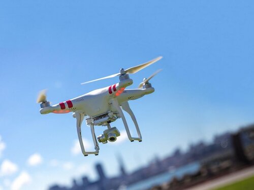
A drone pilot has been hit with fines totalling more than $3,000 for two unauthorised and potentially dangerous flights at YOW – the Ottawa International Airport.

The flights took place in December of 2022 and involved the drone flying in close proximity to active runways while aircraft were landing. The flights were detected – and the pilot located – by the YOW Drone Detection Pilot Project. InDro Robotics supplies the core technology for that system, which has been in operation some 2-1/2 years.

In fact, the system allowed police to be directed to the location of the pilot while he was flying the drone from inside his car at a hotel parking lot.

“The individual was quite surprised that a police cruiser pulled up – and expressed ignorance about flying in the vicinity of the airport,” says Michael Beaudette, Vice President of Security, Emergency Management and Customer Transportation with the Ottawa International Airport Authority.

“He said he wasn’t aware he couldn’t fly there.”

He was about to be educated.

Below: Part of the YOW drone detection system, which uses multiple technologies

Ottawa Drone Detection

INTRUSION


The system at YOW is capable of detecting the location of active DJI drones up to 40 kilometres away. It is also designed to pick up on other brands of commercial drones flying at closer proximity to the airport by identifying their unique radio frequency signatures.

On December 20, the system generated an alert. Someone was flying a DJI Air 2S drone, which weighs 595 grams, adjacent to the airport.

Flight one: The flight began at 10:07 AM and the drone and pilot were detected at the parking lot of the World Fuel Services building. The drone remained at ground level for five minutes; at 10:12 the operator and drone were detected near the hotel immediately adjacent to the airport – a likely indicator the pilot was in a vehicle and on the move. The drone began increasing in altitude, reaching a height of 873′ – nearly 500′ above the altitude allowed by Transport Canada in areas where drones are permitted. The flight lasted nearly 17 minutes, during which a helicopter arrived at the airport.

Our Airport Operations Coordination Centre (AOCC) quickly checked to see if there had been any approvals granted for drone activity in the immediate vicinity of the airport and confirmed that there were none,” explains Beaudette. “They then notified the Airport Section of the Ottawa Police Service of the detection, who were then dispatched to the general area where the drone had been active. However, by that time the flight had been terminated.”

Flight two: The pilot was detected in the parking lot of the Fairfield Inn & Suites by Marriott Ottawa Airport. This flight began at 11:35, climbing initially to an altitude of 200′ before increasing to 507′ Above Ground Level. Lasting 6.85 minutes, the drone landed at 11:41. While that drone was in the air, a Jazz Q-400 landed on Runway 25 at 11:36.


“When we received an alert of the second flight, we were able to track the drone flight in real time and pinpoint the exact location of the pilot,” adds Beaudette. “The Ottawa Police Service cruiser approached the pilot as he was sitting in his car piloting the drone and ordered him to land it immediately.”

It’s no surprise these flights were of great concern to authorities at the airport.

Both flights took place without prior notification to, or approval by, NAV Canada,” says Beaudette. “The drone was operating within 350 meters of an active runway and during the first flight, the drone was also operating in very close proximity to a helicopter that was manoeuvering in the area.”

The image below, via Google Earth, shows where the system detected the pilot. During the second flight, police located the pilot mid-flight and ordered him to bring the drone to the ground.
YOW drone detection

KNOW THE REGS


As the saying goes, “Ignorance is no excuse for the law.” In other words, being unaware of regulations provides zero legal cover. Police took the pilot’s information, which was passed along to Transport Canada.

That’s because it’s TC, not local law enforcement (with the exception of local bylaw infractions), responsible for enforcing rules that govern drones. And in Canada, those rules are found in Canadian Aviation Regulations (CARS), Part IX. (If you’re a drone pilot and haven’t read these yet, we highly recommend you do.)

THE PENALTIES

The pilot violated multiple sections of CARS. And each of those comes with a financial penalty. Here are the sections violated, and the fines assessed:

  • CAR 900.06 – No person shall operate a remotely piloted aircraft system in such a reckless or negligent manner as to endanger or be likely to endanger aviation safety or the safety of any person. (Penalty assessed: $370.50)
  • CAR 901.02 No person shall operate a remotely piloted aircraft system unless the remotely piloted aircraft is registered in accordance with this Division. (Penalty assessed: $370.50)
  • CAR 901.14(1) Subject to subsection 901.71(1), no pilot shall operate a remotely piloted aircraft in controlled airspace(Penalty assessed: $456.00)
  • CAR 901.25(1) Subject to subsection (2), no pilot shall operate a remotely piloted aircraft at an altitude greater than (a) 400 feet (122 m) AGL; or (b) 100 feet (30 m) above any building or structure, if the aircraft is being operated at a distance of less than 200 feet (61 m), measured horizontally, from the building or structure. (Penalty assessed: $456.00)
  • CAR 901.27 No pilot shall operate a remotely piloted aircraft system unless, before commencing operations, they determine that the site for take-off, launch, landing or recovery is suitable for the proposed operation by conducting a site survey that takes into account the following factors:

      (a) the boundaries of the area of operation;

      (b) the type of airspace and the applicable regulatory requirements;

      (c) the altitudes and routes to be used on the approach to and departure from the area of operation;

      (d) the proximity of manned aircraft operations;

      (e) the proximity of aerodromes, airports and heliports;

      (f) the location and height of obstacles, including wires, masts, buildings, cell phone towers and wind turbines;

      (g) the predominant weather and environmental conditions for the area of operation; and

      (h) the horizontal distances from persons not involved in the operation.  (Penalty assessed: $456.00)

    • CAR 901.47(2) Subject to section 901.73, no pilot shall operate a remotely piloted aircraft at a distance of less than

        (a) three nautical miles from the centre of an airport; and

        (b) one nautical mile from the centre of a heliport.  (Penalty assessed: $456.00)

      • CAR 901.54(1) Subject to subsection (2), no person shall operate a remotely piloted aircraft system under this Division unless the person

          (a) is at least 14 years of age; and

          (b) holds either

          (i) a pilot certificate — small remotely piloted aircraft (VLOS) — basic operations issued under section 901.55; or

          (ii) a pilot certificate — small remotely piloted aircraft (VLOS) — advanced operations issued under section 901.64.  (Penalty assessed: $456.00)

        Add that all up? It comes to $3021.00. Those are pretty significant consequences for the pilot.

        Below: The blue and red lines indicate the drone’s path; you can see at the top right the maximum altitude was more nearly 900′ AGL, and the drone was at that height for roughly a third of its time in the air.

        YOW drone detection

        A CAUTIONARY TALE


        YOW was pleased to see that Transport Canada took this incident seriously. And Michael Beaudette hopes this incident can be used to raise awareness.

        “Firstly, to remind drone operators that Transport Canada has regulations regarding drones operating near airports and aerodromes to ensure the safety of the public both in the air and on the ground,” he says. “Secondly, that individuals who are not aware of, or do not respect these regulations can be detected and held accountable, as in this case, subjected to fines that could be in the thousands of dollars.”

        Of course, these flights would likely have gone undetected were it not for YOW’s Drone Detection Pilot Project. This ongoing project, you may be aware, recorded multiple illegal flights during the so-called “Freedom Convoy” protests in Ottawa, and was put to use during US President Joe Biden’s 2023 state visit.

        “It has opened our eyes as to how many drones are active in the National Capital Region, particularly, in and around our approach paths of our runways and in the immediate vicinity of the airport itself,” says Beaudette.

        “It has also led to collaborative efforts between Transport Canada, NAV Canada and multiple Class 1 airports to become better aware of this issue and to develop contingencies to respond to incidents such as the one we experienced in Dec 2022.”

        Below: Data showed the drone in the air as a crewed aircraft came in to land:

        INDRO’S TAKE


        InDro Robotics, like other Canadian professional operators, has a healthy respect for the CARS regulations. They are there for a reason, and not following the regs can lead to serious consequences. In fact, we wrote at length about a collision between an York Regional Police drone and a Cessna at the Buttonville Airport.

        “There can be no question that drones flying near active runways poses a significant – and completely avoidable – threat,” says InDro Robotics CEO Philip Reece, who is also a licensed private pilot.

        “The regulations are there for a reason: To protect the safety of crewed aircraft, as well as people and property on the ground. InDro is proud to be the core technology partner of the YOW Drone Detection Pilot Project – and this incident is a perfect reason why.”

        Interested in a drone detection system? InDro would be happy to discuss your needs and offer our expertise. Contact us here.

        AREA X.O, INDRO ROBOTICS OPEN ‘DARTT’ FOR ADVANCED DRONE AND ROBOT TESTING, TRAINING

        AREA X.O, INDRO ROBOTICS OPEN ‘DARTT’ FOR ADVANCED DRONE AND ROBOT TESTING, TRAINING

        By Scott Simmie


        Not long ago, it was just an idea.

        Today, June 21, the Drone and Advanced Robotics Testing and Training Zone (DARTT) was publicly unveiled with a ribbon cutting ceremony and major public event. It’s the first facility of its kind in Canada.

        “This is a huge asset for R&D companies, First Responders and Law Enforcement, Enterprise users – and more,” says InDro CEO Philip Reece. “It’s amazing to see this come to fruition so quickly, and it’s a testament to the strong partnership with – and vision of – Area X.O and Invest Ottawa.”

        DARTT has been purpose-built to demanding criteria set out by NIST, the US-based National Institute of Standards and Technology. The goal? To put ground robots, drones and pilots through evidence-based exercises designed to test hardware/software capabilities, as well as human skills. The facility has also been built for high-level training.

        The ground robot side features multiple challenging terrains built to evaluate the capabilities of ground robots. There are uneven surfaces, stairways – even an incline ramp that can be changed to different angles to test the ability of robots to climb. There are courses filled with sand, gravel and water to test mobility and Ingress Protection.

        And drones? There’s a very large netted enclosure to permit testing of unproven drone technology in a safe environment. Failsafe testing, which can be risky in the wild, can also be accomplished without the need for a Transport Canada Special Flight Operations Certificate.

        “The new DARTT Zone at Area X.O will help innovators and companies commercialize new robotic solutions and acquire specialized pilot training and certifications,” says Michael Tremblay, President and CEO of Invest Ottawa, Area X.O, and Bayview Yards.

        “This will build Canada’s pool of top tech talent, and help firms get to market, customers, and revenue faster.”

        Below: A Scout 2.0 navigates an uneven surface at DARTT

        DARTT

        THE BIG REVEAL


        Some 200 people registered for the event to officially launch DARTT – including government officials, drone and robotics companies, engineers and even First Responders. They were keen to see first-hand the state-of-the-art facility, funded by the Government of Canada through the Federal Economic Development Agency for Southern Ontario (FedDev Ontario) and in-kind industry contributions from InDro Robotics.

        As we reported earlier, the genesis of this project came about through a simple discussion between InDro Robotics CEO Philip Reece and Rebecca Thompson, Senior Manager of Operations at Area X.O.

        “It was actually a conversation between (InDro CEO) Philip (Reece) and myself,” explains Thompson. “Having InDro here at Area X.O as one of our tenants and partners – and given the amount of focus on drones and robots in the industry – we asked ‘How do we support these partners? What is Area X.O missing? What can we add on?’”

        Reece suggested that an advanced facility for training, testing and evaluation would be of benefit. Such a place would fill a definite void – especially given the tremendous growth in both aerial and ground robots.

        “When Philip brought forth the idea it was a no-brainer,” says Thompson.

        And now…here we are:


        DARTT

        BENEFITS OF DARTT


        Well, there will be many.

        Manufacturers can put their ground robots and drones to the test in a safe environment. Timed courses can be used to measure skills improvement, such as the NIST bucket test – where drone pilots must precisely hover a drone and angle a gimbal to reveal numbers, letters and symbols placed in the bottom of angled buckets (particularly useful for First Responders and Search and Rescue operators). Robots can be tested for their ability to navigate sand, gravel, other uneven surfaces – even stairs and variable inclines.

        Developers, InDro included, can test the ability of their own products in multiple environments in a single session. For those in the R&D world in particular, access to DARTT may well speed a product’s path to market.

        “It will be First Responders, it will be SMEs (Small and Medium-sized Enterprises), but it will also be regulators,” said InDro CEO Philip Reece at the launch.

        “They’ll want to be assured that the equipment that we put out in the field is safe, is tested – that it will do what it’s supposed to do every time. We’ve got SMEs now who are saying: ‘How can we get on site to test our equipment?'”


        FIRST RESPONDERS


        Mike Nolan, Chief of County of Renfrew Paramedic Service, also spoke at the opening. Chief Nolan started out with drones about 10 years ago, running tests alongside Philip Reece out on farms in the very early days of UAVs. Since then, the technology has evolved exponentially – and drones are now considered an indispensable part of the toolkit of First Responders.

        Chief Nolan sees great value in DARTT, and believes the role drones and ground robots play in his field (and others) will only grow.

        “There isn’t a week that goes by when paramedics, police officers, firefighters aren’t using a drone for the search and rescue of individuals across Canada,” he said.

        “This (DARTT) is an ideal playground for professionals. This allows us to be able to develop the technology, test the technology, work with our partners at NAV Canada, Transport Canada and others to be able to demonstrate that the acceleration of this technology is saving lives, and not putting lives at risk.”

        Chief Nolan wasn’t the only speaker who saw the value of these tools.

        “These are life-saving technologies,” said Sonya Shorey, VP of Strategy, Marketing and Communications with Invest Ottawa, Area X.O and Bayview Yards.

        “These are technologies that will change the way we work, the way we operate, and how we deal with crises and disasters.”

        Below: An InDro Sentinel tele-operated robot takes a splash in the water pool – which has three different depths of water.

        Sentinel water DARTT

        AREA X.O


        DARTT is a perfect fit with Area X.O – a private innovation hub founded and operated by Invest Ottawa. The facility is known for cutting-edge infrastructure, including roads designated for autonomous and remotely operated vehicles, complete with traffic lights, railroad crossings and smart sensors. Developers frequently test their products on those roads – but DARTT adds a completely new dimension for evidence-based evaluation.

        “Ottawa is a global tech hub,” said Sonya Shorey. “Our region has the highest tech talent concentration in North America, ahead of Silicon Valley. There are more than 1750 technology companies, including smart mobility, drones and advanced robotics. And this facility is the first of its kind in Canada.”

        In fact, it’s the first combined ground robot and drone testing/proving grounds in North America. And one of its big proponents is Area X.O’s Rebecca Thompson.

        “This is a special day we have been working toward for many months,” said Thompson. “And this is just the beginning.”

        Indeed, InDro is already working on highly specialised Micro-Credential courses that will be rolled out soon at DARTT. And the facility features a tether for the testing of drone taxis – part of the Jetson’s-like future that’s promised in the world of Advanced Air Mobility/Urban Air Mobility.

        “We’ve built this site particularly for the future,” said Reece. “So Advanced Air Mobility…we’ve put a tethered system in here, so that we can bring that kind of equipment in and test it and know that it’s not going to fly away…”

        Below: DARTT features a very large netted enclosure for safe testing of drones – and training of drone operators

        DARTT Launch

        INDRO’S TAKE


        InDro was obviously deeply involved with this project from the outset. In fact, InDro’s Brian Fentiman – who had a career with the RCMP and has deep expertise in law enforcement drone training – designed the course after extensive research.

        Now you might think: Of course InDro is going to be pleased – the company will be doing the training and DARTT is right outside its back door.

        While that’s true, that isn’t really what excites us the most.

        “I see this as a huge asset for the industry proper,” says InDro CEO Philip Reece. “SMEs wanting to test and quickly improve products will now have year-round access to a facility that meets NIST criteria – where they can easily quantify success and even setbacks. I truly believe it will help companies produce better products and get them to market more quickly. And that’s good for all of us.”

        Interested in more information?

        • Read more about DARTT here
        • Read the joint Area X.O/InDro Robotics News Release here
        • Get information on booking DARTT for testing or training here

        We’ll have much more on this state-of-the-art facility in the days and weeks to come.

        uPenn robotics team cleans up at SICK LiDAR competition

        uPenn robotics team cleans up at SICK LiDAR competition

        By Scott Simmie


        There’s nothing we like more than success stories – especially when technology is involved.

        So we’re pleased to share news that a team of bright young engineers from the University of Pennsylvania were the winners of a prestigious competition sponsored by SICK, the German-based manufacturer of LiDAR sensors and industrial process automation technology.

        The competition is called the SICK TiM $10K Challenge. The competition involves finding innovative new uses for the company’s TiM-P 2D LiDAR sensor. Laser-based LiDAR sensors scan the surrounding environment in real-time, producing highly accurate point clouds/maps. Paired with machine vision and AI, LiDAR can be used to detect objects – and even avoid them.

        And that’s a pretty handy feature if your robot happens to an autonomous garbage collector. We asked Sharon Shaji, one of five UPenn team members (all of whom earned their Masters in Robotics this year), for the micro-elevator pitch:

        “It’s an autonomous waste collection robot that can be used specifically for cleaning outdoor spaces,” she says.

        And though autonomous, it obviously didn’t build itself.

        Below: Members of the team during work on the project.

        uPenn Sauberbot

        THE COMPETITION


        When SICK announced the contest, it had a very simple criteria: “The teams will be challenged to solve a problem, create a solution, and bring a new application that utilizes the SICK scanner in any industry.”

        SICK received applications from universities across the United States. It then whittled those down to 20 submissions it felt had real potential, and supplied those teams with the TiM-P 270 LiDAR sensor free of charge.

        Five students affiliated with UPenn’s prestigious General Robotics, Automation, Sensing and Perception Laboratory, or GRASP Lab, put in a team application. It was one of three GRASP lab teams that would receive sensors from SICK.

        That Lab is described here as “an interdisciplinary academic and research center within the School of Engineering and Applied Sciences at the University of Pennsylvania. Founded in 1979, the GRASP Lab is a premier robotics incubator that fosters collaboration between students, research staff and faculty focusing on fundamental research in vision, perception, control systems, automation, and machine learning.”

        Before we get to building the robot, how do you go about building a team? Do you just put smart people together – or is there a strategy? In this case, there was.

        “One thing we all kept in mind when we were looking for teammates was that we wanted someone from every field of engineering,” explains Shaji. In other words, a multidisciplinary team.

        “So we have people from the mechanical engineering background, electrical engineering background, computer science background, software background. We were easily able to delegate work to every person. I think that was important in the success of the product. And we all knew each other, so it was like working with best friends.”


        GENESIS


        And how did the idea come about?

        Well, says the team (all five of whom hopped on a video call with InDro Robotics), they noticed a problem in need of a solution. Quite frequently on campus – and particularly after events – they’d noticed that the green space was littered. Cans, bottles, wrappers – you name it.

        They also noticed that crews would be dispatched to clean everything up. And while that did get the job done, it wasn’t perhaps the most efficient way of tackling the problem. Nor was it glamorous work. It was arguably a dirty and dull job – one of the perfect types of tasks for a robot to take on.

        “Large groups of people were coming in and manually picking up this litter,” says Shaji.

        “And we realised that automation was the right way to solve that problem. It’s unhygienic, there are sanitation concerns, and physically exhausting. Robots don’t get tired, they don’t get exhausted…we thought this was the best use-case and to move forward with.”

        Below: Working on the mechanical side of things

        uPenn SICK Sauberbot

        GETTING STARTED


        You’d think, with engineers, the first step in this project would have been to kick around design concepts. But the team focussed initially on market research. Were there similar products out there already? Would there be a demand for such a device? How frequently were crews dispatched for these cleanups? How long, on average, does it take humans to carry out the task? How many people are generally involved? Those kinds of questions.

        After that process, they began discussing the nuts and bolts. One of the big questions here was: How should the device go about collecting garbage? Specifically, how should it get the garbage off the ground?

        “Cleaning outdoor spaces can vary, because outdoor spaces can vary,” says team member Aadith Kumar. “You might have sandy terrain, you might have open parks, you might have uneven terrain. And each of these pose their own problems. Having a vacuum system on a beach area isn’t going to work because you’re going to collect a lot of sand. The vision is to have a modular mechanism.”

        A modular design means flexibility: Different pickup mechanisms would be swappable for specific environments without requiring an entirely new robot. A vacuum system might work well in one setting, a system with the ability to individually pick items of trash might work better somewhere else.

        The team decided their initial prototype should focus on open park space. And once that decision was made, it became clear that a brush mechanism, which would sweep the garbage from the grass into a collection box, would be the best solution for this initial iteration.

        “We considered vacuum, we considered picking it up, we considered targeted suction,” says Kumar. “But at the end of the day, for economics, it needed to be efficient, fast, nothing too complicated. And the brush mechanism is tried and tested.”

        Below: Work on the brush mechanism


        uPenn SICK Sauberbot

        SAUBERBOT


        The team decided to call its robot the SauberBOT. “Sauber” is the German word for “clean”. But that sweeping brush mechanism would be just one part of the puzzle. Other areas to be tackled included:

        • Depth perception camera for identifying trash to be picked up
        • LiDAR programmed so that obstacles, including people, could be avoided
        • Autonomy within a geofenced location – ie, the boundaries of the park to be cleaned

        There was more, of course, but one of the most important pieces of the puzzle was the robotic platform itself: The means of locomotion. And that’s where InDro Robotics comes in.


        THE INDRO CONNECTION


        Some team members had met InDro Account Executive Luke Corbeth earlier in the year, at the IEEE International Conference on Robotics and Automation, held in Philadelphia in 2022. Corbeth had some robotic platforms from AgileX – which InDro distributes in North America – at the show. At the time the conference took place, the SICK competition wasn’t yet underway. But the students remembered Corbeth – and vice versa.

        Once the team formed and entered the contest, discussions with InDro began around potential platforms.

        The team was initially leaning toward the AgileX Bunker – a really tough platform that operates with treads, much like a tank. At first glance, those treads seemed like the ideal form of locomotion because they can operate on many different surfaces.

        But Luke steered them in a different direction, toward the (less-expensive) Scout 2.0.

        “He was the one who suggested the Scout 2.0,” says Udayagiri.

        “We actually were thinking of going for the Bunker – but he understood that for our use-case the Scout 2.0 was a better robot. And it was very easy to work with the Scout.”

        Corbeth also passed along the metal box that houses the InDro Commander. This enabled the team to save more time (and potential hassle) by housing all of their internal components in an IP-rated enclosure.

        “I wanted to help them protect their hardware in an outdoor environment,” he says. “They had a tight budget, and UPenn is a pretty prominent robotics program in the US.”

        But buying from InDro begs the question: Why not build their own? A team of five roboticists would surely be able to design and build something like that, right? Well, yes. But they knew they were going to have plenty of work on their own without having to build something from scratch. Taking this on would divert them from their core R&D tasks.

        “We knew we would do it in a month or two,” says the team’s Rithwik Udayagiri. “But that would have left us with less time for market research and actually integrating our product, which is the pickup mechanism. We would have been spending too much time on building a platform. So that’s why we went with a standalone platform.”

        It took a little longer than planned to get the recently released Scout 2.0 in the hands of the UPenn team. But because of communication with Luke (along with the InDro-supplied use of the Gazebo robot simulation platform), the team was able to quickly integrate the rest of the system with Scout 2.0 soon after it arrived.

        “The entire project was ROS-based (Robot Operating System software), and they used our simulation tools, mainly Gazebo, to start working on autonomy,” explains Corbeth. “Even though it took time to get them the unit, they were ready to integrate their tech and get it out in the field very quickly. That was the one thing that blew me away was how quickly they put it together.”

        It wasn’t long before SauberBOT was a reality. The team produced a video for its final submission to SICK. The SauberBOT team took first place, winning $10,000 plus an upcoming trip to Germany, where they’ll visit SICK headquarters.

        Oh, and SauberBOT? The team says it cleans three times more quickly than using a typical human crew. 

        Here’s the video.


        A CO-BOT, NOT A ROBOT


        Team SauberBOT knows some people are wary of robots. Some believe they will simply replace human positions and put people out of work.

        That’s not the view of these engineers. They see SauberBOT – and other machines like it – as a way of helping to relieve people from boring, physically demanding and even dangerous tasks. They also point out that there’s a labour shortage, particularly in this sector.

        “The cleaning industry is understaffed,” reads a note sent by the team. “We choose to introduce automation to the repetitive and mundane aspects of the cleaning industry in an attempt do the tasks that there aren’t enough humans to do.”
         
         
        And what about potential jobs losses?
         
         
        “We intend to make robots that aren’t aimed to replace humans,” they write.
         
         
        “We want to equip the cleaning staff with the tools to handle the mundane part of cleaning outdoor spaces and therefore allow the workforce to target their attention to the more nuanced parts of cleaning which demand human attention.”
         
        In other words, think of SauberBOT as a co-operative robot meant to assist but not replace humans. These are sometimes called “co-bots.” 
         
         
        Below: Testing out the SauberBOT in the field
        UPenn SICK SauberBOT

        INDRO’S TAKE


        We’re obviously pleased to have played a small role in the success of the UPenn team. And while we often service very large clients – including building products on contract for some global tech giants – there’s a unique satisfaction that comes from this kind of relationship.

        “It’s very gratifying,” says Corbeth. “In fact, it’s the essence of what I try to do: Enable others to build really cool robots.”

        The SauberBOT is indeed pretty cool. And InDro will be keeping an eye on what these young engineers do next.

        “The engineering grads of today are tomorrow’s startup CEOs and CTOs,” says InDro Robotics Founder/CEO Philip Reece.

        “We love seeing this kind of entrepreneurial spirit, where great ideas and skills lead to the development of new products and processes. In a way, it’s similar to what InDro does on a larger scale. Well done, Team SauberBOT – there’s plenty of potential here for a product down the road.”

        If you’ve got a project that could use a robotic platform – or any other engineering challenge that taps into InDro’s expertise with ground robots, drones and remote teleoperations – feel free to get in touch with Luke Corbeth here.

        Area X.O unveils new simulation portal

        Area X.O unveils new simulation portal

        By Scott Simmie


        Area X.O, the Ottawa facility founded and operated by Invest Ottawa that houses cutting-edge companies involved in robotics and smart mobility R&D, has unveiled a powerful new tool.

        It’s a simulation portal that will allow firms to virtually test products under development. Want to put a robot through its paces on the roads at Area X.O to evaluate its propulsion system and battery life? Have a drone overfly and capture data? Maybe you want to test in snow and cold temperatures, despite it being summertime?

        Unless you happen to be an Area X.O tenant, carrying out any of these tasks in real life would involve getting permission, getting your product to the site – even waiting for months and taking multiple trips if you wanted to test under a variety of weather conditions. The costs on this would quickly add up, and your development time would stretch.

        With the new simulator, you can put your robot or drone (or sensor) through their paces remotely – whether you’re in Ottawa, Vancouver, or even further afield. And you can use the data gathered in the simulator to improve and refine your real-world product.

        “Until recently, Area X.O was limited to the physical world,” said Patrick Kenny, Senior Director of Marketing and Communications for Invest Ottawa, Area X.O and Bayview Yards.

        “This past winter, Area X.O launched a simulation discovery portal powered by Ansys. The simulation portal and program promotes simulation and its ability to reduce time, cost, effort and risk by getting breakthrough innovations to market faster. Innovators now have a new option to consider.”

        Kenny made his remarks during a June 7 webinar. During that event, Area X.O engineers Barry Stoute and Hossain Samei explained how the system works – and even carried out a real-time demonstration.


        Area X.O simulation portal

        POWERED BY ANSYS


        The brains behind the system come from Ansys, which has been in the simulation software business for more than 50 years. It is widely considered to be the most powerful software of its kind.

        “Simulation is an artificial representation of a physical model,” explained simulation engineer Dr. Stoute. He went on to explain, at a high level, two different types of simulation: Finite Element Analysis (FEA) and Digital Mission Engineering.

        In a nutshell, FEA uses software (and really good computers) to see how different models behave under different conditions. The model can be anything: A robot, an antenna, a drone – you name it.

        “Finite Element Analysis solves for mechanical structures, thermal analysis, electronics and optical (components),” explained Dr. Stoute. Want to know what temperature a component might heat to under load? Determine how a transmitter or antennae might behave in differing temperatures? Even “see” what an optical sensor might capture when mounted on a robot? Plug in the right parameters and powerful computing will give the answer.


        DIGITAL MISSION ENGINEERING


        This type of simulation is a way of designing a complex system, particularly where multiple assets interact with another in a simulated environment. In the example seen below, Dr. Stoute says a digital mission engineer could create a model where a drone capturing data interacts with multiple objects. These include satellite communications, a ground station, along with multiple vehicles. The drone’s mission is to capture data from the ground, but the engineer is interested in seeing the Big Picture – the ways in which all these different assets will interact.

        The mission engineer can select and modify the parameters of every asset in that model. How powerful is the ground station and what range will it provide? What speed is the aircraft flying at, and at what altitude. What type of aircraft is it? What sensors are on the drone and what are their specifications? What is the battery life? What are the specifications of the drone’s motors? The ambient temperature and wind conditions?

        The options are dizzying. But the software – along with a well-trained mission engineer – can create a virtual world where the data outcomes closely predict what would happen in a real-world mission.

        “If an engineer creates a physical product and it doesn’t work as planned, they have to go back and remodel it,” explained Dr. Stoute. The simulation environment, by contrast, allows the engineer to tweak that product in a virtual environment without the expense of real-world modifications. Once the product is working well in simulation, those learnings can be applied to the actual physical product.

        Plus, of course, weather parameters can easily be changed; something impossible in real-world testing (unless you’ve got lots of time on your hands).

        “Should he wait until January to get a blizzard to test the product?” asked Dr. Stoute.

        “No, it doesn’t make sense. The simulator can simulate blizzard conditions.”


        Below: Dr. Stoute explains how Digital Mission Engineering works during the webinar


        Digital Mission Engineering

        REAL-TIME DEMONSTRATION


        Now that the basics were explained, the webinar moved on to demonstrate these concepts. Area X.O engineer Hossain Samei took over the controls, doing a real-time demo of the sim’s capabilities.

        For this, Samei used not only the Ansys core system, but another powerful piece of software called Ansys AVxcelerate, which is used to test and validate sensors for self-driving cars. That means you can plug in virtual sensors, including all of their technical parameters, into the system. And not simply the sensors on the cars. In this simulation, which features a very high-resolution 3D map of the Area X.O complex, Hossain also had sensors that are on the Area X.O site embedded into this virtual world.

        “This digital twin also includes the infrastructure embedded into our smart city zone,” explained Samei. “This includes multiple sensors, optical cameras, roadside units, thermal cameras and LiDAR cameras.” The model even includes functioning railroad crossing gates.

        “We’re able to simulate the arms moving up and down,” he said.

        And remember how the Ansys system can simulate weather? The mission engineer can also tailor lighting conditions – very useful for testing visual sensors.


        VIRTUAL TEST DRIVE


        Samei already had the digital twin of Area X.O defined. He then quickly put together an autonomous vehicle and camera sensor using AVxcelerate.

        “Once we have our car defined, as well as the sensors on the vehicle, we’re able to move on to choosing a car simulator,” said Hossain.

        In order to help the car drive on Area X.O’s terrain, Hossain turned to the Open-Source Webots robot simulator.

        “With WeBots, you can define your vehicle, including its suspension, power train and other features to define the vehicle dynamics of the car,” said Samei.

        And now? It was time for a drive.

        Samei began to pilot the car around Area X.O – showing as well that he could change the setting from a clear and dry day to one with snow on the ground with just a few clicks. As the car drove down the road, you could see some of the Smart City sensors that are physically (and virtually) embedded in the Area X.O environment.

        “You can see as we pull up, all of the sensors in the environment are visible. That kind of demonstrates what we’re able to do with this model,” he said.


        VIRTUAL DRONE FLIGHT


        Samei then moved on to programming an autonomous drone flight over one of the experimental farm fields that surround the Area X.O facility. For this portion of the demo, he utilized the Ansys STK toolkit – specifically designed for Digital Mission Engineering. You’ll recall Dr. Stoute spoke of this, and its ability to simulate entire systems – including ground stations, satellite communication, etc.

        Samei defined the area of the field to be scanned, then “built” the quadcopter by selecting motors, battery, propellors – even the pitch of the blades.

        “We end up with a very accurate model of a drone that reflects its actual performance,” he said.

        He also programmed the altitude of the drone and the density of the scan – with passes over the field 400′ apart. With that and a few more clicks (all in real-time, which was pretty impressive to watch), he sent the drone off on its mission.

        The virtual drone quickly scanned the desired area and returned to base with power to spare. Samei then plotted a more tightly focussed grid – lower altitude and more overlap, with grid passes 200′ apart – for greater data density. Then he send the quadcopter off again.

        In this example, Samei was interested in whether the quadcopter could cover the scan with its existing power supply. He was also keen to learn if the ground station would be able to communicate with the drone throughout its mission. Both of these questions were answered in the affirmative without having to use a physical drone.

        “We were able to verify the flight does not need more energy than the battery can provide,” he observed. “We can (also) see the minimum signal strength required – so indeed we are able to maintain consistent communication throughout the mission.”

        That was impressive enough. But get this: The simulation software can even account for potential signal interference caused by buildings. And such flights – whether it’s a drone or a Cessna or a business jet – are not limited to Area X.O. Ansys STK has a database or pretty much anywhere on the planet.

        “You can simulate your missions and flights over anywhere on earth,” said Samei.


        Below: A screen capture during Samei Hossain’s real-time demo. Here, he’s configuring the technical parameters for a simulated quadcopter’s propulsion system

        Area X.O Ansys simulator

        WAIT, THERE’S MORE


        The real-time demo was impressive. But it left one wondering: What kind of a computer do you need to make these kind of simulations actually work? Surely the computational power required exceeds what most of us carry around on our laptop.

        And that’s true. But the good news is, the Area X.O simulator portal includes access to the precise kind of computer required.

        “What we’re providing with our simulation services is access to our computers,” said Samei.

        “We have the workstations necessary that have the computational power, the memory, that’s able to simulate these problems very fast. So it’s not necessary for the clients to have a supercomputer in order to run the simulations. We can take that 10-day simulation time down to 10 hours.”


        THE VIRTUAL ADANTAGE


        If it wasn’t clear by now (and it surely was), the webinar wrapped with a reminder of why simulation is such a powerful and cost-effective tool for developers.

        “We can do more different physics-based simulations such that you don’t have to build…expensive prototypes,” said Dr. Stoute. “People can actually imagine the wildest designs without any limitations. Having your wildest dreams imaginable.”

        Engineer Hossain Samei also weighed in.

        “One thing I really do believe in is: Knowledge is power,” he said.

        “What simulation…lets us know (is) what’s going to happen and not suffer the consequences from actually having to make a product…and then find out: ‘Oops, I have a problem’. Simulation allows you to circumvent that and identify these issues before, where it’s easier to actually solve them.”


        WANT TO TRY IT?


        You can! Though the Area X.O simulation portal is ultimately a paid service, those interested in learning more can sign up for further free demos to get a better sense of what this resource is capable of delivering.

        Sign up for free on this page.

        If you thought you missed a cool demo, you did. But no worries, you can watch a replay of the entire webinar below:

        INDRO’S TAKE


        The Ansys platform is acknowledged as the best simulation platform going. And with the expertise of Area X.O engineers Dr. Barry Stoute and Samei Hossain, we’re confident a solution can be tailored for pretty much any product operating in any environment.

        “It’s a normal part of R&D to go through various iterations of products following real-world testing,” says InDro Robotics CEO Philip Reece. “And while products ultimately need to be tested in the real world prior to deployment, high-level simulation can save time, money – and mistakes.

        “Even though our R&D hub is situated right at Area X.O, we plan on tapping into this powerful tool to analyze some of our products currently on the drawing board.”

        If you’re interested in learning more about this new tool, drop Area X.O a line here


        Port Coquitlam drone grant leads to new Fire and Emergency Services capabilities

        Port Coquitlam drone grant leads to new Fire and Emergency Services capabilities

        By Scott Simmie


        There’s no question that drones have become an essential part of the toolkit for First Responders.

        Drones have proven themselves in Search and Rescue operations (including at night), for Situational Awareness in firefighting and disaster response, and as important tools in accident documentation that can allow police to more rapidly clear the scene and get traffic moving quickly again.

        Now, the city of Port Coquitlam’s Fire and Emergency Services department has upped its capabilities thanks to two new drones and training – the result of a $30,000 grant from the Union of British Columbia Municipalities (UBCM). The money was earmarked as “Community Emergency Preparedness Funding.”

        Below: An image from Port Coquitlam’s Fire and Emergency Services web page

        Port Coquitlam Drone Grant

        EYES IN THE SKY


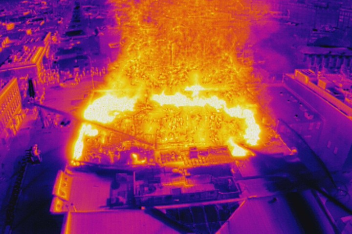
        Drones have proven particularly useful tools to firefighters. They not only provide the Big Picture from above, but drones with thermal sensors can see beyond the visible flames – identifying other hotspots not visible to the naked eye. A section of roof that might appear fine could, in fact, be close to combustion.

        On May 6, 2019, drones played a huge role at one of the worst fires in the City of Victoria’s history. What would come to be known as the Pandora Street Fire would ravage an historical buiding and take a week to fully extinguish. On the morning it broke out, there was so much roiling brown smoke that firefighters couldn’t even see where the flames were. They immediately put an InDro drone, equipped with thermal sensors, in the air.

        “If you’ve ever been to one of these big fires, the smoke is thick and completely impenetrable,” explained InDro Robotics CEO Philip Reece in this story.

        “You’re pointing the hose at where you think the fire is. Now you switch to thermal and it basically cuts the smoke – the smoke disappears. Now you see the heat coming up off the fire. You can actually follow it down through the different radiometric temperature colours to where the real core of the fire is.”

        The image below was taken at the Pandora Street Fire and is courtesy the City of Victoria’s Fire Department. You can see, thanks to thermal, where the hottest spots are. It’s a clear example of how important an airborne thermal sensor is:


        Pandora Street Fire FLIR thermal drone

        DRONES AND MORE


        The drones, purchased via InDro Robotics, are two DJI Mavic 3 Enterprise Thermal units. The camera provides up to a 56x combined optical/digital zoom, and the thermal sensor has 640 x 512 resolution. With flight times of up to 45 minutes, the pair of drones can be easily rotated for continuous situational awareness. The controller allows to displaying both visual and thermal imagery side-by-side.

        “This is a great example of our city using creative technology tools to better serve and protect our community, residents and keeping our firefighters safe,” said Mayor Brad West in this news release

        “Providing immediate access to real-time video footage, helps our firefighters make better on-scene decisions. We are grateful to the Union of British Columbia Municipalities (UBCM) for providing us with this grant that will positively impact our community.”

        TRAINING


        The grant also provides for training of those who will operate the drones – as well as to develop planning exercise scenarios for the City’s Emergency Operations Centre. Five Fire Department pilots currently hold their Transport Canada Advanced RPAS Certificates, and additional training with InDro Robotics will take place to in order to fully exploit the capabilities of the thermal drones and interpret the data.

        The news release states that drones will be able to provide real-time information via live-streaming to the City’s Emergency Operations Center during incidents:

        “A review of the current EOC practices, used to obtain information, suggests that more timely and reliable information can be obtained through the use of technology, such as drones. Using a drone to survey the site of an incident can reduce the risk of injury to first responders as well as give crucial information to the incident commander for planning response activities which can be livestreamed to the EOC.”

        MULTIPLE USE-CASES

        It goes on to outline some of the many benefits of drone use, including:

        • “Provides fast and efficient reconnaissance of the incident from a safe distance prior to sending first responders in to perform search and rescue operations;
        • “The use of drone mounted thermal imaging cameras assist first responders in identifying heat signatures of trapped or injured civilians who may not be easily seen or heard;
        • “Support City staff in pre-disaster planning efforts, e.g. geographic surveys and inspections of bridges, dams, and diking systems; and
        • “Provides staff with updated, accurate, high definition images for the City’s data collection.”

        Councillor Steve Darling, the City Council’s designate for community safety matters, is quoted outlining why these drones are an important addition:

        “The drone(s) will be used to support fire ground operations, relaying important information regarding fire growth and heat. This will also increase firefighter safety, allowing the department to keep an eye on firefighters working in hazardous areas.”

        Below: A DJI video outlining the features of its Mavic 3 Enterprise drones


        INDRO’S TAKE


        It’s been less than a decade since DJI released the original Phantom, which required a separate GoPro and was not capable of video streaming unless you really wanted to buy hobby parts and hack the camera to transmit. Drones were anomalies then, largely purchased by hobbyists.

        But it wasn’t long before First Responders started seeing the potential. Some early adopters embraced the emerging technology, and it wasn’t long before word started to spread. It’s now routine, at pretty much any drone or First Responders convention, for presentations to be made showing real-world examples of how useful – critical, even – drones have become.

        “The growth of drone technology has truly been exponential – and so have the use-cases,” says InDro Robotics CEO Philip Reece.

        “We’ve long been involved with drone training with Port Coquitlam Fire, and applaud the Union of British Columbia Municipalities for this forward-thinking grant. We look forward to hearing about the many ways these drones benefit Port Coquitlam Fire and the City’s Emergency Operations Centre.”

        InDro has, for many years, trained First Responders and supplied specialized drones for their work. If your local First Responders would like to learn more about the capabilities of InDro drones or ground robots – including training at the forthcoming Area X.O advanced drone and ground robot facility in Ottawa – feel free to contact us here