InDro Robotics launches powerful new Sentinel UGV

InDro Robotics launches powerful new Sentinel UGV

By Scott Simmie


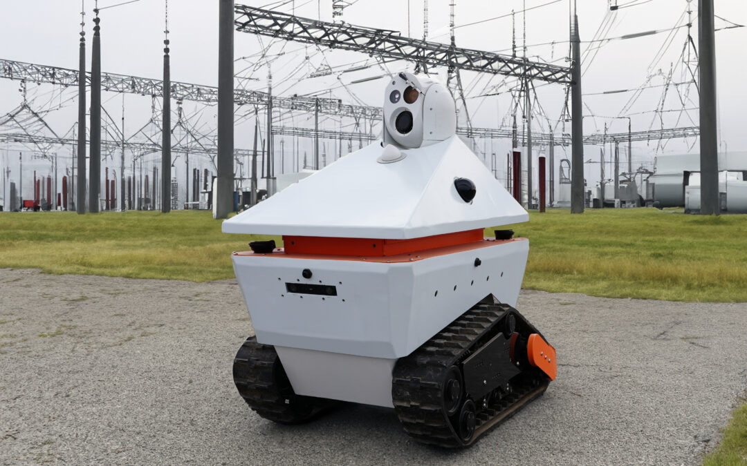
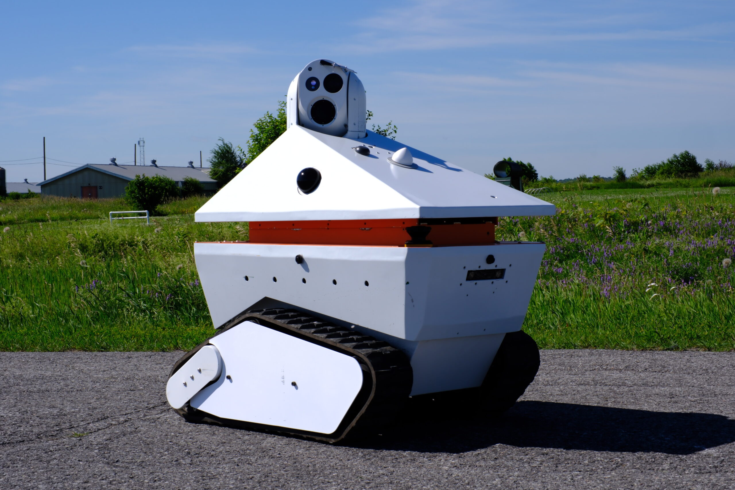
InDro has taken the wraps off its latest innovation – the all-new Sentinel Uncrewed Ground Vehicle.

Sentinel has been built for inspection, remote teleoperation and surveillance over 5G and 4G networks. Its robust build has been designed to take demanding weather and ground conditions in stride, while capturing virtually any kind of data across a broad range of use-cases.

“That’s what really excites me about Sentinel,” says Head of R&D Sales Luke Corbeth. “It can be used across multiple verticals, ranging from remotely inspecting assets like electrical sub-stations, through to agriculture, mining and more. It’s a workhorse.”

We could list all the sensors and processors onboard (and we will), but it’s the synergy here that counts.

“Sentinel has been very purposely designed and integrated so that virtually anyone can carry out highly complex missions with ease,” explains InDro Vice President Peter King. “And with our InDro Autonomy stack onboard, Sentinel can carry out tasks completely on its own for up to four hours before returning to wirelessly recharge at its base.”

That workhorse is the result of a lot of R&D by our Area X.O engineering team – and also the logical step forward from our original Sentinel V1. That was our original design for remote teleoperated inspection.

But, as you likely know by now, at InDro the innovation never stops.

Below: The new InDro Sentinel, carrying out an autonomous mission
InDro Sentinel

INDRO COMMANDER: SMARt AND VERsAtile


What truly sets Sentinel apart from the competition is the synergy of two innovations we’re quite proud of: InDro Commander and InDro Controller. And while Sentinel takes full advantage of these products, they are both robot-agnostic.

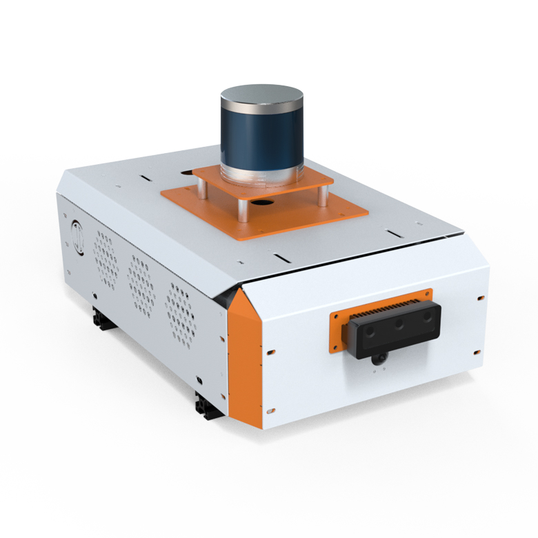
InDro Commander is a module that houses Sentinel’s brain – and allows for the seamless integration and power management of other sensors. With multiple USB slots and ROS1 and ROS2 libraries onboard, it makes modifying Sentinel a pleasure rather than a pain. You can, quite simply, plug in a new sensor and it will be detected; no complex coding or wiring required.

“Having Commander on board allows clients to easily modify their robots with different sensors for different applications. This is particularly appealing to those in the R&D community,” says Engineering Lead Arron Griffiths.

Commander also connects with 5G at near-zero latency for remote teleoperations or monitoring dense data during autonomous missions.

“Whether it’s 4G, 5G or WiFi, it does it all,” he adds.

With two state-of-the-art EDGE processors onboard, Commander also has the compute power and AI to take on anything. For autonomy, we’ve integrated the NVIDIA Jetson AGX Orin – a powerful 64GB developer kit. It’s capable of AI calculations at the astounding speed of 275 trillion operations per second (TOPS). Our InDro Autonomy Stack is embedded in Commander for precision autonomous missions. We’ve also outfitted Sentinel with a Realtime Kinematic (RTK) sensor for centimetre-level positioning accuracy.

The other EDGE processor is the ZED Box, which contains an NVIDIA Orin NX (100 TOPS). This carries out multiple tasks, but is specially built to work with depth-perception ZED cameras. There are two of these cameras on board Sentinel, used for AI obstacle detection and avoidance.

Below: A LiDAR-equipped InDro Commander module
Teleoperated Robots

INDRO CONTROLLER AT THE HELM


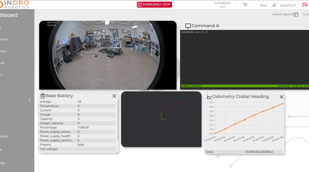
InDro Controller is our custom-built dashboard, and it’s been designed to match perfectly with InDro Commander for an exceedingly powerful but user-friendly means of programming and monitoring missions, robot health, sensor data and more. Operators can easily customize to get precisely the layout they want.

“The dashboard, the cameras, the heads-up display on the autonomous missions – those all can be customised,” says Front End Developer RJ Bundy. “We’re also adding other personal user customisations, like a light and dark mode, metric conversion, schedule missions – all the kinds of features you could want.”

The software resides in Commander and is accessed remotely via an encrypted login system. No one will ever see your missions and data except you – and those you grant the same secure access. (Yes, multiple users can simultaneously monitor a remote operation from locations across the country or across the globe.)

“We’ve created an interface that makes it very hard for a third party to intercept any of those commands or the data coming from the robot to you,” says Bundy.

And while it’s a perfect fit with Sentinel, InDro Controller can be used with any robot.

“It’s an all-in-one data visualization, robot management and robot control software,” he adds. “Whether you’re a student first learning how to use a robot or you’re a commercial giant, you’d be able to manage and maintain all of your robots.”

He’s not kidding. You can intuitively control Sentinel – or any other robot – using an Xbox controller. We’ve done demonstrations more than 4,000 km away from Area X.O where we’ve simply put a controller in someone’s hands. With imperceptible lag, they’re able to operate the robot. (Plus, you can customise the buttons for specific sensor features like pan, tilt, zoom, etc.)

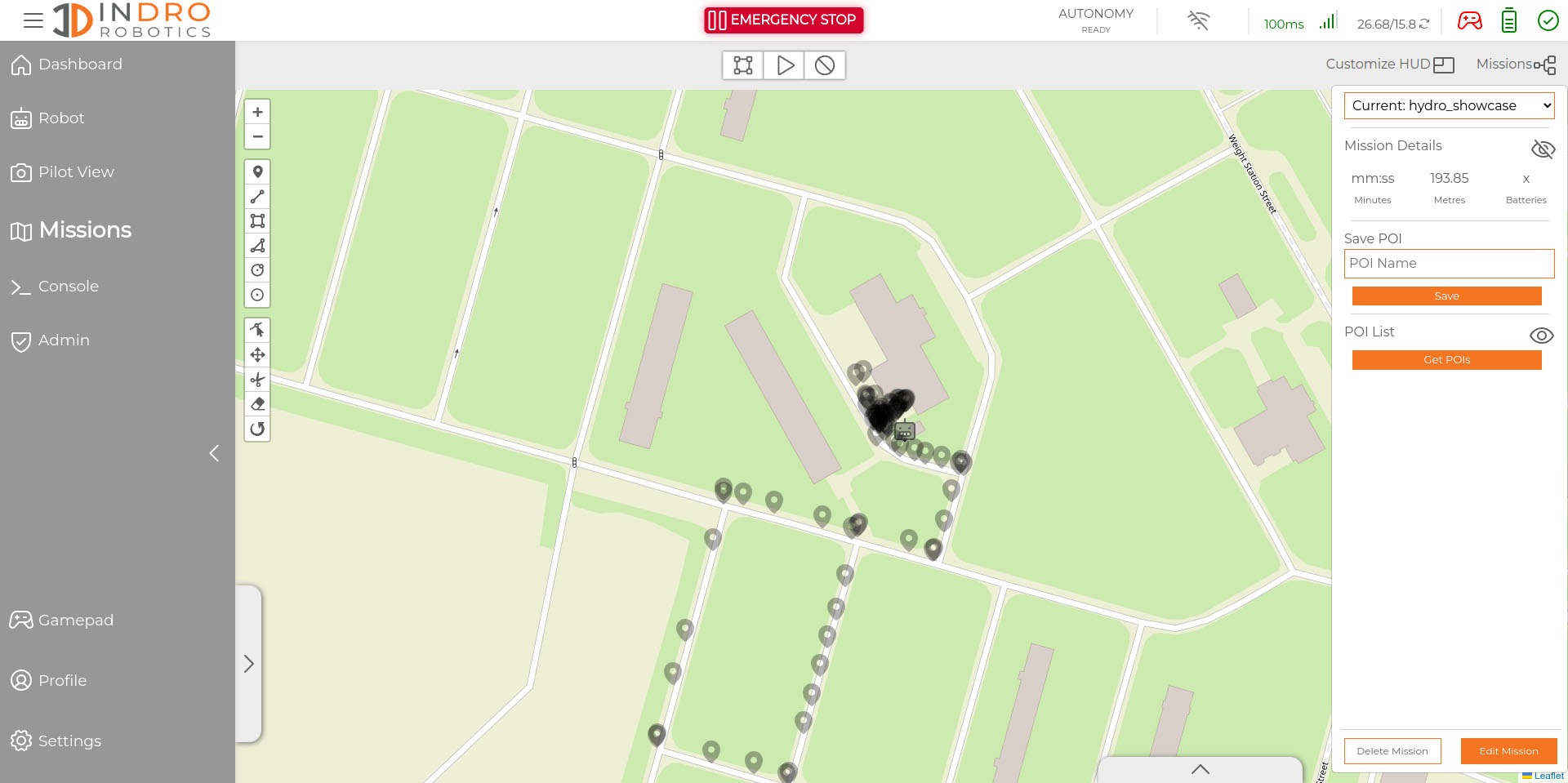
Autonomous missions – including complex actions like stopping at a precise location, tilting a camera to a gauge and then zooming in and capturing the readout – are easily plotted using Controller. Once your mission has been set with multiple waypoints and actions, it’s a single click to repeat it. (And, of course, you can save as many different missions as required.)

The InDro Autonomy stacks are pre-loaded, meaning location doesn’t really matter.

“We have a GPS-based autonomy – which is better for outdoors – and then we have a SLAM- (Simultaneous Localisation and Mapping) based autonomy which is ideal for indoors,” says Head of R&D Sales Corbeth.

There are actually two versions of InDro Controller available; a simpler version is still full-featured but does not ship with InDro Autonomy, meaning it’s ideal for those in the R&D space who want to test their own autonomy software. Several academic institutions have already been using this version, and feedback has been excellent.

And the best news? Both versions will only become even more sophisticated over time.

“We’re heavily invested in continuously improving the software,” says Corbeth. “So regardless of which version you’re shipped, know that this is something that InDro Robotics is constantly developing and improving with client feedback in mind to ultimately provide the best mission planning, teleoperations and development software tool in the robotics industry.”

Below: A screenshot from InDro Controller, showing the path of an autonomous mission; the second image shows realtime data flowing through its customizable dashboard
Robot Teleoperation
Teleoperations with Robots

LONG DURATION, REPEATABLE MISSIONS

It’s already clear Sentinel has the brains. But it also has the brawn to match. Whether the task is inspection, surveillance or other forms of data acquisition, Sentinel has been designed from the ground up to consistently deliver. Featuring a 1500-watt dual drive system and tracks for locomotion, it’s ready for any terrain – from industrial environments through to farm fields and even snow and ice.

With a 120kg load capacity and 30° climbing angle, Sentinel can power its way over pretty much anything. We’ve even designed and manufactured custom metal guards to prevent stones from getting their way between the drive gears and the treads – a common issue with tracked vehicles.

That strength is supplemented by a comprehensive array of sensors for obstacle detection, Simultaneous Localisation and Mapping (SLAM), high-resolution photos and video – and more.


ZOOM, ZOOM, ZOOM

For starters, there’s a 30x optical Point-Tilt-Zoom camera that can be manually operated via the InDro Controller UI. Every time the pilot stops and captures data, all of that information – robot position, camera angle, zoom settings etc. are stored as a Point of Interest. All of those POIs from that initial manual mission are saved, meaning the next time Sentinel is deployed the operator can simply recall the mission and launch Sentinel for an autonomous run.

In fact, we recently did a demo of Sentinel for a government official. We had previously captured photos of five different objects on a path at Area X.O and had saved that mission. During the demo, the robot deployed and autonomously stopped at all five locations, replicating the original shots. This is the kind of feature that’s exceedingly helpful for spotting anomalies, change detection, etc. Of course, the built-in AI can also identify people, cars, trucks, etc. (In fact, we could set Sentinel to trigger an alert if a human is spotted somewhere they’re not supposed to be, a useful feature for both safety and security applications.)

For the operator, whether they’re manually piloting or simply monitoring an autonomous mission, four pinhole cameras provide a 360° view of surroundings for situational awareness. Two ZED 3D depth cameras (one at the front, one at the rear) are on the constant lookout for obstacles. As an additional layer of safety, engineers added two 2D safety-rated LiDAR sensors specifically for detecting people or other objects that might unexpectedly move into Sentinel’s path. If that happens, the robot will automatically stop, then seek an alternate path around the person or object. (It can also be set to simply go to a dead stop.)

Sentinel is also outfitted with two powerful Robosense 3D LiDAR units, enabling it to operate in GPS-denied environments, capture precision scans – and basically understand even a completely unfamiliar environment. Robosense has become our LiDAR of choice, for the reasons outlined in this recent post.

Below: InDro recently built and shipped this fleet for swarm robotics research; all are equipped with Robosense LiDAR units

Robosense LiDAR Swarm

WIRELESS SELF-CHARGING


Using Sentinel for remote ops? Many of our clients will be. And there’s not much point in deploying a robot at a remote location if someone has to go and plug it in to charge or run diagnostics.

Sentinel returns autonomously to its home base, where a wireless charger awaits. The robot understands where it needs to position itself for optimal charging, snugging up close to (but not touching) the induction charging system. Many remotely operated robots rely on making a mechanical connection with charging equipment, which introduces wear-and-tear and additional points of failure.

“Mechanical charging systems fail a lot, and we wanted to avoid that,” explains InDro VP Peter King.

InDro Controller also carries out diagnostics remotely, reporting back on parameters such as latency, battery strength, sensor connection and other indicators of overall robot health. The operator can literally be hundreds (or even thousands) of kilometres from the robot and see its condition with a quick glance at the UI.

“Sentinel can be customised for any client directly by us,” says Engineering Lead Arron Griffiths. “But having Commander on board allows clients to easily modify their robots with different sensors for different applications. This is particularly appealing to those in the R&D community.”

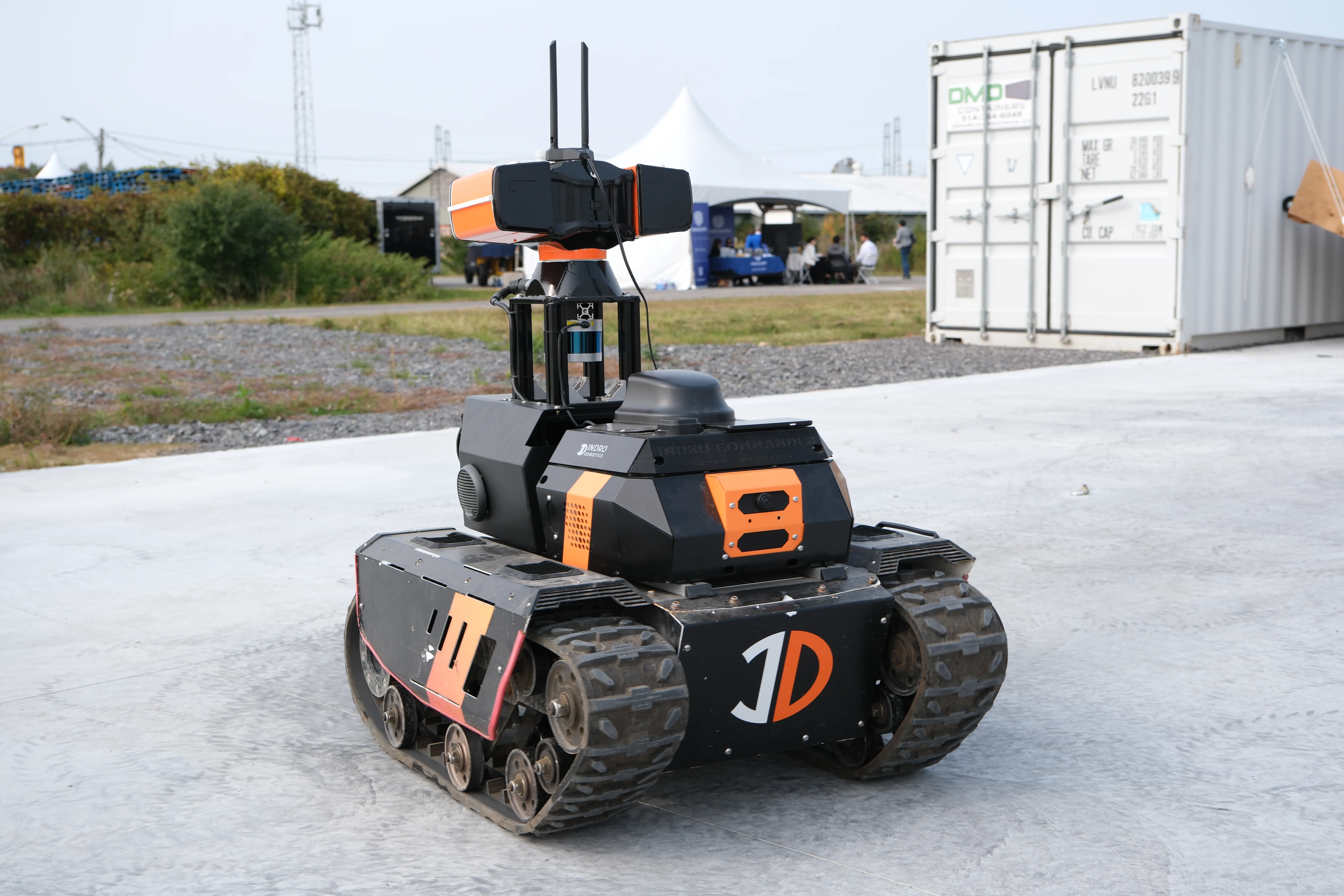
Below: On the shoulders of giants – the original Sentinel V 1.0. InDro has incorporated new AI compute power, sensors and other learnings to take a massive leap forward
Sentinel Inspection Robot

INDRO’S TAKE


The new Sentinel is more powerful, and more suitable to broader use-cases, than our first version of this robot. Don’t get us wrong; the original Sentinel was (and still is) a great machine. But this version is equipped with more powerful EDGE processing, and AI with greater capabilities. It’s also laden with additional and newer sensors, RTK positioning, and a more powerful base platform.

“The new Sentinel is a perfect fusion of industry-leading hardware and software – including InDro Commander, and the new InDro Controller and InDro Autonomy stacks,” says Indro Robotics Founder and CEO Philip Reece. “Our engineering team has put a lot of thought into making this robot capable of highly complex missions – yet easy to use and modify. Sentinel will be a perfect fit for multiple verticals and use-cases, and we look forward to our first deployments.”

Want to learn more about Sentinel – or even arrange to take it for a remote test drive? You can contact Head of R&D Sales Luke Corbeth here.

Methane detection via drone with Aerometrix

Methane detection via drone with Aerometrix

By Scott Simmie


There’s no denying climate change. Whether it’s the recent and devastating floods in Pakistan, fires in Portugal – or the multiple rivers globally that have dropped to historically low levels – the planet’s equilibrium has been changing.

While carbon dioxide emissions get much of the press, methane is one of the most potent contributors to the problem of greenhouse gases.

“Methane has more than 80 times the warming power of carbon dioxide over the first 20 years after it reaches the atmosphere,” states the Environmental Defense Fund.

“Even though CO2 has a longer-lasting effect, methane sets the pace for warming in the near term.”

That’s a key reason why the detection of methane emissions has become a priority. It’s also a large part of why Aerometrix – a company specialising in methane detection using drones – was formed.

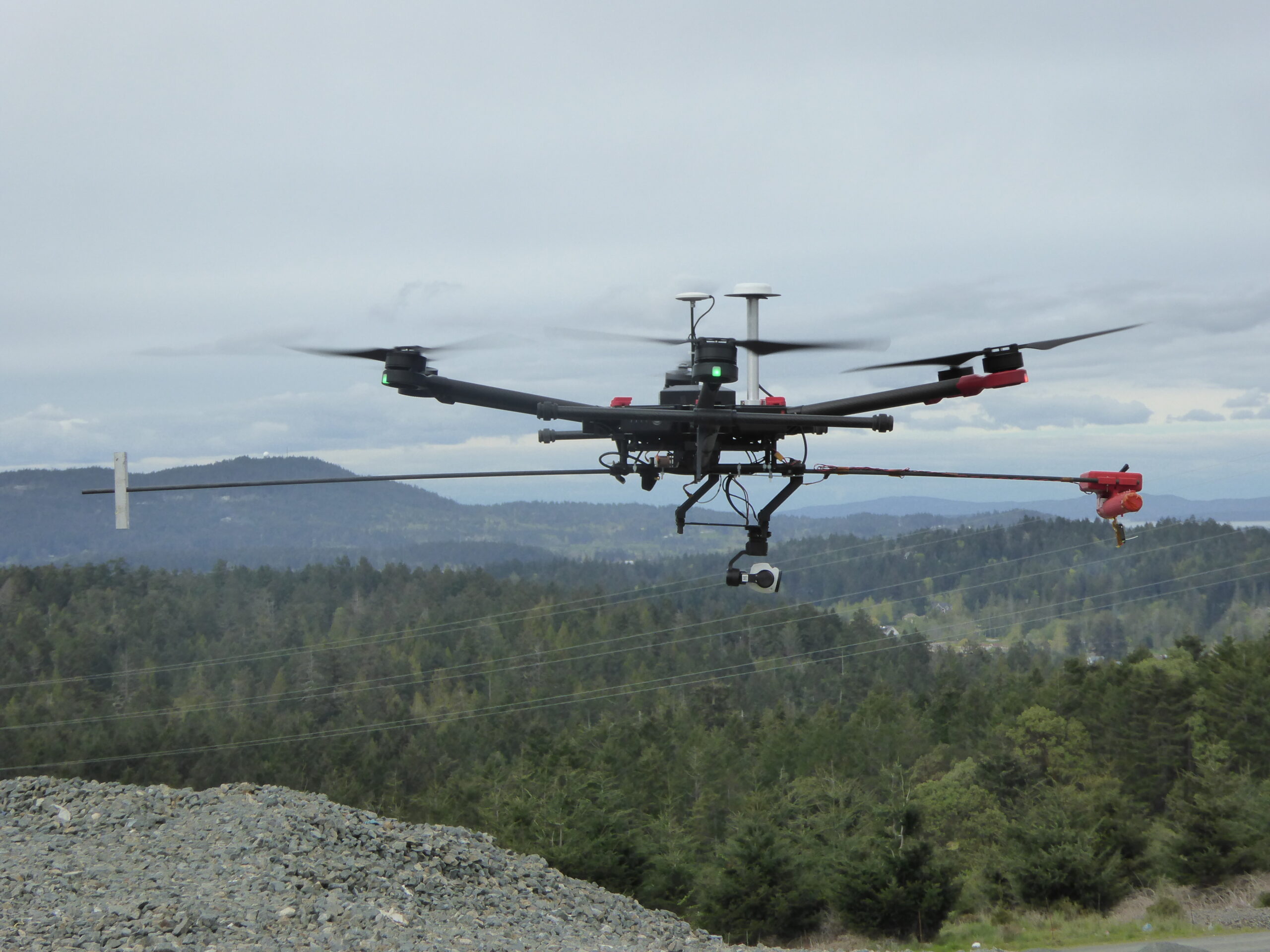
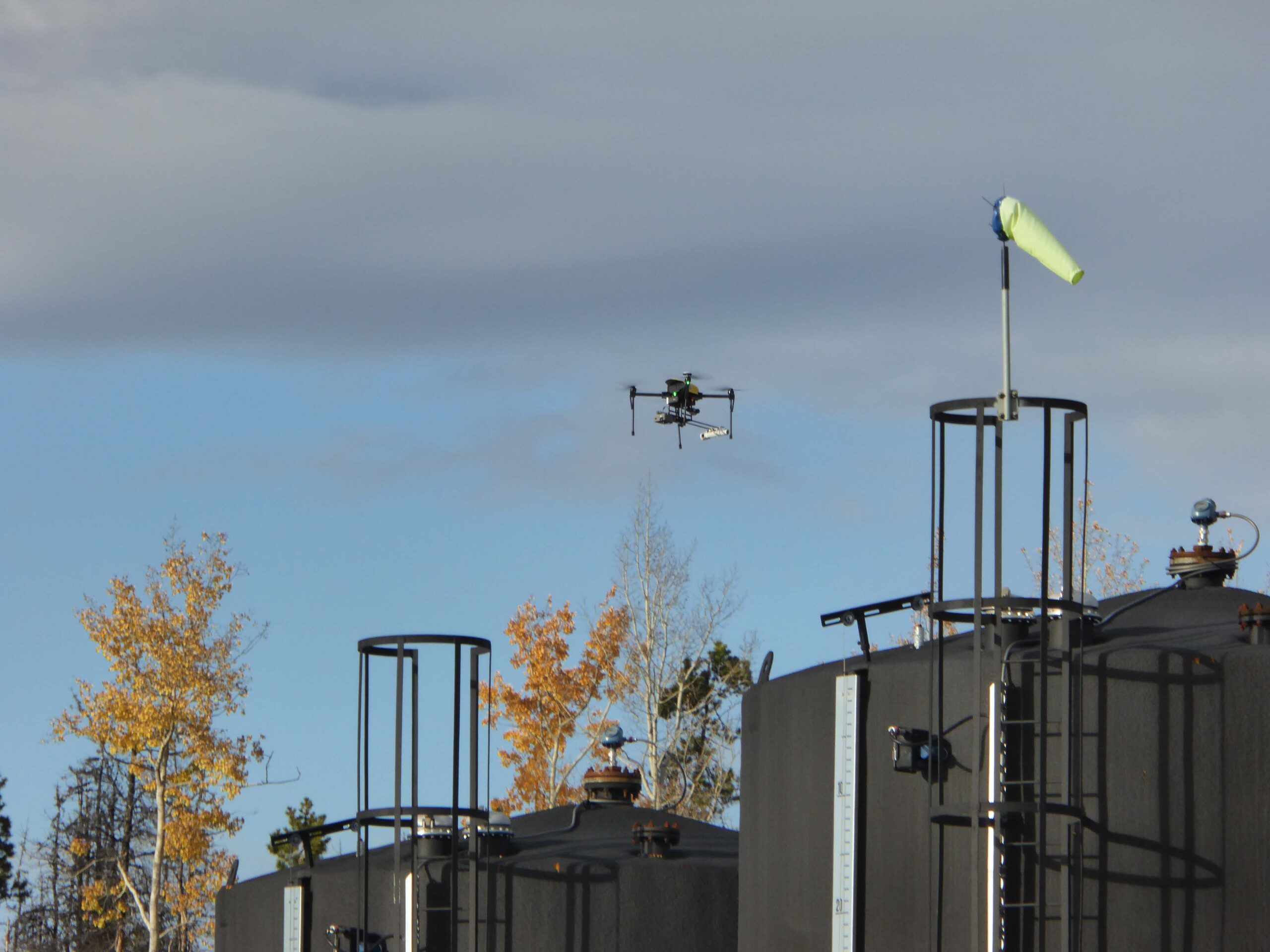
Below: One of the early Aerometrix rigs for methane detection. The sensor is at the forward end of the counter-weighted rod to keep it clear of prop wash.

Aerometrix

Aerometrix


Before we get more into what Aerometrix does (and how it does it), we should point out there’s an InDro Robotics connection here. InDro CEO Philip Reece, along with Michael Whiticar, founded the company. Aerial operations for Aerometrix are carried out by InDro Robotics.

“We felt there was a void in the marketplace for the detection of methane and other gases,” explains Reece. “We also wanted to approach this from an engineering-first perspective, ensuring that we were using, and even developing, the best available sensors and workflow.”

Aerometrix uses two different types of sensors for methane detection. The first is the proprietary GasMap sensor, which is capable of detecting methane in parts per billion (ppb). This laser-based sensor had its origins at NASA’s Jet Propulsion Laboratory, where it was developed for Mars missions. Aerometrix has further refined that sensor and has used it to accurately map methane emissions at petrochemical plants, gas wells, landfills – and even on agricultural sites. (Animals, particularly cows, are a significant methane source.)

“GasMap uses laser spectroscopy,” explains Peter Sherk, an electronics engineer with Aerometrix. “It uses the absorption of lasers by methane to detect concentration. And it’s very precise – detecting not only its presence, but how much there is at a given point in time and space right down to parts per billion.”

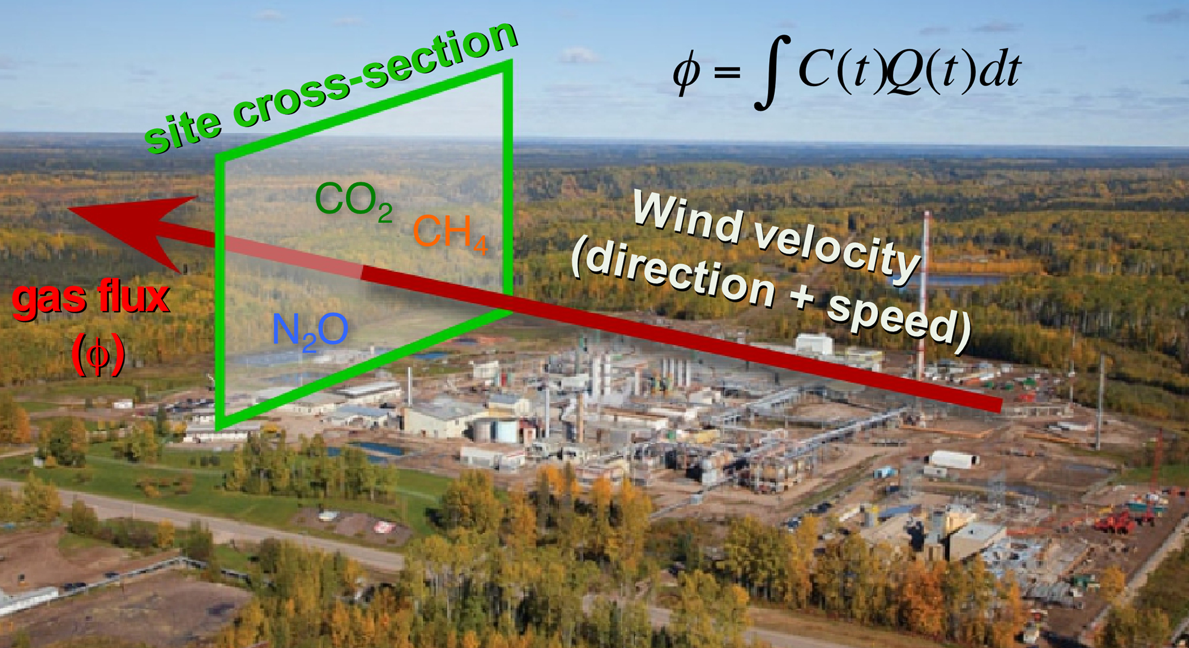
The sensor maps methane (and other gases) by flying horizontally through the plume. When multiple passes at different altitudes have been completed, a “curtain” is obtained. (Don’t worry, we won’t ask you to carry out the calculation – besides, our FluxCurtain software does that.)

Flux Curtain

Zig-zag


As mentioned, the drone flies horizontally through the plume – with each parallel flight at a slightly higher altitude. The sensor is constantly capturing georeferenced data which Aerometrix then runs through software.

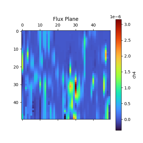
In the images below, you’ll see that zig-zag flight pattern. The blue lines at the bottom indicate methane concentrations. Not surprisingly, those concentrations begin to dissipate at higher altitudes as the methane plume mixes with the surrounding air.

The second image is what’s referred to as the actual “Flux Plane” – where the methane concentrations are represented visually by colour.

Methane Detection
Methane Detection

Efficiency


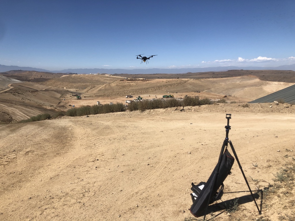
Though pipelines and facilities that handle methane are obvious places where detection is required, local city dumps are also interested in detecting – and even capturing – methane produced by buried garbage. But many are unaware of the efficiency and accuracy of using sensors like the GasMap mounted on a drone.

“A lot of landfills are doing methane detection already,” says Sherk, “but they’re using far less convenient methods. A lot of the time there’s someone walking back and forth with handheld sensors. With larger landfills any sort of grid pattern will take days and days – and walking over an old landfill can’t be a really healthy operation.Operating a drone is vastly more efficient. And the GasMap sensor is capable of detecting not only the presence of methane, but its concentration at various altitudes as the gas forms a plume and mixes with surrounding air.

Some landfills have been able to not only capture but exploit methane that was previously escaping. The Capital Regional District on southern Vancouver Island has been running a power generating plant on-site at the Hartland Landfill, fuelled solely by captured methane produced by decomposing garbage. It’s been doing so since 2004, creating enough energy to power 1,600 homes.

Recently, the volume of methane produced by the landfill has increased, and the power plant is nearing the end of its operational life. In 2023, the landfill will switch gears and process the biogas into natural gas – selling the product to FORTIS BC.

Kudos to the Capital Region District for having such foresight; the example also highlights how captured methane can be put to positive use.

Aerometrix has carried out surveys now at numerous landfills hoping to capture or otherwise mitigate methane emissions. Using FluxCurtain software, its reports turn what was previously an invisible problem into clear, actionable data that provide a clear picture of emissions and concentrations.

Methane Detection

Another sensor


We mentioned a second sensor also being used by Aerometrix. It’s called the LaserScan, and it’s a very lightweight sensor that also uses laser spectroscopy to detect the presence of methane.

Unlike the GasMap, the newer sensor is able to measure vertically. In other words, the drone can be flying directly above a plume and take a measurement straight down to the ground. While it’s not quite as precise as the GasMap sensor (parts per million, rather than parts per billion), the LaserScan does have an advantage when it comes to speed.

Because it does not rely on flying through the plume, the LaserScan is ideal for detecting emissions over large areas. By simply flying a grid pattern at a single altitude, it can rapidly identify emissions. At an altitude of 98.4′, it’s capable of detecting 500 ppm of methane with a plume diameter of one meter.

“While the Falcon is less precise than the GasMap sensor, it has a definite advantage when it comes to speed,” explains Keegan Richter, a mechanical engineer with Aerometrix.

In cases where greater precision is required, Aerometrix can fly two missions: The first with the LaserScan to rapidly detect the location of emissions – particularly over large landfills – followed by GasMap for parts-per-billion accuracy.

Methane Detection

InDro’s Take


We obviously have a special interest in Aerometrix, since InDro’s pilots and drones carry out its aerial missions.

Not surprisingly, since CEO Philip Reece is a co-founder, the mission of Aerometrix closely aligns with InDro’s guiding philosophy: Developing and utilising technology to increase efficiency and – whenever possible – contribute to positive change.

Arguably, the dramatic and apparently escalating shifts we’ve seen to global climate patterns are one of the most pressing problems on the planet. Methane is a key contributor to those changes.

The ability of Aerometrix to accurately detect methane emissions has already helped clients cap leaks and examine other methods for capturing this gas before it hits the atmosphere. Its missions have also meant that human beings are no longer exposed to hazardous environments while capturing data using handheld devices.

In our mind, those are both positive outcomes.

Interested in more information? You can contact Aerometrix directly here.

Let InDro Robotics pilot your next inspection mission – remotely

Let InDro Robotics pilot your next inspection mission – remotely

Picture this: You run a solar farm. And it’s time for a routine inspection to detect faulty or damaged solar cells.

Traditionally, you’ve inspected using a handheld thermal sensor – hoping to identify any anomalies on your solar panels. It does the job, but it’s time-consuming. You’re aware that drones are capable of carrying out this task much more rapidly, but that’s not a simple solution either. The time and expense of training an in-house pilot to meet the regulatory bar, along with the cost of a drone with a thermal sensor, add up.

What options do you have? Well, you could hire someone from outside on a contract basis. That gets pricey as well, since the fee generally includes travel time and other expenses for the operator. Like most solar farms, your facility is located in a rural area far from the nearest major city.

InDro Robotics is pleased to offer a solution: We ship you a fully-charged drone with thermal sensor, and we fly the mission remotely.

And how does that work? Well, just like this:

Inspections without the hassle


Let’s back up a bit.

InDro created this solution in response to a need. Solar and other industries told us they understood the value proposition of drone inspections but couldn’t justify the cost of purchasing a drone with the appropriate sensor for their needs. Many also said they didn’t need a drone pilot on staff.

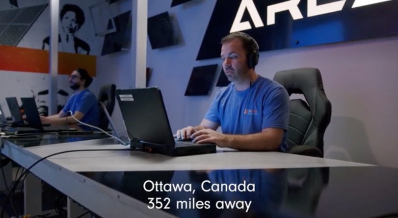
And so we started thinking of options that would work within the current regulatory framework. In Canada, as long as the pilot is in contact with a visual observer monitoring the flight, these missions can be carried out without additional permissions beyond notifying NAVCAN of the flight.

“It’s a straightforward solution for solar farms or other clients requiring any form of aerial inspection,” explains Peter King, InDro’s Head of Robotic Solutions. “A qualified pilot instructs the client how to turn on the drone and monitor airspace. A pilot from InDro Robotics takes care of the rest, capturing and delivering meaningful data to the client – and at a significantly lower price point than having a contractor travel to the client’s location.”

And when the drone lands? The client simply powers it off, puts it back in the box, and ships it to the nearest InDro Robotics location (there are five in Canada).


Wait – there’s more!

Remotely Operated Drones

Secure, remotely operated flights


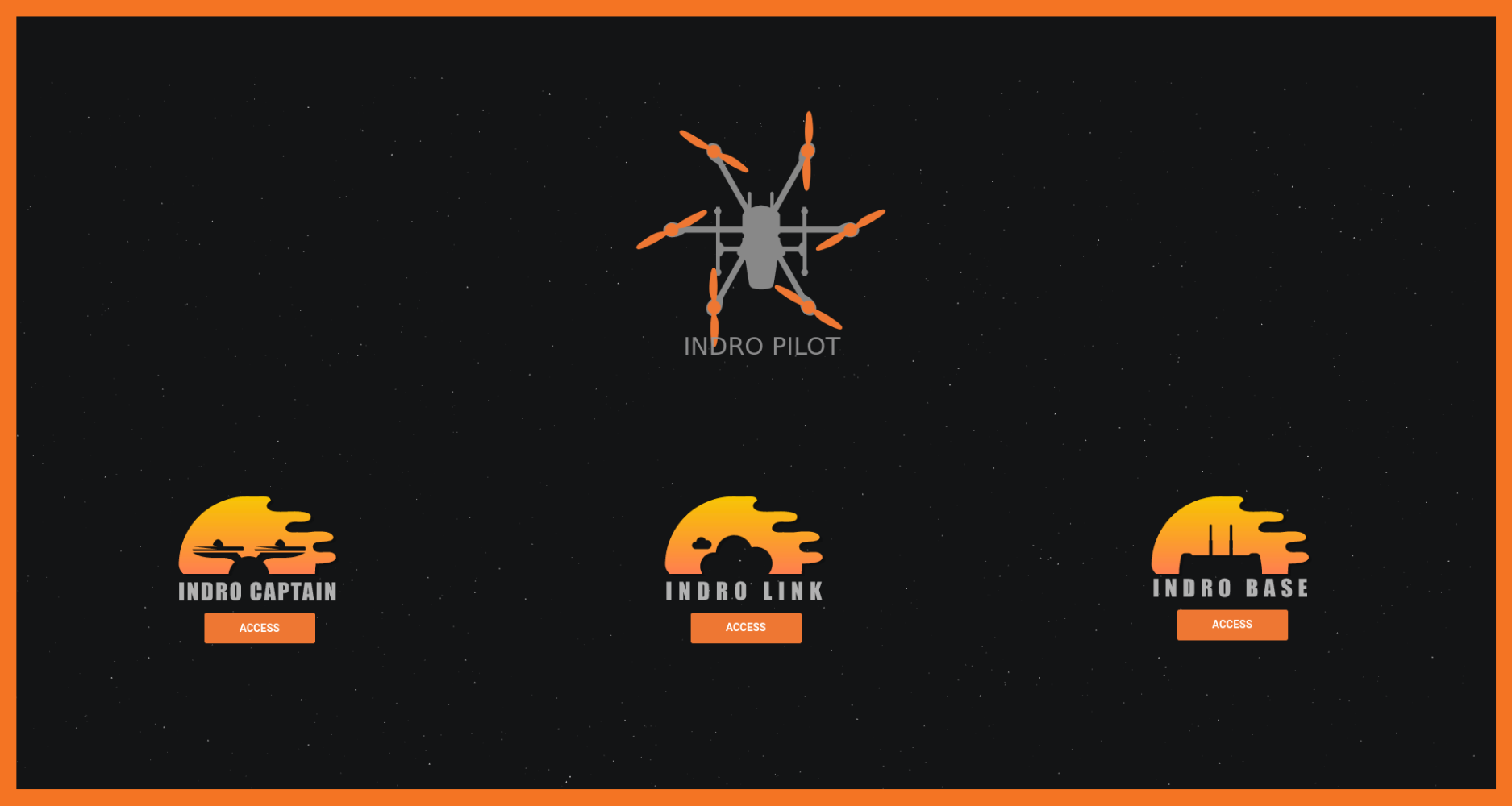
If you follow our news, you’ll be aware we have created our own, proprietary platform for low-latency operations with high data bandwidth. We call the system InDro Pilot, and you can take a deeper dive here.

This system, which includes a special hardware module we’ve developed, is capable of exceedingly low-latency over 5G connections. It can also be operated over 4G as well. So regardless of where you need an inspection, we can carry it out as long as there’s a cellular connection. If that connection is 5G, we have the capability to upload your data in real-time to the cloud for processing – meaning you’ll receive meaningful and actionable data as soon as possible following the flight.

What’s more, the InDro Pilot system also informs traditional aircraft in the vicinity that a drone operation is underway at your location. This “Hear and be Heard” function, using a Software Defined Radio, reduces the likelihood of any conflict with low-flying aircraft.

If you check out the photo below, the black module on our WayFinder contains an Edge processor, high-speed modem, the Software Defined Radio – and much more. This is an integral ingredient in the secret sauce of InDro Pilot.

Canada Drones

InDro’s Take


Not surprisingly, we’re keen on this solution.

But that’s not just because we created it. We truly believe this fills a niche in the marketplace, offering value to those who require top quality data collection and analysis but infrequent flights. For companies requiring up to four annual inspections, missions carried out remotely by InDro Robotics specialists are a cost-effective solution. We simply ship you the drone, ready to fly out of the box. All you have to do is watch the sky and keep in touch with our pilot during the flight – and the data will be your way in no time. And, by the way, InDro Robotics was the first company in North America to carry out a remote inspection in this way.

We are currently offering this solution in Canada. US operations are slightly more complex due to the FAA’s differing regulations, but not impossible.

To learn more of receive a quote for remote data acquisition, contact us here.