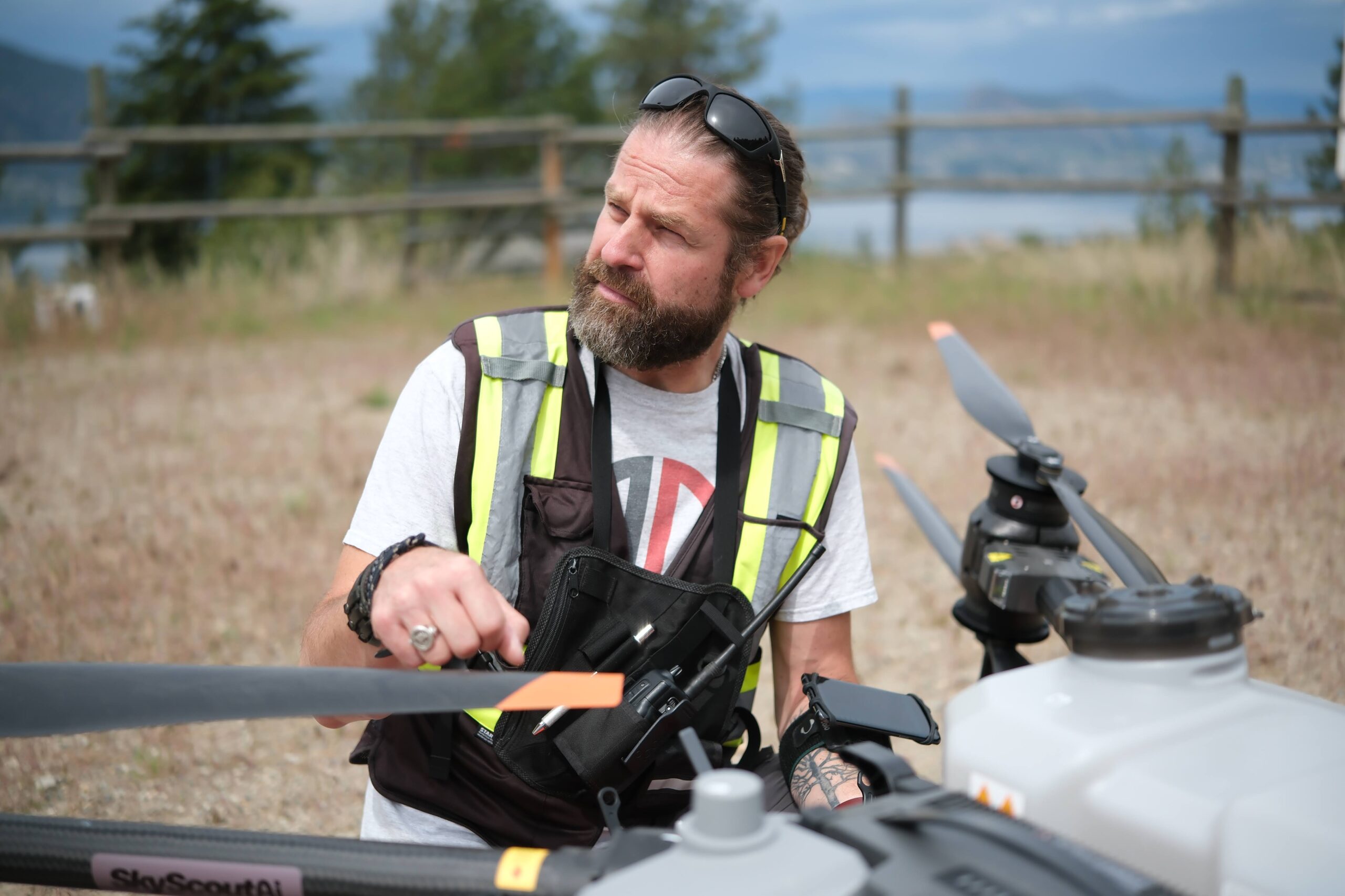
InDro deploys drones, ground robots in Kelowna precision agriculture project

InDro deploys drones, ground robots in Kelowna precision agriculture project

By Scott Simmie

There’s a buzz around Kelowna these days.

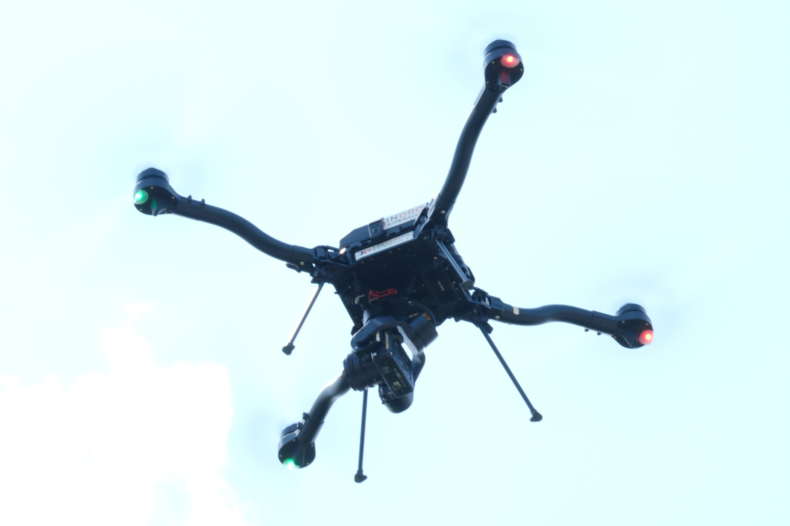
Well, actually, there are two kinds of buzz. The first is the occasional faint sound of a small but smart drone, carrying out flights every two weeks over two separate orchards. These orchards grow peaches, pears, cherries and more.

And the other buzz? Well, that’s the discussion this special two-year project – a collaboration between InDro Robotics and the City of Kelowna (enabled with funding from Agriculture and Agri-Food Canada’s Agriculture Clean Technology Program) – is generating among farmers in the region.

“Technology is always getting bigger and better,” says Riley Johnson, a manager at Byrnes Farms – one of the two locations where the project is being carried out. Johnson is an experienced farmer, and the land has been in the hands of his wife’s family for five generations. He knows the land and crops well, but is curious to see what additional data can be gathered.

“Anything in agriculture, the more information you get, you’re not going to be worse off. Especially for new farmers coming into the industry, any new kind of information can help out ten-fold – particularly if you’re on new land. Any information outside of the Old Farmer’s Almanac is always appreciated.”

What InDro is doing, to the best of our knowledge, is a type of precision agriculture that hasn’t been carried out before. It combines data acquisition from both drones and ground robots to ensure the most robust and reliable data possible.

This data is then used to assess overall vegetation health. Are there indications of pests in certain areas? Are any plants indicating low levels of chlorophyl? Does it look like that patch needs some pesticide – or maybe additional watering?

These are important questions for farmers whose livelihoods depend on maximizing the yield and health of their crops.

And this project? It’s all about finding the answers – and implementing solutions. Those solutions will include precision spraying of nutrients or other compounds in the precise location where they are required. The end result should be maximum yields with minimal – or no – areas of unhealthy crops.

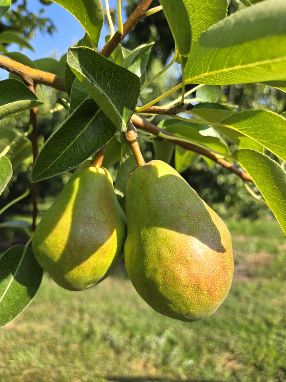
Below: Healthy pears growing at Byrnes Farm. Photo courtesy Riley Johnson

Healthy pears in Kelowna. Photo courtesy Riley Johnson

AN INTRODUCTION


Before we get into all the details, it’s worth introducing you to Dr. Eric Saczuk (assuming you haven’t already met). He’s our Chief of Flight Operations – and comes with some serious chops.

Eric holds a PhD in Remote Sensing. He’s been assessing vegetation health (among many other things) using satellite data since the early days – long before drones came on the scene. But when drones did come on the scene, he quickly recognized their potential for the acquisition and interpretation of multiple kinds of data. He has flown missions all over the world on behalf of InDro, all involving complex data and analysis.

But that’s not all. He’s been an instructor at the British Columbia Institute of Technology since 2003 and has been the director of the institute’s RPAS Hub since 2016. He’s divided his time between BCIT and InDro since 2018 and is our go-to for highly complex operations. He’s also carried out multiple missions to acquire data for projects undertaken by Canada’s National Research Council – including this fascinating research on urban wind tunnels. There’s likely not a more qualified person in the country when it comes to drones and data.

Below: Dr. Eric Saczuk on an InDro mission. Image by Scott Simmie

SkyScout Ai Eric Saczuk

THE PROJECT


Okay. You’ve most likely heard of precision agriculture by now. When it comes to drones, most of us picture something like this: A drone with a multispectral camera flies over a field of wheat or some other crop. That multispectral camera captures spectrums of light both visible and invisible to the human eye. When that data is crunched, it provides a detailed picture of crop health (we’ll explore more of this shortly).

In collaboration with the City of Kelowna and local farmers, we’ve been flying a mission every two weeks over two separate fruit orchards. We use a drone with a special type of camera. It has five lenses. One of those lenses simply captures RGB (or simply, colour) images. But the other four have filters that are tuned to pick up light only within specific spectrums that can be collectively analyzed to indicate the health of vegetation.

“So in addition to the RGB camera, you’d have one camera capturing just red reflected light, one capturing just green reflected light using filters, and then the other two are what we call red edge and near-infrared,” says Dr. Saczuk.

Red edge is particularly useful in the early detection of disease or stress in plants – as it is highly reflected by healthy chlorophyl. But the real magic happens when you take the data captured in these different light wavelengths of light and run some calculations on them. That’s what gives you the bigger picture.

“Think of each of these images as a number. Capturing these multiple spectral bands allows you to combine them using complex equations in a type of calculator to give you various indicators of vegetation health,” he says.

That data can answer a lot of questions.

“Is it healthy? Is it not healthy? Is it being productive? Is there chlorophyll? If so, how active is it?” he says.

“These are the kinds of questions we can answer when we do what we call ‘multispectral band combinations.’ And it gives us a really clear picture that cannot be detected by the human eye.”

A CLOSER LOOK


We’re going to take a look at an image in a moment.

Before we get there, though, it’s worth exploring something Eric said earlier. He mentioned complex math. He’s right. The math happens at the individual pixel level between each of the input bands and there are millions of pixels per band. The most common calculation is used to produce a result called NDVI (not be be confused with NVIDIA, the producer of AI chipsets). The acronym stands for Normalized Difference Vegetation Index. And once the math is done, it gives you an accurate picture of vegetation health.

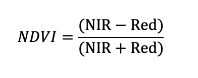
NDVI is calculated by using near infrared (NIR) and red bands (you’ll see the formula below).

The resulting pixel number in an NDVI image, will always be between -1 and +1. The higher the number, the better the health. If the number is low, it means there’s something worth looking at. The NDVI provides a detailed look at crop health and while it is regarded as the gold standard, there are also other calculations that can drill down to more specific indicators of vegetation health.

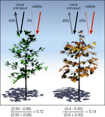
Below: Healthy vegetation absorbs most of the visible light that hits it, reflecting a large portion of the near-infrared spectrum. Unhealthy or sparse vegetation (right) reflects more visible light and less near-infrared light. When you do the math, it yields a lower NDVI number. (Public domain image by Robert Simmon.)

The second image is the equation used to calculate NDVI (which explains what those numbers are at the bottom of the first image).

NDVI
NDVI

FROM DATA TO DECISIONS


Using the equation above (as well as other formulas), Dr. Saczuk turns all of that data into something both meaningful and actionable. By looking at the data – and calculating not just NDVI but other indexes, images are generated that provide an at-a-glance look at crop health.

Traditionally, this has been a hugely time-consuming task involving multiple steps (and plenty of processing) on a laptop. Now, new tools are available that streamline the process. Dr. Saczuk is using a cloud-based solution specifically for precision agriculture.

“It really makes the whole process very efficient – because not only does it do the photogrammetry on the images, stitches them into these orthomosaics, but it also gives you the tools with which to analyse them. This would typically be a multi-step process, but this software makes it a one-stop shop, which is really nice.”

That’s without even getting into some of the AI capabilities of the software. It can, for example, count all the trees in a given orchard – and even give you the elevation of a specific tree.

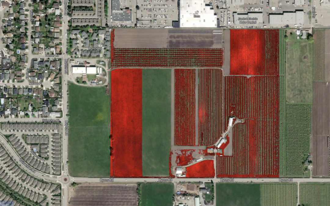
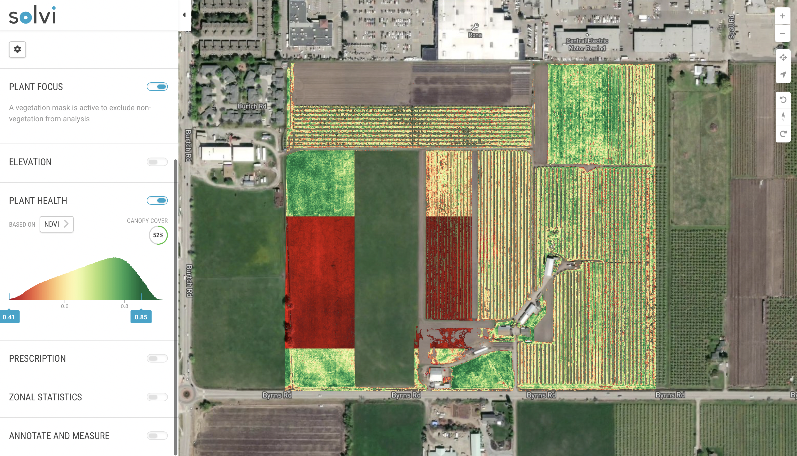
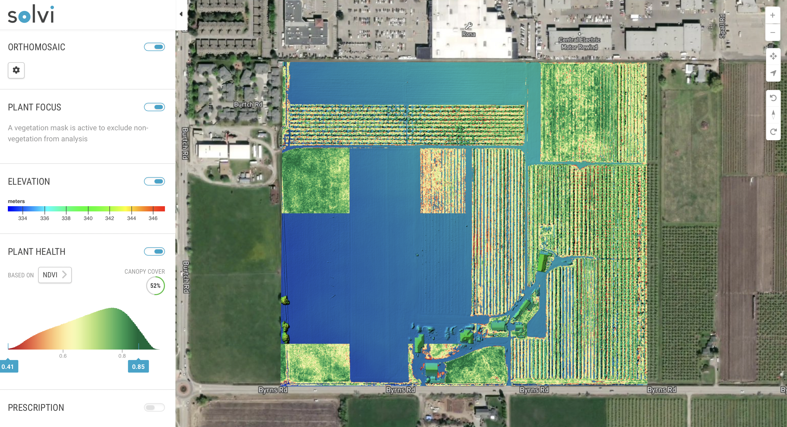
Below: An NDVI image of one of the farms in the Kelowna project.

Solvi Kelowna NDVI

NOW WHAT?


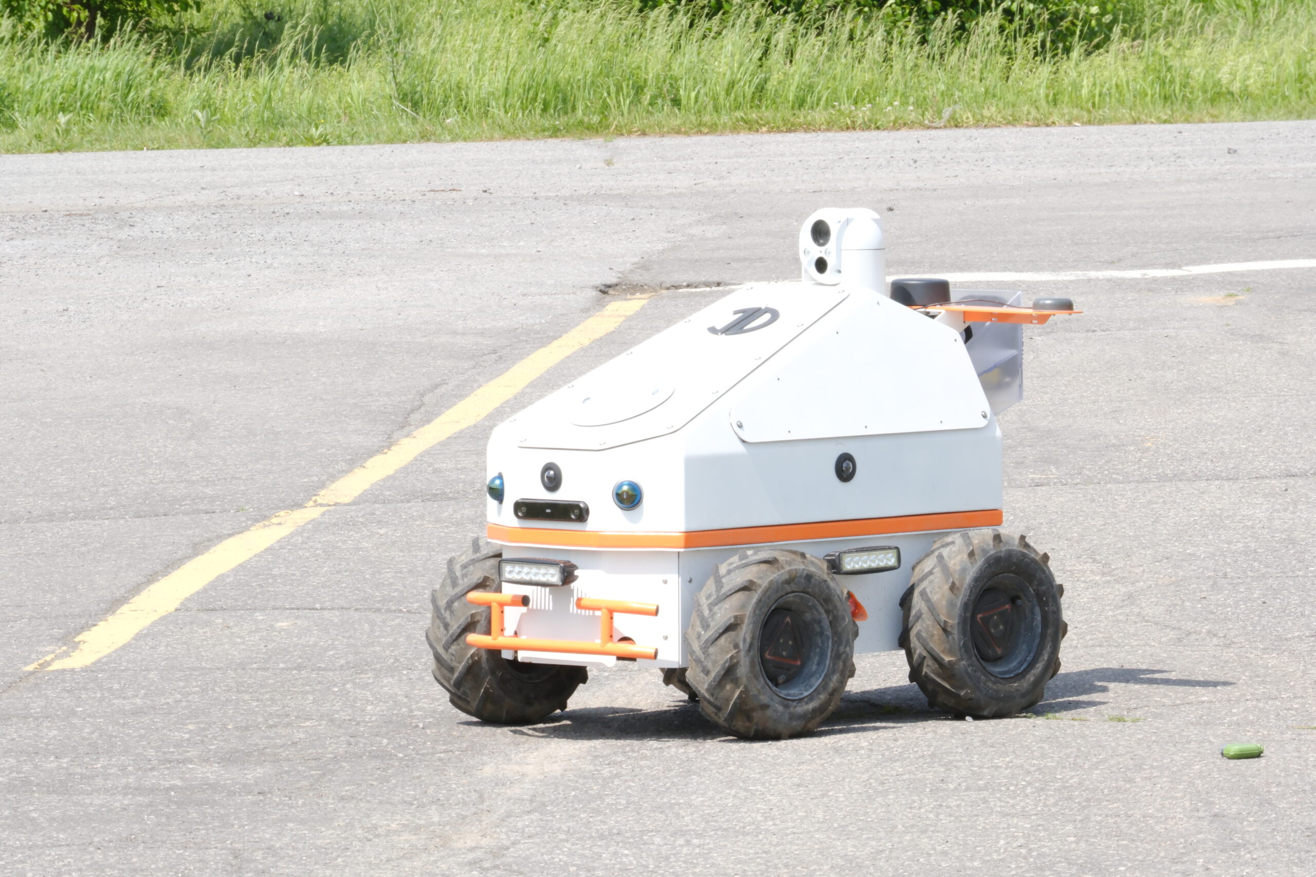
At this phase of the project, InDro is gathering data by drone alone. But as it progresses, two more things will happen: We will introduce ground robots and precision spraying.

The plan is that a ground robot will initially be fitted with the same kind of multispectral sensor used by the drone. Autonomous missions will be plotted and the robot will capture a series of images from the ground as it drives through the orchard. That data will be crunched and compared with the results captured from the air.

“This is a way of doing ground-based validation of what we’re seeing from the air, from the aerial images of the drones,” says Dr. Saczuk.

Once that validation is complete and if problem areas are detected, the next phase would involve precision spraying – which could be carried out by an AGRAS agricultural drone – or even potentially by ground robot. Because all of the data is georeferenced, that means the fertilizer (or possibly pesticide or herbicide, depending on the issue) can be precisely applied to only the required locations. That, of course, is where the term Precision Agriculture comes from.

VICE-VERSA


This project is data-driven, with aerial and ground acquisition. But at the outset, shortly after our initial flight in April of 2024, farmer Riley Johnson noticed that a couple of trees weren’t doing well. It wasn’t clear what was causing this failure to thrive, but he didn’t want to take any chances that a potential disease might spread further in the orchard. So those trees were taken down.

In this case, because the issue was spotted early and the location was known, Dr. Saczuk is quite interested in doing some deep drilling into the data at that spot. In fact, that’s the very issue he has recently been exploring.

“So we’ve got that data, that information that’s saying, ‘Hey, these trees were actually not doing well.’ And then the next question is: Can we see anything in the multi-spectral images that would indicate that these trees are somehow spectrally or reflecting light differently than the ones that are healthy?”

This is something that is also of particular interest to Johnson. Will the data reflect what years of experience indicated was a problem to his naked eye?

“As the season progresses, it will be really interesting to see what InDro comes up with,” he says. “But I can definitely see the value of this for someone just getting into farming, or for farms up the hills with new plantings, new growth. This could be very useful.”

Below: Another image of a Kelowna orchard from this project, showing elevation

Solvi Kelowna Elevation

INDRO’S TAKE


We’ve been involved with precision agriculture projects in the past. In fact, we pioneered a “drone-in-a-box‘ solution, where we’ve shipped a drone to farmers. We talk them through the process of being a visual observer, then instruct them on how to power up the drone. InDro then carries out the flight remotely, using 4G or 5G – while in constant contact with the observer. When it’s done, the farmer puts the drone in the box and sends it back. InDro carries out the data analysis and quickly sends an easy-to-understand report indicating what areas require attention – and what kind of attention they require.

But this project is very different, and exciting for multiple reasons.

“The bi-weekly flights by drone will provide a huge amount of timely data, enabling us to detect any potential problems at an early stage,” says InDro Robotics Founder and CEO Philip Reece. “But by adding robots to validate from the ground, we’ll have a more robust dataset that can be used to truly pinpoint areas of concern and which may require precision spraying. We are going to learn a lot with this project – and believe our findings will be of great benefit to farmers down the road.”

A final note. When Dr. Saczuk isn’t carrying out these flights, they’re being flown by a new addition to the InDro team, Jon Chubb. He’s already had interest from other farmers in the Okanogan who are eager to maximize their own yields and have an early detection system for any trouble spots. If you’re in that neck of the woods and would like to arrange a demo, you can contact Jon here.

Spexi offers broad range of geospatial tools for drone pilots

Spexi offers broad range of geospatial tools for drone pilots

A Canadian firm has been quietly gaining customers – and a reputation – with its broad palette of geospatial tools for drone operations.

That company is Vancouver-based Spexi.

And while it might not be a household name yet, a growing number of professional drone operators are using its palette of tools (including its mobile app), to plan efficient and accurate flights for the gathering of geospatial data.

The Spexi platform has been designed for a wide variety of sectors requiring actionable data from above, including real estate, construction, precision agriculture and more.

On the real estate front, here’s an example of a panorama produced with Spexi. Get in there with your mouse and scroll around. You can also zoom via scroll or pinching on your trackpad.

The big picture


That panorama was seamless, and with great resolution even zoomed in. But it’s only one of many offerings on the Spexi platform. So let’s take a step back for a look at the bigger picture.

The Spexi website outlines the company’s many offerings, along with features of its powerful mobile app.

In terms of data products, Spexi offers the following:

  • 3D models and point clouds showing proportionality of the building and structural features
  • High resolution image galleries with annotations for easy collaboration
  • Up-to-date Google Map tiles showing the property with the ability to measure slopes & volumes and annotate features
  • High resolution image galleries with annotations for easy collaboration
  • 360˚ panoramas with hot spots for points of interest

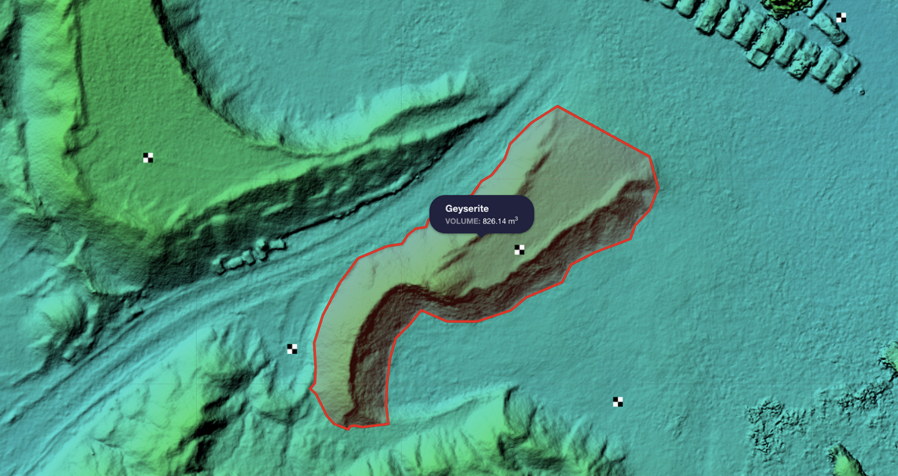
Here’s a look at a volumetric calculation captured and computed via Spexi. Beats trying to do this manually:

Spexi

The Spexi app


A large part of the Spexi value proposition is its mobile app. It allows pilots to quickly plan flight parameters, carry out autonomous data capturing missions, upload and crunch the data – and share the resulting files with stakeholders.

Specific features of the app include:

  • Planning tools for efficient and accurate data acquisition
  • Autonomous flight using the latest DJI drones
  • Secure, cloud-based footage processing and sharing
  • Spexi can carry out survey work using Ground Control Points.

Not a pilot but need a job? Spexi offers access to its network of pilots who can take on the mission on your behalf.

Cost?


Good question. Spexi offers a couple of options here, suitable both for those requiring the odd one-off job as well as Enterprise users.

If you’re interested in only the occasional mission, Spexi offers both value and incentive via its “credit” option. Sign up for a free account and you’ll receive five credits. A single credit can be used for a job like the panorama you saw above. A single credit covers up to 100 uploaded images and processing. So just by signing up you can cover five jobs like this. Additional credits can be purchased for $15 each.

Users with high volume processing needs can sign up for the monthly plan. It allows for the processing of up to 3,000 images per month at a cost of $300 per month. If you’re an ultra heavy user, Spexi offers packages for requirements exceeding 3,000 monthly images.

“Our goal is really to help companies and people transform their operations to be more efficient using drones and make better decisions with drone-based data,” explains Spexi Chief Operating Officer Alec Wilson – a helicopter pilot with a degree in geography and remote sensing. He was also a key part of the team that built Coastal Drones into a large online learning platform.

“Spexi is really the only Canadian drone software-based platform that can service contracts at this scale,” he says.

Spexi has already received a vote of confidence from the federal government. Innovative Solutions Canada offered financial backing to Spexi on its path to commercialization and enabled testing and evaluation of the product, including some pretty ambitious missions. Here’s COO Wilson, in a video explaining just one of multiple projects it carried out as a result.

Just the beginning


Though Spexi is already an easy-to-use platform with mutiple use-cases, expect more features to come. With the promise of routine BVLOS flight hopefully somewhere around the corner, COO Alec Wilson has ambitious plans for the near future.

“Looking into the future, we see our platform being used to produce drone-based data at much larger scales,” he says.

“There are some amazing new emerging technologies that enable collaboration in ways we have never seen before.  We are in the infancy of this technology, and we at Spexi have some big plans to get drone-based data into the hands of those who need it most including leveraging BVLOS capabilities once available.”

Plans also include collaboration and integration with the FLYY training platform, enabling students to take a deep dive into Spexi’s capabilities. More on that soon.

InDro’s Take


We’re pleased to see a Canadian data acquisition and processing company begin to make its name in the field. While it’s up against some stiff competition from larger photogrammetry companies, the Spexi platform is simple to use and powerful – with plans for enhanced capabilities as the industry evolves. Its option for pay-as-you-go credits for those requiring one-off missions is attractive and a great way to test the waters (especially with five free credits on sign-up).

InDro Robotics has some collaboration underway with Spexi, and anticipates this relationship will only grow. More details on that…down the road.

CONTACT

INDRO ROBOTICS
305, 31 Bastion Square,
Victoria, BC, V8W 1J1

P: 1-844-GOINDRO
(1-844-464-6376)

E: Info@InDroRobotics.com

copyright 2022 © InDro Robotics all rights reserved

On the scene: InDro Robotics – in Saudi Arabia

On the scene: InDro Robotics – in Saudi Arabia

At InDro Robotics, it’s fair to say we receive inquiries from all over the world.

Some inquiries are about our R&D, and whether we might create a solution for a client’s problem. Others are about InDro’s many services – ranging from training and certification to hands-on service provision. And sometimes, companies simply want to tap into our expertise, to see if we can help them out with a job.

We don’t say that to brag, but to help explain how and why our own Dr. Eric Saczuk happened to recently be flying drone missions in Saudi Arabia. One more bit of background: Eric is an expert when it comes to drones and data capturing and interpretation. He has a PhD in Remote Sensing and – in addition to working for InDro Robotics – is also head of the RPAS (drone) Hub at the BC Institute of Technology.

That’s why Eric is one of our “go-to” pilots when it comes to complex data acquisition missions. He travels a lot – but why this trip to Saudi Arabia?

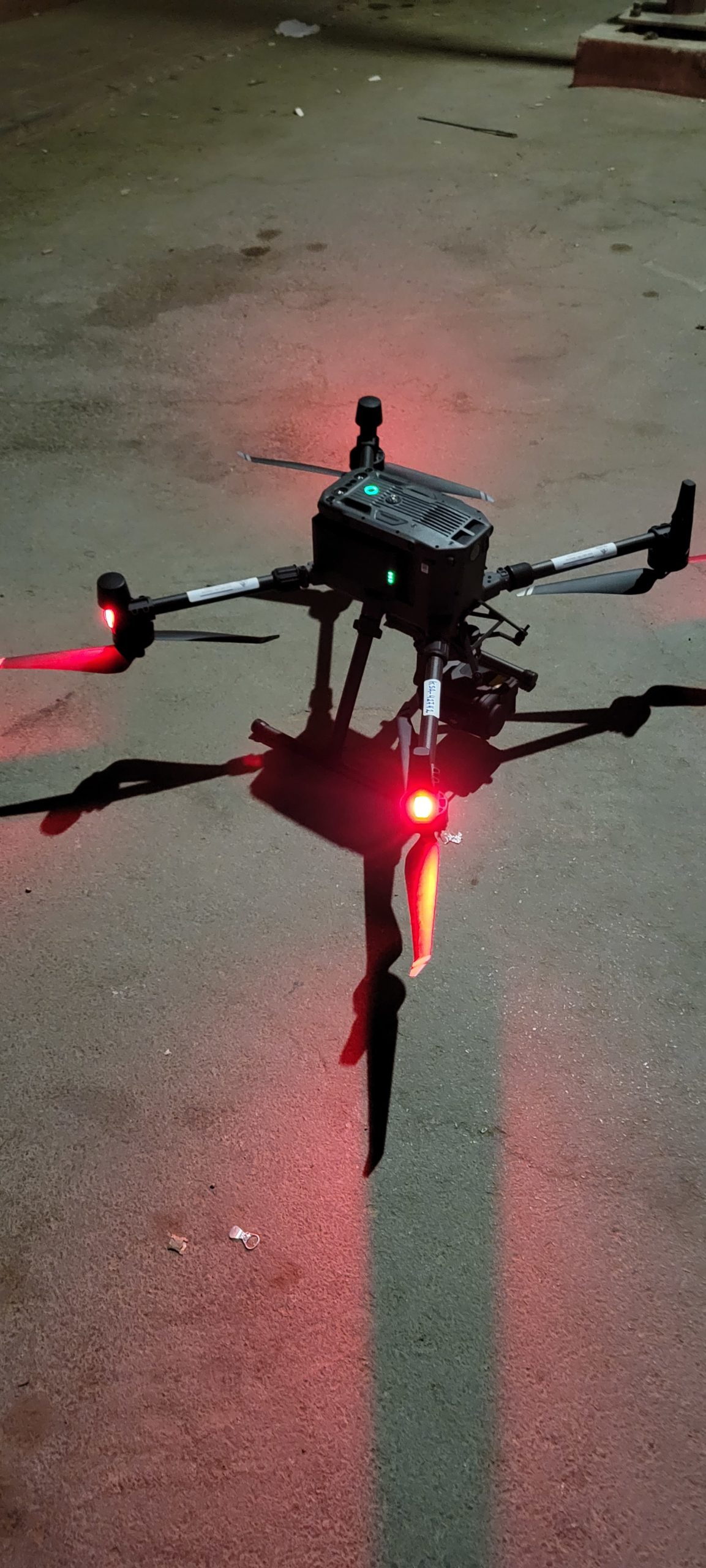
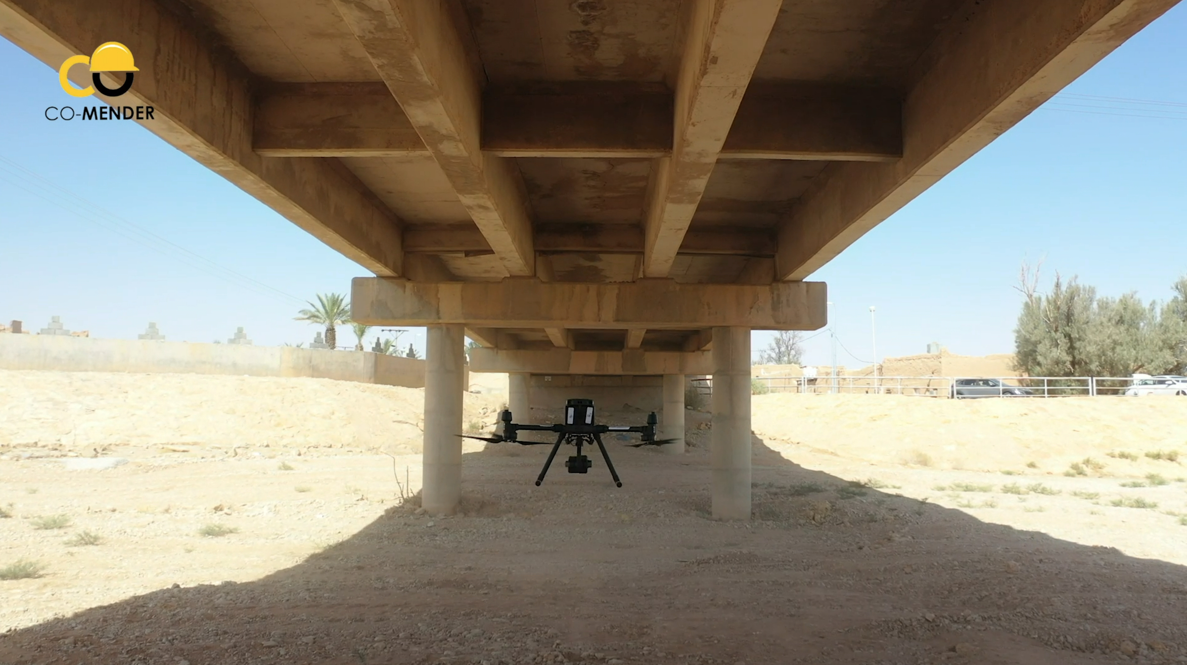
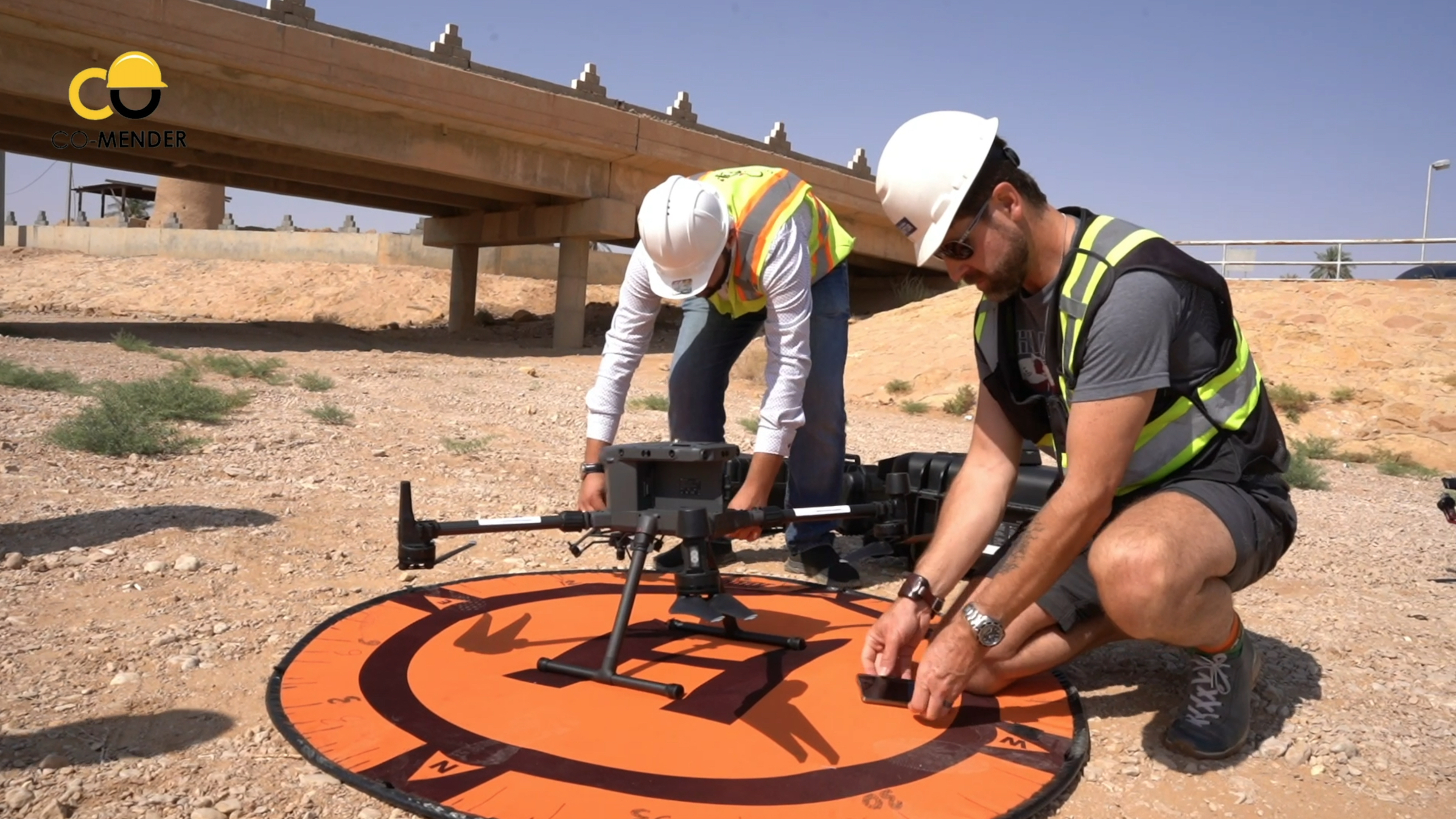
“I went to essentially help a company develop their drone inspection and survey program,” he explains. The company (Co-Mender, which specializes in concrete infrastructure inspection and repair) had purchased a DJI M300 from Canada and hadn’t flown it yet. The firm also had a couple of critical inspections they wanted to get done ASAP.

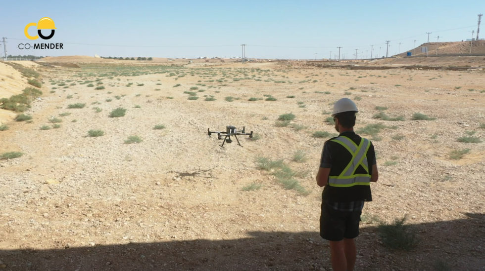
So Eric hopped on a jet, and 17 hours later arrived somewhere decidedly less green than his home base of Vancouver. He took this snap while on the trip:

Saudi Drone Inspection

Getting the drone to fly…


Normally, this is the easy part. You set up the machine, ensure the firmware is updated, do a physical inspection, check that all permissions have been obtained and that it’s generally safe to proceed. (There are other steps, but you get the drift.) Except in this case, there was a problem – even though it was a brand new enterprise drone that had never been flown.

They turned it on, and, well, nothing.

“Their drone was actually region-locked to North America, so there was no way it would turn on in Saudi Arabia. So the first order of business was to figure out how to unlock it. As soon as the drone turned on it was saying ‘I’m in Saudia Arabia, I’m not supposed to be here. I will not turn on.'” (Well, it wasn’t literally saying that, but that was the gist of the message popping up on the controller.)

The clients, of course, were concerned. Their brand-new drone wasn’t working and they had time-sensitive jobs to do. So Eric set to work.

Canada Drone Companies

The path to a solution

After trying everything he could think of related to firmware hacks, Eric contacted InDro’s engineering team and reached out to DJI’s Enterprise side for support. While waiting for some a workaround and not one to waste time, Eric borrowed a DJI Mavic Air 2 from a company hired to create video content about the projects. This allowed for the capture of preliminary photogrammetry of the bridge. Eric also took ground-based DSLR photos from the ground, shooting upward to capture the underside of the bridge.

Drone photos are all geo-referenced, meaning they contain metadata that places the photo in 3-D space at a specific time. But, with rare exceptions, DSLR images do not contain that kind of data. So how would these images be integrated? Well, the photogrammetry software is capable of picking out common features in any kind of imagery, whether aerial or terrestrial. So once it understood what a certain pillar looked like, for example, the software integrated those DSLR photos and a rough 3D digital twin could be created.

But the project required an accurate digital model, which mean that they still needed that M300 to fly. Finally, says Eric, the answer came from DJI support.

“Within two days, we had a solution from DJI to apply for a geo-unlock prior to each flight,” he explains. “It was not ideal, but it allowed us to get the jobs done.”

Several days later, Eric began re-flying the bridge mission, using the M300 to capture the structure from all angles (including from below, with the gimbal tilted upward). There were issues with dust, as the M300 kicked up a fair bit when flying beneath the low bridge. In fact, Eric had to pause the mission from time to time to wipe the lens clean.

M300 Drone

M300 back in action


With the M300 back in action, Eric was able to proceed with the mission with the ultimate goal of producing a complete digital twin of the bridge (a 3D digital reconstruction of the physical site, which is very useful for inspection purposes). Engineers use these digital twins to look at the asset and inspect it from all angles. If they find areas of concern, seeing the high-res images associated with that spot are just a few clicks away. In this case, the firm was attempting to determine whether the bridge should be repaired or replaced.

Then it was on to the next mission.

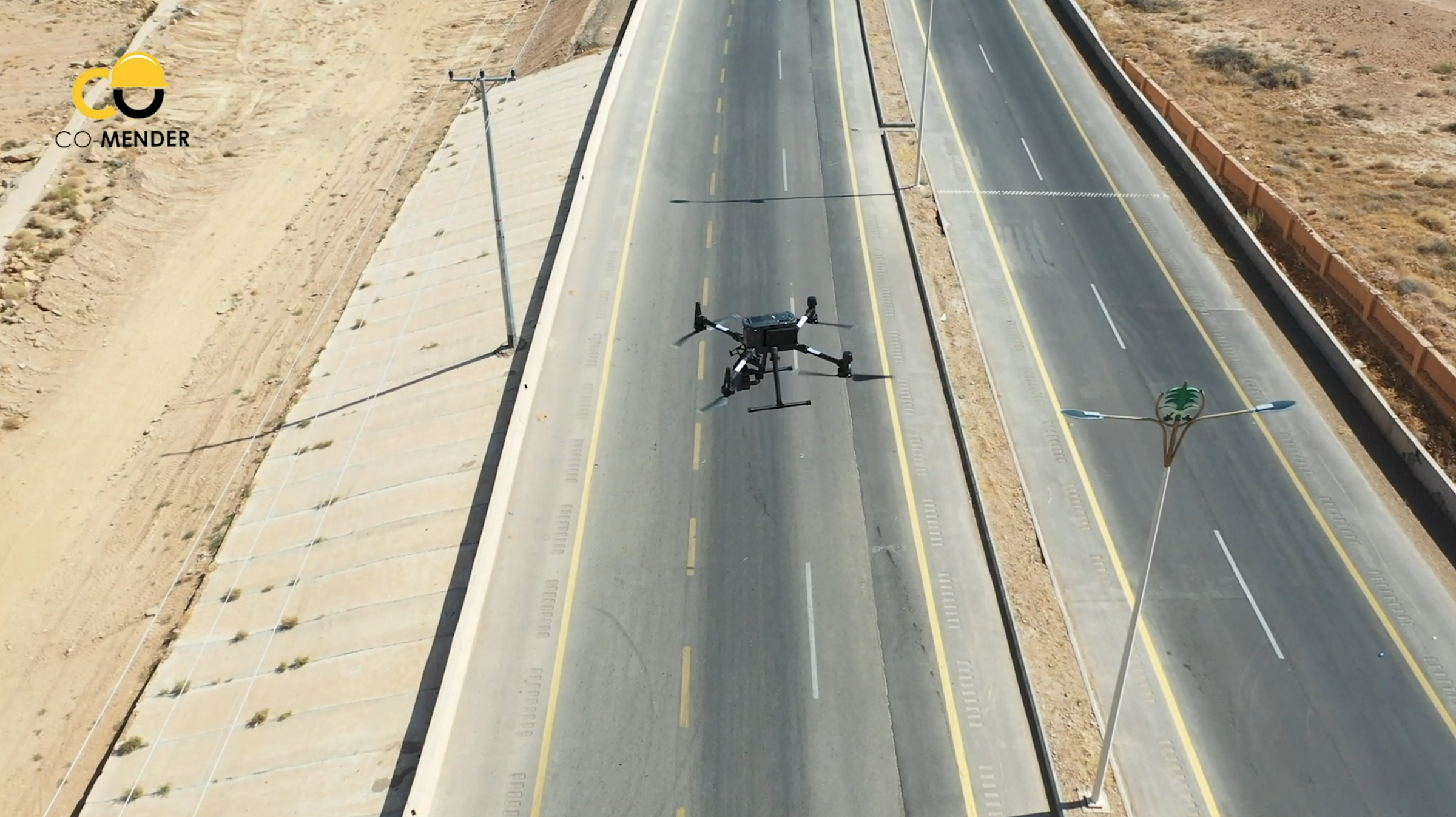
“The other site was about 50 kilometres southeast of the mountainous town of Al-Bahah. Here, the team was dealing with a dangerous 80-metre high rock cliff adjacent to a recently twinned highway,” explains Eric. “They were quite concerned about the high risk of rock fall activity and needed to engineer mitigative structures to stabilize the slope. In order to proceed, they needed detailed contours so their engineering team could design these structures.”

M300 Drone

If only there was a video…

Words and photos are nice, but sometimes a video can really give you a better sense of the job. Thankfully, Co-Mender pulled one together and has given us permission to share it. You’ll get a glimpse of the work InDro’s Dr. Saczuk carried out:

So, how did it go?


According to Eric, very well. Putting an enterprise drone to work, in conjunction with an excellent ground crew and reliable photogrammetry software, produced impressive results.

“I think ultimately it was quite shocking for the client: To be able to fly the drone for a couple of hours to collect the imagery, and within 24 hours deliver to them accurate contours. That was something they had never had access to before on that short of a timeline and that level of accuracy. To have surveyed that slope manually and generate contours would have taken probably taken two weeks.”


M300 Drone

‘A memorable trip


Eric says he met a really great team at Co-Mender and Gulf Crete (the support company), including one engineer who wanted to soak up as much knowledge as humanly possible during his stay. Eric also really enjoyed experiencing Saudi Arabia for the first time.

“I was quite keen on experiencing the culture – and I’m glad I did. I met incredibly friendly people and saw such diversity – everything from 400-year-old villages to a theme park that was like New York/Vegas.”

Eric also sends a ‘Thank You’ to Ian Wills, the President of Coastal Drone Co. It was Ian who connected the client with InDro Robotics.


InDro’s View


We are pleased with the outcome of this trip – simply because the client was happy. We perhaps don’t advertise these services as much as we should, but InDro has a full team of engineers and expert pilots (both of drones and Uncrewed Ground Vehicles), who are happy to help with solutions and training pretty much anywhere on the planet.

“A lot of foundations at InDro are based on providing unique and specialized training and solutions for clients,” says Eric. “And there have already been discussions on how we now take that to an even greater scale.”

If you have a problem…we’d love to help you solve it. Get in touch here.