InDro Robotics positions itself for the next phase of growth trajectory

InDro Robotics positions itself for the next phase of growth trajectory

By Scott Simmie


We’ve just hired more bright people at InDro Robotics: Four engineers in total, with another one coming soon.

That’s a significant investment in our staff, and in our company. And while we’ll introduce a few of them here, this post isn’t really a “get to know you” story. It’s a broader narrative about growth, strategy and trajectory.

If you follow InDro Robotics (and presumably that’s why you’re here), you’ll know we’ve grown from a startup to a what’s known as an SME – a Small to Medium Enterprise. You’ll also know that our motto is: Invent, Enhance, Deploy.

That is, and will continue to be, our ethos. We invent our own products and market them – and build custom robots and drones for clients (including for some of the biggest technology companies on the planet). We also do highly specialised service provision and run the Drone and Advanced Robotics Testing and Training Zone (DARTT) at Area X.O, where clients can test robots on a course that meets the demanding criteria set out by NIST, the US-based National Institute of Standards and Technology. The drone section features a large netted enclosure, allowing operators to carry out training or even test drones with new technologies without the need for a Special Flight Operations Certificate from Transport Canada. It’s a very cool facility.

At our Area X.O engineering headquarters, we’ve grown from three engineers a little over three years ago to a staff of 20 (in addition to other operations elsewhere in Canada). Because so many components come into our shop – and so many robots go out – we have a full-time Supply Chain Manager and Logistics Coordinator. We have a Head of R&D Sales. And, of course, we have InDro Forge – a full-service rapid prototyping and limited production run facility that has every high-end fabrication tool you could think of (including a 3D printer capable of printing at volumes of up to one cubic metre).

It has been a steady and calculated growth trajectory so far, says Engineering Manager Aaron Griffiths:

“It’s been very strategical,” he explains. “We’ve been looking for robustness and longevity rather than speed.”

And – up until now – that growth has been reflective of our core tasks: Building custom products for clients and inventing our own products.

We’ve done that very well – and will continue to do so. But the long-term InDro roadmap has always included more. And we have now reached that stage.

Below: Team InDro at the opening of DAART in June of 2023

Area XO DARTT

INVENT, ENHANCE, MANUFACTURE


InDro has created some landmark products in recent years – with more to come. We can’t discuss all of them due to NDAs. But some public highlights that immediately come to mind include InDro Commander, InDro Pilot, InDro Controller, our Sentinel remote inspection robot, and much more.

Most of what was just mentioned are InDro innovations – meaning we have invented or developed these products with clients in mind, but not specifically as one-off projects. In other words, they have been built with an eye to actually producing and selling these products at scale.

Don’t get us wrong, we have certainly sold each of these products. But we’ve now reached a stage where demand – as planned – dictates that we expand in order to be able to run as a manufacturing facility while still retaining our ability to build custom robots and drones.

“If you want to turn out 10-20 robots over a few months, that requires a whole production team,” explains Griffiths. “That would be an additional five to 10 people just to do that kind of work.”

And not just a production team. As we continue to deploy more robots in the field, InDro now sees the need to start expanding our team to include Field Engineers.

“So you need a production team to make the things – and then a field engineering team to maintain and run them on client sites,” he adds.


FIELD ENGINEER


Our first Field Engineer hire is a familiar face to InDro. Liam Dwyer, who graduated from Queen’s University Canada in June of this year with a B.Sc. in Mechanical Engineering, previously carried out a 16-month co-op placement with InDro at Area X.O. But he’s heading into a very different role, suited to InDro’s growth.

“I’m going to be an on-site support and integration person to either get the client set up with the robot, supported with the robot, or to repair robots that may have been either damaged or just need maintenance,” he says.

He also recognizes the significance of his role in the bigger picture.

“I think the fact this title now exists at InDro really shows a lot of growth as a company. The fact there is now a full-time role to move and support these robots really means that the reach of InDro has gone pretty far – the name has gotten out.”

It’s also – both for Dwyer and InDro – a perfect fit.

“I’m a big fan of travel and I like field work, so I’m very excited for it,” he says. “It really puts a lot of emphasis on your individual ability to solve the problem and produce a solution. I was able to do some field work during my placement here, and I really like this kind of challenge.”

There are already plans for a second Field Engineer hire. And that’s on top of three other recent hires at InDro, including the highly experienced Steve Weaver in the senior position of Embedded System Engineer. He’s been in this space for some 25 years.

“Steve has been hired as a senior engineer for his wisdom,” says Griffiths. “He knows what to do and – just as important – knows what not to do.”

He’s joined by Nathan Sun, who has less long-term experience but has been working with all of the latest and greatest tools in AI and brings a fresh approach to things. Sun is also an Embedded Systems engineer, and should make the perfect work partner for Weaver.

“Nathan is the other side of the coin to Steve,” says Griffiths. “Together they’ll make a great team because they complement each other very well.”

That’s not all. Just prior to these three new hires, InDro also brought Sebastian Mocny on board in the role of Robotics Software Engineer. He’s currently busy taking Cypher Robotics‘ Captis cycle-counting AMR to the next level. InDro has an incubation agreement with Cypher Robotics, which also taps into the expertise and gear at InDro Forge. So that’s four engineers in short order, with more to come.

Below: New hire Liam Dwyer (R) during his co-op at Area X.O, with Tirth Gajera

Liam Dwyer and Tirth Gajera

BUILDING A TEAM


It’s been quite a voyage at Area X.O, with a lot of growth over the past few years. All of the hires go through Founder and CEO Philip Reece, as well as Vice President Peter King. But it’s generally Arron Griffiths who has to ultimately determine if prospective employees will be a fit for the Area X.O team culture InDro has worked so hard to foster (and where Griffiths works daily).

With a very low attrition rate and high job satisfaction, InDro is clearly selecting the right people – and building the right environment.

“It’s really all about personality,” say Griffiths. “It boils down to people’s mental state, their values. I would argue that if they’re driven, if they’re kind, if they’re a proactive learner, if they have empathy…the qualities you look for in a nice person are typically what you’ll find in a good and productive employee.”

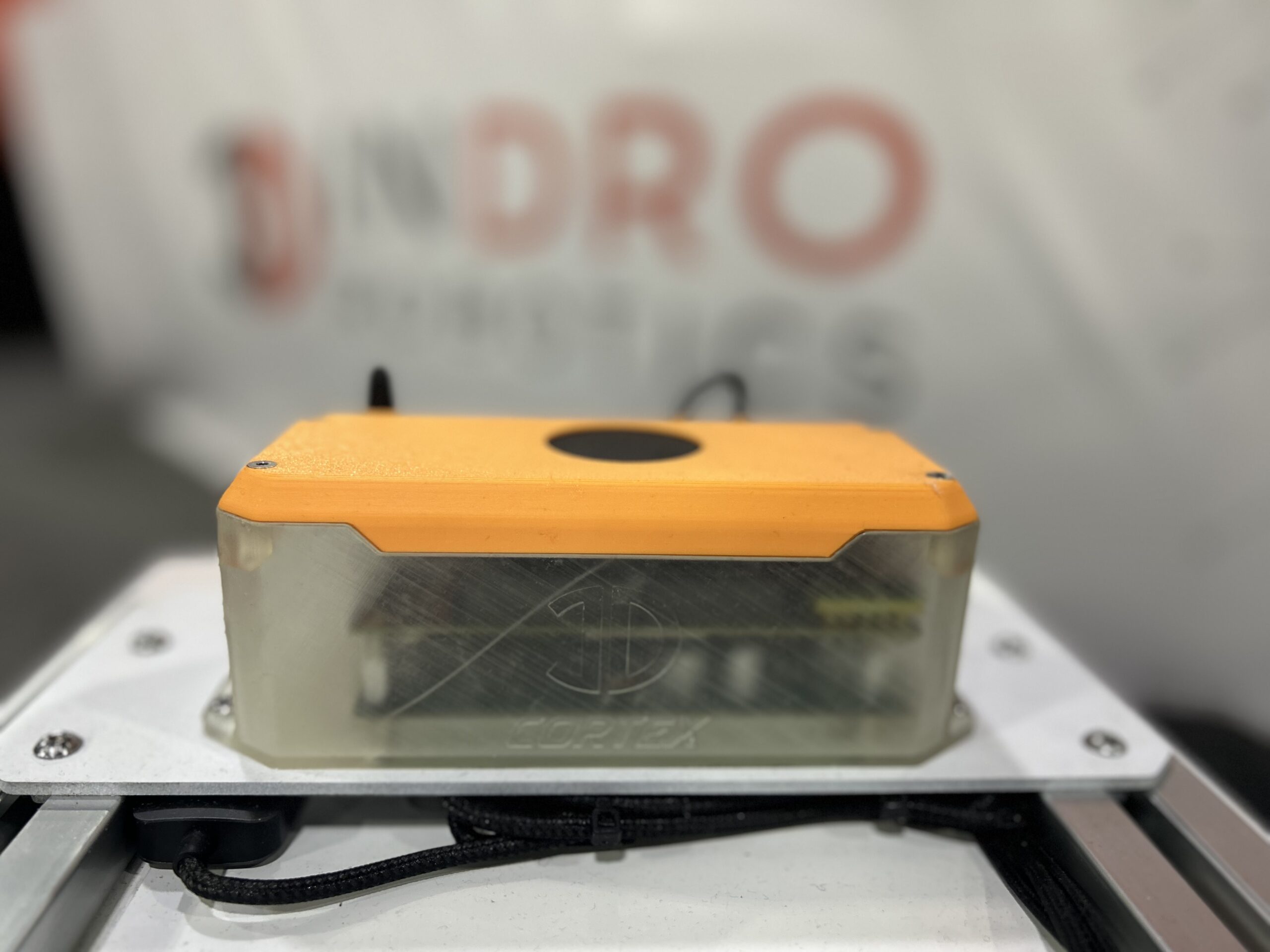
One of the big projects for next year will be the push to manufacture the recently-announced InDro Cortex. It’s a small but exceedingly powerful brain box for computer customisation that allows for rapid sensor integration and contains power management for multiple sensors along with ROS2 files. The Plug & Play (or Plug & Work) device follows on the incredible success of InDro Commander – and there’s already impressive demand. It also enables teleoperation and is the perfect match with InDro Controller – our intuitive dashboard for even highly complex autonomous missions.

And while we’re proud of the engineering work that has gone into Cortex, Griffiths says products like this “stand on the shoulder of giants” in the engineering world. And here, he’s referring to the tremendous advances in AI compute and other technologies that allow Area X.O engineers to truly work with the most advanced tools available.

“We have good and talented engineers,” explains Griffiths. “but we are definitely aware that other engineers out there have helped enable us to be on the leading edge of things. We’re hitting that very sweet spot in terms of technology maturity that’s enabling us to do this right.”

Below: InDro Cortex


InDro Control Module ICM Cortex

INDRO’S TAKE


We’re obviously pleased to announce these four new hires – and to welcome these talented individuals to our team. We are equally proud to have reached a stage where we’re in the position and have the name recognition to forge ahead into manufacturing at greater scale. It’s a testament to the dedication of all of our employees – including administration, sales, logistics, marketing and management. (Oh yes, and content, too.)

“As we prepare to push into manufacturing and dedicated employees for onsite customer field support, I’m grateful to everyone for their hard work – and to our clients as well,” says InDro Robotics Founder and CEO Philip Reece.

“And to those clients who have relied on us in the past for custom solutions? Don’t worry. We’ll still be doing that with the same care and attention to detail. This simply marks a new expansion into manufacturing for InDro, which will continue to put significant resources into custom builds and R&D. Onward.”

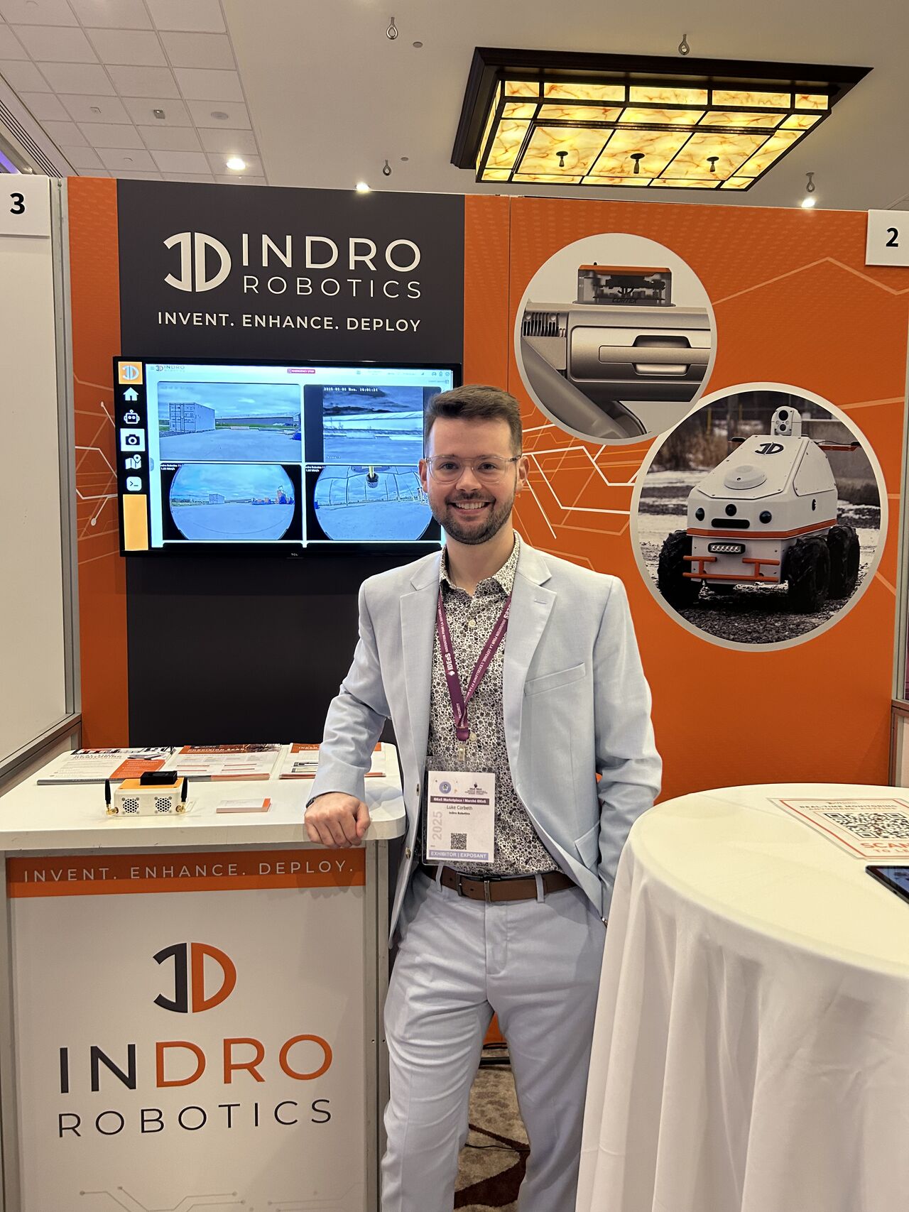
Interested in exploring a solution from InDro? You can contact Head of R&D Sales Luke Corbeth right here. He’s incredibly knowledgeable and loves nothing more than helping clients find the perfect solution.

Teara Fraser looks to give others “wings” and advance reconciliation

Teara Fraser looks to give others “wings” and advance reconciliation

By Scott Simmie


Aviation entrepreneur and Métis champion Teara Fraser has a lot say.

And, during the recent Aerial Evolution Association of Canada’s annual conference and exhibition in Ottawa, she took the opportunity to touch on a broad variety of topics – ranging from the impact of Residential Schools through to sustainable aviation, RPAS and Advanced Air Mobility.

She didn’t pull any punches. The land where the conference took place, she pointed out, is on unceded Anishinabe Algonquin territory.

“These are stolen lands” she emphasized bluntly.

To further stress the point, she encouraged attendees to check out the Native Land Digital website. It outlines, on a global scale, why the term First Nations exists: Indigenous peoples were, obviously, the original inhabitants far longer than the settlers who now occupy those lands.

It’s one thing to say it, but another to look at the website’s global map. It’s an eye-opener, and you can enter your own address to see who was here first:

Native Land Digital First Nations Indigenous

FRASER’S BACKSTORY


Fraser has had quite the journey.

Her Grandfather was born in remote Fort Chipewyan, a hamlet in northern Alberta colloquially known as Fort Chip. On the western tip of Lake Athabasca, it’s right next door to Wood Buffalo National Park – the second-largest national park in the world (44,741 square kilometres, or larger than Switzerland). That park is also home to half of the globe’s endangered wood bison population. It was established as a trading post back in 1788 and was named for the Chipewyan people who lived in the area.

Her Grandfather was raised in the Métis way, but – like so many Indigenous people – was taken from his home in the failed assimilation attempt of the Residential School system. Fraser did not elaborate on the impact, but few emerged from that horrific system without deep scars. She did, however, say that she grew up in “intergenerational poverty.”

By the time she was 30, she was a single mother of two who hadn’t finished high school. She was still struggling to make ends meet. But she had aspirations. And one day she sat down in a Chapters – in the self-help section – and wrote down a bucket list. It was kind of a dream, really, but she knew that one day she wanted to go to Africa, to see giraffes and zebras in the wild.

It felt so out of reach that she said “it seemed completely impossible…for someone like me.”

But – against all odds – she did go back in 2001. And, fortuitously, she took an aerial tour. From the moment she stepped inside that plane, her first experience in a small aircraft, It was breathtaking…and life-changing.

“To witness the land in that way changed everything for me. When I went on this flight, I was like: ‘I’m going to be a pilot. I will never forget that moment. I didn’t care what it would take to become a pilot – that’s what I was going to do.'”

But there was still that voice in her head, the one that told her such dreams were impossible. She recalls some negative self-talk: “‘C’mon, sweetie. Honey, you have no access to money, you have no education. It’s just not possible.'”

But she wasn’t going to let that stop her.

“Two weeks later, I went skydiving.”

If you’re starting to get a sense that you should never underestimate Fraser when she has a vision in her head, you’re on the right track.

“Less than one year later, I had my commercial pilot’s license and my journey in aviation was about to begin,” she recalled.


“GAVE ME WINGS”


Her aviation career included piloting the Dash 8 (Q400), a turboprop capable of flying at near jet-like speeds. She worked overseas in Nigeria, then eventually started a company in 2010 called Kîsik Aerial Survey (with her partner at the time) – which did large-format, precision captures. That company would last more than six years (she sold it in 2016), and was the beginning of Fraser’s driven work as an entrepreneur. She served as Director of the British Columbia Aviation Council from 2011 to 2013 (and again from 2018 to 2020).

While aviation has been central to her life since obtaining her license, that passion is shared equally with making a difference in the Indigenous community, and also helping others outside of that circle connect, engage with, and learn about First Nations, Métis, and Inuit peoples. To that end, she established the Indigenous Lift Collective in early 2018. The non-profit corporation’s stated mission is “collectively LIFTing, amplifying, celebrating, and connecting Indigenous peoples for a sustainable, thriving, and better world.​ Indigenous LIFT Collective is a collective that acts as a home to wide-ranging initiatives who ALL LIFT the voices, stories, businesses, communities and nations of Indigenous peoples.”

Just a month after launching that initiative, she founded Iskwew Air (pronounced ISS-KWAY-YO) – a Cree word for ‘woman.’ As its website explains, “The name was chosen to celebrate the first Indigenous woman-owned airline, all women, and all those lifting women. It was chosen as an act of reclamation of womanhood, matriarchal leadership, and language.”

Fraser received her operating certificate for that airline October 19, 2019. And, of course, it wasn’t long before COVID-19 upended the entire world.

“An airline startup is even harder in a global pandemic,” she said dryly. Soon, Iskwew air was delivering PPE and other critical supplies into Indigenous communities.

Iskwew Air now carries out six flights daily between the town of Qualicum Beach on Vancouver Island and Vancouver, with four flights daily on weekends. In June of 2024, Raven Indigenous Capital Partners announced a $1,750,000 investment in Iskwew Air.​​ In addition to that equity investment, Iskwew announced the addition of the third Piper Navajo in its fleet, named “Baby Bison.”

But Iskwew air doesn’t simply transport passengers and goods. It also helps Fraser in her vision of encouraging young Indigenous people who have an interest in aviation, via her Indigenous Lift Collective. You’ll see Teara Fraser in this video:

WAIT, THERE’S MORE


Fraser has already accomplished more than many will in their lifetime. But she’s not finished yet.

She is also the CEO of elibirdaero, which offers flight training and everything from ground school courses through to Private Pilot License, Commercial Pilot License, Night and Instrument Rating – even aircraft maintenance (elibird is a BC training centre for the Foundational Training Program (FTP) Aircraft Service Technician (FAST) with the approval of the Canadian Council for Aviation and Aerospace.

And yes, there’s even more. elibird aero has put down a deposit on two electric training aircraft, part of its commitment to sustainability and respecting the planet. Fraser is emphatic on the company’s desire for minimal impact on the natural world, and sees that as a driving force for plans to expand fully into the coming world of sustainable Advanced Air Mobility. elibird aero’s long-term roadmap includes just about everything related to the world of AAM, including RPAS, aerodromes, aero technology and more.

While on that path, she’s mindful of her commitment to First Nations, Métis and Inuit peoples, and wants to see these technologies benefit them. In fact, she gave the conference a brief outline of the “Highway of Tears” – a 719-kilometre road between Prince George and Prince Rupert in BC that passes through 23 First Nations communities. More than 40 people, mostly Indigenous and mostly women and girls, have been murdered or gone missing along that route since its completion in 1970. How, she wondered, might RPAS technology be implemented to potentially keep this road safer?


RECOGNITION


Fraser has received multiple honours for her work. But there’s one she’s particularly proud of. DC Comics produced a graphic novel featuring Wonder Woman on its cover. It’s called: Wonderful Women of the World.

“Wonder Woman has been an inspiration for decades, and while not everyone would choose her star-spangled outfit for themselves, her compassion and fairness are worthy of emulation,” says the DC website. “We’ll be presenting tales of the real-world heroes who take up Diana’s mantle and work in the fields of science, social justice activism, diplomacy and more!”

The book is divided into five sections: Strength, Compassion, Justice, Truth and Equality. It includes profiles of former Supreme Court Justice Ruth Bader Ginsberg, environmental activist Greta Thunberg, space shuttle astronaut Ellen Ochoa and even Beyoncé. And at the top of the list in the DC synopsis? Teara Fraser.

“It was an incredible honour to be included in this anthology,” Fraser told the audience.

Below: The cover of the DC Comics graphic novel

Teara Fraser DC Comics

NEXT STEPS


Teara Fraser, obviously, has many plans for her companies and advocacy. But, she emphasized, those in attendance at the conference can make their own contributions on the path toward reconciliation and inclusion.

First off, she encouraged people to learn. Whether it’s checking out the Native Lands Digital website mentioned above or reading the summary of the Truth and Reconciliation Commission’s report, she suggested that the first steps include gaining some knowledge –and then putting that knowledge into action.

“Who are the Indigenous businesses in this space, and how are you supporting them?” she asked.

“The country is built on the genocide of Indigenous peoples… Co-creating the conditions for Indigenous business to thrive is the single most natural, swift, and effective pathway to economic reconciliation in our country. Indigenous people bring so much wisdom; we have so much to learn from Indigenous people.”

Over the years, there have been many outstanding speakers at the annual conferences of the Aerial Evolution Association of Canada. Never has one held such undivided attention of the audience. You could literally hear a pin drop through the presentation, which was greeted with the most extended standing ovation seen at this event.

Immediately after she finished speaking, she helped moderate an Indigenous panel. She was joined by Darcy Hunt, Founder and CEO of Aboriginal Training Services Limited and Kimberly Mike, an Advanced Pilot with Stinson Aerial Services. The trio sat on stage, with a fourth empty chair. Audience members were invited into that circle to discuss any topic – whether related to RPAS, Canada and Indigenous Peoples…anything.

It was powerfully symbolic of reconciliation, the path forward – and the work that still remains to be done.

Teara Fraser AEAC

INDRO’S TAKE


We were pleased to see Teara Fraser make such an impactful presentation at the AEAC Conference and Exhibit. As both an entrepreneur and advocate, she’s made (and continues to make) a big and positive difference in the aviation, AAM and Indigenous spaces. InDro Robotics has long tried to work closely with First Nations peoples whenever possible. We remain particularly proud of our work during the COVID-19 pandemic, when we transported test kits from Penelakut to and from the mainland with BVLOS drone flights. This enabled a healthcare worker to remain at the clinic and serve the community, rather than take the long ferry ride twice a day to hand-deliver.

“Teara Fraser is an impressive individual and I’m proud to call her a friend,” says InDro Robotics Founder and CEO Philip Reece. “Her impact on the aviation world in BC cannot be overstated, and the same goes for her advocacy and mentorship. We look forward to future opportunities to work with, collaborate with and engage with First Nations communities, and with Teara herself.”

We encourage readers to take Teara’s advice on that path to reconciliation, starting with the websites she mentioned..

InDro explores USV marine sector – and speaks with a PhD researcher on their work

InDro explores USV marine sector – and speaks with a PhD researcher on their work

By Scott Simmie


At InDro Robotics, there’s nothing we love more than research and development.

That shouldn’t be a surprise, because that’s how the company was built. From our early work building and modifying Uncrewed Aerial Vehicles (UAVs) for clients and service provision through to a wide variety of Uncrewed Ground Vehicles (UGVs) we have invented or customised for customers, R&D has always been the heart and soul of InDro. That’s why we have a large and continually scaling team at our Area X.O operations in Ottawa.

We’ve previously done work on the marine side of things and have built and tested Uncrewed Surface Vehicles. Our ‘Talos” USV was remotely piloted and carried a sonar that was deployed via winch. We successfully deployed that on multiple missions, mapping lakebeds and vegetation. Its capabilities were excellent, but our priorities shifted to the aerial and ground side of robotics due to client demands. But we’ve always kept a close eye on marine robotics developments, particularly when it comes to R&D.

There are some really exciting companies in this space in Canada, including Open Ocean Robotics. We are very impressed with its DataXplorer, a solar-powered and self-righting autonomous vehicle suited for long-range data acquisition in the open ocean. It’s a brilliant design, and Co-Founder and CEO Julie Angus is a very impressive individual. With an MSc in Molecular Biology, she’s both a serial entrepreneur and was the first woman to row across the Atlantic Ocean from mainland to mainland. She’s a director on NATO’s Maritime Unmanned System Initiative Innovation Advisory board and was honoured with National Geographic’s Adventurer of the Year award for her trans-Atlantic achievement. Like we said, impressive.

Another company that has caught our attention at conferences is Deep Trekker. It has a solid lineup of ROVs, and we were able to operate its smallest offering at a couple of different trade shows. Recently, it launched an Uncrewed Ground Vehicle that is also submersible. We can see a wide variety of use-cases.

Below: An Open Ocean Robotics video shows off DataXplorer, followed by the InDro Robotics Talos

InDro Robotics Talos

THE R&D FACTOR


Of course, companies can’t create products like these without a significant investment in research and development. This is something we truly understand.

We also know that many innovations have their genesis in a lot of hard work from graduate students and those holding PhDs, who often put in untold hours on projects that can lead to commercial breakthroughs. So we thought it would be enlightening to spend some time talking to one of those people.

We sat down for a chat recently with Thomas Sears, a PhD candidate in Electrical and Computer Engineering with Queen’s University’s Offroad Robotics and Ingenuity Labs Research Institute. He holds a Master of Applied Science in Aerospace Engineering and is a Professional Engineer.

And he’s really, really interested in boats and waves. Specifically, working with USVs to learn more about predicting wave patterns and – ultimately – creating algorithms so that autonomous or pilot-assist systems can anticipate what waves might be coming and how best to orient a boat depending on what those waves are likely to do and the desired outcome.

Sears is a really good explainer. And he started the conversation by talking about humans anticipate and react to waves when they are in the water.


HOW PEOPLE REACT


“As humans when we go to the beach, we can kind of intuitively feel the waves coming and we know, OK, it’s probably four more seconds for another wave,” he says. “How do we give the boat that intuition to know: If I felt a wave here, if I move forward three meters, I’m probably going to feel in four seconds that wave is going to hit me from the side.”

That takes a lot of math, plus a bunch of sensors. But to what end? Is it simply to help ensure a boat might not capsize in rough water?

Well, explains Sears, there are a wide variety of use-case scenarios. Understanding waves, being able to predict them, could for example be of great use to Kingston colleagues who are coastal engineers and study the impact of waves on the coastal environment. A deep understanding of the math and physics involved could be highly useful in predictive models. What’s going to happen to this coastline over time? During a powerful storm?

But there are many other applications. Returning to the human example, Sears points out when a wave is approaching, a human being carries out their own calculations and braces themselves for impact.

“I’d like the boat to be able to do the same thing. If the boat can be out in the water and it can start to notice this trend, whatever the trend is, maybe I can then take an action on that trend,” he says before outlining multiple options for how a boat might respond:

“‘Aha, I’m about to get pushed by the wave.’ Maybe I’d like to surf the wave. Maybe I’d like to push against the wave. Maybe I’d like to turn so I’m safer, whatever that is. That’s sort of for the next person to work on.”

But the work being carried out by Sears will lay the foundation for that next step. He can see, even with an identical set of waves, there might be different optimal autonomous responses depending on the scenario.

“We could see this getting scaled up to crewed vessels…The boat could essentially say: ‘OK, well, we’re worried about passenger comfort.’ Or ‘We’re worried about fuel efficiency’, whatever it (the use-case) is. I’d like to just dial in that option and then the boat can start to go: ‘OK, well, given these wave conditions, here’s how we might want to act.'”

But to get there, you need research, data and predictive models.

“Without the ability to make those predictions of the waves, we have no information to act on. We would just be acting reactively. So we would just say: ‘Oh, I just got hit by a wave, do something quickly’.”

In other words, the boat has to understand what’s coming. And here, things get even more complicated. A boat doesn’t respond immediately to inputs the way an electric car does.

“When you start energizing the motors, it doesn’t move instantly. It starts churning water before something happens. Boats have a bit of a spin-up.”

So that, too, has to be factored into the equation(s) – and would have to be factored into future algorithms suited to specific boats.

“It’s the opportunity to look not just forward in time, but look around the boat for maybe a nicer spot to sit; to let me take an action before the motors are ready to go. So I can I can sort of pre-empt things, which is a sort of a superpower that I’d like to give these boats.”

Below: Thomas Sears with the USV, followed by the USV on a calm day (photos courtesy of Offroad Robotics). YouTube video shows Sears explaining his research

Kingston University Thomas Sears USV

A CUSTOM USV


This is the perfect kind of research for an Uncrewed Surface Vehicle. But to get the right USV took a lot of work from Sears and his team.

They initially were looking for an off-the-shelf USV that would come with most of what they needed. And those needs included the Robot Operating System (ROS) software. They had plans to purchase something from a Canadian robotics company, but it had just ended production on its USV. So they were left with simply finding a base platform and doing all the modifications themselves. Researchers often prefer to put their time into algorithms and R&D rather than building and integration, but that was the option they were left with. Thankfully, with his background in Electrical Engineering this was a task Sears was capable of carrying out.

“The boat that we purchased was not designed for robotics research,” he says. “We had to take on a lot of the non-recurring engineering work of turning it into a research vessel. I’ve been involved in everything from the algorithms that are running on board to picking the computer that is running those algorithms. I happen to come from a background where that’s a comfortable thing for me.”

Doing that work, says Sears, was a “considerable time-sink” – but having a ROS-based platform was critical to the research. They not surprisingly went with ROS 2, the latest iteration of the Robot Operating System. The team actually wrote the interface software themselves, and released it on GitHub.

Then there was the sensor integration: The hardware, the wiring, the software. Plus, of course, making everything waterproof. There was a high performance Inertial Measurement Unit (IMU) and a 16-beam Velodyne LiDAR. It was only when the USV was dispatched that they discovered the LiDAR beams were absorbed by the water. It was, he says, a “weird” thing.

“So unlike our our ground vehicles, where we see the ground, we see the floor, the boat is just floating in nothingness. But the really cool thing is we can leverage that because now if we see something, we know it’s not water. We just see objects – so we don’t have to worry about segmenting out ground and objects.”

That has been particularly useful in research by others using the same USV that involves identifying the coastline. The USV also carries a dual-antenna RTK-enabled GPS receiver.

“That’s critical on a USV platform because you can move sideways on a boat, if the water pushes you sideways, you can move sideways,” he says. “And that fuses with the gyroscope and with the accelerometers on board to give us a really good position measurement.”

For the data to be useful. Sears has to know precisely where the USV is at any given moment – both in terms of its absolute position and its position relative to the waves. There’s also a sonar unit, which is of great use to researchers on the civil engineering side of things. There’s also a camera on board, though Sears laughs that watching its feed is “nausea-inducing.”)

With Queen’s University’s proximity to Lake Ontario, Sears and others can literally launch the USV in about 20 minutes. They also do research inside a wave tank at Queen’s.


THE BIGGER PICTURE


As mentioned, other researchers at the university also capture and analyze data from the USV. All of them have a deep appreciation for the importance of Lake Ontario – and not just as a shipping corridor.

“Lake Ontario is full of life. It’s our source of water for drinking and agriculture, so it needs to be monitored and protected,” says Sears. “Having these water drones watching the lake on our behalf is going to help us ensure that the lake stays healthy, that we stay healthy, that wildlife stays healthy.

“We‘re working toward monitoring this very large space uninhabited by humans that we take for granted in daily life.”

Below: Queen’s University researchers look at data being collected by the USV

 
Kingston University Thomas Sears USV

INDRO’S TAKE


Marine robotics are kind of the third leg when it comes to uncrewed vehicles. And, given our reliance on water, a very important one. Our initial vision for InDro Robotics was that we would develop products for all three realms – and we’re still quite proud of our Talos USV.

But during the company’s initial growth we made the decision to put our energy into UAV innovations such as remote teleoperations, deliveries, enhanced service provision and more. (InDro was the first company in Canada to operate UAVs over 4G and 4G, and was the first to obtain a cargo license for drones from the Canadian Transportation Agency, among other firsts). This decision was largely driven by customer demand at the time, as well as our then-startup status.

InDro has now scaled sufficiently that we are once again exploring the marine sector.

“We will have some ROS-based offerings soon that we can customize to enable R&D researchers and commercial clients to carry out complex data acquisition in a marine environment,” says InDro Robotics Founder and CEO Philip Reece. “We’re testing the waters, so to speak, but are optimistic this could be the  next sector for our engineers to tackle.”

Already, we have some platforms available that can be used for cleaning surface garbage and cutting aquatic vegetation that’s impinging on the surface. But, like all of InDro’s offerings, these can be customized with additional sensors and teleoperation capabilities based on client needs.

“We have had a mandate since Day One that we want to be experts in unmanned systems,” says Head of R&D Sales Luke Corbeth. “To date, that’s really meant just UAVs and ground robots. But ultimately, we want to be experts on land, air and water. This is our first move into water, and I’m incredibly excited.”

We all are. If you’re interested in our offerings, contact us to learn more.

Feature image at top of story shows the DataXplorer in action; photo courtesy of Open Ocean Robotics

NAV CANADA says enhanced capabilities coming to NAV Drone app

NAV CANADA says enhanced capabilities coming to NAV Drone app

By Scott Simmie


If you’re an RPAS pilot in Canada, you’re likely using NAV Drone (and if you’re not, you should be).

The mobile and web app from NAV Canada is the app to ensure your mission is approved. As the NAV CANADA website explains: “NAV Drone is the only app that lets you safely and legally request permission to fly a drone in airspace controlled by NAV CANADA. From the web or a mobile device, professional and recreational drone pilots and operators can easily see where they can and cannot fly with interactive maps and, when needed, submit requests to fly in controlled airspace.”

It’s a snap to use. The app lets you know where you can fly – and where you can’t – and could save you from both dangerous operations and potential fines. The app also notifies you if there are other drone operations underway in the vicinity of your operations, which is really useful for situational awareness.

Last week, at the Aerial Evolution Association of Canada‘s annual conference and exhibition, NAV CANADA offered an update on usage stats for the app – and revealed there are more enhancements on the horizon.

Below: Screengrabs from the NAV Drone mobile app, followed by a NAV CANADA explainer video

NAV Drone
NAV Drone

BY THE NUMBERS


NAV Drone has been operational now for several years. There was a lot of buzz in the industry when it was first released, but what has that translated to in terms of actual use? Here, NAV CANADA offered some numbers – which indicate the app has been widely embraced across the sector.

In 2024, NAV Drone had processed 53,000 permission requests as of early November, a growth rate of 26 per cent over the previous year. By automating this process – and avoiding manual approval (30 minutes per request at $130/hour), NAV CANADA says the app has saved more than $6.5M in Air Traffic Service (ATS) costs. What’s more, users seem to really like the app; it has excellent ratings on the App Store and Google Play.

And, of course, NAV Drone has greatly enhanced safety (and provided a huge amount of data) for NAV CANADA, the country’s privately run non-profit corporation that operates our civil air navigation system.

“Safety is the key reason it’s there. It’s all about keeping the airspace safe,” explained Alan Chapman, NAV CANADA’s director of RPAS Traffic Management.

As we head toward increased RPAS traffic, including regulations that will permit low-risk Beyond Visual Line of Sight flights in 2025, NAV CANADA has bold plans to enhance the offerings of the NAV Drone app. And that’s good news for both RPAS operators and also those operating traditional crewed aviation.

“Some big changes are coming to NAV Drone in 2025,” said Stewart Paveling, Product Family Leader, RPAS Traffic Management NAV CANADA during a panel discussion.

That includes a number of additional features to the app, including greater capabilities with RPAS Traffic Management (RTM), low-risk BVLOS and EVLOS flight approvals – Including the ability to record flights undertaken with a Special Flight Operations Certificate through the app.

These are big changes, indicative of recognition this industry will continue to grow as well as NAV CANADA’s desire to safely help the industry expand as we head, ultimately, into the era of Advanced Air Mobility (AAM).

“NAV CANADA’s strategic direction positions us to take a leadership role to effect change across the air navigation system,” read a slide during its presentation. “To unlock not just our own potential, but also the potential of the industry to be more effective, more efficient, and more environmentally sustainable going forward.”

To further emphasise that, the slide continued – including the bold in the following paragraph:

“RTM facilitates the safe integration of RPAS, in a highly automated way, enabling growth of operations and expansion of use cases to capture the potential aviation and societal benefits.”

That was followed by a high-level road map indicating priorities for the coming years.

NAV CANADA Nav Drone

NEXT STEPS


Following the slides, there was a panel discussion about future plans, along with other suggestions on ways to improve the existing app. In addition to Alan Chapman and Stewart Aveling, the panel included Joanne Moon (Manager of RPAS Operations, NAV CANADA), Anne Sophie Ripple-Bouvier (Flight Safety Officer, Aerial Evolution Association of Canada) and Brian Fentiman (Project Manager, InDro Robotics/CEO BlueForce UAV Consulting, Inc.).

As the slide above notes, NAV Drone will keep pace with Transport Canada regulations – including the much anticipated changes that will allow low-risk BVLOS flights in 2025. The emphasis here is on pushing the envelope with a highly automated RTM system “to support safe, efficient and scalable BVLOS operations.”

For years, the sector has been eager to enable BVLOS flight without the need for a time-consuming Special Flight Operations Certificate. This obviously opens the door to a broad range of use-case scenarios, ranging from monitoring long-range assets like railroad tracks and pipelines through to large-scale mapping and other data acquisition.

For those operations that will still require an SFOC, NAV Canada revealed that the capability will be in place to allow flights to be recorded in the app. Though that will simplify the process of recording for operators, NAV Canada will not approve SFOCs; these applications will still be reviewed by Transport Canada, which is responsible for approving SFOCs.

Later this year, Paveling added, there will be new map layers for restricted airspace. NAV Canada is also planning to improve the flight clipboard that comes with the system, redesigning it and making it easier to read. There will also be changes to the web-based support site, including a move away from PDF manuals “with better content that’s easier to consume and search.”

Outside of the app, NAV Canada said it is working to beef up its ability to detect drone incursions.

“We see reports of RPAS in control zones on approach paths,” said Joanne Moon of NAV Canada, adding that the corporation also obtains data from drone detection systems in place at airports. (InDro Robotics is the chief technology partner with the drone detection system at YOW. That data is shared with NAV CANADA and Transport Canada, among others.)

NAV Canada, she said, is looking at strengthening its capabilities and enforcement in this arena.

“(We’ve) Been working with industry partners, looking at things like drone detection, information sharing, emergency response, collaboratiion with airport authorities (as well as) our own air traffic services unit.”


OTHER IMPROVEMENTS


There was also an opportunity during the panel to discuss other improvements that could be made to the NAV Drone app. And here, InDro’s Brian Fentiman offered some suggestions.

“One of the biggest things I find, more as a trainer than an operator, is the weak spot. The weak spot seems to be emergency procedures…With a flyaway, I would much prefer that there’s a single number. I’d like to see that phone number up front so it’s easy for people to find. In controlled airspace, you do get a phone number but it’s buried in a flight report…Sometimes you’ll get that phone number and the tower is not even open during those hours.”

It’s an important point – and one NAV Canada says it’s about to address.

“We are actively working on that right now…for an upcoming change to NAV Drone,” said Moon.

The other point Fentiman raised was with regards to conspicuity – meaning the electronic visibility of a drone within a broader RTM system.

“To enable BVLOS, we need conspicuity…whether it’s from the drone to other (RPAS) traffic or to commercial aviation,” he said.

That is something, said NAV CANADA, that is precisely on its roadmap. And the best way to fully get there, it was suggested, was to ensure that everyone in the industry uses the NAV Drone app.

“The more people who use the tool, the better situational awareness we have,” said Chapman.

Below: Brian Fentiman on the NAV CANADA panel at AEAC2024. Photo by Scott Simmie, InDro Robotics

Brian Fentiman AEAC 2024 NAV CANADA

INDRO’S TAKE


The annual Aerial Evolution Association of Canada’s conference and exhibit is always a great event – and precisely due to learning opportunities like this one. Conversations with bodies like NAV CANADA and Transport Canada are tremendously important for the growth of the sector.

“We are fortunate in Canada to have a collaborative relationship with NAV CANADA and Transport Canada, as that’s not always the case between the industry and regulators or air traffic systems organizations,” says Philip Reece, Founder and CEO of InDro Robotics.

“We have seen a true evolution over the years in terms of this relationship – and from both sides. There’s a greater recognition now from the industry that safety has to remain paramount if the sector is going to continue its growth trajectory. And we’ve also seen a real willingness from NAV CANADA and Transport Canada to work with RPAS operators to safely continue growth. The NAV Drone app – and how widely it’s now used – is evidence of this collaboration from both sides. We look forward to enhanced capabilities on this already excellent tool.”

Want to learn more about the benefits of membership with the Aerial Evolution Association of Canada? You can find all the details here.

Feature image by Scott Simmie, InDro Robotics

GCXpo 2024: A stunning showcase of Smart Mobility

GCXpo 2024: A stunning showcase of Smart Mobility

By Scott Simmie


The third annual showcase of Canada’s Smart Mobility sector – formerly known as TCXpo – is a wrap.

Bringing together more than 80 companies from across Canada and abroad, more than 1500 attendees registered to see the latest and greatest innovations – some of them being shown publicly for the first time. Ground robots, drones, even agricultural equipment and demonstrations of new technologies – it was all on display at Ottawa’s Area X.O, a private facility where technology companies (including InDro Robotics) build and test innovative products on a daily basis.

This was the largest event so far – and that’s reflected in the title. It’s now called “GCXpo” – with the first two letters standing for Government of Canada (the previous “TC” stood for Transport Canada). It’s a reflection of the importance Canada puts on supporting this growing sector as companies develop new products and push toward commercialisation. And there are a *lot* of agencies and departments behind this event.

GCXpo is hosted by Area X.O and operated by Invest Ottawa in partnership with the Government of Canada and event sponsors, including:

“GCXpo Is truly about celebrating Canadian innovation, companies driving the smart revolution that are changing our country for the better,” said Invest Ottawa President and CEO Sonya Shorey during opening remarks. She also pointed out why Area X.O in the nation’s capital is such a fitting location: Ottawa per capita, has “the top tech talent concentration in all of North America.”

And GCXpo 2024 did not disappoint.

Below: A crowd watches as Matt Johnston, Assistant Test Integration Engineer with Lockheed Martin Skunkworks Calgary, demonstrates a drone that can fly (and land) in GPS-denied environments, followed by the drone in flight. All photos by Scott Simmie

A LOT TO SEE


With some 80 companies, government agencies, academic institutions and others at the show, there was a lot of ground to cover. And while the exhibits were underway, the CAVCanada Stage provided top-flight panels and keynotes on a wide range of topics.

InDro Robotics Founder and CEO Philip Reece took part in a panel entitled: “Creating the Cities of Tomorrow,” which looked at how municipalities and regulators can best work together to safely encourage the transition toward newer technologies.

‘I would say failing fast is a super important thing,” he said. “We started flying drones 10-12 years ago, when it was really new. And the answer to everything at the start was: ‘No, you can’t do that.’ So instead of accepting that, we basically brought them (Transport Canada) with us, and we’d say ‘What would it take to do this? How can we do this next step?'”

There were some failures, but with the regulator on site there was a joint understanding of why things had failed – and the willingness to work together to identify those points of failure and take another run at things. This helped both the company – and the regulator itself. And it ultimately led toward a new way of thinking – with both parties viewing themselves as partners with a common goal.

“It’s much better to invite them in – let’s (jointly) spur innovation forward,” said Reece.

Interestingly, as the move toward Smart Cities continues, there’s obviously a lot of adoption of AI technologies and research in that realm. Because those AI processors can use a lot of energy – and because AI-enabled devices are starting to become ubiquitous in our lives – Ottawa Hydro has noticed a surge in energy demands and has had to adjust its own resources to ensure it’s keeping up with the transition. This surge has also, presumably, been influenced by the increasing adoption of electric vehicles (which, in addition to charging, rely heavily on AI).

“Bringing on AI has a very different energy footprint, and it’s not just one section of the city we’re seeing that in – we’re seeing it throughout,” said Julie Lupinacci, Chief Customer Officer with Ottawa Hydro.

“We’re moving from a utility that was planning and building one substation every five years – to one every year. So these are very interesting and exciting times, but it’s very crucial to get this right for the future.”

Below: InDro Robotics CEO Philip Reece

FROST, FOG AND Electric vehicles


If you’re a Canadian who drives in the winter, you’ll know all about the challenges of frost and fog on your windshield. But you likely haven’t given much thought to the energy requirements it takes to de-ice or de-fog that windshield, particularly in electric vehicles (EVs).

But one Ontario company based in Oakville, Betterfrost Technologies, has given this problem a lot of thought over many years. And it has developed a solution for the problem that uses 10x to 20x less energy than traditional methods.

And how does it do that? Well, there’s an invisible layer in the windshields of most cars today that is used for passive cooling, by deflecting infrared rays. That same layer can be energised using rapid pulses of power to concentrate on melting the frost or ice right where at counts: At the point where it adheres to the windshield. The company has produced an algorithm that’s embedded on a small chip that can be added to pretty much any modern vehicle with a couple of wires. When that algorithm gets the energy pulsing at the right frequency and intensity, that boundary layer is quickly and efficiently melted, allowing for the easy physical removal of frost or ice.

“This was researched at New Hampshire’s Dartmouth College’s Ice Research Laboratory,” explains company co-founder and CTO Sameh Saad. “They looked at how ice attaches to surfaces and the best way to break that bond, between ice and any surface. Most of the stickiness of ice happens at the interface. So if you can melt the ice at the interface it will fall off with external force.”

And so the company developed an algorithm that ensures the heat only goes to that boundary layer – and isn’t wasted beyond.

“The pulsing gives us better control, so the heat doesn’t move as far. So even though the pulsing is high power, the way this works leads to low energy consumption,” says CEO Derrick Redding.

And it’s not just about EVs.

“The other application besides automotive is aerospace, where airplane wings or critical surfaces need to be clear of ice and frost before takeoff and during flight,” says Saad. “So this could be done using the same technology, using a polymer coating. And if we do automotive vehicles, we can do defence vehicles, bridge windows on ships – it doesn’t matter how thick the glass is. What’s important is that we can defrost it and defog it very quickly.”

The company has been around since 2015, and Better Frost Technologies is hoping its product may soon come standard on vehicles straight off the production line.

“We’re working closely with two car OEMs and one truck OEM, and that’s going very well,” says CEO Redding.

Below: CTO Sameh Saad, a mechanical engineer, with the company’s proprietary algorithm-embedded chip.

Better Frost Technologies CTO Sameh Saad

A LITTLE BIT OF EVERYTHING


Though the overarching theme of the show is Smart Mobility, one of the joys of this event is the variety of companies showing off innovations you might not immediately associate with the sector but which are nonetheless both interesting and related. One such surprise was KTV Working Drone Ottawa, a company that uses a drone for high-rise window and facade cleaning. The company’s president, Gesummino Sala, explained he’d come across the idea of using drones for cleaning, and was thinking of starting his own drone company.

He then discovered Norwegian company KTV Working Drone already had such a product and was franchising it. In fact, it had operations in Halifax and Vancouver. Sala managed to secure the franchise for Ottawa (along with rights for a large portion of Ontario). He launched earlier this month.

“It’s been about a year in the making, but lots of preparation was needed for this,” he says.

The platform is a DJI M350 RTK, where that realtime kinematic sensor allows for very precise positioning. A hose attached to a spraying unit on that drone sucks up purified water (to 0 ppm) heated to 80° C and applies it directly to the windows of facade. Because of that hot, pure water – Sala says the building dries quickly and cleanly. He says the drone can loft that hose up to the Transport Canada ceiling of 400′ AGL, meaning it could clean a 40-storey building.

“The finish is spotless,” says Sala. “It’s safer, the building doesn’t get damaged from swing stages (which are used in traditional window washing operations), it’s more efficient, and it’s faster. Everybody’s interested; people who have heard about it want to see it.”

Below: KTV Working Drone Ottawa’s President, Gesummino Sala

RIDESHARK


When it comes to commuting, Smart Mobility doesn’t just mean autonomous vehicles (though there were plenty of those at GCXpo). It can also mean a smarter way of commuting that will eventually include self-driving cars. And that’s why an Ottawa-based company called RideShark was at the show. We asked President and Co-Founder Sharon Lewinson to give us the elevator pitch.

“RideShark is a multi-modal platform that helps people choose sustainable transportation options to reduce congestion, emissions, and improve quality of life,” she says.

And how does it do that? Well, with a very sophisticated mobile app.

“In one click, a person can enter their destination and it automatically gives them all their multi-modal transportation options: Carpool partners, transit options, bike buddies, shuttles…And then it has carpooling. People can book, pay and communicate all in-app.”

RideShark sells its SaaS platform to clients, and it’s then “white labelled” – meaning the app might bear the name and branding of a university, large corporation, or one of the many other institutions and sectors where it’s in use. The company secured Nortel as its first customer back in 2006. It’s grown a lot since then, and has multiple high-profile clients across North America.

Now, says, Lewinson, it’s time for the next step.

“We’ve been around a lot and now we’re looking to globally scale. We’re a partner with Invest Ottawa – they provide a lot of support. GCXpo is where the future is of what we call ‘unified mobility.’ With all the autonomous vehicles, ultimately they have to get people into those vehicles – and our technology will help with that.”

Below: A video explaining how RideShark works, followed by a photo of company president Sharon Lewinson.

Sharon Lewinson RideShark

THE NEXT GENERATION


Innovation is on a stellar trajectory. With the accelerated use of AI and related technologies, the breakthroughs just keep on coming. So it’s worth noting that many educational institutes were at GCXpo, along with government agencies and accelerators that help fund startups to encourage continued innovation.

We stopped briefly at the Algonquin College booth, partly to let them know we’d recently profiled two InDro employees – both of whom came to Canada from India – to study engineering there. (Their story documents a pretty remarkable voyage and can be found here.)

“Why GCXpo?” we asked Algonquin representatives.

“We’re here to kind of market the value of not only the Co-op & Career Centre, but everything our Experiential and Innovation centre can offer – ranging from applied research, co-op positions, through to entrepreneurship co-ops,” explained Ashoka Patel, the College’s Industry Engagement Specialist Team Lead.

“When we’re at these events, we want to meet with anyone interested in attending the college, so (we talk about) work-integrated learning opportunities, which could be a placement, a short-term internship. And then we speak to our current students to encourage them to look for jobs and ask how we can help them, help out with research projects. And then we want to meet with employers and see what we kind of different programs we can provide to students and graduates.”

And, says Patel, that commitment doesn’t end with commencement.

“Once a student leaves Algonquin College, we still offer them post-graduation support to find their career of choice.”

And those are the people, from Algonquin College and elsewhere, who will forge the next wave of innovations.

Below: Ashoka Patel, along with Industry Engagement Specialist Alexandra Trudel.

Algonquin College Ashoka Patel and Alexandra Trudel

INDRO’S TAKE


This event is now in its third year – and GCXpo has truly become the showcase of Canadian and international companies in the Smart Mobility and related sectors. It’s an opportunity for everyone from big industry players through to small entrepreneurs and interested students and members of the public to learn about the products, services and agencies that are committed to helping shape the future in a positive way.

“As always, Area X.O and Invest Ottawa have done a tremendous job of hosting and planning this event,” says InDro Robotics CEO Philip Reece. “The shift from TCXpo to GCXpo really highlights the commitment of the Government of Canada to this future, and also illustrates how truly engaged regulators and funding agencies are to this growing sector. Of course, it’s always nice to show what InDro has been up to – but the real value here is the diversity of thought and innovation on display, all in one place and in one day. We look forward to 2025.”

See you next year!

InDro deploys drones, ground robots in Kelowna precision agriculture project

InDro deploys drones, ground robots in Kelowna precision agriculture project

By Scott Simmie

There’s a buzz around Kelowna these days.

Well, actually, there are two kinds of buzz. The first is the occasional faint sound of a small but smart drone, carrying out flights every two weeks over two separate orchards. These orchards grow peaches, pears, cherries and more.

And the other buzz? Well, that’s the discussion this special two-year project – a collaboration between InDro Robotics and the City of Kelowna (enabled with funding from Agriculture and Agri-Food Canada’s Agriculture Clean Technology Program) – is generating among farmers in the region.

“Technology is always getting bigger and better,” says Riley Johnson, a manager at Byrnes Farms – one of the two locations where the project is being carried out. Johnson is an experienced farmer, and the land has been in the hands of his wife’s family for five generations. He knows the land and crops well, but is curious to see what additional data can be gathered.

“Anything in agriculture, the more information you get, you’re not going to be worse off. Especially for new farmers coming into the industry, any new kind of information can help out ten-fold – particularly if you’re on new land. Any information outside of the Old Farmer’s Almanac is always appreciated.”

What InDro is doing, to the best of our knowledge, is a type of precision agriculture that hasn’t been carried out before. It combines data acquisition from both drones and ground robots to ensure the most robust and reliable data possible.

This data is then used to assess overall vegetation health. Are there indications of pests in certain areas? Are any plants indicating low levels of chlorophyl? Does it look like that patch needs some pesticide – or maybe additional watering?

These are important questions for farmers whose livelihoods depend on maximizing the yield and health of their crops.

And this project? It’s all about finding the answers – and implementing solutions. Those solutions will include precision spraying of nutrients or other compounds in the precise location where they are required. The end result should be maximum yields with minimal – or no – areas of unhealthy crops.

Below: Healthy pears growing at Byrnes Farm. Photo courtesy Riley Johnson

Healthy pears in Kelowna. Photo courtesy Riley Johnson

AN INTRODUCTION


Before we get into all the details, it’s worth introducing you to Dr. Eric Saczuk (assuming you haven’t already met). He’s our Chief of Flight Operations – and comes with some serious chops.

Eric holds a PhD in Remote Sensing. He’s been assessing vegetation health (among many other things) using satellite data since the early days – long before drones came on the scene. But when drones did come on the scene, he quickly recognized their potential for the acquisition and interpretation of multiple kinds of data. He has flown missions all over the world on behalf of InDro, all involving complex data and analysis.

But that’s not all. He’s been an instructor at the British Columbia Institute of Technology since 2003 and has been the director of the institute’s RPAS Hub since 2016. He’s divided his time between BCIT and InDro since 2018 and is our go-to for highly complex operations. He’s also carried out multiple missions to acquire data for projects undertaken by Canada’s National Research Council – including this fascinating research on urban wind tunnels. There’s likely not a more qualified person in the country when it comes to drones and data.

Below: Dr. Eric Saczuk on an InDro mission. Image by Scott Simmie

SkyScout Ai Eric Saczuk

THE PROJECT


Okay. You’ve most likely heard of precision agriculture by now. When it comes to drones, most of us picture something like this: A drone with a multispectral camera flies over a field of wheat or some other crop. That multispectral camera captures spectrums of light both visible and invisible to the human eye. When that data is crunched, it provides a detailed picture of crop health (we’ll explore more of this shortly).

In collaboration with the City of Kelowna and local farmers, we’ve been flying a mission every two weeks over two separate fruit orchards. We use a drone with a special type of camera. It has five lenses. One of those lenses simply captures RGB (or simply, colour) images. But the other four have filters that are tuned to pick up light only within specific spectrums that can be collectively analyzed to indicate the health of vegetation.

“So in addition to the RGB camera, you’d have one camera capturing just red reflected light, one capturing just green reflected light using filters, and then the other two are what we call red edge and near-infrared,” says Dr. Saczuk.

Red edge is particularly useful in the early detection of disease or stress in plants – as it is highly reflected by healthy chlorophyl. But the real magic happens when you take the data captured in these different light wavelengths of light and run some calculations on them. That’s what gives you the bigger picture.

“Think of each of these images as a number. Capturing these multiple spectral bands allows you to combine them using complex equations in a type of calculator to give you various indicators of vegetation health,” he says.

That data can answer a lot of questions.

“Is it healthy? Is it not healthy? Is it being productive? Is there chlorophyll? If so, how active is it?” he says.

“These are the kinds of questions we can answer when we do what we call ‘multispectral band combinations.’ And it gives us a really clear picture that cannot be detected by the human eye.”

A CLOSER LOOK


We’re going to take a look at an image in a moment.

Before we get there, though, it’s worth exploring something Eric said earlier. He mentioned complex math. He’s right. The math happens at the individual pixel level between each of the input bands and there are millions of pixels per band. The most common calculation is used to produce a result called NDVI (not be be confused with NVIDIA, the producer of AI chipsets). The acronym stands for Normalized Difference Vegetation Index. And once the math is done, it gives you an accurate picture of vegetation health.

NDVI is calculated by using near infrared (NIR) and red bands (you’ll see the formula below).

The resulting pixel number in an NDVI image, will always be between -1 and +1. The higher the number, the better the health. If the number is low, it means there’s something worth looking at. The NDVI provides a detailed look at crop health and while it is regarded as the gold standard, there are also other calculations that can drill down to more specific indicators of vegetation health.

Below: Healthy vegetation absorbs most of the visible light that hits it, reflecting a large portion of the near-infrared spectrum. Unhealthy or sparse vegetation (right) reflects more visible light and less near-infrared light. When you do the math, it yields a lower NDVI number. (Public domain image by Robert Simmon.)

The second image is the equation used to calculate NDVI (which explains what those numbers are at the bottom of the first image).

NDVI
NDVI

FROM DATA TO DECISIONS


Using the equation above (as well as other formulas), Dr. Saczuk turns all of that data into something both meaningful and actionable. By looking at the data – and calculating not just NDVI but other indexes, images are generated that provide an at-a-glance look at crop health.

Traditionally, this has been a hugely time-consuming task involving multiple steps (and plenty of processing) on a laptop. Now, new tools are available that streamline the process. Dr. Saczuk is using a cloud-based solution specifically for precision agriculture.

“It really makes the whole process very efficient – because not only does it do the photogrammetry on the images, stitches them into these orthomosaics, but it also gives you the tools with which to analyse them. This would typically be a multi-step process, but this software makes it a one-stop shop, which is really nice.”

That’s without even getting into some of the AI capabilities of the software. It can, for example, count all the trees in a given orchard – and even give you the elevation of a specific tree.

Below: An NDVI image of one of the farms in the Kelowna project.

Solvi Kelowna NDVI

NOW WHAT?


At this phase of the project, InDro is gathering data by drone alone. But as it progresses, two more things will happen: We will introduce ground robots and precision spraying.

The plan is that a ground robot will initially be fitted with the same kind of multispectral sensor used by the drone. Autonomous missions will be plotted and the robot will capture a series of images from the ground as it drives through the orchard. That data will be crunched and compared with the results captured from the air.

“This is a way of doing ground-based validation of what we’re seeing from the air, from the aerial images of the drones,” says Dr. Saczuk.

Once that validation is complete and if problem areas are detected, the next phase would involve precision spraying – which could be carried out by an AGRAS agricultural drone – or even potentially by ground robot. Because all of the data is georeferenced, that means the fertilizer (or possibly pesticide or herbicide, depending on the issue) can be precisely applied to only the required locations. That, of course, is where the term Precision Agriculture comes from.

VICE-VERSA


This project is data-driven, with aerial and ground acquisition. But at the outset, shortly after our initial flight in April of 2024, farmer Riley Johnson noticed that a couple of trees weren’t doing well. It wasn’t clear what was causing this failure to thrive, but he didn’t want to take any chances that a potential disease might spread further in the orchard. So those trees were taken down.

In this case, because the issue was spotted early and the location was known, Dr. Saczuk is quite interested in doing some deep drilling into the data at that spot. In fact, that’s the very issue he has recently been exploring.

“So we’ve got that data, that information that’s saying, ‘Hey, these trees were actually not doing well.’ And then the next question is: Can we see anything in the multi-spectral images that would indicate that these trees are somehow spectrally or reflecting light differently than the ones that are healthy?”

This is something that is also of particular interest to Johnson. Will the data reflect what years of experience indicated was a problem to his naked eye?

“As the season progresses, it will be really interesting to see what InDro comes up with,” he says. “But I can definitely see the value of this for someone just getting into farming, or for farms up the hills with new plantings, new growth. This could be very useful.”

Below: Another image of a Kelowna orchard from this project, showing elevation

Solvi Kelowna Elevation

INDRO’S TAKE


We’ve been involved with precision agriculture projects in the past. In fact, we pioneered a “drone-in-a-box‘ solution, where we’ve shipped a drone to farmers. We talk them through the process of being a visual observer, then instruct them on how to power up the drone. InDro then carries out the flight remotely, using 4G or 5G – while in constant contact with the observer. When it’s done, the farmer puts the drone in the box and sends it back. InDro carries out the data analysis and quickly sends an easy-to-understand report indicating what areas require attention – and what kind of attention they require.

But this project is very different, and exciting for multiple reasons.

“The bi-weekly flights by drone will provide a huge amount of timely data, enabling us to detect any potential problems at an early stage,” says InDro Robotics Founder and CEO Philip Reece. “But by adding robots to validate from the ground, we’ll have a more robust dataset that can be used to truly pinpoint areas of concern and which may require precision spraying. We are going to learn a lot with this project – and believe our findings will be of great benefit to farmers down the road.”

A final note. When Dr. Saczuk isn’t carrying out these flights, they’re being flown by a new addition to the InDro team, Jon Chubb. He’s already had interest from other farmers in the Okanogan who are eager to maximize their own yields and have an early detection system for any trouble spots. If you’re in that neck of the woods and would like to arrange a demo, you can contact Jon here.