On the scene: InDro Robotics – in Saudi Arabia

On the scene: InDro Robotics – in Saudi Arabia

At InDro Robotics, it’s fair to say we receive inquiries from all over the world.

Some inquiries are about our R&D, and whether we might create a solution for a client’s problem. Others are about InDro’s many services – ranging from training and certification to hands-on service provision. And sometimes, companies simply want to tap into our expertise, to see if we can help them out with a job.

We don’t say that to brag, but to help explain how and why our own Dr. Eric Saczuk happened to recently be flying drone missions in Saudi Arabia. One more bit of background: Eric is an expert when it comes to drones and data capturing and interpretation. He has a PhD in Remote Sensing and – in addition to working for InDro Robotics – is also head of the RPAS (drone) Hub at the BC Institute of Technology.

That’s why Eric is one of our “go-to” pilots when it comes to complex data acquisition missions. He travels a lot – but why this trip to Saudi Arabia?

“I went to essentially help a company develop their drone inspection and survey program,” he explains. The company (Co-Mender, which specializes in concrete infrastructure inspection and repair) had purchased a DJI M300 from Canada and hadn’t flown it yet. The firm also had a couple of critical inspections they wanted to get done ASAP.

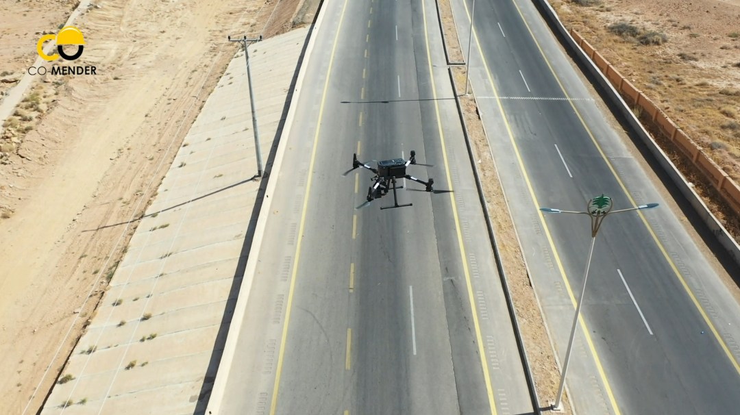
So Eric hopped on a jet, and 17 hours later arrived somewhere decidedly less green than his home base of Vancouver. He took this snap while on the trip:

Saudi Drone Inspection

Getting the drone to fly…


Normally, this is the easy part. You set up the machine, ensure the firmware is updated, do a physical inspection, check that all permissions have been obtained and that it’s generally safe to proceed. (There are other steps, but you get the drift.) Except in this case, there was a problem – even though it was a brand new enterprise drone that had never been flown.

They turned it on, and, well, nothing.

“Their drone was actually region-locked to North America, so there was no way it would turn on in Saudi Arabia. So the first order of business was to figure out how to unlock it. As soon as the drone turned on it was saying ‘I’m in Saudia Arabia, I’m not supposed to be here. I will not turn on.'” (Well, it wasn’t literally saying that, but that was the gist of the message popping up on the controller.)

The clients, of course, were concerned. Their brand-new drone wasn’t working and they had time-sensitive jobs to do. So Eric set to work.

Canada Drone Companies

The path to a solution

After trying everything he could think of related to firmware hacks, Eric contacted InDro’s engineering team and reached out to DJI’s Enterprise side for support. While waiting for some a workaround and not one to waste time, Eric borrowed a DJI Mavic Air 2 from a company hired to create video content about the projects. This allowed for the capture of preliminary photogrammetry of the bridge. Eric also took ground-based DSLR photos from the ground, shooting upward to capture the underside of the bridge.

Drone photos are all geo-referenced, meaning they contain metadata that places the photo in 3-D space at a specific time. But, with rare exceptions, DSLR images do not contain that kind of data. So how would these images be integrated? Well, the photogrammetry software is capable of picking out common features in any kind of imagery, whether aerial or terrestrial. So once it understood what a certain pillar looked like, for example, the software integrated those DSLR photos and a rough 3D digital twin could be created.

But the project required an accurate digital model, which mean that they still needed that M300 to fly. Finally, says Eric, the answer came from DJI support.

“Within two days, we had a solution from DJI to apply for a geo-unlock prior to each flight,” he explains. “It was not ideal, but it allowed us to get the jobs done.”

Several days later, Eric began re-flying the bridge mission, using the M300 to capture the structure from all angles (including from below, with the gimbal tilted upward). There were issues with dust, as the M300 kicked up a fair bit when flying beneath the low bridge. In fact, Eric had to pause the mission from time to time to wipe the lens clean.

M300 Drone

M300 back in action


With the M300 back in action, Eric was able to proceed with the mission with the ultimate goal of producing a complete digital twin of the bridge (a 3D digital reconstruction of the physical site, which is very useful for inspection purposes). Engineers use these digital twins to look at the asset and inspect it from all angles. If they find areas of concern, seeing the high-res images associated with that spot are just a few clicks away. In this case, the firm was attempting to determine whether the bridge should be repaired or replaced.

Then it was on to the next mission.

“The other site was about 50 kilometres southeast of the mountainous town of Al-Bahah. Here, the team was dealing with a dangerous 80-metre high rock cliff adjacent to a recently twinned highway,” explains Eric. “They were quite concerned about the high risk of rock fall activity and needed to engineer mitigative structures to stabilize the slope. In order to proceed, they needed detailed contours so their engineering team could design these structures.”

M300 Drone

If only there was a video…

Words and photos are nice, but sometimes a video can really give you a better sense of the job. Thankfully, Co-Mender pulled one together and has given us permission to share it. You’ll get a glimpse of the work InDro’s Dr. Saczuk carried out:

So, how did it go?


According to Eric, very well. Putting an enterprise drone to work, in conjunction with an excellent ground crew and reliable photogrammetry software, produced impressive results.

“I think ultimately it was quite shocking for the client: To be able to fly the drone for a couple of hours to collect the imagery, and within 24 hours deliver to them accurate contours. That was something they had never had access to before on that short of a timeline and that level of accuracy. To have surveyed that slope manually and generate contours would have taken probably taken two weeks.”


M300 Drone

‘A memorable trip


Eric says he met a really great team at Co-Mender and Gulf Crete (the support company), including one engineer who wanted to soak up as much knowledge as humanly possible during his stay. Eric also really enjoyed experiencing Saudi Arabia for the first time.

“I was quite keen on experiencing the culture – and I’m glad I did. I met incredibly friendly people and saw such diversity – everything from 400-year-old villages to a theme park that was like New York/Vegas.”

Eric also sends a ‘Thank You’ to Ian Wills, the President of Coastal Drone Co. It was Ian who connected the client with InDro Robotics.


InDro’s View


We are pleased with the outcome of this trip – simply because the client was happy. We perhaps don’t advertise these services as much as we should, but InDro has a full team of engineers and expert pilots (both of drones and Uncrewed Ground Vehicles), who are happy to help with solutions and training pretty much anywhere on the planet.

“A lot of foundations at InDro are based on providing unique and specialized training and solutions for clients,” says Eric. “And there have already been discussions on how we now take that to an even greater scale.”

If you have a problem…we’d love to help you solve it. Get in touch here.


The InDro Robotics “InDro Commander” for ground robots

The InDro Robotics “InDro Commander” for ground robots

By Scott Simmie, InDro Robotics


Today, building basic robots isn’t hugely challenging for engineers – though, of course, some robots are a lot more complex than others.

The really tough part is making those robots be useful.  Tasks like navigating, capturing thermal imagery and other data – even identifying and manipulating objects – all require much more than wheels and sensors and end effectors (the robotic equivalent of hands). Regardless of whether the robot is simple or complex, it needs brains.

Those brains consist of both hardware and software, with specific bundles of code that can help with specific tasks. And that’s where the Robot Operating System, or ROS, comes into play. ROS.org is a repository of software packages, purpose-built for specific robotic applications by a global network of collaborators.


via ROS.org

As the organization’s website explains it, ROS “is a collection of tools, libraries, and conventions that aim to simplify the task of creating complex and robust robot behavior across a wide variety of robotic platforms.

“Why? Because creating truly robust, general-purpose robot software is hard. From the robot’s perspective, problems that seem trivial to humans often vary wildly between instances of tasks and environments. Dealing with these variations is so hard that no single individual, laboratory, or institution can hope to do it on their own.”

And so ROS could be thought of as a super helpful toolkit, where collaborators upload and share code they’ve developed – and also download and integrate (or even modify) code others have written in order to make their robot carry out required tasks, including specific ways of communicating with an operator or base station.


ROS is cool, but could it be even cooler?


Some time back, we started to ponder this question. Specifically, what if you could pack some of that software in a box – along with the hardware required to run it? And what if that box could easily be integrated to a ground-based robot (most already use ROS drivers) to get it up and running as seamlessly as possible?

That’s the concept of a new InDro Robotics product called InDro Commander, developed by Engineering Manager Arron Griffiths in conjunction with the InDro Robotics Area X.O team.

Arron had been working with ROS for about five years, so he already had a great understanding of the available software tools. Arron has worked in robotics for more than a decade now (he was also the Senior Application Engineer at Clearpath Robotics prior to joining InDro Robotics). And Unmanned Ground Vehicles, or UGVs, is an area that has really picked up for InDro since we partnered with Chinese robotics leader AgileX. The picture below is of “Scout” – one the company’s UGVs.


AgileX Scout

With a solid understanding of the software and the hardware required to run it, Arron realized there could be tremendous potential for an “all-in-one, bolt-on” solution. Such a device could get an ROS-compatible robot up and running much more quickly, with zero hassle. In a nutshell, that’s the concept behind InDro Commander. Here’s Arron:

“We’ve created a hardware product around the concept of a simple ROS module, which can be utilized on multiple different robot types. We’re also trying to make it platform-agnostic. We actually don’t want to make a robotic platform, we want to make a box that has robotic systems in it, to make other robotic platforms smarter.”

We’ve been using our InDro Commander on the AgileX Scout Mini, a great R&D platform. And, well, it works like a charm. InDro Commander is also compatible with all the AgileX platforms and any other ROS-ready robot platform.

In fact, we’re so proud of this InDro Robotics innovation that we produced this video for the recent ROS World 2021 Virtual Conference. (At that time, we were calling it ROS-IN-A-BOX):


InDro Commander integrates easily


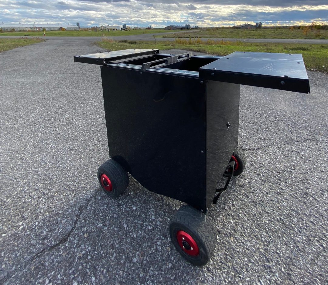
That’s a key piece here. The box contains everything a developer or end-user would need. EDGE computing is done onboard by the NVIDIA Jetson processor, reducing latency and unlocking potential for AI-related tasks like object recognition or change detection. Connectivity is via 4G/5G, and the box can utilize the CAN (Controller Area Network) protocol, Serial or Ethernet. The ruggedized box has its own cooling system and power regulator, and has an Ingress Protection factor of IP55. It’s literally a solution you can bolt onto pretty much any ground-based robot and begin remote teleoperations over 4G or 5G.

And yes, InDro Commander vastly simplifies things.

“It’s just two wires (battery power and communications) people plug in,” says Arron. “The box already has cameras, communications, power regulators – all inside the box. So you’re not fiddling with all of these various peripherals. It’s truly a self-contained ecosystem. Suppliers, OEMs, they don’t have to think – they just have to bolt this box on.”

ROS-IN-A-BOX

InDro Robotics has long been known for its R&D in the drone space, and has garnered multiple industry “firsts” as a result. Now, with the company’s expansion into ground robotics, InDro Commander is a significant breakthrough – not only for InDro, but for others who will immediately see the benefit of this solution.

“We work closely with academia and collaborate with industry partners and end users,” explains InDro Robotics CEO Philip Reece.

“The common question is: ‘How can we integrate this sensor or piece of tech with this robot or system?’ Now we have a simple working answer to this question, as InDro Commander is designed as a Plug and Play all-in-one module and is platform agnostic.” (Providing the platform either has a ROS driver already, or working example (Python/C++) code which Indro can use to develop a custom ROS driver.)

ROS-IN-A-BOX

Reece says the creation of this product is a very different solution, which he anticipates will help many in the Unmanned Ground Vehicle (UGV) space.

“There are many UGV companies, and more start up every day. Ninety-five per cent of them only make custom solutions for their own. hardware. InDro is doing things differently,” he says.

“InDro Commander is an important addition to our technology development, as we are supplying the industry with a number of different ground robots, and they are interacting in many different ways. InDro Commander will build on the benefits of a common operating system such as ROS, by bringing a standard suite of sensors and systems (camera, GPS, IMU, Computers Power distribution, communications, 4/5G) that can all be simply but powerfully integrated onto any flavour of UGV.”

InDro partners with ROCOS

We’re already quite proud of the InDro Commander solution. But we’ve taken things a step further, partnering with ROCOS. The company’s Robot Operations Platform allows an operator to connect, monitor and control robots – whether it’s a single unit or an entire fleet. But that’s not all.

ROCOS was recently acquired by DroneDeploy, one of the world leaders in drone data acquisition, interpretation and photogrammetry. And what does that mean? Well, imagine having data acquired by a ground robot seamlessly integrated with what is captured by air and presented as meaningful data for the end-user. Further picture a desktop, browser-based console where you can program aerial or ground-based missions and monitor a feed as they unfold in real-time.

Force multiplier

Whether the use-case is industrial, agricultural, security – and much more – having eyes in the air, combined with robotic boots on the ground, can only be a force multiplier.

We’ve already seen what InDro Commander can do in our own testing; we can’t wait to see what others do with this solution.

For more information on InDro Commander, contact us here.

InDro Robotics, Rogers make first drone / RPAS flight in Canada using 5G network

InDro Robotics, Rogers make first drone / RPAS flight in Canada using 5G network

InDro Robotics has flown two drone missions utilizing a Rogers 5G network – another important Canadian first. The flights took place at the University of British Columbia (UBC) in April, 2021. 

This milestone demonstrated potential future applications of 5G-enabled autonomous flights in Canada and around the world.

The two UAVs, both manufactured and operated by InDro Robotics, were standard quad models integrated with a 5G transmitter/receiver. The RPAS units used the Rogers 5G network at UBC to perform various tasks during test flights.

InDro flies drone missions over Rogers 5G network

The 5G network was installed by Rogers as part of a three-year, multimillion dollar partnership with UBC. The goal is to build a real-world 5G hub on campus that will be the blueprint for 5G innovation and research in Canada.

Drones generally communicate using standard radio frequencies. These have limited range and data bandwidth. Flying drones over the Rogers 5G network, InDro Robotics can share videos and even dense data with multiple users anywhere on the network at a much faster rate.

Rogers 5G Drone
Rogers 5G Drone

The InDro Robotics mission flying drones over 5G networks

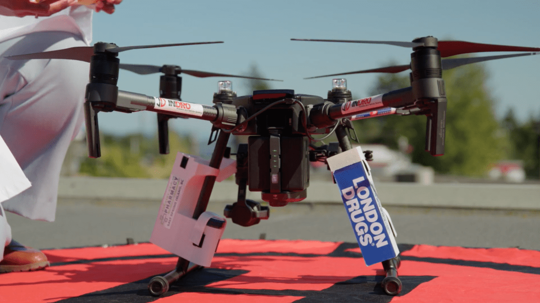
The drone flights, carried out by InDro Robotics over a Rogers 5G network, were highly successful. The drones completed tasks such as picking up and dropping off a box containing first-aid medical supplies from one location to another. 

InDro Robotics President and CEO, Philip Reece, said the ability to fly utilizing a 5G network opens up more opportunities for new uses for UAV technology, such as deployment during natural disasters and critical incidents. The use of 5G allows sharing data with multiple users. More importantly, it enables the operation of UAVs from off-site command centres that could be hundreds or thousands of kilometres away from the mission. 

Two greatly anticipated technologies that have developed over the past years are commercial drones and 5G networks. On their own each have an amazing impact on many industries. Together, they do so much more. We now have drones flying over public and private 5G networks that can collect and send data into the cloud for AI processing and back to offsite command centres with near-zero latency. This enables drones to operate smarter and safer, sharing critical data with those that need it instantly. This helps keep First Responders out of harm’s way, and allows engineers to inspect infrastructure faster and more efficiently. It also helps keep airspace safe, and so much more,” said Reece.

We are proud to be leading the industry in deploying drones over cellular networks in North America.”

InDro Robotics delivers COVID-19 tests by drone in B.C.

InDro Robotics delivers COVID-19 tests by drone in B.C.

Throughout 2020, healthcare providers of Penelakut Island in British Columbia, Canada, were challenged with a very difficult situation. 

Due to the COVID-19 pandemic, a single ferry boat was accessible between the island and the nearest medical lab located in Chemainus on Vancouver Island, putting the timely transport of samples at risk. 

The process of getting the supplies to the lab took hours to complete, and one of the island’s three nurses had to travel with the supplies, making them unavailable to provide health services during the day.

InDro Robotics was tasked by the Island to begin deploying a Unmanned Aerial Vehicles (UAVs), or drone, to expedite the transportation of COVID-19 tests,

To start evaluating this problem, the team at InDro Robotics worked alongside Penelakut Island’s residents in strategizing a plan to fly samples using specialized drones and navigation software. Penelakut Island is currently home to over 1,000 people from the Penelakut First Nations community.

While InDro Robotics had the technology to fly between both islands, connection latency became a key issue during the trials.

Often drones are equipped with satellite connectivity solutions to accommodate the real-time video streaming needed to enable Beyond Visual Line of Sight (BVLOS) operation of UAVs (Unmanned Aerial Vehicles). However, according to Philip Reece, President and CEO of InDro Robotics, satellite is hindered by as much as 7 seconds of latency, which is way too much to provide safe operations for BVLOS.

Transport Canada also requires companies to use technology features that track signal

strength during a UAV’s journey. This meant that any solution chosen by InDro Robotics would need to support such features while integrating their proprietary flight navigation software.

As a solution for the constant high-performance connectivity needed for its drones, InDro Robotics deployed Cradlepoint’s NetCloud Service for Mobile, with the Advanced Plan, and wireless edge routers built for in-vehicle use. NetCloud’s cellular signal monitoring and thermal mapping features would allow InDro Robotics to optimize performance and safety during the drones’ route.

Using Cradlepoint’s NetCloud API, InDro Robotics was able to pull GPS-based cellular health information into the company’s flight navigation systems.

These endpoints also leveraged LTE service, provided by Rogers, instead of satellite connectivity, which carries too much latency for the real-time video streaming necessary on these flights.

The cloud-managed cellular connectivity would ensure that the low-latency video streaming can be essential to successful drone flights, and the map-based performance analytics can still be necessary to optimize flight patterns while meeting Canadian drone regulations.

“Using an enterprise-grade router on our drones allows us to stream video well from two on-board cameras along with full command and control, which is essential as we continue to expand our UAV products and services,” said Reece.

InDro Robotics also used NetCloud’s GeoView suite of location-based features forregulatory requirements. This was used to save time and money during the project, as InDro Robotics was able to track cellular health analytics and identify “dead zones” on a heat map during several test flights in various weather conditions on various routes. This lead to evidence-based decisions about the best possible flight paths to and from the island for its UAVs.


Fortunately for residents of Penelakut Island, these LTE enabled drones can mean medical supplies and COVID-19 tests will be swiftly transported in a shorter time-frame. This also meant that local medical professionals could offer more time to serve their patients on the island.


END NOTES


InDro Robotics is a leader in drones, or  Unmanned Aerial Vehicles (UAVs), as well as the first North American company to develop beyond visual line of site (BVLOS) technology with regulatory approval for emergency and first responder missions. InDro Robotics has accumulated thousands of flight hours and has collaborated with leading agencies such as Transport Canada, Canadian Space Agency, and NASA.