First Responders find drones invaluable tools

First Responders find drones invaluable tools

By Scott Simmie

It’s no secret that drones have become an essential tool for many First Responders.

Emergency services frequently use these devices to obtain situational awareness – also known as “The Big Picture.” Police departments deploy them to search for missing people, locate suspects, monitor protests and collect images following serious collisions in order to clear the scene more quickly. Fire departments use them to monitor fires, detect hot spots, hazardous spills and more. And paramedics? Well, they’re using them too.

In fact, paramedics in Ontario used a drone – as first reported in this story – to assist during a Search and Rescue operation on a cold winter’s night early in 2022. Specifically, it was members of the Hastings Quinte Paramedic Services based in Belleville, Ontario.

Not surprisingly, that got us interested. And so we contacted Mike Slatter, Deputy Chief of Quality and Development, to find out more. As it turns out, we’d seen Deputy Chief Slatter make a presentation about drones back in 2019 in Ottawa at the annual national convention of Unmanned Systems Canada (now the Aerial Evolution Association of Canada).

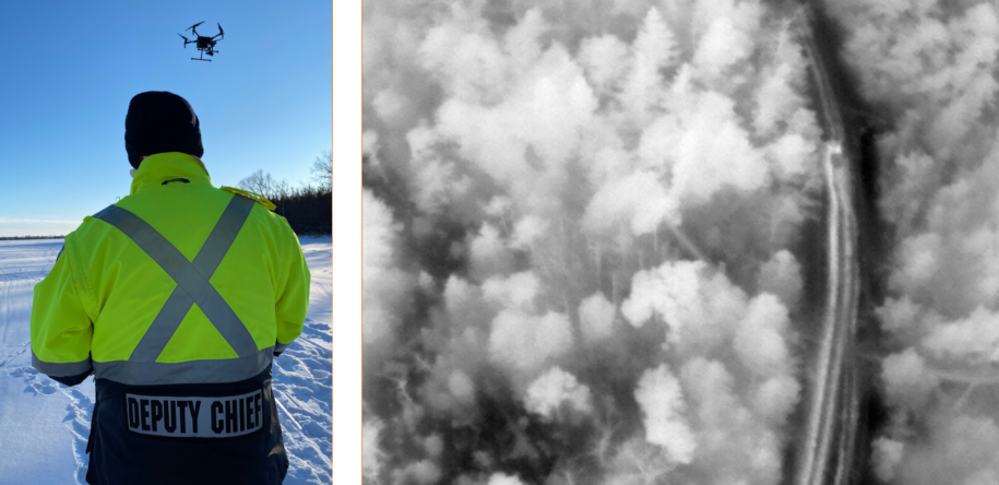
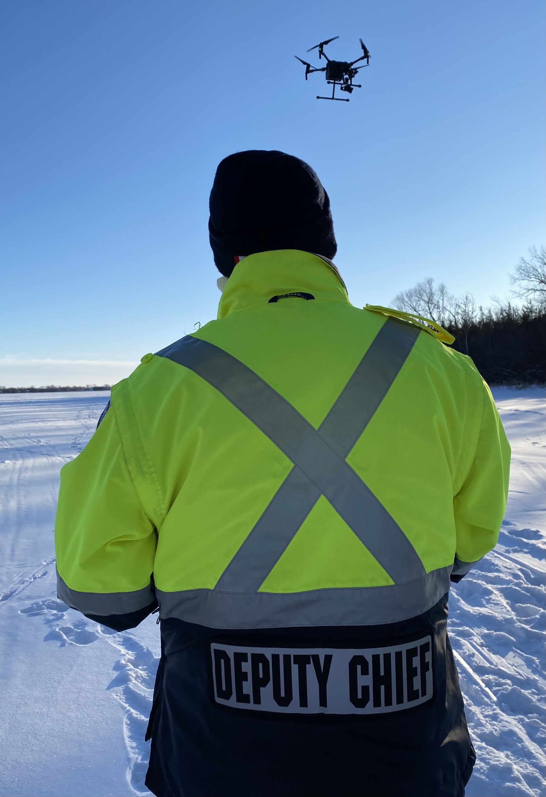
We were really eager to learn more about how his team came to use drones. And, more specifically, how it uses them in some of its day-to-day operations. We found what Mike Slatter had to say fascinating – and believe you will, as well. FYI, that’s Deputy Chief Slatter in the image below, bringing in a drone for landing.

First Responder Drones

Paramedics do more than you might realize…


We started this off with a simple question. What do paramedics do?

Deputy Chief Slatter explained that in the case of Hastings Quinte Paramedic Services, there’s much more to the job than car crashes or calls to homes and businesses. Its rural catchment area means hunting accidents or injuries on farms crop up. The paramedics also assist local fire departments, sometimes offering medical assistance to firefighters who have just emerged from the heat and smoke of an active fire.

What’s more, Canadian Forces Base Trenton is nearby, and the service responds to calls there. Slatter’s team has also worked with members of the CFB Trenton Search and Rescue team, and sometimes receives occasional calls from CFB Mountain View, an airfield which also has a parachute jumping site.

That’s not all. Come summer, the area fills up with vacationers. There are boating accidents, drownings, injuries on the beach and more. So the workload involves a lot more than car accidents.

Drones enter the picture


With the help of a federal program, the paramedic service got into the drone world in 2018. Members of the service first did online training through InDro Robotics, followed by in-person flight instruction with InDro staff.

“I was fully impressed,” says Slatter. “Philip’s team was very professional; I thought it was very reassuring that Philip is so connected on the cutting edge of what’s going on with drones and safety. The experience was invaluable.”

Since then, the Service has deployed its DJI Matrice 210 and Mavic Pro Enterprise on a variety of missions, including Search and Rescue, house fires (using FLIR thermal imaging to detect hotspots), and even at a high school lockdown for situational awareness.

But not every drone mission is a dramatic, slam-dunk with a high-profile rescue. The real utility, says Slatter, is the ability to provide First Responders with that ‘big picture’ situational awareness.

“It gives you such a different perspective as to what’s going on,” he says. “The field of vision during the day is just amazing, and the camera technology is quite useful for zooming in and looking at things more closely to determine what’s happening.”

Let’s zoom in ourselves, and take a closer look at two recent incidents involving Hastings Quinte Paramedic Services.

First Responder Drones

Friday, January 28


Someone calls 9-1-1. They think they hear someone out on the ice at the Bay of Quinte calling for help.

It was still daytime, but the ice had a thick covering of snow – which would have made searching on foot a slow and laborious task. There was also a lot of ground to potentially cover, dotted with the occasional ice fishing hut. To give you a sense of scale, most of those huts were at least two kilometres from the shore.

“The Fire Department was there with their iceboat and team,” says Slatter. “The area we were looking at probably had a radius of five kilometres.”

With excellent visibility and a drone remote control monitor designed for high visibility even on sunny days, Slatter and his colleagues could monitor a live high-resolution video feed from the drone. With a background of snow and ice, it was relatively easy to scan fairly large areas as the drone flew overhead.

Scenarios like this make the drone what’s often termed a “force multiplier” – meaning the information it was gathering was greater than a single person could have acquired on their own. It also meant the Fire Department could pull its team back from the ice to wait on shore. There was no point in slogging on foot for kilometres when the drone could do the job.

Did it find someone? No. But it also revealed that no one appeared to be in distress in the reported area. That information was valuable for all the First Responders: Resources would not be expended where they were not required.

“Essentially nobody had to go out on the ice and it saved a lot of time – taking it from being an operation that would have taken several hours to about an hour or an hour and half,” says Slatter. “We were also able to cover areas along the shore that would have been difficult to get to, as well.”

Monday, January 31


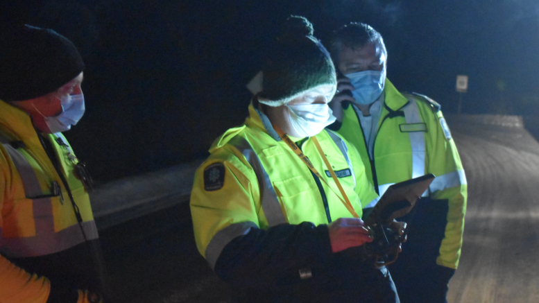
Another emergency call, this time as dusk was approaching. A person who had been searching for a runaway dog had become lost in the Sandbanks Provincial Park. The Ontario Provincial Police also received the call, and asked the paramedics if they could bring their drone. The OPP, as it turns out, had limited resources due to the protests in Ottawa. Because of that, an OPP helicopter that might normally have been put to use was unavailable.

The OPP dispatched search teams on an All-Terrain Vehicle, and suggested a location where the drone might be most helpful. The paramedics launched their Matrice into the dark sky.

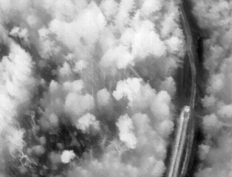
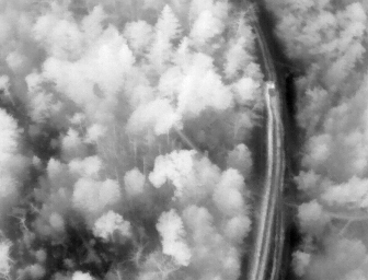
The drone’s FLIR thermal sensor is designed to detect differing levels of heat on the ground: The brighter the image, the warmer the object.

Thermal cameras are incredibly useful for finding missing persons at night, when the ground is cooler than during the daytime. A human being will display a relatively bright heat signature that contrasts the ground. In this case, you can see a paramedic ATV that seats two, also known as a Side-by-Side. Slatter scanned the area, searching for a bright spot that might indicate a person.

Emergency Response Drones

The drone was flown back for a battery swap, and then it was returned to the air. An OPP K9 unit had discovered some tracks that matched the description of the boots of the missing person. They were fresh. The OPP and paramedics, each in their own ATVs, began following those tracks toward a beach area. Slatterly returned the drone to the sky and began following the searchers while monitoring a much wider area from above.

“There are lakes on two sides of the area we were in,” says Slatter. “Because there are sand dunes, with the ice buildup there’s a lot of crevices along the shoreline. So the main concern was that the person had fallen or laid down due to being tired. By being up in the sky we could see a greater view than just a single person on the ground.”

Drone Detection

As the second set of batteries became exhausted and paramedics were returning the drone, word came in: The missing person had been located elsewhere.

‘Hey’ – you might think. ‘The drone didn’t find them.’ No, it didn’t – because they weren’t in the search area. But that is *precisely* the point in this case. The drone provided accurate intelligence that the missing person was not in a location being searched.

And that is absolutely valuable information that assisted First Responders.


“(It was) Very useful,” says Slatter. “We were able to cover a larger area and  eliminate areas where we felt the person wasn’t.”

And so, in these recent two examples – both occuring within a week – paramedics dispatched drones. These cases might not grab headlines in the way a dramatic rescue might, but the drone provided valuable data. What’s more, these examples are highly illustrative of just how much a part of the daily First Responder toolkit drones are becoming.


What’s next?


Drones are clearly now part of the workflow, when required. There’s also no question that the technology continues to advance. InDro Robotics, for example, has conducted numerous trials using drones to transport Automated External Defibrillators, transporting them to the scene of a simulated cardiac arrest. Drones tend to get there significantly faster than a paramedic vehicle. InDro has also delivered critical pharmaceutical supplies, such as an EpiPen (used to treat severe allergic reactions that can prove fatal) or Narcan (Naloxone HCI nasal spray), used for opioid overdoses.

You can see an example of this kind of work here:

And the future?


With successful trials of AED deliveries and pharmaceuticals delivered Beyond Visual Line of Sight, it’s not a huge leap to envision a future where such flights are routine. Where, for example, a 9-1-1 call for cardiac arrest might simultaneously dispatch an autonomous or remotely piloted drone to the site of the call. Or where an Epipen reaches someone in respiratory distress within minutes.

It’s a future Deputy Chief Mike Slatter believes could well be on the horizon as an important tool for First Responders.

“I think we are definitely on the cusp of that happening,” he says – adding that the Hastings Quinte Paramedic Services has purchased its own small AED for its drone.

“I think the potential for a small First Aid Kit or Narcan (delivered by drone), especially in the rural areas like we have here, definitely would have benefits… I think getting that device to a person even a couple of minutes ahead of a responding ambulance or First Responder could make a difference for a person.”

Slatter also has some final words about InDro’s training.

“It was very reassuring that (CEO) Philip (Reece) is so connected on the cutting edge of what’s going on with drones and safety,” he says. “You see a lot of different companies out there advertising drone training. And it calls into question: What is the standard for a training service? And I think that’s where InDro has set the benchmark. Our program really has credibility because of the training that we did with InDro.”

InDro’s Take


InDro Robotics has both deep respect for and a proud tradition of working with First Responders. We’ve helped train and outfit paramedics, RCMP and others across Canada, building solid relationships along the way. Drones have become an indispensable tool for Emergency Services, aiding in rapid decision-making, keeping First Responders out of harm’s way – and even saving lives. With advances in drone technology and ground robotics, we’re confident these devices will become an even more essential part of their toolkit in the future.

If you are a First Responder looking to gain drone skills or upgrade the skills of your team, there are a couple of InDro options. You can gain the knowledge required for your Basic or Advanced Remotely Piloted Aircraft Certificate online through an InDro course here. We also provide in-person instruction, anywhere in the world. Please get in touch.

CONTACT

INDRO ROBOTICS
305, 31 Bastion Square,
Victoria, BC, V8W 1J1

P: 1-844-GOINDRO
(1-844-464-6376)

E: Info@InDroRobotics.com

copyright 2021 © InDro Robotics all rights reserved

Summerland Cherries

Summerland Cherries

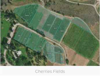
The test field chosen for this study is the Summerland Research and Development Centre (SuRDC). The site is located on the western shore of Okanagan Lake, south of Summerland urban center and bounded on the North and West by Trout Creek.

The case study itself will be carried out by performing two identical flights during each visit to the site.

The first flight will be flown when diurnal solar loading results in large temperature differentials between soil, fruit and ambient air – typically early to mid-morning prior to the surrounding soil normalizing to ambient temperature. A thermal infrared (TIR) camera will acquire data during the first flight, which will specifically target data on crop temperature.

A second flight will be flown relatively close to solar noon if possible (in order to minimize the effects of shadow) using a multispectral MicaSense sensor (green, red, red edge, near infrared) in order to collect visual and near infrared wavelengths that will be used to construct the vegetation indices for the project.

Pitt Meadows Blueberries

Pitt Meadows Blueberries

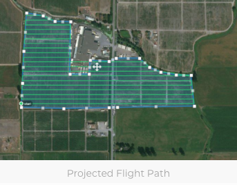
The test field chosen for this study is Purewal Blueberry farms, located about 8km west of Coquitlam.

The case study itself will be carried out by performing two identical flights during each visit to the site.

The first flight will be flown when diurnal solar loading results in large temperature differentials between soil, fruit and ambient air – typically early to mid-morning prior to the surrounding soil normalizing to ambient temperature. A thermal infrared (TIR) camera will acquire data during the first flight, which will specifically target data on crop temperature.

A second flight will be flown relatively close to solar noon if possible (in order to minimize the effects of shadow) using a multispectral MicaSense sensor (green, red, red edge, near infrared) in order to collect visual and near infrared wavelengths that will be used to construct the vegetation indices for the project.

Identification of Swimmers in Distress ….

Identification of Swimmers in Distress ….

at the Mont-Tremblant IRONMAN Triathlon

Department of Emergency Medicine, McGill University, Montreal, Quebec, Canada; bCounty of

Renfrew Paramedic Service, Pembroke, Ontario, Canada;

Funding: This work was supported by the Chaire de recherche en médecine d’urgence, InDro

Robotics, County of Renfrew Paramedic Service, and Groupe Conseil Promutech.

Abstract

Background: This preliminary report describes our experience using unmanned aerial vehicles

(UAVs) to identify swimmers in distress at the 2018 Mont-Tremblant IRONMAN triathlon

(Quebec, Canada).

Methods: In a prospective pilot study, we sought to determine whether UAV surveillance could identify swimmers showing signs of distress quicker than conventional methods (i.e., lifeguards

on the ground and on watercraft). In addition, we investigated the feasibility of using UAVs for medical surveillance at a triathlon event in terms of operations, costs, safety, legal parameters

and added value. Prior to the race, we screened participants for medical conditions that could elevate their risk of injury during the swim portion of the triathlon. Athletes deemed to be at

increased risk were given a yellow swimming cap to enhance their surveillance by trained observers watching a live video feed from the UAVs.

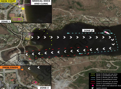
Results: On race day, a total of 3 UAVs (2 mobile, 1 tethered) were launched over Lake Tremblant and provided 3 observers with live video of the swimmers. Of the 2473 race

participants, there were 25 athletes with pre-identified medical conditions who wore a yellow cap during the swim. We did not detect any signs of distress among swimmers wearing yellow caps.

Among the remaining 2448 athletes, there were 5 swimmers who demonstrated signs of distress and required mobilization of water rescue boats; UAV surveillance identified 1 of these 5 distress events before it was seen by lifeguards on rescue boats. None of the athletes in the IRONMAN suffered an adverse event while swimming. Several technical and safety issues related to UAV surveillance arose including poor visibility, equipment loss, and flight autonomy.

Conclusion: While our preliminary findings suggest that using UAVs to identify distressed swimmers during an IRONMAN race is feasible and safe, more research is necessary to

determine how to optimize UAV surveillance at mass sporting events and integrate this

technology within the existing emergency response teams.