Ottawa International Airport, InDro, provide drone detection during Biden visit

Ottawa International Airport, InDro, provide drone detection during Biden visit

By Scott Simmie


A drone detection system described as “probably the best at any airport in the country” played a role in ensuring the safety of Air Force One during Joe Biden’s first visit as US President to Canada.

InDro Robotics is one of the key technology partners, supplying drone detection hardware and software for the Ottawa International Airport (YOW) Drone Detection Pilot Project. It detects drone flights both near YOW and much further afield.

In advance of President Biden’s visit, The US Secret Service, as well as an advance team from Air Force One, visited YOW as part of advance preparations.

The teams wanted to be briefed on airport security, including security measures for the skies and the airport grounds. That included learning about the capabilities of YOW’s Drone Detection Pilot Project – which has been accurately detecting drones at the airport and beyond for years. The program has gained significant media attention – including a cover story for WINGS magazine in 2022:

Drone detection

DRONE DETECTION


When the Secret Service and those involved with Air Force One visited YOW on an advance reconnaissance trip, one of the first questions asked was about drones.

“They asked do we have a drone detection capability – and we were quite proud to tell them that we have probably the best at any airport in the country,” says Michael Beaudette, VP of Security, Emergency Management and Customer Transportation at YOW.

“It provides us with situational awareness not only of the immediate area, but throughout the National Capital Region up to almost 40 kilometres.”

Certain areas of Ottawa’s downtown core are designated restricted airspace because of the House of Commons, Embassies and other sensitive locations.

“During his (Biden’s) visit we paid particular attention to anything flying near the Ottawa airport or downtown,” says Beaudette. “Law enforcement are aware of the capabilities we have. It’s a good partnership and we were happy to be able to give something back to the police and intelligence services.”


THE INDRO CONNECTION

InDro provides core technology for the drone detection system. Other technology partners include Accipiter Radar, Aerial Armor and Skycope – a Canadian firm whose tech includes a database of unique RF signatures emitted by multiple brands of drones. NAV Canada is part of the project, and Transport Canada is kept in the loop on the data generated by the operation.

The effectiveness of the system was proven during the massive convoy protest in downtown Ottawa early in 2022. It detected multiple flights of drones in restricted airspace where UAVs are not permitted to fly. Those detections were covered by the Ottawa Citizen.

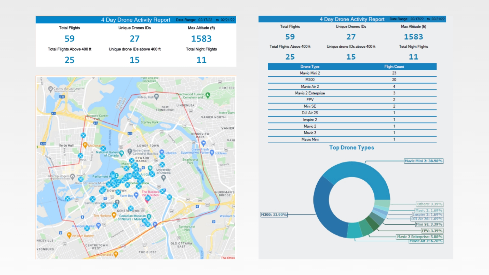
Below: Some of the data captured during the 2022 convoy protest in Ottawa. A wealth of data on illegal drone flights was captured:

Drone Detection

ONGOING DETECTION


The system runs 24/7, and is capable of triggering an alert whenever a drone intrusion is detected. In mid-March, 2023, a week prior to the US President’s visit, the system indicated an attempted drone intrusion on airport property.

“The alarms went off and they were tracking it – but because of the geofence around the airport, the pilot couldn’t get control of the drone and put it back down again and departed airport property,” says Beaudette.

“That one’s in our investigations right now. Anything that happens a week out from the visit we look at it very closely. Is it someone doing a rehearsal to detect weak points? Is it a plane enthusiast having a look? Someone who bought a new drone at Costco and decided to try it out? While it’s a little more challenging because the individual left, we did get a license plate and we’re now just connecting the dots.”


A SIGNIFICANT INTRUSION


That’s not the only recent intrusion. In December of 2022, there was a much more serious incident.

A pilot popped up a drone directly in the vicinity of YOW runways, flying within a couple of hundred feet of where planes were landing. It was also a larger drone, which would have almost certainly caused damage were there a collision with crewed aircraft.

The system was capable of not only detecting the drone, but pinpointing the location of the pilot. Law enforcement was immediately dispatched, and the pilot was caught in the act.

Wary of recent global incidents, authorities at YOW kept a very close watch during the US Presidential visit:

“We’ve seen a lot of incidents where drones can pose a significant threat, and certainly the war in Ukraine has advanced the offensive nature of drone use considerably,” says Beaudette. “There’s also recent footage of drone infiltration into Russian military installations where they were able to land a drone on top of an aircraft undetected. So you really have to have the capability to detect and respond to those threats.”

While the system does not have mitigation capabilities at this point (jamming RF frequencies is very complex under Canadian regulations except in extraordinary circumstances), the system is highly capable of real-time drone detection and identification, as well as pinpointing the position of the operator.

Below: Michael Beaudette, VP of Security, Emergency Management and Customer Transportation at the Ottawa International Airport, during an interview with Scott Simmie


Drone Detection

EYES ON THE SKY

The system did detect some drone activity in the National Capital Region during President Biden’s visit, but nothing that was deemed to pose a threat.

Below: President Biden meets with Canadian Prime Minister Justin Trudeau March 23, 2023. Image via Prime Minister Trudeau’s Twitter account:

President Biden

MISSION ACCOMPLISHED

President Biden, along with his aides and a media contingent, departed YOW the evening of March 24.

No drone flights were detected at the Ottawa International Airport during the visit.

“There’s been nothing that looks like it’s targeting the airport or wanting to get a look at Air Force One,” said Beaudette at the close of the Presidential trip.

Below: File photo of US President Joe Biden boarding Air Force One.

President Joe Biden

INDRO’S TAKE

InDro was, obviously, pleased there were no drone incursions at YOW during the visit by the US President. But it’s nice to know there was a system in place that could have detected any drone flights during this important visit.

“The Drone Detection Pilot Project has proven its worth since its inception,” says InDro Robotics CEO Philip Reece. “Getting no detections and being assured there’s no potential threat is just as valuable as identifying incursions – especially during a high-security event such as this.

“We’re proud of this ongoing project and our partnership with YOW, NAV Canada, and our technology partners Accipiter, Aerial Armor and Skycope. We believe this has proven to be an effective model, and one that could be deployed with confidence at other major airports or sensitive facilities.”

Reports are generated on a monthly basis by the YOW drone detection system; we’ll be sure to update you when news warrants. And speaking of that, we issued a news release on this as well. You can download it here.

CONTACT

INDRO ROBOTICS
305, 31 Bastion Square,
Victoria, BC, V8W 1J1

P: 1-844-GOINDRO
(1-844-464-6376)

E: Info@InDroRobotics.com

copyright 2022 © InDro Robotics all rights reserved

CONTACT

INDRO ROBOTICS
305, 31 Bastion Square,
Victoria, BC, V8W 1J1

P: 1-844-GOINDRO
(1-844-464-6376)

E: Info@InDroRobotics.com

copyright 2022 © InDro Robotics all rights reserved

Indro Robotics provides live drone video feed at Montreal Marathon in pilot medical project

Indro Robotics provides live drone video feed at Montreal Marathon in pilot medical project

By Scott Simmie


The Montreal Marathon, 2022 edition, was held over the weekend. The main event, the signature 42-kilometre run, took place early Sunday. And three InDro Robotics engineers were there.

They weren’t running, but were instead providing a live feed from drones. Those live feeds were being monitored on large video monitors by dedicated research assistants. They were assessing the quality of the feeds and their usefulness in detecting runners who might be in need of medical assistance.

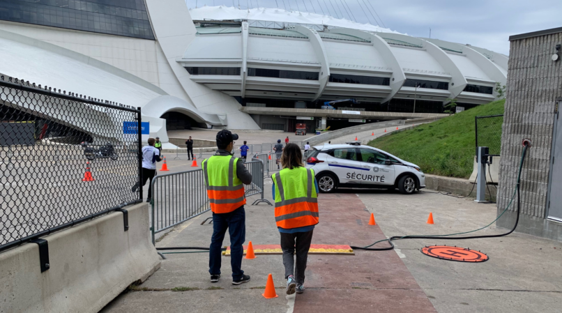
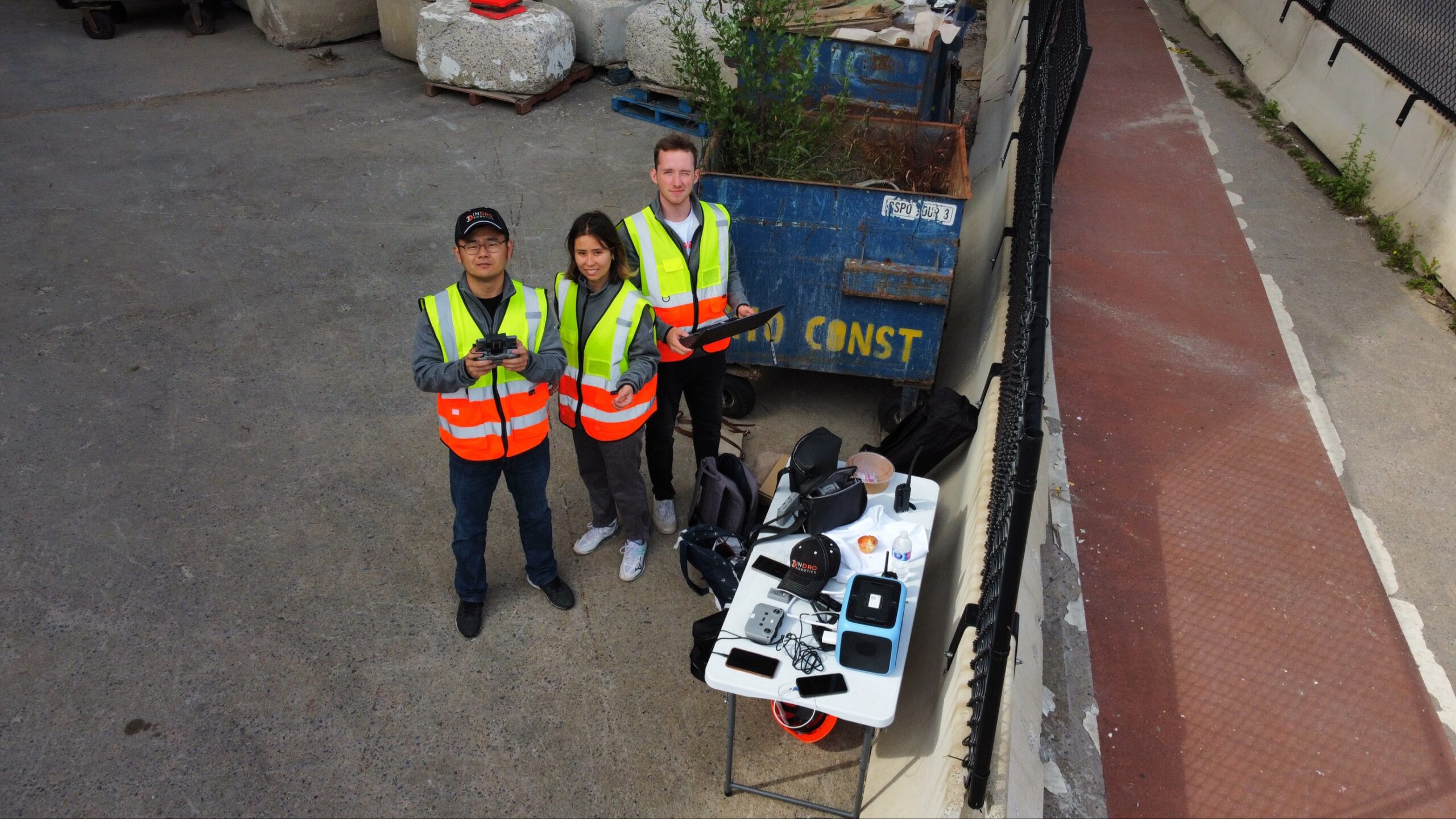
Below: Team InDro, wearing safety vests, with Montreal Marathon runners on the right

Montreal Marathon

Research project


InDro became involved with this through Dr. Valérie Homier, an Emergency Physician at McGill University Health Centre. She has long had an interest in how drones can be used in the health care sector, and has collaborated with InDro on two previous research projects.

One of those projects evaluated whether drones or ground delivery could transport simulated blood products more efficiently to a trauma facility – the Montreal General Hospital. Drones were faster.

The second project studied whether drones could help identify swimmers in distress at an IRONMAN event in Mont-Tremblant. You can find that research here.

With the Montreal Marathon coming up, Dr. Homier knew there would likely be medical events. There generally are.

“In these long-distance sporting events there are usually some significant injuries, including cardiac events and heat strokes,” she says.

These tend to be more likely in the later phases of events like marathons, after the athlete has already been under stress for an extended time. The thinking was that perhaps drones could be a useful tool.

Dr. Homier was particularly interested in whether two drones in the air, covering two critical segments toward the end of the marathon, could provide useful data. Specifically, would the live video feed be consistent enough in quality and resolution to be a useful tool?

This pilot aimed to find out.

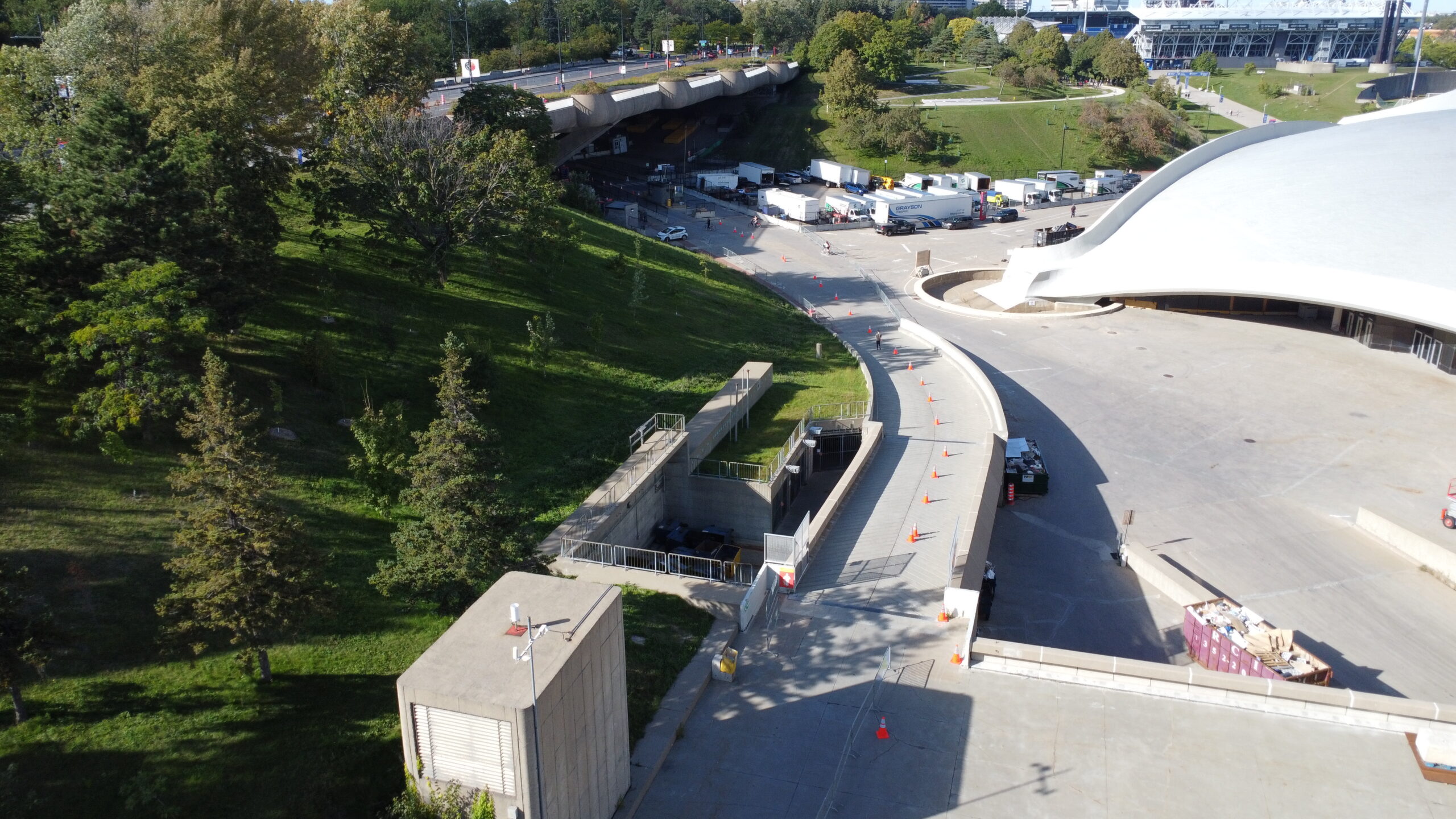
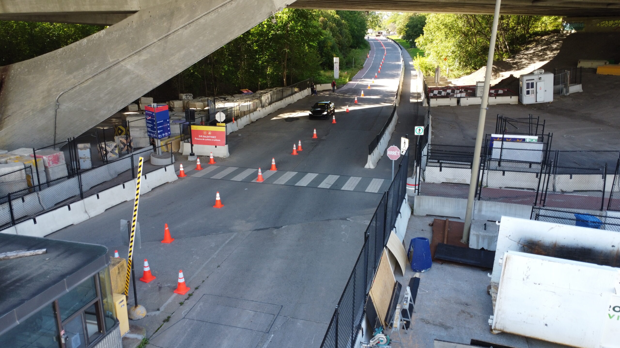
Below: An uphill segment near the Montreal Marathon finish line. This is was the target area for one of the Indro Robotics drones 


Montreal Marathon

InDro’s role


There was a lot of planning required for the mission to ensure the drones could provide continuous coverage and be safe for flying in an area with so many people. Project Manager Irina Saczuk (who happens to also be an RN) worked closely with Dr. Homier to help figure out the nuts and bolts of the InDro side of things.

InDro assigned three employees from the Area X.O facility to the project: Software developers Ella Hayashi and Kaiwen Xu, along with mechatronics specialist Liam Dwyer. All three hold Advanced RPAS certificates and took part in planning meetings to understand the mission and their roles. They also looked into optimising the drones’ video feeds to ensure the best quality would reach those monitoring remotely on large screens.

“At big-scale events such as this marathon, lots of people could go down with injuries,” says InDro’s Ella Hayashi. “But it can be hard to get timely support because roads are blocked. So drones have the potential to really help with sharing the precise location and other information when a person may need help.”

Worth noting here: The InDro engineers/pilots were not to be actively ‘looking’ for people in medical distress. Their role was simply to pilot the drones at the assigned locations and maintain a video feed that offered those watching the large-screen monitors with good situational awareness. In the event of an emergency, the pilots were to follow instructions, including moving in closer to a runner in distress.


Sub-250 grams


The team took four DJI Mini 2 drones to Montreal. Though InDro has a fleet of much larger and sophisticated drones the company has built, these consumer drones were perfect for the job. That’s because the Mini 2 is a sub-250 gram drone that can be flown near and over people. In the exceedingly rare event of a failure, the small device is unlikely to cause any substantial injury to someone on the ground. They’re also capable of very good video quality.

The team also used a third-party app – Airdata – to carry the video streams. The app created secure links for each drone’s feed that could be shared with those who would be monitoring the feed. Three drones were to be used in rotation so that two drones were always in the air providing live video at any given time. A fourth drone was onsite for backup.

“We modified the parameters and were streaming in 720p,” explains Dwyer. “We selected a lower resolution because on the bigger screen it didn’t have to be crystal clear but it needed to be smooth.”

There was, initially, some concern over whether the local LTE network would be able to handle the feed due to the large number of people using cellphones to capture and stream from the finish line.

“The night before the mission, a medical person told us there were going to be 20,000 people around the stadium,” says Xu. “We were worried about network connectivity, it was possible that our video streaming would not work. But actually the network was pretty good that day.”

Below is a drone selfie of the InDro team: From left to right, Kaiwen Xu, Ella Hayashi, Liam Dwyer


Live Drone Video Feed

A useful exercise


Remember: This was simply a pilot project to determine if drones could provide a clean video stream that might be useful. The pilots were to focus on hovering the drones in two specific adjacent locations, with some overlap in their video to ensure they were not missing a spot of this critical part of the marathon.

“Our job was 100 per cent flying the drones,” says Dwyer. “Just straightforward, wide-angle shots with all runners in the field of view.”

We should mention here that InDro also took part in a simulated cardiac event prior to the marathon reaching this area. A medical dummy was placed in a location and one of the drone pilots was instructed to get closer for a better look. A small electric vehicle – think a large golf cart adapted for First Responder use – was dispatched. Chest compressions were performed on the dummy, which was then loaded into the vehicle. A drone followed as the vehicle drove to a nearby stadium and the victim was transported inside to the treatment area. The feed gave others on the Medi-Drone team an opportunity to see, in real-time, the progress of the patient’s arrival.

“The drone response really gave them an active timeline of when they should expect to receive this patient,” says Dwyer.

So the drones proved useful during a simulation. But how would they perform with runners during the actual marathon?

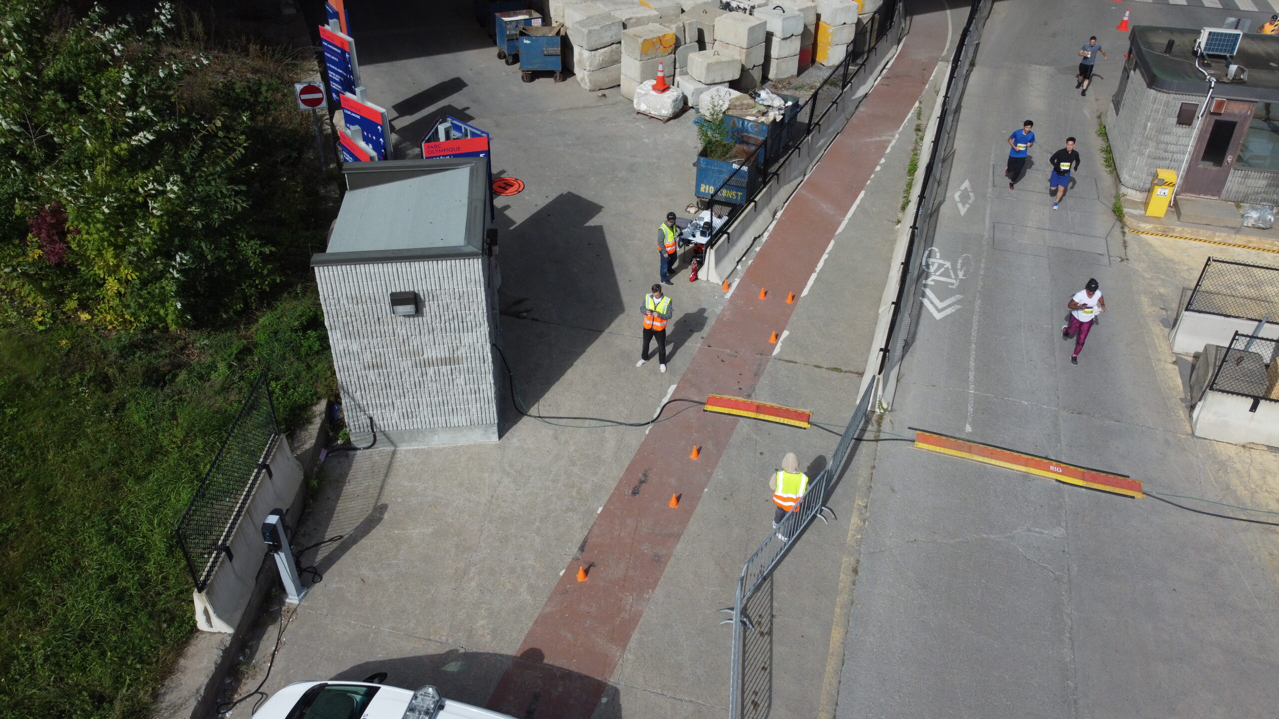
Below: The downhill segment monitored by InDro Robotics

Montreal Marathon Drone Video

From simulation to real-world


As the lead runners came in, the field wasn’t crowded. But, of course, it would become more congested.

When athletes are moving together en masse like this, Dr. Homier says there’s a certain flow that can be observed from the drone. Because that flow is consistent and smooth, a runner in distress literally pops up as looking out of place.

And it happened. Those watching the live feed spotted someone who appeared to be in distress. They had stopped, were hanging on to a railing on the side of the course. Then they fell over the railing, dropping to the grass. A drone pilot was asked to move in for a closer look. It was clear this runner needed help.

In fact, while the pilots were intended to simply hover their drones, Dr. Homier had anticipated such a scenario, and built it into the protocol for the pilot project. Suddenly, an InDro pilot had become part of a First Responder team, providing much-needed situational awareness.

“It was embedded in the research protocol, that eyes on the event becomes what is required,” she explains. “It was called into dispatch and pilots were able to provide eyes on the incident. That was amazing; dispatch came down after and brought us a radio.”


Lessons learned


For Dr. Homier, there’s still work ahead and a lot of data to be analyzed.

“There’s a lot to learn from this project, and there’s a way forward for multiple surveillance methods,” she says.  “And the drones are way up there. The view from above when monitoring moving crowds is just incomparable.”

Plus, says Dr. Homier, the project sparked a tremendous amount of interest from other healthcare professionals on site.

“The interest was incredible, coming from the drone pilots, the students, the medical directors, the medical staff – they all thought it was so cool,” she says.

“We’re talking about 250 people involved in the medical team. Many came to see the viewing station, so in terms of letting people know about this new use of the technology – that was also a great success.”

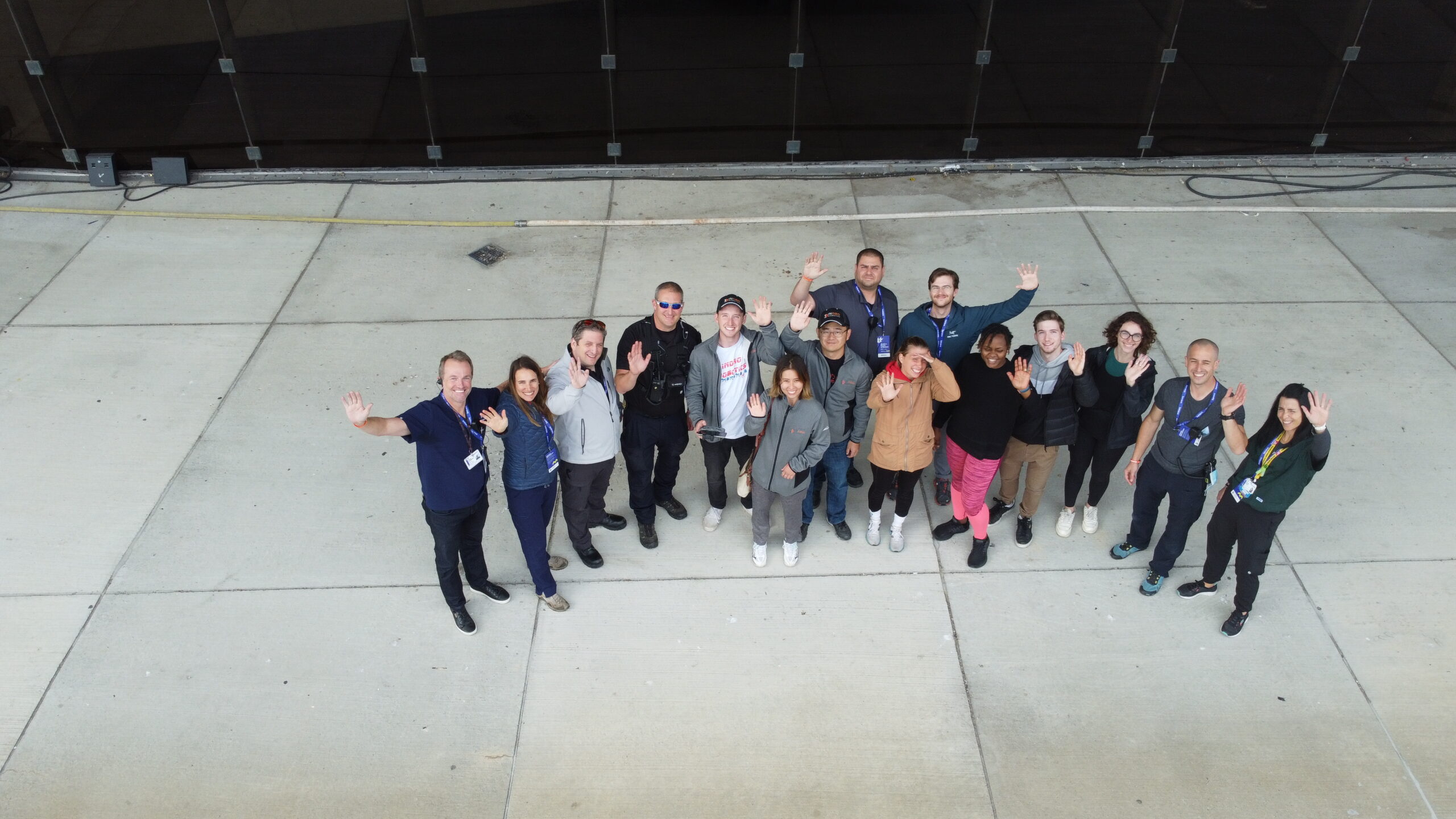
Below: Mission accomplished! Team InDro is joined by key members of the marathon’s medical response team for this post-race drone selfie

Montreal Marathon

InDro’s take


We’re proud to be involved with this project – just as we’re proud to have collaborated previously with Dr. Valérie Homier on other research projects involving drones. In fact, we find this kind of research particularly meaningful.

“For us, using drones for good is much more than a catchy hashtag,” says InDro Robotics CEO Philip Reece. “Aerial and ground robots can perform so many useful tasks. We’ve helped securely deliver prescriptions to remote locations, COVID test supplies, and more. But playing a role in helping to ensure that someone in medical distress receives timely assistance is up near the top of the list. We look forward to the next project with Dr. Homier.”

And nice job, Ella, Kaiwen and Liam.

PS: We’ve issued a news release about this project. You can read it here.


Methane detection via drone with Aerometrix

Methane detection via drone with Aerometrix

By Scott Simmie


There’s no denying climate change. Whether it’s the recent and devastating floods in Pakistan, fires in Portugal – or the multiple rivers globally that have dropped to historically low levels – the planet’s equilibrium has been changing.

While carbon dioxide emissions get much of the press, methane is one of the most potent contributors to the problem of greenhouse gases.

“Methane has more than 80 times the warming power of carbon dioxide over the first 20 years after it reaches the atmosphere,” states the Environmental Defense Fund.

“Even though CO2 has a longer-lasting effect, methane sets the pace for warming in the near term.”

That’s a key reason why the detection of methane emissions has become a priority. It’s also a large part of why Aerometrix – a company specialising in methane detection using drones – was formed.

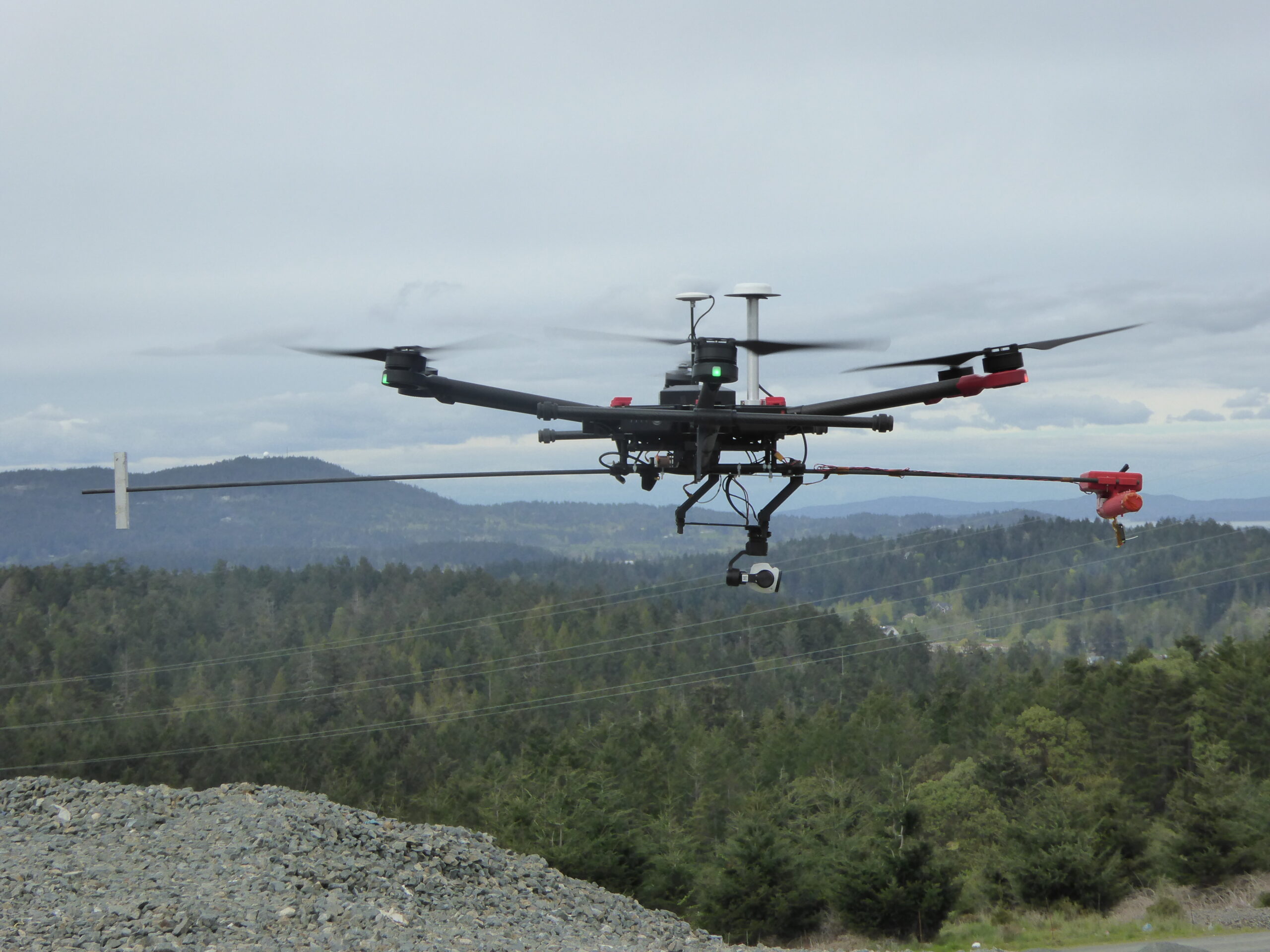
Below: One of the early Aerometrix rigs for methane detection. The sensor is at the forward end of the counter-weighted rod to keep it clear of prop wash.

Aerometrix

Aerometrix


Before we get more into what Aerometrix does (and how it does it), we should point out there’s an InDro Robotics connection here. InDro CEO Philip Reece, along with Michael Whiticar, founded the company. Aerial operations for Aerometrix are carried out by InDro Robotics.

“We felt there was a void in the marketplace for the detection of methane and other gases,” explains Reece. “We also wanted to approach this from an engineering-first perspective, ensuring that we were using, and even developing, the best available sensors and workflow.”

Aerometrix uses two different types of sensors for methane detection. The first is the proprietary GasMap sensor, which is capable of detecting methane in parts per billion (ppb). This laser-based sensor had its origins at NASA’s Jet Propulsion Laboratory, where it was developed for Mars missions. Aerometrix has further refined that sensor and has used it to accurately map methane emissions at petrochemical plants, gas wells, landfills – and even on agricultural sites. (Animals, particularly cows, are a significant methane source.)

“GasMap uses laser spectroscopy,” explains Peter Sherk, an electronics engineer with Aerometrix. “It uses the absorption of lasers by methane to detect concentration. And it’s very precise – detecting not only its presence, but how much there is at a given point in time and space right down to parts per billion.”

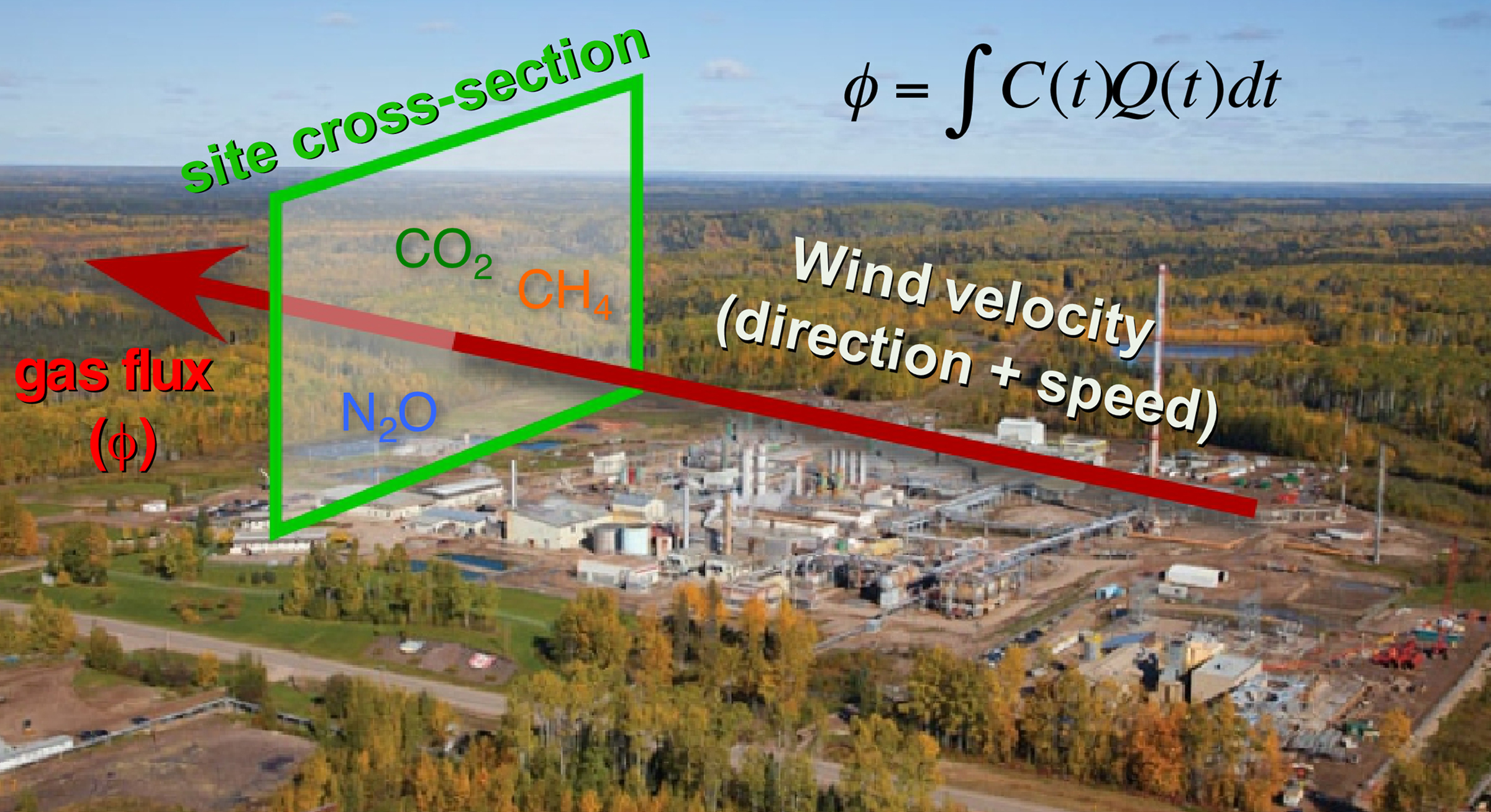
The sensor maps methane (and other gases) by flying horizontally through the plume. When multiple passes at different altitudes have been completed, a “curtain” is obtained. (Don’t worry, we won’t ask you to carry out the calculation – besides, our FluxCurtain software does that.)

Flux Curtain

Zig-zag


As mentioned, the drone flies horizontally through the plume – with each parallel flight at a slightly higher altitude. The sensor is constantly capturing georeferenced data which Aerometrix then runs through software.

In the images below, you’ll see that zig-zag flight pattern. The blue lines at the bottom indicate methane concentrations. Not surprisingly, those concentrations begin to dissipate at higher altitudes as the methane plume mixes with the surrounding air.

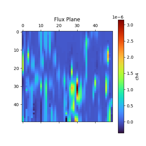
The second image is what’s referred to as the actual “Flux Plane” – where the methane concentrations are represented visually by colour.

Methane Detection
Methane Detection

Efficiency


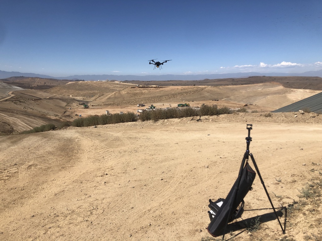
Though pipelines and facilities that handle methane are obvious places where detection is required, local city dumps are also interested in detecting – and even capturing – methane produced by buried garbage. But many are unaware of the efficiency and accuracy of using sensors like the GasMap mounted on a drone.

“A lot of landfills are doing methane detection already,” says Sherk, “but they’re using far less convenient methods. A lot of the time there’s someone walking back and forth with handheld sensors. With larger landfills any sort of grid pattern will take days and days – and walking over an old landfill can’t be a really healthy operation.Operating a drone is vastly more efficient. And the GasMap sensor is capable of detecting not only the presence of methane, but its concentration at various altitudes as the gas forms a plume and mixes with surrounding air.

Some landfills have been able to not only capture but exploit methane that was previously escaping. The Capital Regional District on southern Vancouver Island has been running a power generating plant on-site at the Hartland Landfill, fuelled solely by captured methane produced by decomposing garbage. It’s been doing so since 2004, creating enough energy to power 1,600 homes.

Recently, the volume of methane produced by the landfill has increased, and the power plant is nearing the end of its operational life. In 2023, the landfill will switch gears and process the biogas into natural gas – selling the product to FORTIS BC.

Kudos to the Capital Region District for having such foresight; the example also highlights how captured methane can be put to positive use.

Aerometrix has carried out surveys now at numerous landfills hoping to capture or otherwise mitigate methane emissions. Using FluxCurtain software, its reports turn what was previously an invisible problem into clear, actionable data that provide a clear picture of emissions and concentrations.

Methane Detection

Another sensor


We mentioned a second sensor also being used by Aerometrix. It’s called the LaserScan, and it’s a very lightweight sensor that also uses laser spectroscopy to detect the presence of methane.

Unlike the GasMap, the newer sensor is able to measure vertically. In other words, the drone can be flying directly above a plume and take a measurement straight down to the ground. While it’s not quite as precise as the GasMap sensor (parts per million, rather than parts per billion), the LaserScan does have an advantage when it comes to speed.

Because it does not rely on flying through the plume, the LaserScan is ideal for detecting emissions over large areas. By simply flying a grid pattern at a single altitude, it can rapidly identify emissions. At an altitude of 98.4′, it’s capable of detecting 500 ppm of methane with a plume diameter of one meter.

“While the Falcon is less precise than the GasMap sensor, it has a definite advantage when it comes to speed,” explains Keegan Richter, a mechanical engineer with Aerometrix.

In cases where greater precision is required, Aerometrix can fly two missions: The first with the LaserScan to rapidly detect the location of emissions – particularly over large landfills – followed by GasMap for parts-per-billion accuracy.

Methane Detection

InDro’s Take


We obviously have a special interest in Aerometrix, since InDro’s pilots and drones carry out its aerial missions.

Not surprisingly, since CEO Philip Reece is a co-founder, the mission of Aerometrix closely aligns with InDro’s guiding philosophy: Developing and utilising technology to increase efficiency and – whenever possible – contribute to positive change.

Arguably, the dramatic and apparently escalating shifts we’ve seen to global climate patterns are one of the most pressing problems on the planet. Methane is a key contributor to those changes.

The ability of Aerometrix to accurately detect methane emissions has already helped clients cap leaks and examine other methods for capturing this gas before it hits the atmosphere. Its missions have also meant that human beings are no longer exposed to hazardous environments while capturing data using handheld devices.

In our mind, those are both positive outcomes.

Interested in more information? You can contact Aerometrix directly here.

Putting Sentinel through its paces at EPRI

Putting Sentinel through its paces at EPRI

By Scott Simmie


There’s testing. And then there’s “real-world” testing.

For example, InDro Robotics builds and tests drones and ground robots. We do this constantly, pushing for continuous improvements (and even breakthroughs) with our products. In BC, we’re frequently flying missions to test cellular connectivity or our new proprietary drone software, InDro Pilot.

At Area X.O in Ottawa, we routinely deploy our ground robots on missions to test tele-operations, new sensors, and even autonomous functions. (We have a real advantage here, because Area X.O is made for robots. There are several roads – and even traffic lights – designated for testing and use by autonomous vehicles.)

And while such research always provides us with useful data, it’s just not the same as putting technology to the test in a real-world environment.

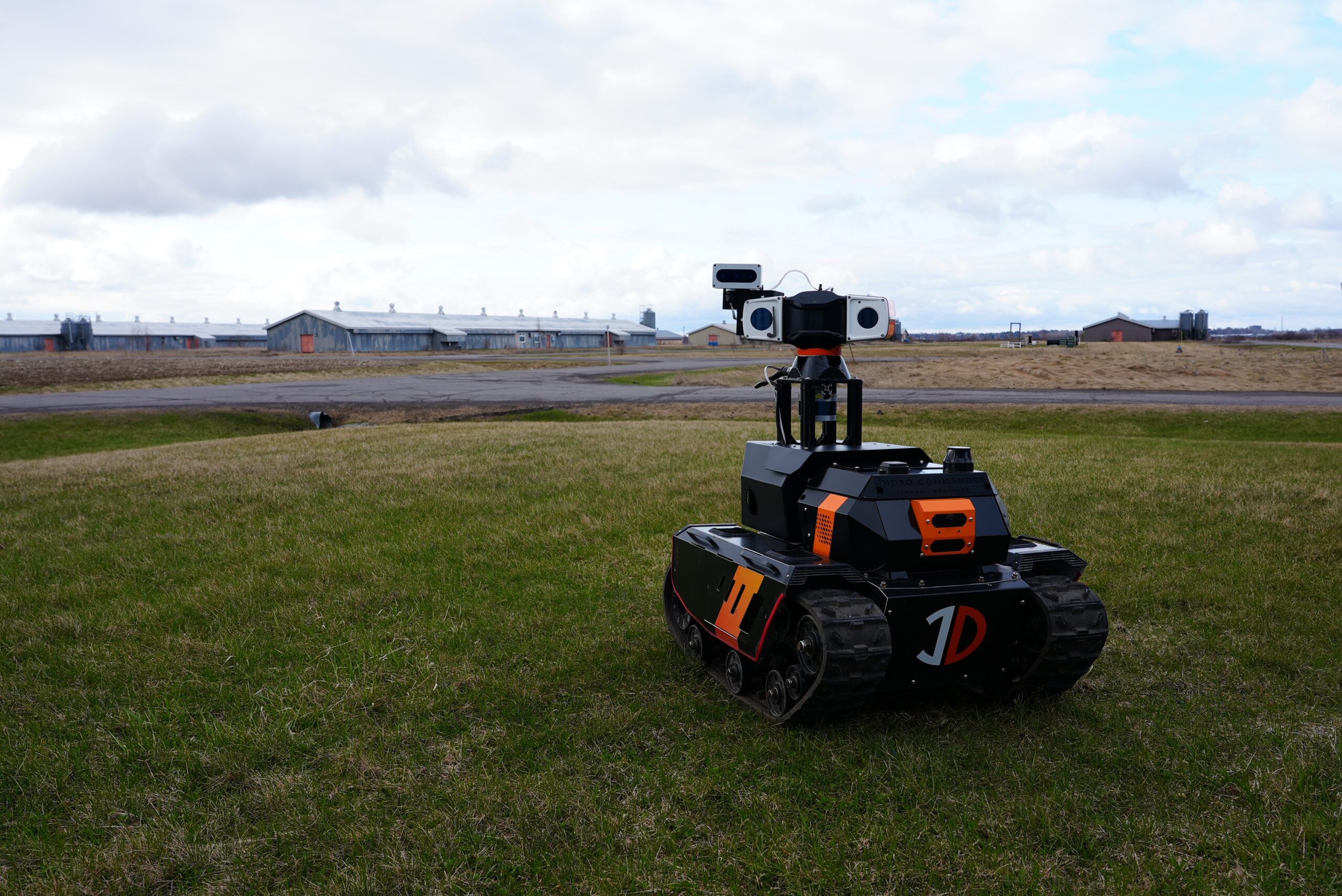
That’s why we took Sentinel – our custom-built robot for monitoring and inspection at remote facilities – to Massachusetts.


Autonomous Robots

The EPRI challenge


EPRI stands for the Electric Power Research Institute. It’s a non-profit energy research, development and deployment organisation. EPRI is constantly doing research – collaborating with more than 450 private companies across 45 countries globally. The purpose, according to its website, is to “ensure the public has clean, safe, reliable, affordable, and equitable access to electricity across the globe.” EPRI shares its research with members, which represent virtually all facets of the power generation and delivery sector.

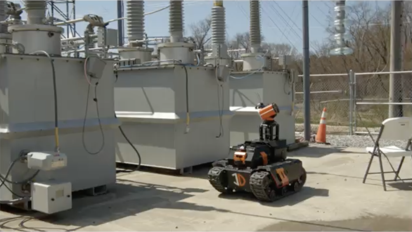
EPRI has multiple research facilities, including one in Lenox, Massachusetts. This particular location features an electrical substation that can be energised, de-energised – and can even simulate rain for testing purposes.

Earlier this year, InDro Robotics was one of a small number of companies to participate in research to analyse the effectiveness of remotely-operated and autonomous ground robots in a variety of conditions. The purpose was to determine the ability of such devices to carry out inspection and monitoring – including whether these robots could detect problems such as arcing.

InDro Robotics Sentinel

The InDro Team


We dispatched InDro Account Executive Luke Corbeth and Robotics Engineer Austin Greisman (along with Sentinel, of course) to the EPRI facility in Lenox, Massachusetts.

“EPRI’s goal for this program was to evaluate technologies that are capable of 24/7 autonomous substation inspection and security monitoring,” explains Corbeth. “This put Sentinel in a real substation environment, to conduct inspections and security patrols amidst powerful electrical currents.”

In fact, there was a series of specific tests during the week-long demonstration. These included all permutations of the following:

  • With the substation energised and de-energised
  • With simulated rain and without rain
  • During daylight and at night

That makes for eight separate missions carried out in different conditions – including an energised substation with simulated rain during nighttime, and a de-energised substation on a clear day.

In addition, each of the above eight missions was carried out both via remote teleoperations – and also autonomously. Factor that in, and there were 16 separate challenges.

And that’s not all. EPRI engineers carried out their own tests on Sentinel, seeing how well it handled inclines, manoeuvres through mud, what weight it could carry at what speeds, and battery life. On these tests, Sentinel performed very well.

“Once we were on site, the value that Sentinel brings to utilities became very apparent – especially identifying thermal signatures to identify (overheating) components onsite or intruders trying to break in,” says Corbeth.

“The performance at night and during simulated rain tests was very successful. They actually have hoses that go overhead and can blast the site with water.”

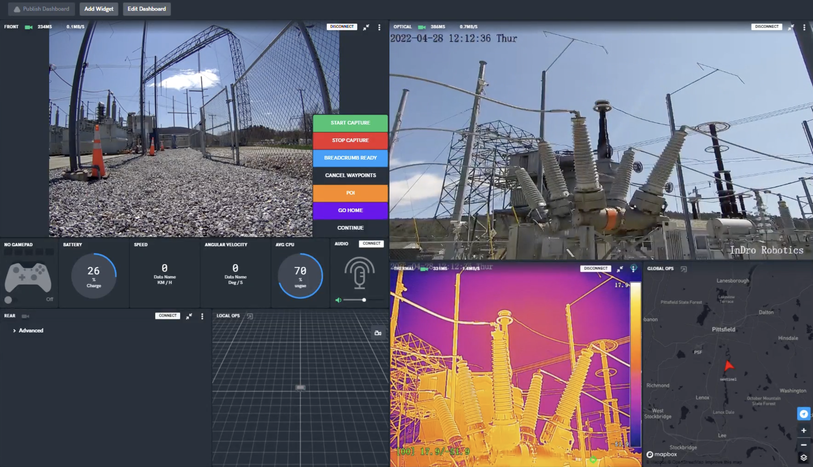
FYI, the image below is a screenshot from the secure, browser-based controller for Sentinel. The operator can see all key parameters, control propulsion and camera systems, in real-time.

EPRI

Lessons learned


At the outset, we told you this was very much a real-world test for Sentinel. If this article were simply a piece of marketing, we’d tell you that everything went perfectly. But it didn’t, and there were lessons learned.

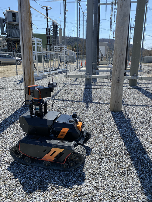
For one thing, we discovered that Sentinel’s track-based locomotion – though ideal in numerous demanding terrains – fell somewhat short in the heavy gravel bed of this substation. Pieces of gravel got caught in the tracks from time to time. As a result, we’re now building a rugged wheel-based variant of Sentinel specifically for this kind of surface (though the tracked version will still be available).

We also faced some challenges with autonomous missions. For one thing, at the time of testing Sentinel did not yet have an optical-based docking system for wireless re-charging (it does now). We also originally thought that a GPS-based guidance system would work in this environment. And while it did, we soon realized that SLAM (Simultaneous Localisation And Mapping) would be a better option. That feature will be integrated into Sentinels going forward.

“The opportunity to get onsite enabled us to test our autonomy package and understand what it’s good at, as well as what needs to be improved,” says Corbeth. “We believe we’re well on our way to a complete, 24/7 autonomous solution. I’d say we’re 85 per cent of the way there. This is new technology” 

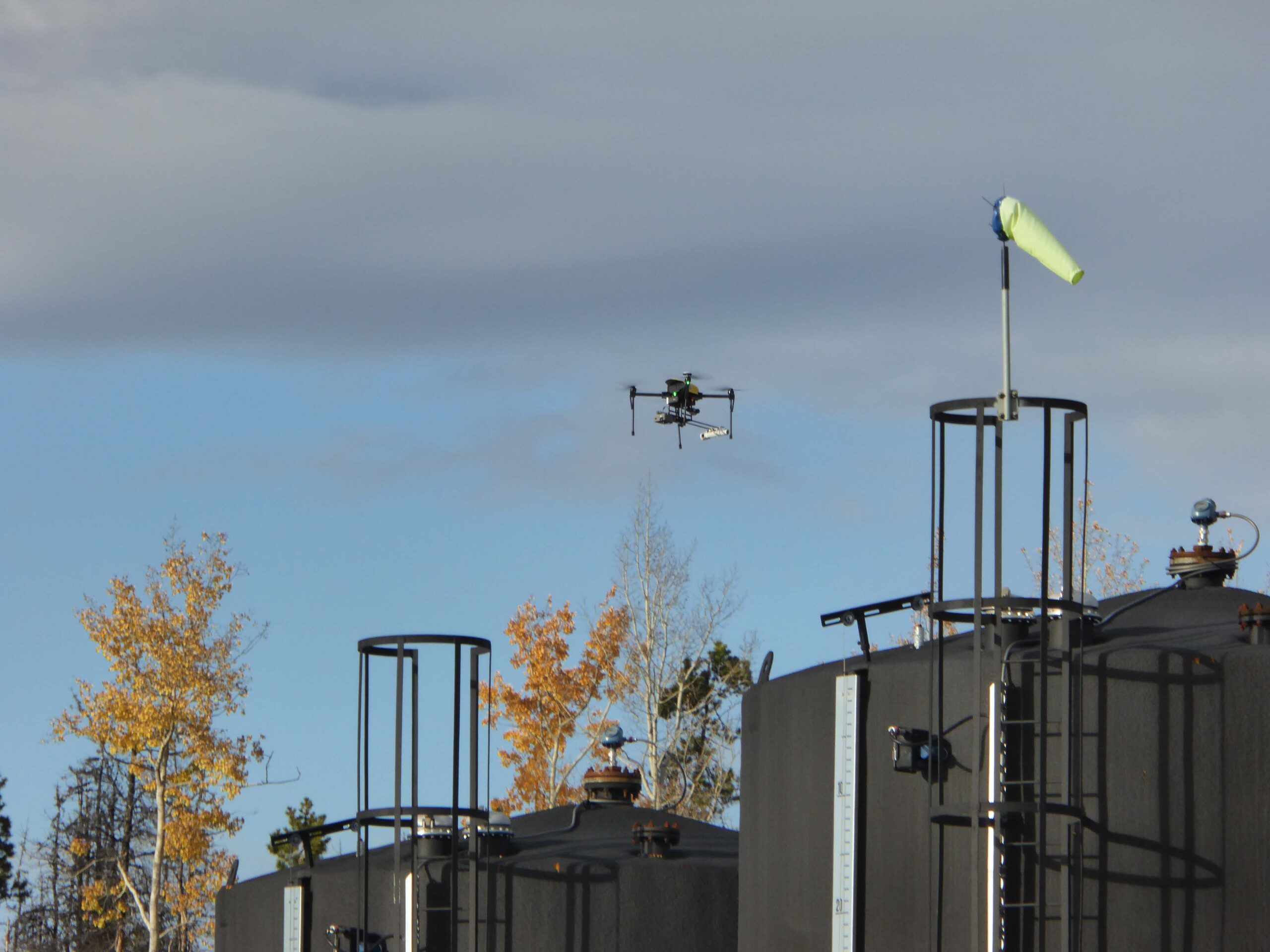
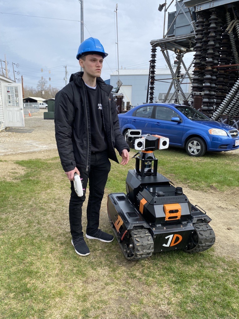
InDro Engineer Austin Greisman on-site in Lenox with Sentinel

InDro Robotics Sentinel

InDro’s Take


Research and development, as we often say, is at the very core of InDro Robotics.  And a big part of R&D is testing outside of the confines of the lab.

And while we were very pleased with many aspects of Sentinel’s performance in the field, we also identified areas where there was room for improvement. Sentinel is now capable of fully autonomous docking to its wireless charging station, and we’re well along the path with fine-tuning SLAM on this device.

Full autonomy, as many of you know, is a difficult challenge. Whether it’s ground robots or drones, InDro has always taken a “Crawl, Walk, Run” approach. Sentinel is now hitting its stride with walking – and getting ready to run.

InDro Robotics releases “NERDs” White Paper

InDro Robotics releases “NERDs” White Paper

By Scott Simmie, InDro Robotics

We’re pleased to release a White Paper detailing an ambitious and successful project we’ve recently completed.

That project, perhaps appropriately enough, goes by the acronym NERDS – which stands for Network Enhanced Realtime Drone project. It began as a technology challenge issued by the Ontario Centre of Innovation, whose mandate is to “develop and deliver programs that accelerate the development, commercialization, and adoption of advanced technologies to drive job creation.” The project included technical support from Ericsson and access to the ENCQOR network, a test-bed 5G network with a corridor through Quebec and Ontario.

The goal of this challenge? To greatly enhance capability of Enterprise drones and enhance the safety of Beyond Visual Line of Sight flights. The challenge involved designing, building and testing a module that would allow an Enterprise drone to be flown over the 5G network while transmitting even highly dense data in realtime. Some of the more specific goals included:

  • Drone Command & Control (C2) over 5G
  • Transmission of telemetry back to the control station: altitude, speed, compass heading, high-precision GPS, battery level, ambient temperature, barometric pressure, etc.
  • Transmit ultra low-latency, uncompressed 4K video stream via 5G
  • Use a Software Defined Radio to transmit to nearby traditional aircraft that a drone operation in the area is underway

There were other bits and pieces as well, but that sums up the core of the project.

Under the lead of engineer Ahmad Tamimi, InDro got to work. There was a ton of testing, simulations – even mapping out the strength of 5G signals at various altitudes – before we pulled the hardware and software together into a module compatible with any Enterprise drone using a Pixhawk flight controller.

Here’s generation one of that module, which we call InDro Capsule. It’s that black, hexagonal device on top of the drone.


Network Enhanced Realtime Drone Technology

Plug & Play


We are currently working on a commercial version of InDro Capsule. It won’t be long before we turn this into a product that will enable other Enterprise drones to be flown over 4G and 5G networks. That product will include the Software Defined Radio for alerting private aircraft to drone operations.

There’s actually much more to the system, which integrates into our new software platform, InDro Pilot. One of the more unique features of the InDro Pilot ecosystem is that it will allow Enterprise drone operators to quickly integrate other sensors, simply using a drag and drop interface. You simply select the appropriate module for the desired sensor.

We’re not going to jump into details here, but if you’re like more info about this system you’ll find it here. We will, however, give you a glimpse of how this works by showing you the Winch module:

Network Enhanced Realtime Drone Technology

Context


Now that you’ve got some background, we’ll get to the White Paper.

Like all White Papers, this one methodically details the scope of the project, the steps that were taken to achieve those goals, as well as the results. If you’re into the fine details of how a challenge like this gets accomplished, you’ll find plenty to interest you. It’s also a testament to the hard work of InDro’s engineering team – and Ahmad Tamimi in particular. Ahmad spent the early months of the COVID outbreak working on this project solo (along with virtual meetings with Ericsson).

The image below gives you a sense of the granular detail contained in the document.

You can download a .pdf of the White Paper here.

Network Enhanced Realtime Drone Technology

InDro’s Take


At InDro, we love a challenge. And the NERDs project presented us, along with partners Ericsson, a significant one.

We believe the resulting InDro Pilot system (which includes the InDro Capsule module) will enable safer BVLOS flight. The 4K streaming and ultra low-latency enhance situational awareness for the pilot, and the Software Defined Radio will alert neaby aircraft to drone operations in the area. In addition, even dense data can be uploaded directly to the cloud during missions. Just as the InDro Commander offers a plug-and-play solution for customizing ground robots, InDro Pilot will do the same for Enterprise drones on the Pixhawk platform.

We are currently making InDro Capsule lighter and more compact, and look forward to commercializing the entire package in the near future.

YOW drone detection program reveals surprising data during final days of Ottawa protests

YOW drone detection program reveals surprising data during final days of Ottawa protests

By Scott Simmie, InDro Robotics


Scores of drone flights took place in restricted airspace – what you might think of as a ‘No-Fly Zone’ – over Parliament Hill in Ottawa during the police operation to clear anti-vaccine mandate protests in February of 2022. While some of those flights were carried out by law enforcement, most flights were illegal and in violation of Transport Canada regulations.  

Data collected by the Ottawa International Airport Authority’s (YOW) Drone Detection Pilot Project reveals an incredible spike in flights – a total of 59 – during the days when police were actively clearing protestors from the site. 

“In an average month, you’d probably see half a dozen flights (in that same area),” says Michael Beaudette, Ottawa International Airport’s Vice President for Security, Emergency Management and Customer Transportation.  

A total of 27 different drones carried out those 59 flights over a period of four days. Of those, 25 flights exceeded 400’ above ground level (Transport Canada’s limit, except in special circumstances), with some flying more than 1500’ AGL. Eleven flights took place during hours of darkness at night – though that’s not a violation of regulations providing the drone is using lights that allow the pilot to maintain Visual Line of Sight and orientation.  

While a number of those flights were likely curious hobbyists either ignorant of or willfully ignoring regulations, it’s believed at least some were likely piloted by protestors or supporters seeking to gain intelligence of police movements. 

“The majority of those drones were not police or First Responder drones,” says Beaudette. “Some of them could have been looky-loos – just trying to see – or it could have been people wanting to know where the police were forming up.” 

Drone Detection

Drone flights, with identifying data redacted, via YOW 


Restricted airspace


The airspace above Parliament Hill (as well as 24 Sussex Drive and Rideau Hall) is restricted to all aircraft – crewed and uncrewed – unless special authorization is obtained. In terms of drones, only law enforcement or other First Responders would have legal permission to fly except in special circumstances. 

The data was obtained by Ottawa International Airport as part of a broader pilot project aimed at understanding drone traffic in proximity of the airport and developing protocols for aviation safety in the drone era. InDro Robotics is one of the partners in this project, providing key technology used in drone detection. Transport Canada regulations prohibit the operation of small RPAS within 5.6 kilometres of airports and 1.9 kilometres from helipads, except for pilots holding an advanced certification. Airspace permission is also required. (Drones weighing less than 250 grams are a different case, and we’ll touch on that shortly.)

How the drones were detected 


The airport uses two different types of technology for drone detection. The first is a micro-Doppler Radar in conjunction with an automated camera. The system, called Obsidian, comes from the British firm QinetiQ. Its high frequency (9-12 GHz) radar can detect the spinning of propellers on a drone anywhere within a two-kilometre range of the airport. Once detected, a camera automatically zeros in on the drone.  

You can get a good sense of how the system works via this QinetiQ video: 

The second system has been supplied for the trials free of charge by InDro Robotics. It’s capable of capturing data from drones manufactured by DJI, which account for approximately 75 per cent of all consumer drones.  

“Our system electronically ‘interrogates’ each device within its range,” explains InDro CEO Philip Reece. “We can triangulate the drone’s position – and on many models we’re able to also detect the type and serial number of the drone, its takeoff point, flight path, current GPS position and altitude. In addition, we can see where the pilot associated with that drone is located. With this data, YOW can quickly determine whether or not a given drone poses a threat to civil aviation.”

The system was intended to pick up any flights within a 15-kilometre radius of YOW. In practice, however, its range has been far greater. 

“When we turned it on, we realized our expectations were far exceeded,” says YOW’s Michael Beaudette. “We were getting hits 40 kilometres plus. It’s really done the heavy lifting for the drone detection project. You can identify where the pilot is, where the drone is, and where they are in real time within 15 or 20 seconds.” 

Data collected during the police operation to clear the protest reveals the bulk of the flights were carried out by DJI Mini 2 drones – very small machines that weigh just under 250 grams and which do not require a Transport Canada Remotely Piloted Aircraft System (RPAS) Certificate to operate. Microdrones like these are not prohibited from operation near airports or in controlled airspace if operated safely, but cannot gain access to the restricted airspace near Parliament without prior permission.

Drone Detection

A controversial catalyst


So. What started this project? 

The 2018 Gatwick Airport drone incident prompted many airports to take a closer look at the potential threat posed by drones. About 1000 flights were cancelled between December 19 and 21 following reports of two drones being sighted near the runway. Some 140,000 passengers were affected, with a huge economic impact. 

The incident remains controversial, because there was never any clear physical evidence that drones had indeed posed a threat. Two people were wrongfully charged, released, and later received a settlement. 

What cannot be denied, however, is that the highly disruptive incident was a massive wake-up call to airports worldwide. With an ever-growing number of drones in the air, the question of drone detection and potential mitigation became a pressing topic. If a drone detection system had been in place at Gatwick back then, it would have had concrete data as to whether there was truly a drone threat or not. 

A Blue Ribbon Task Force was launched by the Association for Uncrewed Vehicle Systems International (AUVSI) in conjunction with regulators and airport representatives. YOW President and CEO Mark Laroche was a member of the Task Force along with representatives of the Federal Aviation Administration (FAA) and NAV Canada. (Its final report can be found here.) 

Gatwick, then, was the catalyst that prompted YOW to start taking a very deep look at the issue. 

Below: Gatwick Airport. Image by Mike McBey via Wikimedia Commons

Gatwick Airport

“We wanted to be able to help shape a national drone response protocol for airports, so that we didn’t run into a situation like Gatwick, where we would have to shut down,” says Beaudette. “We didn’t even know if it’s a problem. We had to get some baseline data, some situational awareness.  So we (decided to) focus on drone detection…to identify if it was even a threat.” 

DJI, to its credit, has geofencing software that prevents its products from taking off in the immediate vicinity of major airports unless the pilot confirms on the app they have permission to do so. And while that’s useful, the geofencing is highly localized and cannot always prevent a pilot from putting a drone into the takeoff or landing path of an aircraft. 

“What causes us concern is when they’re in the flight path,” says Beaudette. 

In the fall of 2019, YOW began its pilot project. A news release made the project public in June of 2021, quoting Michael Beaudette as saying: “As an airport operator, we felt it was vitally important that we test systems to detect drones operating on flight paths, near the airport and in other restricted zones to help ensure the safety of air crews and passengers.” 

Surprising data

With the InDro and QinetiQ systems up and running, the data started coming in. It was something of a shock. 

“This opened our eyes,” says Beaudette. “We had no idea of the drone activity that was taking place.” 

There were a lot of drone flights taking place close to YOW.  

“In March of 2021, our program detected and reported on 101 drone flights within that 5.6-kilometre radius,” said CEO Mark Laroche in a news release. “April’s numbers were even higher at 167. A number of these were flown during hours of darkness and some exceeding altitudes of 1,600 feet.” 

Every month, YOW crunches the data into a comprehensive report sent to Transport Canada, NAV Canada, InDro Robotics and other stakeholders. The report from May of 2021 reveals a steep increase in the number of flights.  

Drone detection

The rapid increase was due to warmer weather and the increasing popularity of sub-250 gram drones, which are both more affordable and do not require an RPAS Certificate or registration. Here’s a breakdown of the top 30 drone models detected within a 15-kilometre radius during that same month: 

Drone Detection

The monthly report from this period states: “Detecting and identifying ‘drones of concern’ operating in the vicinity of the Ottawa Airport remains one of our primary objectives. This month, there were 19 such drones of concern within the YOW 5.6 km zone. These include drones that flew during hours of darkness, or were over 250 grams and flew over 400 ft. Of these 19 flights, there were 11 unique Drone IDs.” 

Because the system can capture drones from even farther afield, other interesting data has emerged during the course of the pilot project. 

“We started tracking other locations – Parliament Hill, Gatineau Airport,” says Beaudette. “And we were very surprised to see drones flying at all hours of the day and night and at high altitudes.” 

These weren’t just hobby flights. Unusual activity was detected around certain embassies in Ottawa, with the same drones making repeated trips. There were drones flying close to the CHEO and Civic hospital Helipads used by helicopters with the air ambulance service Ornge. There were drones apparently peering into high-rise windows, Peeping-Tom style, and others that appeared to be involved with offering intelligence to people carrying out Break & Enters. (Beaudette says police were notified in some of these instances.) 

As part of the Pilot Project, YOW worked with its partners – including NAV Canada, Transport Canada and InDro Robotics – for some real-world exercises. One such test involved determining the accuracy of the detection system. A drone was flown (with all appropriate permissions) from the E.Y. Centre, a massive exhibition/convention facility very close to the airport. When the data captured by the detection system was overlaid with the actual flight log, they were identical. Not only that, but the YOW data precisely identified the location of the pilot. 

“We could actually tell which stall in the parking lot (the pilot was standing in),” says Beaudette. 

Mitigation


Detection is one thing, but drone mitigation is quite something else. There are systems capable of jamming the Command and Control signal between the drone and the controller (including systems from Bravo Zulu Secure part of the InDro group of companies. Here’s a quick overview of how these systems work. 

But such systems are not in cards for YOW or other airports in Canada. Quite simply, Transport Canada and Industry Canada (which regulates radio spectrum frequencies) prohibit them in this country except in extraordinary circumstances. 

“First and foremost, a drone – like any other airplane – is considered an aircraft,” says Beaudette. “And so Transport Canada has restrictions: Nobody has the authority to interfere with the flight of that aircraft. So you won’t see airports with jammers or other kinetic solutions to that unless they have the proper authority.” 

Plus, he emphasizes, the Drone Detection Pilot Project is focused on drone detection. It’s a data-gathering exercise to help formulate protocols, provide useful information for regulators, and alert airport authorities immediately if a drone poses a threat to a flight path. YOW is not the drone police; its primary interest is in ensuring the safety of aircraft using the facility.  

“If we can detect something, we may be able to mitigate it by rerouting aircraft, delaying aircraft, or we can locate the pilot,” says Beaudette. 

Thankfully, despite many flights violating the 5.6 kilometre radius, YOW has not encountered a drone that posed a serious threat since the program began. Should that occur, it does have protocols in place to ensure civil aviation safety. Plus, of course, Transport Canada has the option of imposing heavy fines on pilots who put aircraft at risk or are flying without a Remotely Piloted Aircraft Certificate. And with the detection system in place, locating an offending pilot would not be difficult. 

Know the regs

Ultimately, the biggest piece of the puzzle is around education. Some pilots simply don’t know the rules and unwittingly violate them – an excuse that won’t help them much if facing a fine. YOW has found, for example, that pilots often fly from nearby neighborhoods or golf courses without realizing they’re impinging on that 5.6 kilometre zone.  

There’s also the issue of confusion around piloting sub-250 gram drones. Because they do not require an RPAS certificate or registration, many believe the rules somehow don’t apply to them. Yet the over-arching meaning of the regulations is clear: They must not be flown in an unsafe manner. And that includes near airports. 

“We actually had a case where we found a drone that crash-landed inside the (airport) fence,” says Beaudette. 

“We’re still the proud owners of that drone.” 

InDro’s take

Several members of the InDro Robotics team – including our CEO – have expertise as private and commercial pilots. As a result, we have perhaps a heightened awareness of the potential risk drones can cause if they’re in the wrong place at the wrong time. Drone detection at airports and other sensitive facilities is critical, and the deep data collected by YOW reflects that.

We’re proud to be part of the YOW Drone Detection Pilot Project and look forward to assisting others with drone detection and even mitigation, where appropriate. If you’re interested in exploring such a system, we’d be happy to help.