Area X.O unveils new simulation portal

Area X.O unveils new simulation portal

By Scott Simmie


Area X.O, the Ottawa facility founded and operated by Invest Ottawa that houses cutting-edge companies involved in robotics and smart mobility R&D, has unveiled a powerful new tool.

It’s a simulation portal that will allow firms to virtually test products under development. Want to put a robot through its paces on the roads at Area X.O to evaluate its propulsion system and battery life? Have a drone overfly and capture data? Maybe you want to test in snow and cold temperatures, despite it being summertime?

Unless you happen to be an Area X.O tenant, carrying out any of these tasks in real life would involve getting permission, getting your product to the site – even waiting for months and taking multiple trips if you wanted to test under a variety of weather conditions. The costs on this would quickly add up, and your development time would stretch.

With the new simulator, you can put your robot or drone (or sensor) through their paces remotely – whether you’re in Ottawa, Vancouver, or even further afield. And you can use the data gathered in the simulator to improve and refine your real-world product.

“Until recently, Area X.O was limited to the physical world,” said Patrick Kenny, Senior Director of Marketing and Communications for Invest Ottawa, Area X.O and Bayview Yards.

“This past winter, Area X.O launched a simulation discovery portal powered by Ansys. The simulation portal and program promotes simulation and its ability to reduce time, cost, effort and risk by getting breakthrough innovations to market faster. Innovators now have a new option to consider.”

Kenny made his remarks during a June 7 webinar. During that event, Area X.O engineers Barry Stoute and Hossain Samei explained how the system works – and even carried out a real-time demonstration.


Area X.O simulation portal

POWERED BY ANSYS


The brains behind the system come from Ansys, which has been in the simulation software business for more than 50 years. It is widely considered to be the most powerful software of its kind.

“Simulation is an artificial representation of a physical model,” explained simulation engineer Dr. Stoute. He went on to explain, at a high level, two different types of simulation: Finite Element Analysis (FEA) and Digital Mission Engineering.

In a nutshell, FEA uses software (and really good computers) to see how different models behave under different conditions. The model can be anything: A robot, an antenna, a drone – you name it.

“Finite Element Analysis solves for mechanical structures, thermal analysis, electronics and optical (components),” explained Dr. Stoute. Want to know what temperature a component might heat to under load? Determine how a transmitter or antennae might behave in differing temperatures? Even “see” what an optical sensor might capture when mounted on a robot? Plug in the right parameters and powerful computing will give the answer.


DIGITAL MISSION ENGINEERING


This type of simulation is a way of designing a complex system, particularly where multiple assets interact with another in a simulated environment. In the example seen below, Dr. Stoute says a digital mission engineer could create a model where a drone capturing data interacts with multiple objects. These include satellite communications, a ground station, along with multiple vehicles. The drone’s mission is to capture data from the ground, but the engineer is interested in seeing the Big Picture – the ways in which all these different assets will interact.

The mission engineer can select and modify the parameters of every asset in that model. How powerful is the ground station and what range will it provide? What speed is the aircraft flying at, and at what altitude. What type of aircraft is it? What sensors are on the drone and what are their specifications? What is the battery life? What are the specifications of the drone’s motors? The ambient temperature and wind conditions?

The options are dizzying. But the software – along with a well-trained mission engineer – can create a virtual world where the data outcomes closely predict what would happen in a real-world mission.

“If an engineer creates a physical product and it doesn’t work as planned, they have to go back and remodel it,” explained Dr. Stoute. The simulation environment, by contrast, allows the engineer to tweak that product in a virtual environment without the expense of real-world modifications. Once the product is working well in simulation, those learnings can be applied to the actual physical product.

Plus, of course, weather parameters can easily be changed; something impossible in real-world testing (unless you’ve got lots of time on your hands).

“Should he wait until January to get a blizzard to test the product?” asked Dr. Stoute.

“No, it doesn’t make sense. The simulator can simulate blizzard conditions.”


Below: Dr. Stoute explains how Digital Mission Engineering works during the webinar


Digital Mission Engineering

REAL-TIME DEMONSTRATION


Now that the basics were explained, the webinar moved on to demonstrate these concepts. Area X.O engineer Hossain Samei took over the controls, doing a real-time demo of the sim’s capabilities.

For this, Samei used not only the Ansys core system, but another powerful piece of software called Ansys AVxcelerate, which is used to test and validate sensors for self-driving cars. That means you can plug in virtual sensors, including all of their technical parameters, into the system. And not simply the sensors on the cars. In this simulation, which features a very high-resolution 3D map of the Area X.O complex, Hossain also had sensors that are on the Area X.O site embedded into this virtual world.

“This digital twin also includes the infrastructure embedded into our smart city zone,” explained Samei. “This includes multiple sensors, optical cameras, roadside units, thermal cameras and LiDAR cameras.” The model even includes functioning railroad crossing gates.

“We’re able to simulate the arms moving up and down,” he said.

And remember how the Ansys system can simulate weather? The mission engineer can also tailor lighting conditions – very useful for testing visual sensors.


VIRTUAL TEST DRIVE


Samei already had the digital twin of Area X.O defined. He then quickly put together an autonomous vehicle and camera sensor using AVxcelerate.

“Once we have our car defined, as well as the sensors on the vehicle, we’re able to move on to choosing a car simulator,” said Hossain.

In order to help the car drive on Area X.O’s terrain, Hossain turned to the Open-Source Webots robot simulator.

“With WeBots, you can define your vehicle, including its suspension, power train and other features to define the vehicle dynamics of the car,” said Samei.

And now? It was time for a drive.

Samei began to pilot the car around Area X.O – showing as well that he could change the setting from a clear and dry day to one with snow on the ground with just a few clicks. As the car drove down the road, you could see some of the Smart City sensors that are physically (and virtually) embedded in the Area X.O environment.

“You can see as we pull up, all of the sensors in the environment are visible. That kind of demonstrates what we’re able to do with this model,” he said.


VIRTUAL DRONE FLIGHT


Samei then moved on to programming an autonomous drone flight over one of the experimental farm fields that surround the Area X.O facility. For this portion of the demo, he utilized the Ansys STK toolkit – specifically designed for Digital Mission Engineering. You’ll recall Dr. Stoute spoke of this, and its ability to simulate entire systems – including ground stations, satellite communication, etc.

Samei defined the area of the field to be scanned, then “built” the quadcopter by selecting motors, battery, propellors – even the pitch of the blades.

“We end up with a very accurate model of a drone that reflects its actual performance,” he said.

He also programmed the altitude of the drone and the density of the scan – with passes over the field 400′ apart. With that and a few more clicks (all in real-time, which was pretty impressive to watch), he sent the drone off on its mission.

The virtual drone quickly scanned the desired area and returned to base with power to spare. Samei then plotted a more tightly focussed grid – lower altitude and more overlap, with grid passes 200′ apart – for greater data density. Then he send the quadcopter off again.

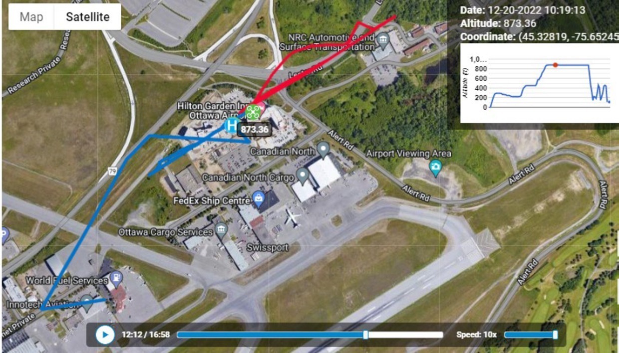
In this example, Samei was interested in whether the quadcopter could cover the scan with its existing power supply. He was also keen to learn if the ground station would be able to communicate with the drone throughout its mission. Both of these questions were answered in the affirmative without having to use a physical drone.

“We were able to verify the flight does not need more energy than the battery can provide,” he observed. “We can (also) see the minimum signal strength required – so indeed we are able to maintain consistent communication throughout the mission.”

That was impressive enough. But get this: The simulation software can even account for potential signal interference caused by buildings. And such flights – whether it’s a drone or a Cessna or a business jet – are not limited to Area X.O. Ansys STK has a database or pretty much anywhere on the planet.

“You can simulate your missions and flights over anywhere on earth,” said Samei.


Below: A screen capture during Samei Hossain’s real-time demo. Here, he’s configuring the technical parameters for a simulated quadcopter’s propulsion system

Area X.O Ansys simulator

WAIT, THERE’S MORE


The real-time demo was impressive. But it left one wondering: What kind of a computer do you need to make these kind of simulations actually work? Surely the computational power required exceeds what most of us carry around on our laptop.

And that’s true. But the good news is, the Area X.O simulator portal includes access to the precise kind of computer required.

“What we’re providing with our simulation services is access to our computers,” said Samei.

“We have the workstations necessary that have the computational power, the memory, that’s able to simulate these problems very fast. So it’s not necessary for the clients to have a supercomputer in order to run the simulations. We can take that 10-day simulation time down to 10 hours.”


THE VIRTUAL ADANTAGE


If it wasn’t clear by now (and it surely was), the webinar wrapped with a reminder of why simulation is such a powerful and cost-effective tool for developers.

“We can do more different physics-based simulations such that you don’t have to build…expensive prototypes,” said Dr. Stoute. “People can actually imagine the wildest designs without any limitations. Having your wildest dreams imaginable.”

Engineer Hossain Samei also weighed in.

“One thing I really do believe in is: Knowledge is power,” he said.

“What simulation…lets us know (is) what’s going to happen and not suffer the consequences from actually having to make a product…and then find out: ‘Oops, I have a problem’. Simulation allows you to circumvent that and identify these issues before, where it’s easier to actually solve them.”


WANT TO TRY IT?


You can! Though the Area X.O simulation portal is ultimately a paid service, those interested in learning more can sign up for further free demos to get a better sense of what this resource is capable of delivering.

Sign up for free on this page.

If you thought you missed a cool demo, you did. But no worries, you can watch a replay of the entire webinar below:

INDRO’S TAKE


The Ansys platform is acknowledged as the best simulation platform going. And with the expertise of Area X.O engineers Dr. Barry Stoute and Samei Hossain, we’re confident a solution can be tailored for pretty much any product operating in any environment.

“It’s a normal part of R&D to go through various iterations of products following real-world testing,” says InDro Robotics CEO Philip Reece. “And while products ultimately need to be tested in the real world prior to deployment, high-level simulation can save time, money – and mistakes.

“Even though our R&D hub is situated right at Area X.O, we plan on tapping into this powerful tool to analyze some of our products currently on the drawing board.”

If you’re interested in learning more about this new tool, drop Area X.O a line here


Port Coquitlam drone grant leads to new Fire and Emergency Services capabilities

Port Coquitlam drone grant leads to new Fire and Emergency Services capabilities

By Scott Simmie


There’s no question that drones have become an essential part of the toolkit for First Responders.

Drones have proven themselves in Search and Rescue operations (including at night), for Situational Awareness in firefighting and disaster response, and as important tools in accident documentation that can allow police to more rapidly clear the scene and get traffic moving quickly again.

Now, the city of Port Coquitlam’s Fire and Emergency Services department has upped its capabilities thanks to two new drones and training – the result of a $30,000 grant from the Union of British Columbia Municipalities (UBCM). The money was earmarked as “Community Emergency Preparedness Funding.”

Below: An image from Port Coquitlam’s Fire and Emergency Services web page

Port Coquitlam Drone Grant

EYES IN THE SKY


Drones have proven particularly useful tools to firefighters. They not only provide the Big Picture from above, but drones with thermal sensors can see beyond the visible flames – identifying other hotspots not visible to the naked eye. A section of roof that might appear fine could, in fact, be close to combustion.

On May 6, 2019, drones played a huge role at one of the worst fires in the City of Victoria’s history. What would come to be known as the Pandora Street Fire would ravage an historical buiding and take a week to fully extinguish. On the morning it broke out, there was so much roiling brown smoke that firefighters couldn’t even see where the flames were. They immediately put an InDro drone, equipped with thermal sensors, in the air.

“If you’ve ever been to one of these big fires, the smoke is thick and completely impenetrable,” explained InDro Robotics CEO Philip Reece in this story.

“You’re pointing the hose at where you think the fire is. Now you switch to thermal and it basically cuts the smoke – the smoke disappears. Now you see the heat coming up off the fire. You can actually follow it down through the different radiometric temperature colours to where the real core of the fire is.”

The image below was taken at the Pandora Street Fire and is courtesy the City of Victoria’s Fire Department. You can see, thanks to thermal, where the hottest spots are. It’s a clear example of how important an airborne thermal sensor is:


Pandora Street Fire FLIR thermal drone

DRONES AND MORE


The drones, purchased via InDro Robotics, are two DJI Mavic 3 Enterprise Thermal units. The camera provides up to a 56x combined optical/digital zoom, and the thermal sensor has 640 x 512 resolution. With flight times of up to 45 minutes, the pair of drones can be easily rotated for continuous situational awareness. The controller allows to displaying both visual and thermal imagery side-by-side.

“This is a great example of our city using creative technology tools to better serve and protect our community, residents and keeping our firefighters safe,” said Mayor Brad West in this news release

“Providing immediate access to real-time video footage, helps our firefighters make better on-scene decisions. We are grateful to the Union of British Columbia Municipalities (UBCM) for providing us with this grant that will positively impact our community.”

TRAINING


The grant also provides for training of those who will operate the drones – as well as to develop planning exercise scenarios for the City’s Emergency Operations Centre. Five Fire Department pilots currently hold their Transport Canada Advanced RPAS Certificates, and additional training with InDro Robotics will take place to in order to fully exploit the capabilities of the thermal drones and interpret the data.

The news release states that drones will be able to provide real-time information via live-streaming to the City’s Emergency Operations Center during incidents:

“A review of the current EOC practices, used to obtain information, suggests that more timely and reliable information can be obtained through the use of technology, such as drones. Using a drone to survey the site of an incident can reduce the risk of injury to first responders as well as give crucial information to the incident commander for planning response activities which can be livestreamed to the EOC.”

MULTIPLE USE-CASES

It goes on to outline some of the many benefits of drone use, including:

  • “Provides fast and efficient reconnaissance of the incident from a safe distance prior to sending first responders in to perform search and rescue operations;
  • “The use of drone mounted thermal imaging cameras assist first responders in identifying heat signatures of trapped or injured civilians who may not be easily seen or heard;
  • “Support City staff in pre-disaster planning efforts, e.g. geographic surveys and inspections of bridges, dams, and diking systems; and
  • “Provides staff with updated, accurate, high definition images for the City’s data collection.”

Councillor Steve Darling, the City Council’s designate for community safety matters, is quoted outlining why these drones are an important addition:

“The drone(s) will be used to support fire ground operations, relaying important information regarding fire growth and heat. This will also increase firefighter safety, allowing the department to keep an eye on firefighters working in hazardous areas.”

Below: A DJI video outlining the features of its Mavic 3 Enterprise drones


INDRO’S TAKE


It’s been less than a decade since DJI released the original Phantom, which required a separate GoPro and was not capable of video streaming unless you really wanted to buy hobby parts and hack the camera to transmit. Drones were anomalies then, largely purchased by hobbyists.

But it wasn’t long before First Responders started seeing the potential. Some early adopters embraced the emerging technology, and it wasn’t long before word started to spread. It’s now routine, at pretty much any drone or First Responders convention, for presentations to be made showing real-world examples of how useful – critical, even – drones have become.

“The growth of drone technology has truly been exponential – and so have the use-cases,” says InDro Robotics CEO Philip Reece.

“We’ve long been involved with drone training with Port Coquitlam Fire, and applaud the Union of British Columbia Municipalities for this forward-thinking grant. We look forward to hearing about the many ways these drones benefit Port Coquitlam Fire and the City’s Emergency Operations Centre.”

InDro has, for many years, trained First Responders and supplied specialized drones for their work. If your local First Responders would like to learn more about the capabilities of InDro drones or ground robots – including training at the forthcoming Area X.O advanced drone and ground robot facility in Ottawa – feel free to contact us here


2022 InDro Highlights

2022 InDro Highlights

Wow. Another year has passed.

And for InDro Robotics, it was a year marked by new products, new deployments, and multiple milestones.

We did a deep dive on the year with our Year in Review story, which you can find here. But we realise some people might prefer a condensed version. So here we go, starting with the image above.

That’s Sentinel, our rugged teleoperated robot for remote inspections. We launched that product at the very beginning of 2022. It’s been designed for remote inspections, carried out over 4G and 5G networks. We customise Sentinel’s sensors based on client needs, but the standard model comes with a 30x optical Pan-Tilt-Zoom camera, thermal sensor, and a high-res wide-angle camera that gives the operator a clear view of surroundings.

Operations are a snap, using an Xbox controller plugged into a laptop with a comprehensive dashboard. Even dense data can be streamed and downloaded in real-time over 5G. In fact, we’ve proven Sentinel’s minimal-latency capabilities from more than 4,000 kilometres away. (That took place from Bellevue, Washington State, where we were invited to demo our system by T-Mobile.)

It didn’t take long for word to get around. A couple of months after Sentinel’s launch, we were invited to put it through its paces at the Electric Power Research Institute, or EPRI. Check out this next image – it’s a frame grab from the Sentinel dashboard, and was captured during a mission at an EPRI testbed electrical substation in Lenox, Massachussetts.

InDro Robotics

There’s a lot we could tell you about Sentinel but we’re trying to keep this tight. If you’d like more in-depth details you can read this story, or reach out to superstar Account Executive Luke Corbeth here

InDro Commander

INDRO COMMANDER

A significant part of what gives Sentinel its various superpowers is an innovation we call InDro Commander. It’s a bolt-on box that contains a camera, EDGE computer, a 4G- and 5G-compatible modem and the ROS1 and ROS2 software libraries. That means it’s a snap for clients to add any additional sensors they’d like without the hassle of coding. 

You can operate any InDro Commander-enabled platform using an Xbox controller over a highly intuitive dashboard on your desktop or laptop. FYI, that box you see just above the InDro Logo (and just below the camera) in the image below? That’s InDro Commander.

DRONES

Though InDro has a stellar reputation for ground robotics, the company was founded on the Unmanned Aerial System side of things. So we’ve been busy in that arena, as well.

The most significant development of the year is a software and hardware package we call InDro Pilot. In a nutshell, it’s a bolt-on module that’s similar to Commander. It enables remote BVLOS operations over 4G or 5G, dense data throughput, simplified sensor integration – plus the ability to broadcast to nearby traditional crewed aircraft that drone operations are taking place in the vicinity. 

That hexagonal box in the image is Version 1.0 of the hardware side. We’ve since created a much smaller and lighter version, capable of transforming any Enterprise drone using the Pixhawk flight controller into a low-latency, BVLOS super-RPAS.

InDro Pilot

GROUND (BREAKING) DELIVERIES

In 2022, InDro teamed up with London Drugs to test out ground deliveries via our ROLL-E robot. 

There were two separate trials. The first, in Victoria, involved ROLL-E taking goods ordered online to a parking lot for touchless, curbside delivery. The second, in Surrey BC, involved the second generation of ROLL-E delivering goods from a London Drugs outlet to a consumer’s home. ROLL-E features 4G and 5G teleoperation, and is equipped with a total of six cameras (including two depth-perception cameras), giving the operator tremendous spatial awareness.

That’s ROLL-E 2.0, in the image below. Its secure cargo bay – which unlocks when the robot reaches its destination – can carry up to 50 kilograms.

Delivery Robot

GOOD DOG

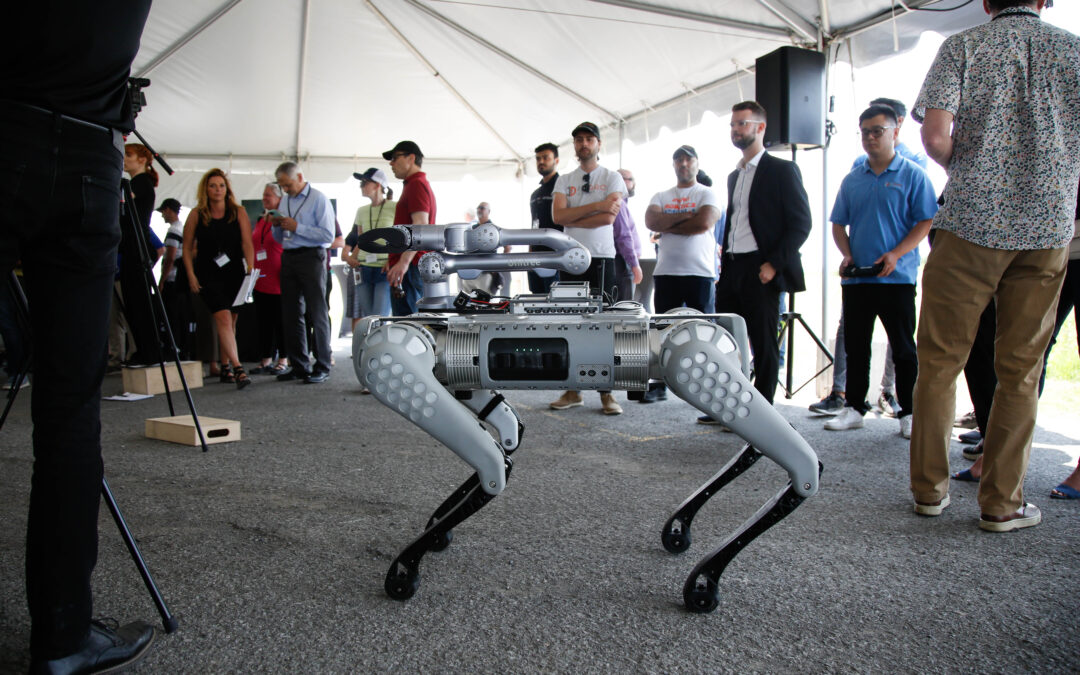
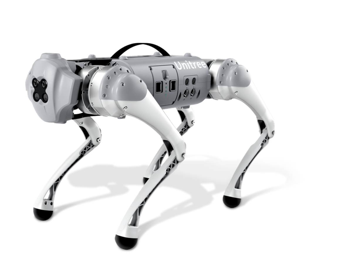
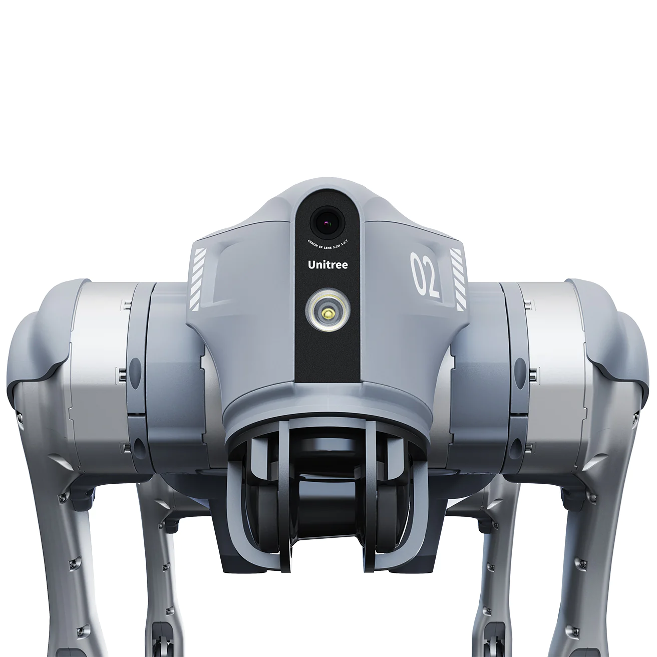
Also in 2022, InDro Robotics became a North American distributor for the Unitree line of quadruped robots. These rugged, agile robots are well-suited to a variety of tasks, including remote inspection. In the video below, Luke Corbeth puts the entry-level GO 1 through its paces.

InDro backpack

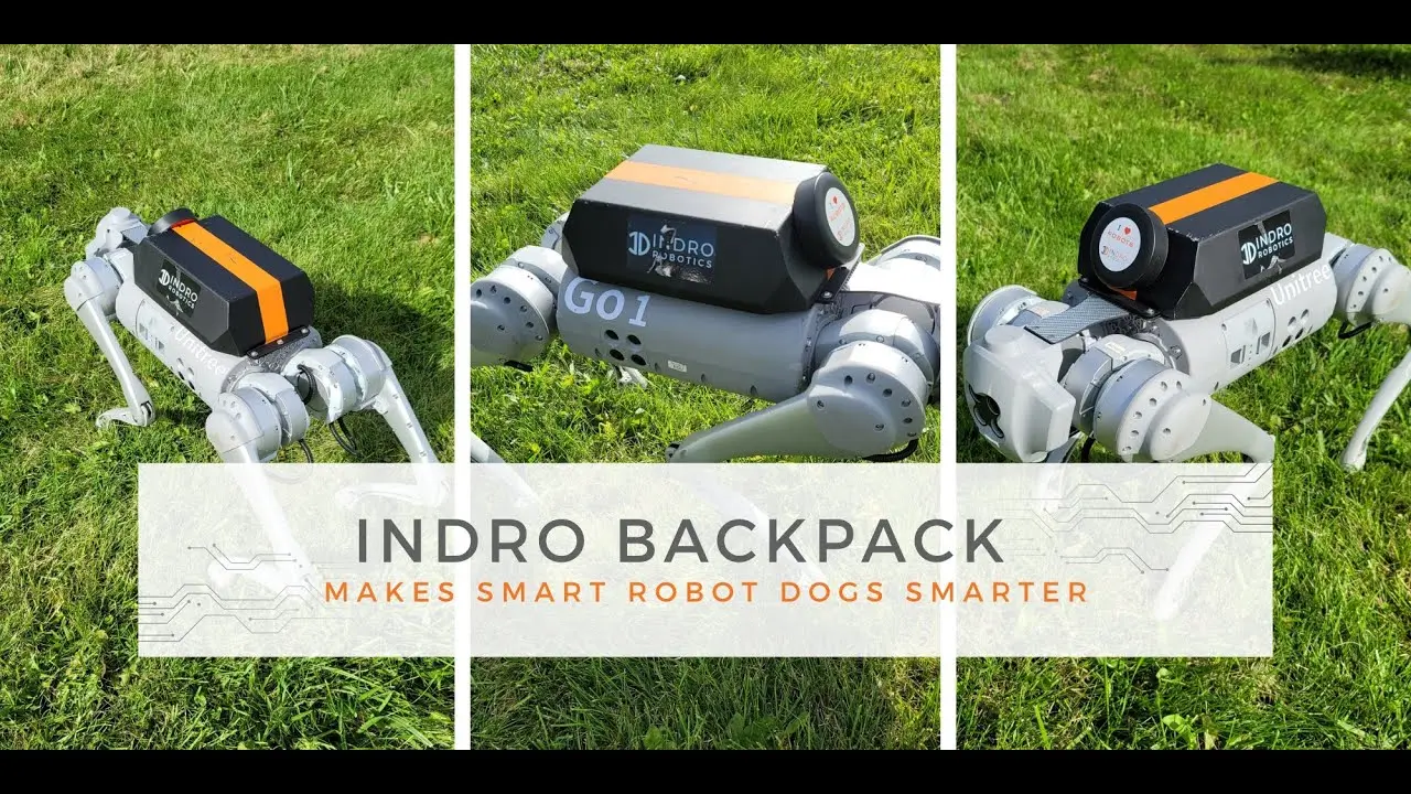
Remember InDro Commander, the box that enables remote teleoperations and easy sensor integration? We figured a module like that could really expand the capabilities of the Unitree quadrupeds. 

And so – you guessed it – we built it. We call this device InDro Backpack, and you can see it on the robot below.

InDro Backpack

meet limo

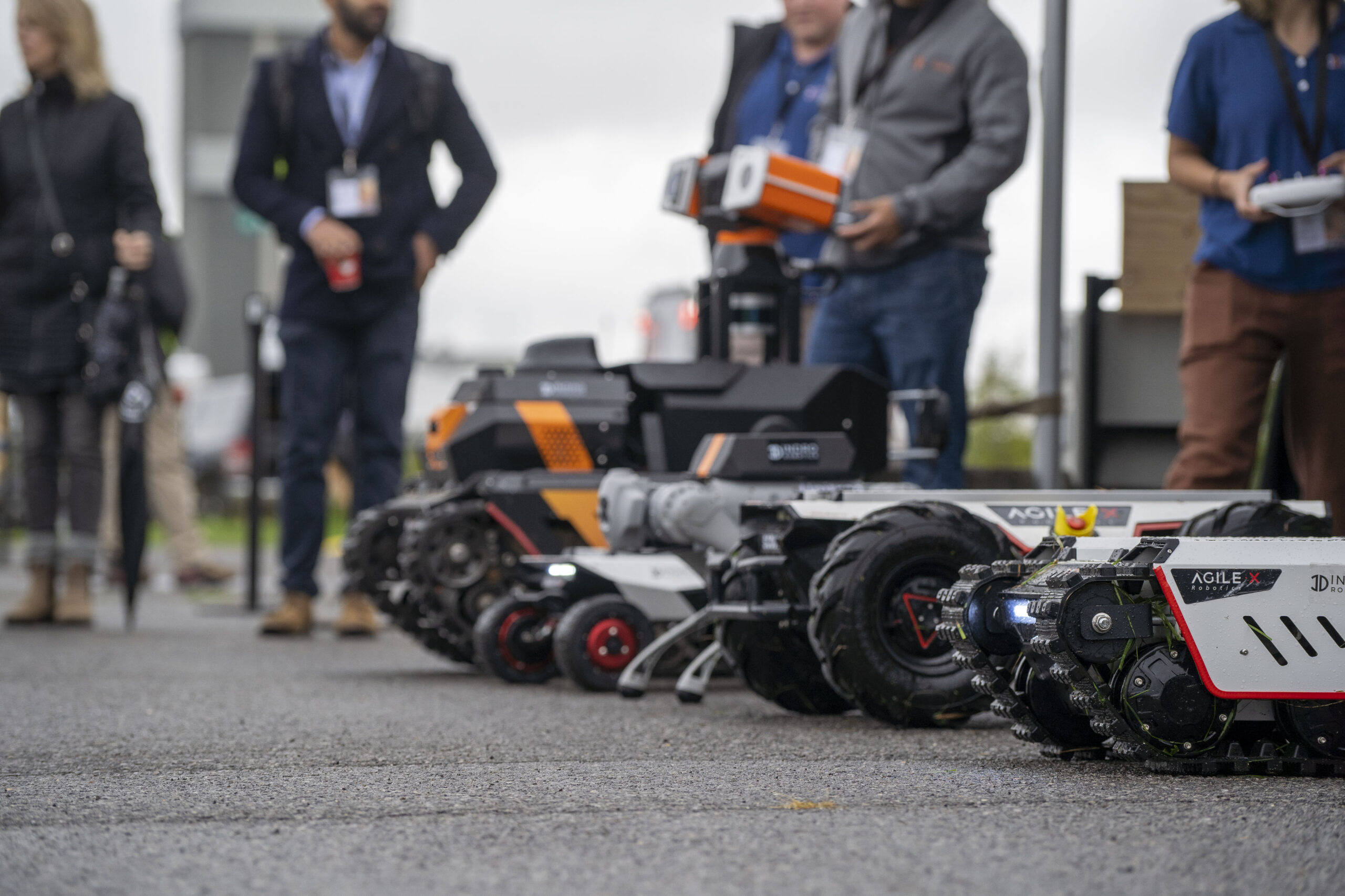
InDro Robotics is also a North American distributor of the excellent AgileX robot line. This past year saw the introduction of a very cool machine for education and R&D called LIMO. It comes with an impressive number of features straight out of the box, including:

  • An NVIDIA Jetson Nano, capable of remote teleoperation over 4G
  • An EAI X2L LiDAR unit
  • Stereo camera
  • Four steering modes (tracked, Ackerman, four-wheel differential, and omni-directional)

It’s a powerful, SLAM-capable machine. Best of all? It’s really affordable.

LIMO

montreal marathon

Three InDro employees took part in the Montreal Marathon – but they were largely standing still.

In fact, they were operating sub-250 gram drones as part of a medical research pilot project. The drones – two were constantly in the air throughout the run – were positioned at a point near the end of the course where runners sometimes encounter medical distress. Live feeds from the drones were monitored in a tent by researchers for two reasons: To see if the aerial view could help them quickly identify someone needing help, and to help pinpoint their location so assistance could be rapidly dispatched.

The results? The drone feeds helped quickly identify and locate two runners in need of help

“The view from above when monitoring moving crowds is just incomparable,” says Dr. Valérie Homier, an Emergency Physician at McGill University Health Centre and the lead researcher on the project. 

Below: InDro pilots Kaiwen Xu, Ella Hayashi and Liam Dwyer.

Montreal Marathon

TCXpo

One of the highlights of the year was the TCXpo event at Area X.O in Ottawa. Sponsored by Transport Canada and Innovation, Science and Economic Development Canada, it was a full day of demonstrations from Canadian leaders in the world of Smart Mobility. 

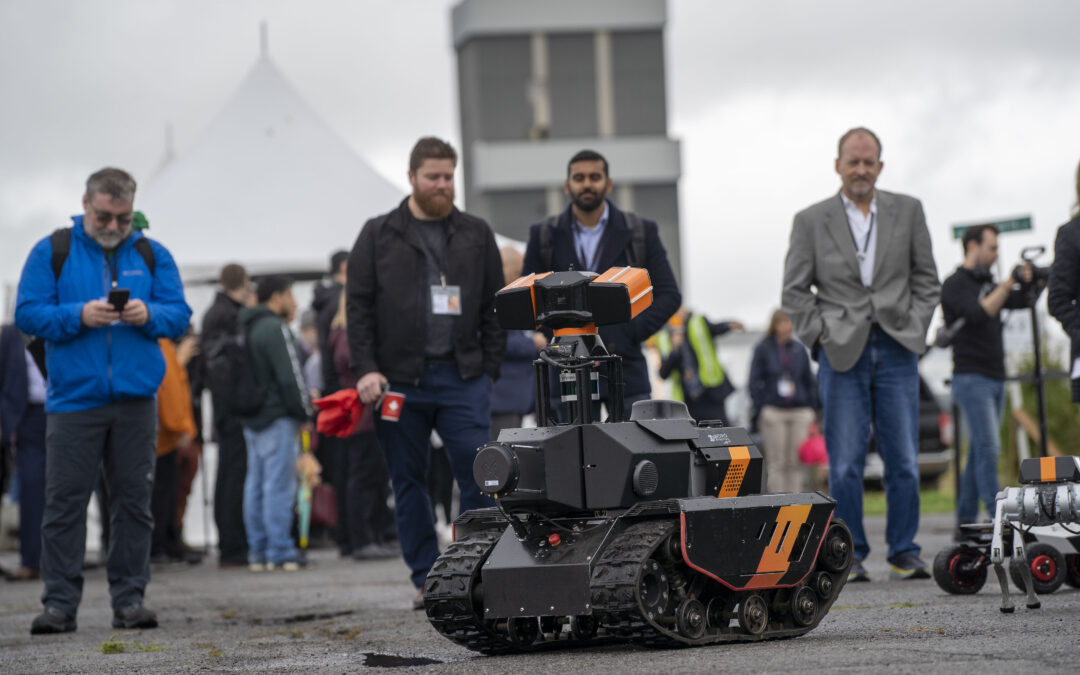
InDro was there, of course, displaying our InDro Pilot-enabled Wayfinder drone, as well a *lot* of ground robots. CEO Philip Reece moderated a panel – and was also in charge of airspace for multiple drone demonstrations. That’s Philip, below, talking about aerial and ground robotics to attendees.

InDro Robotics
Drone Training

training

Speaking of drones, we also launched drone training and resource portal FLYY. Online lessons are carried out by our own Kate Klassen, widely recognised as one of the best (and most qualified) drone instructors in North America. Whether you’re looking to obtain your Basic or Advanced RPAS certificate, or want to further expand your skills, Kate’s got the goods.

If you’re looking for training for multiple people, Kate offers discounts for companies and educational institutes. You can reach her here.

it's a secret...

The other big thing happening in 2022 (and continuing in 2023) was InDro’s work with major global clients. We can’t disclose that work due to non-disclosure agreements, but we can tell you we’re busy with multiple, exciting, ongoing projects!

Finally, we closed out 2022 with another successful InDro Hack-a-Thon. Employees were given a day and a half to work on a project or process that could benefit InDro down the road. Once again, Team InDro delivered, with some amazing projects completed within the deadline. You can read all about it here

a final word...

As you can see, it’s been quite a year – and CEO Philip Reece couldn’t be happier.

“I’m incredibly proud of the work InDro accomplished in 2022,” he says. “Our engineering and sales staff consistently punch above their weight, with multiple significant milestones – including excellent revenue growth – achieved in the past year. Just as gratifying is the fact our employees love what they do.”

Very true. Now stay tuned for an even more amazing 2023.

And if you’d like to reach InDro, just give that little orange button a click. Though we’ve got plenty of robots, we’ll make sure a real human being gets back to you shortly.