FAA releases airspace blueprint for Urban Air Mobility

FAA releases airspace blueprint for Urban Air Mobility

By Scott Simmie


If you’re involved in the world of drones or traditional aviation, odds are you’ve heard of air taxis, cargo drones and the coming world of Advanced Air Mobility, or AAM.

But what does that mean? And how will it differ from our current skies?

To get started, it’s worth looking at a definition of AAM. We like this one from BAE Systems:

“Advanced Air Mobility is an air transport system concept that integrates new, transformational aircraft designs and flight technologies into existing and modified airspace operations. The objective of AAM is to move people and cargo between places more effectively, especially in currently underserved local, regional, urban, and rural environments.”

And these transformational aircraft designs? Well, they include air taxis and heavy-lift drones capable of efficiently moving people, goods and critical supplies from major urban centres to nearby regions. Many of these destinations – certainly initially – are likely to be close to major urban centres but not have traditional airports. Often, those underserved areas have never had enough traditional air traffic demand to support the required infrastructure. Plus, it doesn’t really make sense to fly a plane over a very short distance.

The coming generation of new aircraft, for the most part, will not require runways and will be more environmentally friendly than ground transport. Most of the aircraft under development are electric and capable of vertical takeoff and landing – often transitioning to more efficient fixed-wing flight for the journey. And that means minimal infrastructure will be required. Think helicopter landing pads.

Sustainable electric or hybrid-powered flight, along with the promise of autonomous missions that can efficiently ferry goods through the sky while reducing road congestion, are among the key benefits of AAM.

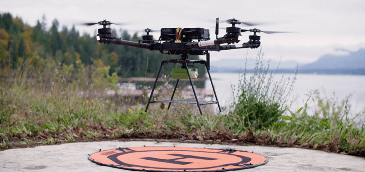
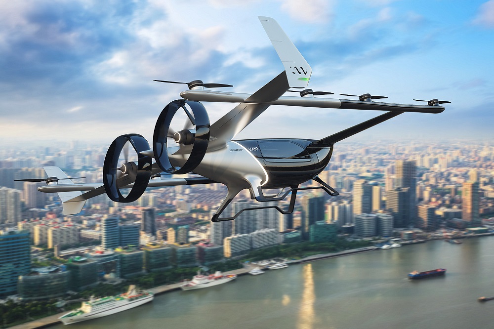
Below: Volkswagen is just one of many companies developing new types of aircraft for the coming world of Advanced Air Mobility. Some firms are actively testing.

Urban Air Mobility

AAM and UAM


The drone and aviation world loves its acronyms. And one that goes hand-in-hand with AAM is UAM – Urban Air Mobility.

UAM refers to the use of Advanced Air Mobility technologies in a strictly urban setting. Picture a major city where you can hail an air taxi to a landing pad, also known as a vertiport, with a phone app. Or where goods are routinely shuttled by drone or other new aircraft across urban skies. That’s what Urban Air Mobility refers to. Think of it as a subset of AAM.

But while UAM offers unique efficiencies and a reduction in ground traffic, it also comes with greater risk than flying goods to regional areas. That’s because these aircraft will be flying over property and people for the entire duration of their missions.

They’ll also be flying at lower altitudes than traditional crewed aircraft, and – eventually – in greater numbers. So regulators are interested in helping to shape the coming UAM (and AAM) eras to ensure a safe system that seamlessly meshes these new aircraft with existing airspace.


FAA


In early May, the Federal Aviation Administration – the US regulator – released an updated blueprint of how it envisions AAM will unfold. The Concept of Operation (ConOps) document outlines what procedural changes might help ensure a slow, safe and smooth transition into the coming era.

Transportation is constantly evolving,” it states. “Each step forward yields new opportunities that fundamentally change the relationship that humankind has with distance and travel. While it may not significantly reduce surface traffic volume, UAM will provide an alternative mode of transportation that should reduce traffic congestion during peak times.”

And the driving force behind all of this? Technology.

“Major aircraft innovations, mainly with the advancement of Distributed Electric Propulsion (DEP) and development of Electric VTOLs (eVTOLs), may allow for these operations to be utilized more frequently and in more locations than are currently performed by conventional aircraft,” says the regulator.

We’ll dive a little deeper in a moment. But the FAA says – in addition to certifying aircraft and pilots – that the blueprint is a “key step” in efforts to move safely toward this next phase of aviation. The blueprint should be of interest to everyone in the industry – particularly those who have plans for moving people and cargo by this next generation of aircraft. The FAA describes the blueprint as a “frame of reference” for itself, NASA, and the industry.

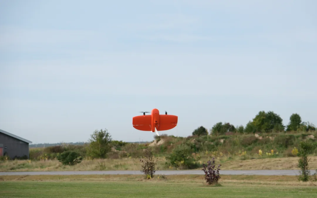
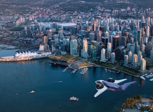
Below: Might Vancouver’s skies one day include aircraft like the one pictured below? Odds are, yes.


THE BLUEPRINT


So how will the US get from here…to there?

What guidelines or steps are needed to ensure a safe transition from now to then? The key, says the FAA, is to adopt a “crawl-walk-run approach.” In other words, start slowly – very slowly – and integrate these new aircraft in a highly methodical way while building on incremental successes.

“The envisioned evolution for UAM operations includes includes an initial, low-tempo set of operations that leverage the current regulatory frameworks and rules (e.g., Visual Flight Rules [VFR], Instrument Flight Rules [IFR]) as a platform for increasing operational tempo, greater aircraft performance, and higher levels of autonomy,” says the FAA.

That “low-tempo” means you won’t be hailing an autonomous air taxi anytime soon. In fact, when it comes to moving people and goods, fully autonomous aircraft are in the last stage of the FAA’s Concept of Operations.

Here’s a look at the three main phases the FAA has identified, taken directly from the blueprint:

  • Initial UAM operations are conducted using new aircraft that have been certified to fly within the current regulatory and operational environment.
  • A higher frequency (i.e., tempo) of UAM operations in the future is supported through regulatory evolution and UAM Corridors that leverage collaborative technologies and techniques.
  • New operational rules and infrastructure facilitate highly automated cooperative flow management in defined Cooperative Areas (CAs), enabling remotely piloted and autonomous aircraft to safely operate at increased operational tempos.

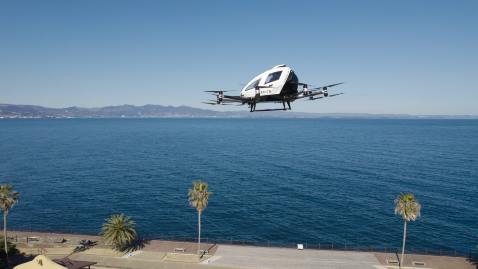
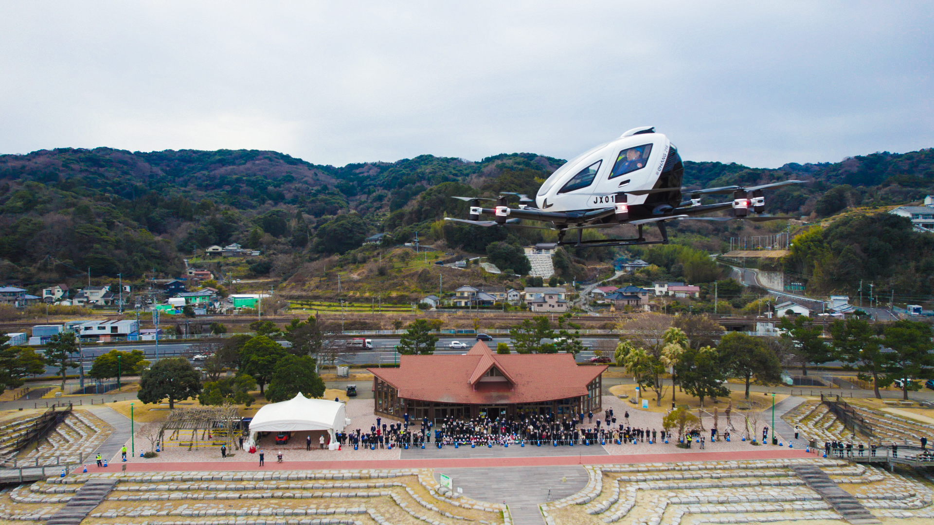
Below: An EHang EH216 carries out a passenger-carrying, autonomous flight in Oita Prefecture, Japan. The company has already logged 30,000 safe flights and is in the certification process with the Civial Aviation Administration of China. Image via EHang. 

EHang 216

AIR TAXIS


The FAA document focuses on air taxis – eVTOLs capable of carrying either people or cargo. And, in line with its “crawl-walk-run” approach, envisions a phased integration of these vehicles into US airspace.

All aircraft would be need to be certified. And initially, the Pilot-in-Command would need to be onboard and manually flying the aircraft using Visual Flight Rules (VFR) and Instrument Flight Rules (IFR). Pilots would communicate with Air Traffic Services, which would be responsible for ensuring adequate separation with traditional aircraft.

The ConOps document also envisions corridors – three-dimensional freeways in the sky that would be set aside for air taxi traffic. These corridors would at first be one-way only, though that would likely change in future.

In the early phases, the FAA believes existing helipads or other current infrastructure would be adequate. But it encourages planners and municipalities to use the best available data and forecasts when determining where to build vertiports.

“State and local governments are being encouraged to actively plan for UAM infrastructure to ensure transportation equity, market choice, and accommodation of demand for their communities,” says the document.

“The vertiports and vertistops should be sited to ensure proper room for growth based on FAA evaluated forecasts and be properly linked to surface transportation (when possible), especially if the facility primarily supports cargo operations. Local governments should also have zoning protections in place to protect airspace in and around vertiports and vertistops.”

As demand – and technology – advance, the FAA foresees traffic management becoming more automated. Data-sharing and detect-and-avoid technology would likely enable the eventual rollout of fully autonomous flights. In that scenario, these machines would operate under what the FAA calls “Automated Flight Rules” – or AFRs.

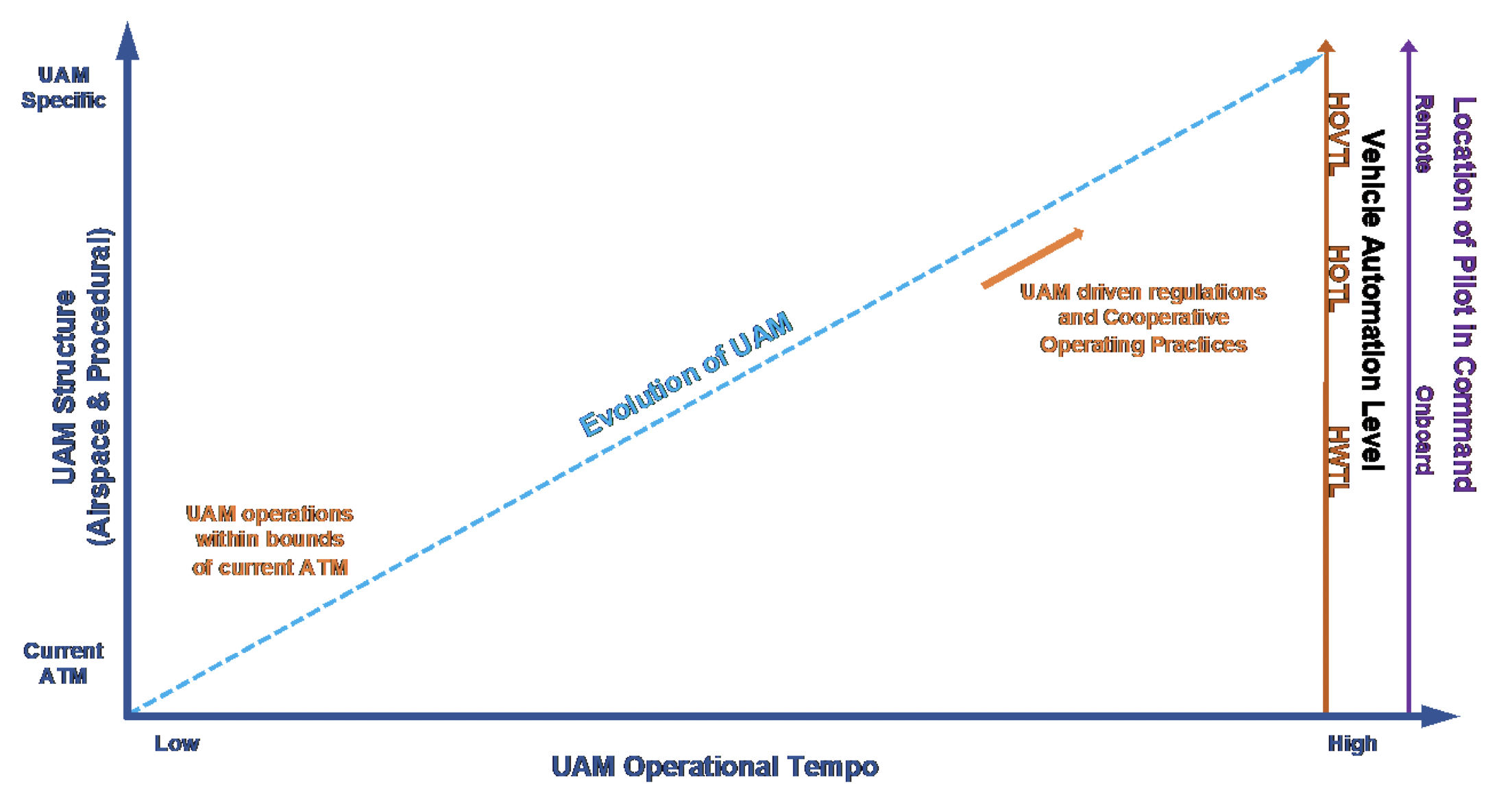
It’s all part of an evolution that would see the gradual implementation of automation, with people playing less active roles over time. Initially, the FAA says, there would always be a Human-Within-the-Loop (HWTL) – meaning a pilot. That would evolve to a person having supervisory control of automation, known as a Human-on-the-Loop (HOTL).

In a fully mature system, people would simply be notified by automation if action is required. This is referred to as Human-Over-The-Loop (HOVTL), defined by the FAA as follows:


  • Human is informed, or engaged, by the automation (i.e., systems) to take action
  • Human passively monitors the systems and is informed by automation if, and what, action is required
  • Human is engaged by the automation either for exceptions that are not reconcilable or as part of rule set escalation

“UAM operations may evolve from a PIC onboard the UAM aircraft to RPICs/remote operators via the advent of additional aircraft automation technologies,” states the blueprint.

The following FAA graphic indicates the predicted evolution of the UAM operational environment:

FAA UAM evolution

SLOW AND STEADY


There’s much more to the FAA document, and we encourage those interested to explore it here. But the key point is a slow and measured integration of these new transformational aircraft with an emphasis on safety and human oversight within existing regulations. As technology and data-sharing improve, this will evolve to a more automated/autonomous system with humans involved only if they are flagged to intervene. New regulations will likely evolve as the technology continues to develop.

The FAA released a brief video in conjunction with its blueprint, which hits some of the highlights discussed in this post:

INDRO’S TAKE


Like many, we see the great potential in the coming Advanced Air Mobility/Urban Air Mobility era. Certified aircraft safely moving people and goods will be faster, more efficient and more sustainable than current ground travel. It could also be a boon to people living in communities currently not served by traditional aircraft.

“We see particular utility for remote and cut-off communities in need of critical goods,” says InDro CEO Philip Reece.

“We always use the crawl-walk-run model when deploying our own new technologies, and believe this incremental approach is the best way to ensure safety and public acceptance. We anticipate Canadian regulators, working with industry and the Canadian Advanced Air Mobility Consortium, will be taking a similar approach.”

The new FAA blueprint, though it’s a ConOps document and not carved in stone, does leave us feeling that plans are starting to take shape. We look forward to the slow, steady and successful integration of UAM/AAM in the US, Canada and elsewhere.

If you’d like to do some further reading on AAM – and what’s happening on the Canadian scene – you’ll find that here.

Police drone collision raises questions

Police drone collision raises questions

By Scott Simmie


There’s no question that drones have become an essential tool for First Responders.

They’re used to assess fires, document accidents, search for missing people and even get a sense of damage following a natural disaster like a tornado.

They’re also used by police on occasion to actively search for a suspect trying to evade capture. In such scenarios, you can imagine that officers might be highly focussed on apprehending the suspect.

That may have been a factor in an incident that occurred August 10, 2021. It involved a York Regional Police officer with an Advanced RPAS certificate, a DJI M210…and a Cessna. The incident is outlined in detail in a new Transportation Safety Board report.

(If you’ve read the report and just want to hear our take, skip to the end.)

Police Drone Collision

What happened


On August 10, 2021, a student pilot and flight instructor were in a Cessna 172N on a typical training flight. They were on final approach to Runway 15 at Toronto/Buttonville municipal airport. And then, in the words of the TSB report, this happened:

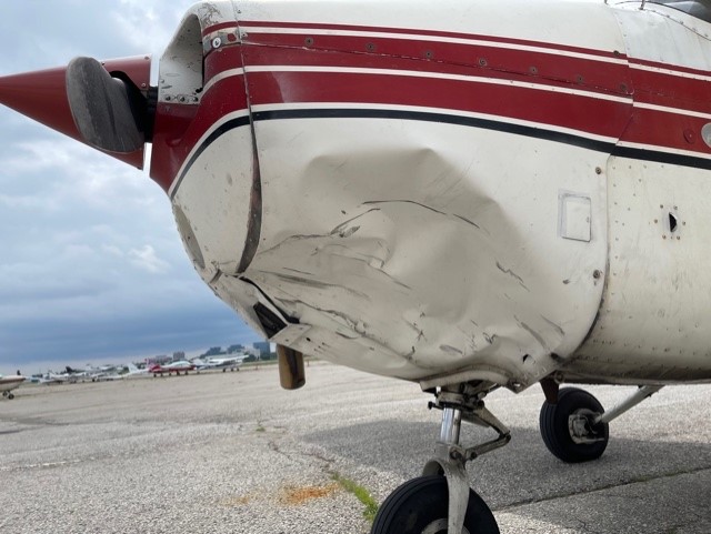
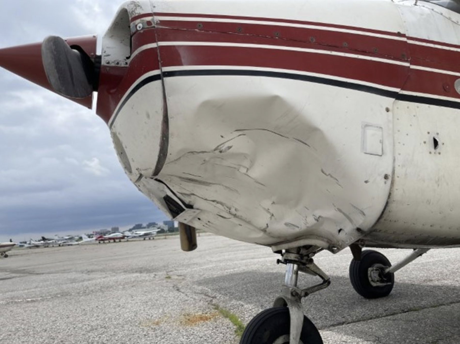
At approximately 1301 Eastern Daylight Time, the student pilot and flight instructor heard and felt a solid impact at the front of the aircraft. Suspecting a bird strike, they continued the approach and made an uneventful landing, exiting the runway and proceeding to park on the ramp. After parking the aircraft, they observed damage on the front left cowl under the propeller; however, there were no signs that a bird had struck the aircraft.

So what did?

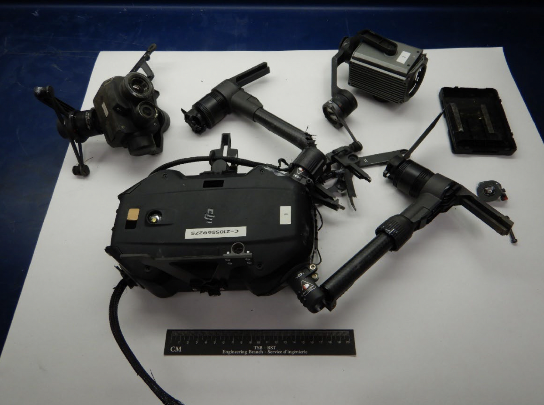
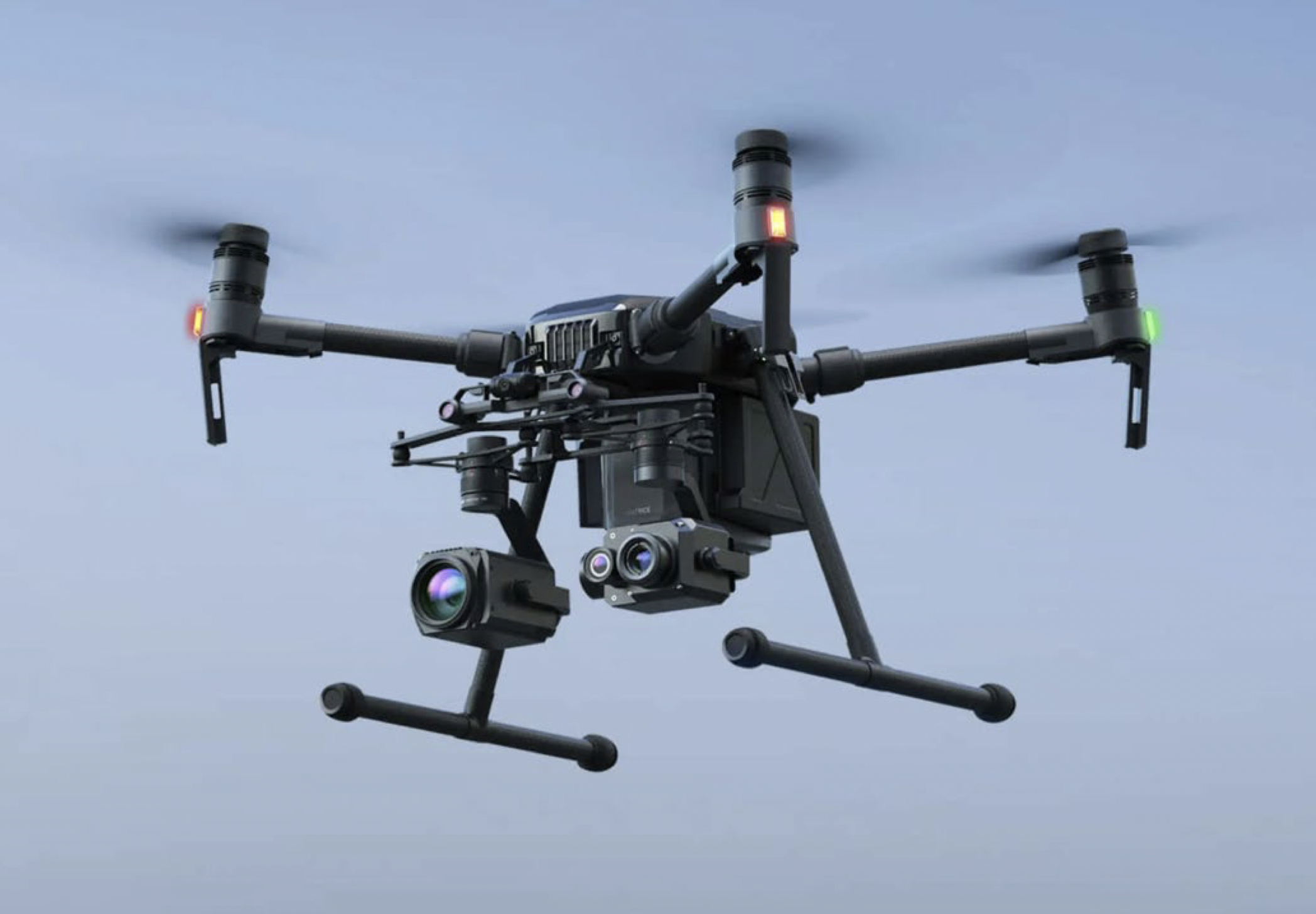
Shortly afterward, a member of the York Regional Police reported to airport staff that he believed a collision had occurred between the remotely piloted aircraft he had been operating and another aircraft. The remotely piloted aircraft, a DJI Matrice M210 (registration C-2105569275), had been in a stationary hover at 400 feet above ground level when the 2 aircraft collided. The DJI Matrice M210 was destroyed.

There were no injuries to either pilot on the Cessna 172N or to persons on the ground.

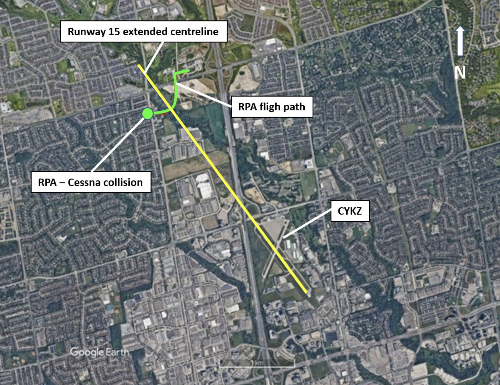
Here’s a look at the runway, along with the location of the RPAS. (Looks like the report missed a “t” on the word “flight.”)


Police Drone Collision

The drone


York Regional Police (YRP) were looking for a potentially armed suspect, and called the YRP’s Air Support Unit (ASU) to assist at 12:02 pm. The pilot of the drone arrived at the scene at 12:20. The first flight of the DJI Matrice M210 took off at 12:32. Shortly after takeoff, the pilot asked some officers standing nearby to watch the drone during flight; one of the officers said they’d do the task.

After some initial reconaissance, the officer landed the flight 16 minutes later to change batteries. It was now 12:48.

“During this time,” says the report, “the pilots in the Cessna had completed their exercises in the practice area and were returning to the airport. They made the appropriate radio calls declaring their intention to fly over the airport and join the right-hand downwind for Runway 15. There was no other traffic broadcasting on the CYKZ mandatory frequency (MF) at the time, nor had the pilots heard any other transmissions on the frequency during their return flight.”

It’s worth noting the “Mandatory Frequency” here. This airport does not have a tower and its own Air Traffic Control. Aircraft are to announce their intentions over a mandatory frequency (124.8 MHz) and monitor that same frequency for situational awareness of other air traffic.

At 12:56, the DJI M210 took off for its second flight. The pilot, who was watching a flat-screen tv displaying the drone feed, took the drone up to 400′ AGL.

The pilots in the Cessna, meanwhile, were scanning for other aircraft as they began their approach toward the runway. They made a radio call with their intentions to land at 12:57. When the drone reached 400′, it was put into a stationary hover.

But that hover, unfortunately, was directly in the flight path of the Cessna. The report notes that a stationary black object, when viewed against urban clutter, would likely not have stood out to the pilots. When the aircraft was approximately 1.2 nautical miles from the airport, traveling at about 65 knots (120 km/hour), it impacted the drone at 13:01.

The Cessna landed without incident. But upon exiting the aircraft, this damage to the cowling was observed. There was also a slight scratch on the propeller.

Police Drone Collision

And the drone?

 Well, it was pretty much destroyed – as shown in this Transportation Safety Board photograph of the pieces that were recovered:

Police Drone

Other factors


The DJI drone was equipped with an Automatic Dependent Surveillance-Broadcast (ADS-B) receiver. These pick up signals from ADS-B equipped aircraft in the vicinity, and issue a warning to the drone pilot. The Cessna was not equipped with an ADS-B unit, however, so no warning would have been generated.

The Report says the drone pilot was monitoring the airport’s Mandatory Frequency during operations, using a handheld VHF radio. The drone pilot also had his Restricted Operator Certificate with Aeronautical Qualification (ROC-A), allowing him to operate an aviation radio. Unlike the pilots in the Cessna, drone operators are not required to broadcast their intentions when in controlled airspace. In fact, NAV CANADA does not encourage RPA pilots to broadcast on those radios, as it can contribute to clutter on the airwaves.

But the report does point out an additional key responsibility for Remotely Piloted Aircraft operators:

RPA operators are required to receive authorization from the provider of air traffic services (ATS) to operate in controlled airspace (see section 1.17.2.1). The request for this authorization must include contact information for the pilot, and “the means by which two-way communications with the appropriate air traffic control unit will be maintained.”

When authorization is granted from ATS, a telephone number for the relevant ATC unit is included in the authorization. This telephone number is to be used in case of an emergency or loss of control of the RPA. This exchange of contact information between RPA pilot and ATS is meant to satisfy the Canadian Aviation Regulations (CARS) requirement that two-way communication be maintained.

Flying a drone in controlled airspace requires obtaining clearance through NAV CANADA’s NAV Drone app. If the operation looks very complex and might involve greater than normal risk, the app will bump that request for a more careful review by Air Traffic Services.

But that’s not what happened. According to the Report, the NAV Drone app was not used at all in this incident.

The pilot of the occurrence RPA was aware of the NAV Drone application and knew that the operation on the day of the occurrence would take place entirely within the CYKZ control zone, therefore requiring authorization from ATS.

Due to the nature of the police operation underway, which involved a potentially armed individual, the RPA pilot felt a sense of urgency to get the RPA airborne as soon as possible. As well, the RPA pilot had not observed any traffic in the area during the set up of the RPA and had heard no recent transmissions on the hand-held VHF radio. As a result, the RPA pilot did not request authorization.

Interestingly, investigators later tested the NAV Drone app, requesting to fly an RPA at 400′ AGL at the location where the collision had occurred. The request was denied, and the app suggested they re-submit the request with a maximum altitude of 100′ AGL – a position far less likely to have caused problems for crewed aircraft on approach.

Police Drone Collision

Role of visual observer


The TSB Report spends some time on this topic. It also documents what happened on that day in October. It appears that the role of visual observer was not explained to the officer that took on the role. And it also appears that officer spent most of his time looking at the video feed from the drone, rather than maintaining Visual Line of Sight with the drone itself:

During the day of the occurrence, the RPA pilot asked for another officer to be a visual observer. Although a nearby officer acknowledged the request, the RPA pilot did not confirm who, among the officers present, would assume that role, nor did he inform that specific officer what their duties or responsibilities would be. The officer was not aware of the requirement to maintain visual contact with the RPA.

The officer who was acting as the visual observer was observing the TV display for much of the time that the RPA was airborne and did not see or hear any airborne traffic, nor could he recall hearing any radio calls over the RPA pilot’s portable VHF radio.

The report also notes that the drone pilot did not use the York Regional Police’s mandatory RPAS Pilot Checklist, and instead relied on memory to prepare for the flight. It further suggests the pilot may have been ‘task saturated,’ – “restricting his ability to visually monitor the RPA and hear radio calls on the control zone’s MF and the sound of incoming aircraft, both of which preceded the collision.”


Some findings…


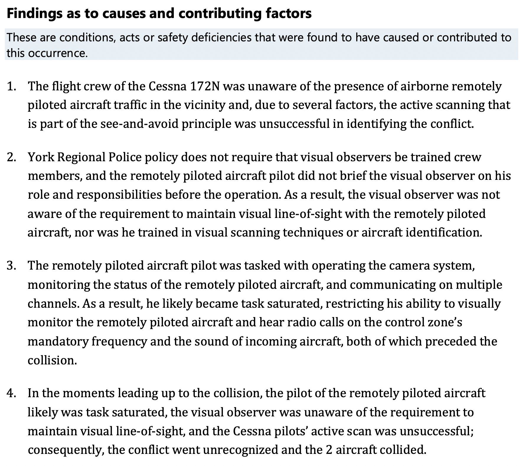
It is not the Transportation Safety Board’s role to find fault or blame. But it does identify contributing factors and/or causes that likely all played a role in the collision. Here are the four key findings on that count:

Police Drone Collision

“Findings as to risk”


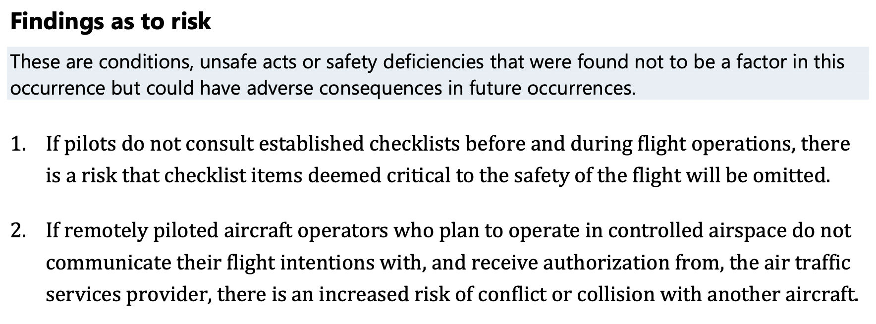
The report also notes two findings under the above category. It emphasizes that what appears below does not appear to have contributed to the collision, but could lead to adverse outcomes in the future:

Police Drone Collision

Kate Klassen weighs in…


InDro’s Kate Klassen is a drone and airplane pilot and has about 1000 hours instructing on the same type of plane involved in the collision. She’s also very familiar with the minutiae of RPAS regulations in Canada.

Klassen read this report with great interest and noted a few useful takeaways. In particular, how it appears the apparent focus on the task – catching a criminal suspect – may have obscured what should have been standard procedures.

“Typically First Responders have established with the Air Traffic Service providers that they can do the job and inform as soon as possible, rather than following the NAV Drone pre-authorization process the rest of us follow.” she says.

“So I think it’s less that they launched as they did, and more that they didn’t have the situational awareness to operate there safely. They were perhaps too invested in getting the job done, where they figured ‘It’s not going to happen to me’, and weren’t taking advantage of all the tools at their disposal. They probably didn’t realize how risky this location was, especially to be operating at that altitude.”


Briefing visual observer


Klassen also notes that the selection of a visual observer was not accompanied by any sort of thorough briefing – which would have included maintaining Visual Line of Sight with the RPA, monitoring the radio, and listening (along with watching) for any crewed aircraft.

“I think the situational awareness piece is important,” she says. “Have the radio on the right frequency, have the visual observer actively monitoring it. It can’t be just ticking the box that you’ve assigned someone the task.”

“A more effective trained role would be explaining or ensuring they have skill to listen in on the radio and build that situational awareness of where the aircraft are. Also monitoring the sky, listening for aircraft noise. If you can hear a crewed aircraft but not see it, that’s when it’s sketchy.”

Klassen has worked with many First Responders across Canada, and understands the pressure they can be under to get a drone in the air. The challenge is to follow Standard Operating Procedures despite that pressure – particularly in controlled airspace this close to an airport.


InDro’s take


Though no one was injured during this collision, it was a serious incident. The drone could just as easily have hit the windshield, the leading edge of the wings near the fuel tanks or damaged the landing gear. Thankfully, that didn’t happen.

The Transportation Safety Board report is both methodical and meticulous. While not pointing the finger of blame, it does highlight some procedures that most certainly could have been handled better – and likely would have, were the flight not so high-priority.

Accidents and investigations should be, in our view, viewed as learning opportunities. And in this case – whether you’re a First Responder or not – there are clearly lessons to be learned.